Geological and Archaeological Heritage Route
Malpartida de Cáceres, Cáceres![]()
![]()
![]()
![]()
![]() (0)
(0)
Archaeological treasures hidden in an unparalleled natural setting
Malpartida de Cáceres, Cáceres![]()
![]()
![]()
![]()
![]() (0)
(0)
Archaeological treasures hidden in an unparalleled natural setting
As if it were a landscape from another world taken from the most imaginative science fiction, the Los Barruecos Natural Monument surprises the visitor by the uniqueness of its forms and the rich biodiversity that inhabits it. But this magnificent place not only treasures rocks of a thousand different silhouettes, it is also a real jewel of the history and culture of the area, as evidenced by its many archaeological sites or particular works of art that are scattered throughout it.

The geological and archaeological heritage route of Los Barruecos through its 3.6 km will lead us, from the car park of the Interpretation Center, by the history and the characteristic morphology of this area that are the hallmark of this land. A walk in which we will soon find ancient anthropomorphic tombs or the remains of ancient settlements both Neolithic and Roman, current representatives of the first settlers of Los Barruecos. From the car park of Los Sentidos we will also enter the labyrinthine landscape of unique rocks whose forms remind us of many characters and objects. Rocks and boulders that were, in their day, true canvases for various artists who, in the form of engravings and paintings, captured their beliefs and customs. The flora of the place together with the fauna that inhabits it throughout the year contribute even more value to this authentic natural monument. Like the important colony of storks that choose Los Barruecos and its Peñas del Tesoro, as home to spend the long winter.

An authentic labyrinth of paths cross this area in search of the best places from which to observe each rock and its inhabitants, or to take us along the different treasures that this area of the province of Cáceres holds. Routes such as Las Charcas which encircles the wetlands that give even more life to these fields, or the route of the Peñas del Tesoro which brings all visitors who dare to enter the area to them without much effort. Visitors such as those who visit the Vostell Malpartida Museum, or the works of art that await us along the route we are traveling. Without a doubt a singular museum from which it is possible to enjoy a superb panoramic of Los Barruecos. Undoubtedly this simple route of hiking will become even shorter than it already is when without almost realizing it we find ourselves again in the parking lot of the interpretation center, where we will reluctantly end the tour.

Legend has it that the Peña of La Horca receives its name not by chance, but it is known as such since in Roman times it was used to execute thieves who were condemned to death, even beyond the end of the empire continued to be used for this purpose. So many people perished in it that it is not uncommon to hear people claiming to have heard the laments and groans as they passed by this unique rock, no doubt coming from the prisoners who lost their lives there.
Malpartida de Cáceres is located in the middle of the N-521, shortly after leaving Cáceres towards the border with Portugal. The EX-207 regional road also reaches the town, connecting it with neighbouring towns as well as with Alcántara. Once there, shortly before leaving the town as we cross it arriving from the capital, we will find the signs indicating the detour that leads to the Natural Monument of Los Barruecos. We still have to go through the streets that delimit the town and that will lead us to pass next to the sports facilities of Malpartida de Cáceres. From there, and always following the indications, we will cross the course of the asphalt track that without more complications takes us to Los Barruecos, where we will find the parking of the Center of interpretation next to the detour towards the museum Vostell. Being in this parking lot where we will be able to park our vehicle and to give beginning to the route.
Without a doubt, it's an adventure for our friend that shouldn't be a problem for him. It is important not to let him loose to avoid unnecessary problems or misunderstandings, especially if he does not go out in the wild very often.
There is no water on the whole route so we cannot miss the corresponding ration, nor is it advisable, nor is it almost certainly allowed to let him take a bath in one of the ponds.
It is important to respect the rest of the animals that live in the area. There are also a number of donkeys and mules, as well as horses that usually roam this area.
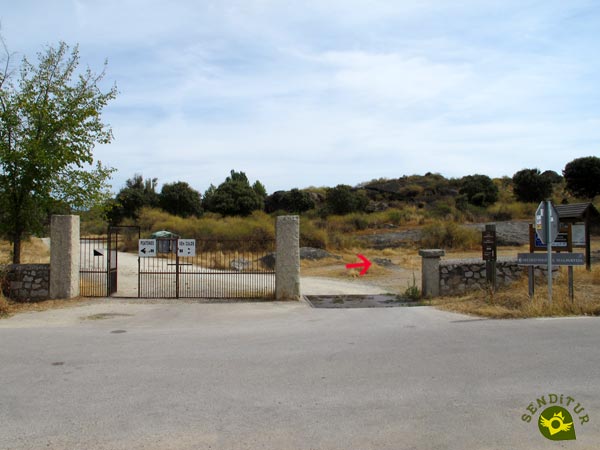
We begin this simple hiking route through the Los Barruecos Natural Monument from the parking lot of the Interpretation Center (0h 00min).

We crossed the road that brought us here to access the path that leads to the museum.

Although as soon as we cross the door that separates it from the road we will turn right, leaving behind this path by which we will return.

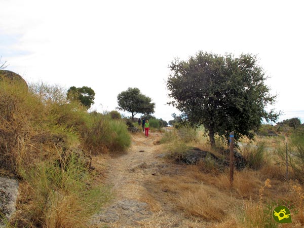
Our route continues after crossing a new little gate, following the trail along the road. There are, and will be, many trails along the route, so it is important to pay attention to the blue marks that will guide us.

Although it is true that there will be few occasions when we will be left to our own devices to choose the right route to follow.

For the moment we stay relatively close to the road, separated from it by a fence.

Not much further on our trail turns sharply, making us leave the road behind us.

Luckily here the route markings do not leave much room for error, even if the vegetation does not make it so easy.

After climbing a small hill we will start a gentle descent following the trodden trail.

Quickly our trail will lead us to the track that from the nearby road leads to the parking lot we are heading to.

As soon as we arrive at the parking of Los Sentidos (0h 20min) we will leave the track to go in search of the beginning of the Route of Los Sentidos.
From this moment on, we will coincide with the adapted layout of this route which will be in charge of guiding us in this part of the tour.

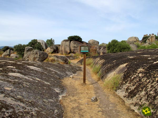
From now on, we will find ourselves walking around the enormous rocks, of curious shapes that we used to see from afar.

In this part of the route you can see the route that before the works of conditioning followed our disappeared trail.

The undulating route takes us from one rock to another allowing us to enjoy the spectacular landscape they form, without forgetting the archaeological sites that also await us along the route.

The moment to say goodbye to the Route of the Senses is marked by the viewpoint that is also its final point.

We return to our trail to enter the maze of rocks that awaits us a little further on.

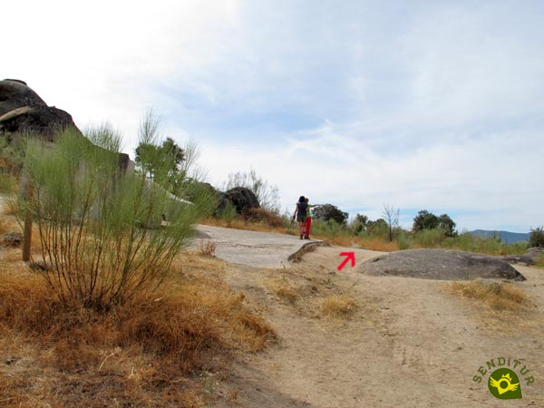
We will quickly reach the junction with the detour that will bring us closer to our next objective. We continue a few meters to the left to climb up between two rocks in search of a treasure.

As soon as we go up the short slope we will be able to enjoy the magnificent panorama that the Rocks of the Treasure (0h 45min) offer.

But the real treasure is hidden under the huge rock that awaits us on our left, just up the short slope.

Here, the most daring can literally get under the rock to discover the treasure it hides in its inner chamber.
From here it is possible to shorten the route a little by following the labyrinthine network of paths to the Los Sentidos car park and miss out on some of the surprises that await us.

The rest of us will have to retrace our steps to the detour we left behind before, to continue our route. Once again, the footpath leads us through attractive rocks.

With almost no time to assimilate this part of the route we will come across a new junction where the marks and the greater concentration of rocks will make it clear that the route continues to the left.

Almost immediately we will start a short descent that will take us once again into the rocks.

As on other occasions, there will be several trails that we will have to cross.

Once down, we will suddenly come across the route of the Charcas, which will be our inseparable companion until the end. So from now on we should not be surprised to see the marks of both routes on the same post.

The pond of the Barrueco de Abajo besides offering us a beautiful panoramic will serve us as reference, having to border it always leaving it to our right hand.

Here, we are met by some of the external works of the museum we are going to.

Without hardly noticing it, we will have surrounded the Rocks of the Treasure and we will be ready to leave them behind us.

Now there are three routes that coincide in their layout, as we have been joined by the Route of the Rocks of the Treasure, which adds its yellow marks to the green and blue ones we already followed.

We descend with certain rapidity until arriving at the esplanade where we find the detour towards the parking of Los Sentidos (1h 00min).
We leave on our right the track that leads to the car park and on our left the pond, to undertake a short but demanding ascent.

Once upstairs, we will follow the trail that turns left, leaving behind a bird observatory. Again we will see ourselves following the wide and marked path as we border this part of the pond.

Once again we will come across different trails and paths, many of which we had left behind at the beginning of the route and now we discover where they lead.

The undulating layout of our route makes us gain and lose height, although without major complications.

Our trail leads us directly to a gate through which we will cross the fence that delimits the place.

After a short descent we arrive at the parking area of the museum, where we can choose which of the two options to follow, as both are joined again a little later.

The Vostell Malpartida Museum (1h 15min), in addition to its undeniable cultural importance and its interesting surroundings, can also be a good place to rest and refresh before continuing.
From the museum we only have a short stretch of perfect dirt track that will take us to the end of the route.

This track, which is also used by vehicles, is the one we decided not to follow at the beginning of the route.

Quickly, in front of us we will see the gate that we must cross again to, crossing the road, reach the parking lot of the Interpretation Center (1h 20min) from where we started and where we finished this route of hiking through Los Barruecos.
The different options offered by the area allow us to make a route according to our preferences.
Undoubtedly this figure has to increase considerably due to the time that surely we have to devote to the different corners of the Natural Monument of Los Barruecos through which we will go.
Obviously the heat can condition our visit significantly so it is important, as with winter situations, to adapt our visit to these conditions. A period of special value as far as the natural one is concerned is when the storks populate the zone, although we must know that in certain moments the access to certain zones is restricted to preserve the young of these birds.
Comfortable shoes and clothes, preferably for hiking, water, a camera and a snack to get your strength back while enjoying the scenery is all that should be highlighted for this route, without forgetting of course the advice and habits that we should follow in any hiking activity. Protection against the sun or the cold in winter should not be overlooked either, if the conditions chosen so advise. Consult our list of material and equipment for hiking. Read more.
Physical
Neither the distance nor the unevenness cause great difficulties a priori, as long as we are used to walking. It is certain that the days of heat can harden considerably this simple route of hiking of the province of Cáceres, reason why without a doubt it is a factor to consider very.
Severity of the environment
As long as we do not leave the marked route we should not encounter any or almost no difficulties, beyond the traffic that runs through the areas where we will coincide with the vehicles of the people who visit this place. Outside the marked trails we must also take into account that the vegetation covers the gaps between the rocks so it is easy to end up putting the leg where it should not. Of course it is not usually a good idea to climb the rocks, and it is not allowed in many of them.
Orientation
The large number of trails and paths that run through the area is what will cause us the most complications, although in general the routes are well signposted and the main path is quite heavily trodden. Even so, as with any other hiking or mountain route we are encouraged to take, it is important to prepare it in advance so as to have a clear idea of the route to be followed and the difficulties or recommendations to be taken into account, however simple the route may be a priori.
| 1-Interpretation Centre | 0:00h | 338m | 0Km | 29S 714623 4366441 |
| 2-Parking Los Sentidos | 0:20h | 350m | 0.9Km | 29S 715225 4366257 |
| 3-Rocks of the Treasure | 0:45h | 368m | 2Km | 29S 715541 4366477 |
| 4-Los Sentidos parking detour | 1:00h | 350m | 2.8Km | 29S 715248 4366452 |
| 5-Vostell Malpartida Museum | 1:15h | 345m | 3.4Km | 29S 714796 4366512 |
| 6-Interpretation Centre | 1:20h | 338m | 3.6Km | 29S 714623 4366441 |
Coordinates UTM Datum WGS84

![]() Slope: 160m
Slope: 160m
![]() Slope +: 80m
Slope +: 80m
![]() Slope -: 80m
Slope -: 80m
![]() Maximum altitude: 370m
Maximum altitude: 370m
![]() Minimum altitude: 338m
Minimum altitude: 338m

This sketch of the route is not made to scale nor does it contain all the information relating to the area, it is merely indicative.

This schematic with the path is approximate and has been created from the derived cartographic base © Instituto Geográfico Nacional "Cuadrante 704-1 y 704-3, 1:25.000"
Senditur has manipulated the tracks to correct the aberrant points that may exist, caused by problems with the reception of the GPS signal. In any case the tracks are always approximate. SENDITUR encourages you to use the new technologies within your reach, using them as support and consultation in your activity, not basing the realization and orientation of the same only and exclusively on them, since they may see their functioning altered by very diverse causes, not functioning correctly and their indications may not be precise.
¿Did you know that...
The Vostell Museum was founded in 1976 and currently occupies the building of the old wool wash house that was active in Los Barruecos until the end of the 19th century. The intense industrial activity that took place there and the importance of the transhumance and the different royal cañadas in the Iberian Peninsula speak to us in the interpretation centre that is located there.
Don't miss out...
Once you have enjoyed Los Barruecos and visited Malpartida de Cáceres, you cannot but approach, if you have not done so, the capital, Cáceres, from which we are only a few kilometres away and where you can visit one of the best preserved architectural complexes in the peninsula.
From the commitment of SENDITUR with Nature and the respect to the balance of the environment, SENDITUR urges you to travel in a responsible way, with low environmental impact and respecting at all times the Natural, Cultural and Social environment wherever you go.
Besides sharing with all of us your experience on the route we would be grateful if you could write to us to inform us of any erroneous or outdated information you may have found, or simply to let us know what you think at Thank you.
This route has been carried out in the field by SENDITUR on 03-10-2016. The route may vary greatly depending on the time of year, weather conditions and terrain, as well as the actions of third parties and the evolution suffered in the natural environment where it is located. All opinions, advice and/or assessments made by SENDITUR in their descriptions are for guidance only and are subject to and/or refer to the specific conditions of the specific day of the route, referring to that specific day, taken from trained people, with the appropriate experience and with a high level of physical and technical preparation as a reference, as well as correctly equipped.
All the times are approximate and take an orientative character, the stops have not been taken into account, no matter how small they are. All the information related to the route, texts, images, videos, maps, diagrams, tracks, towns, and places of tourist interest are published as a guide, and may not coincide with the current state of each place. Before undertaking any activity, assess your technical knowledge, your physical condition, find out about the weather and the variations that the route may undergo, equip yourself correctly, be prudent and responsible at all times, and do not exceed your capabilities. SENDITUR is not responsible for any misuse or inappropriate use of the comprehensive guides of its routes and/or publications as well as its electronic guides, nor for any variations in their descriptions for the aforementioned reasons, and recommends that everyone be responsible and prudent in carrying out the activity. We also encourage you to read books and specialised guides to complement the information described above.
Continue watching …