Gorbeia from Murua along the Path of Egillolarra
Touring the Gorbea Natural Park in Alava
Touring the Gorbea Natural Park in Alava
The mythical summit of the Gorbea gives its name to the Gorbea Natural Park, a protected natural area that extends between the Basque provinces of Biscay and Alava. Lush forests full of life, slender mountains of rounded shapes that contrast with the tight silhouettes of their nearby sisters in white limestone, in short a great diversity and not only natural, but also landscape that characterizes this unique place. The Alava side of the park is a clear example of this, and climbing from Murua to Gorbeia along the Path of Egillolarra allows us to immerse ourselves in this wonderful labyrinth of different paths and landscapes.
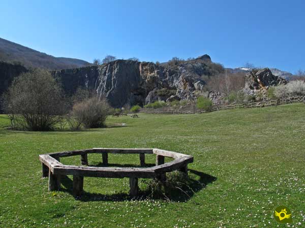
The route with its 12.6 km starts from the Quarry of Murua, a place recovered from the old industry that carved its walls and that today has become a natural space prepared for enjoyment and recreation. Leaving behind the quarry and the reservoir of Murua we begin a climb that takes us through a beech forest, dotted with some spectacular oak. The old coalmen who worked here have left for our delight the singular trunks of trees that we find. The Cave of Mairuelegorreta tempts us with its charms, inviting us to make a detour to visit it. As we ascend, we gradually leave the forest behind us until we reach the Egillolarra huts, which mark the end and the beginning of the final stretch of the ascent to the grassy summit of Gorbea. The Path of Murua and the Path of Zarate join us as we imagine ourselves travelling along the steep spur of Igiñiger.

The Cross of the Gorbeia, of great bearing, is approaching with each step we take until it welcomes us to the summit of this great Basque mountain. After treading on its summit and identifying the summits of the Aldamin, the Miruhen Haitza, the Lekandao and the Axkorrigan, among others, we dare to vary the return route. We set out for the Aldamiñoste pass from where we can enjoy an unbeatable view of the Campas of Arraba, to leave it behind us and start a rapid descent down the Dulao stream ravine. A route that runs marked by the wild silhouette of the mountains that surround it, passing by the path that leads to the summit of the Azero, from where we will begin the final descent that will lead us to the quarries of Murua, surrounded by imposing beech trees.

The Gorbeia Natural Park is crossed by countless paths and tracks that usually connect with each other allowing us to design an itinerary to our liking. We can for example visit the cave of Mairuelegorreta and then take the route without having to return on our steps. However, it is important to know or have available the necessary information in order to know which path we should follow at each moment.
To get to the town of Murua we have to follow the road that connects Vitoria - Gasteiz with the port of Altube and the AP-68. Once on this stretch of road we have to take the detour that leads to Gopegi and from there follow the road to Murua. Once there, after crossing the town, we will find the badly damaged track that leads to the quarry of Murua where we will have to decide in which of the different zones enabled for the parking, we will park.
We are in a natural park whose regulations require our dog to always accompany us tied up. For the rest and except for specific limitations we will only have to enjoy the route with our friend.
We are in front of a demanding route in which we must control the impetus of our friend so that he does not waste energy without necessity. It is important to bring him water and some food as he will need it.
It is not strange to meet the cattle even at the summit of the Gorbea, as well as many other pets.
The Quarries of Murua (0h 00min) are the starting point for our route as well as for many other routes that cross the Gorbeia Natural Park.

Along the road that leads to them we find the different car parks from where we will leave, returning along the road that brought us here to meet the beginning of the route.

Our route following the course of the road will be more or less long depending on where we park.

On our right is the path where we must continue to say goodbye to the asphalt.

At the moment we begin to gain height while we follow a wide track that climbs to the top of the quarry of Murua, from where we will enjoy magnificent views of this place.

After this break we continue our route and quickly turn left at a crossroads, leaving behind the one that would take us to the cave of Mairuelegorreta.

This part of the route still forces us to make an effort to overcome the different ramps that come our way. Luckily, we have a few resting places that allow us to catch our breath.

Soon the road begins to wind, to make us gain height with greater comfort. There will be several junctions that we will leave behind.

Crossroads that on more than one occasion make it clear that they offer us the opportunity to smooth out somewhat the slope to be overcome.

Even so, given the large number of trails and paths that run through this area, it is not advisable to venture out without having a clear idea of the direction we are taking, a direction that continues to make us gain height with every step.

The path as it gains in inclination loses its relative good grip. As if he wanted to warn us of the tough climb ahead.

Luckily this area of the route runs under the protection of the leafy forest that populates this hillside of the Gorbeia.

To our right we leave a new path, which rushes down the hillside, while we continue to climb.

The steep slope we are facing alternates with some slightly more comfortable areas, but soon it gains degrees of inclination again.

Not far from the end of this ramp we find a new detour, here we will have to decide, we will be able to extend a little more the ascent following the way of our left, or to face a steep trail.

The path, even if it is a little longer, notably softens the slope we are facing.

Both options are joined again a little later, with hardly any slope. This area of relative rest allows us to recover strength for the hard stretch ahead.
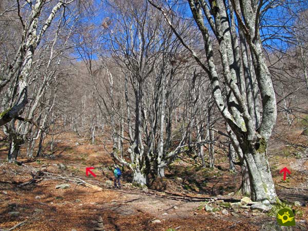
We arrived at a somewhat chaotic area where there are numerous trails drawn on the steep hillside that we have to overcome.
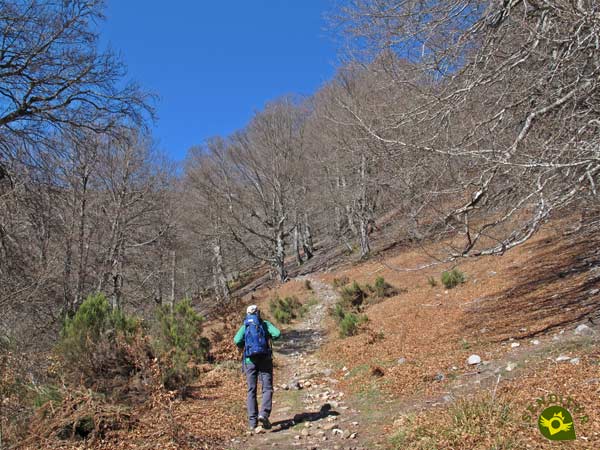
In our case we look for the blurred trail that draws a long curve allowing us to overcome this area with a little more ease.
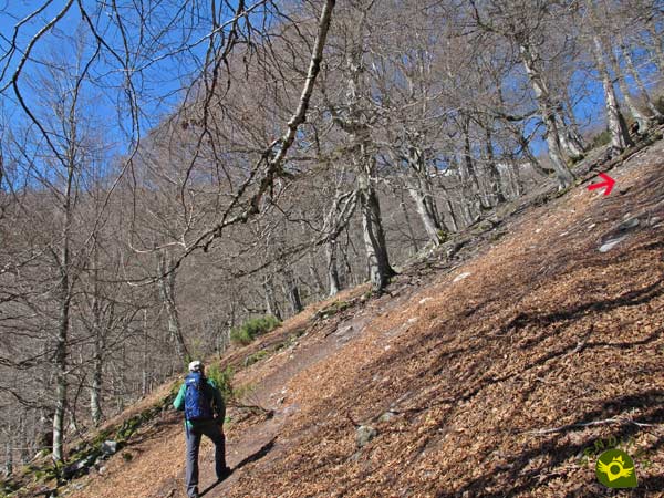
Even so, the slope is considerable and if it were wet, the terrain would be somewhat difficult.
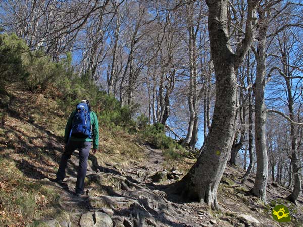
The trail we are following turns radically to recover the correct orientation and continue to ascend.

We soon reached the limits of the forest we were walking through, where we could approach some huts to take a well-deserved rest or continue our route towards the Gorbea.

An itinerary that continues to force us to strive to move forward. The landscape around us has changed completely, the forest has disappeared allowing us to contemplate clearly the itinerary to follow.

A route that, although still clearly uphill, is not as demanding as on previous occasions. Little by little we are getting closer to our objective, which is already visible in front of us.

This area of the pass between the Arroriano and the Gorbea, allows us to enjoy magnificent views as we prepare for the final part of the ascent.

A final part that we will do in the company of those who followed the Path of Murua or the path of Zarate that we joined. The final stretch of the ascent to Gorbeia is longer than it seems at first sight.
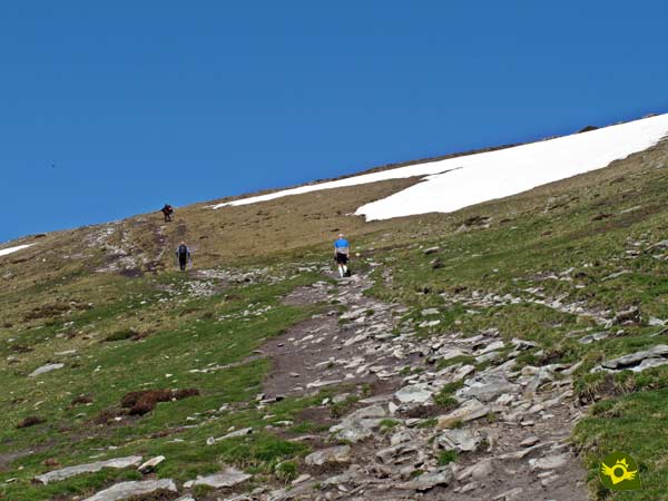
However, the slope to be overcome, although evident, does not represent a greater demand than the accumulated tiredness we have at this point of the route.

The famous Cross of the Gorbeia (2h 30min) welcomes us to the summit of this mythical Basque Mountain.
Once enjoyed the landscape with which the Gorbeia gives us we undertake the return to the quarries of Murua, we can do it following the same route by which we climbed or through the Path of Murua, but we embark on a return journey perhaps less crowded than the previous ones.
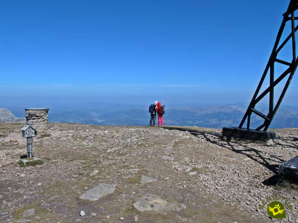
To do this we start to descend towards the Bizkaia side of the mountain following the famous route that goes up from Pagomakurre.

A descent with much more slope than the one we have overcome to reach the summit of Gorbeia, while the steep Aldamin serves as a reference to follow while contemplating the spectacular landscape around us.

When we reach the pass of Aldamiñoste we say goodbye to the Path of Pagomakurre and head to our right in search of a solitary rain gauge.

The rain gauge serves as a reference to find the beginning of the trail we must follow. A trail that makes us lose height quickly and sometimes gets lost under the green mantle that covers it.

Even so, the route to be followed does not make it too difficult for us to follow it. We advance embedded between the steep walls of the mountains that mark the ravine through which we are descending.

We must be vigilant, as we will soon have to leave the trail that follows its course to Dulau, to continue into the ravine.

This return route in some of its sections is not as clear and marked as other routes in the park.

But these loser areas soon end up leaving us with a trodden trail to follow.

The problem is that there will be several trails that we will encounter and that will force us to be clear about which one we should follow.

Once again, the forest reclaims its protagonism, enveloping us with its freshness. For now, the trail we are following only has a few lonely milestones that confirm that we are on the right track.

Milestones that we pass at the crossroads are not much help in deciding which way to go.
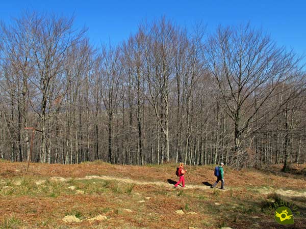
Luckily we soon find ourselves on a bad road that makes our job a little easier.

A path that runs next to a wire fence that separates the different hillsides of the mountain. From now on we will see ourselves following this old path that runs along the hill of the mountain towards which we are heading.
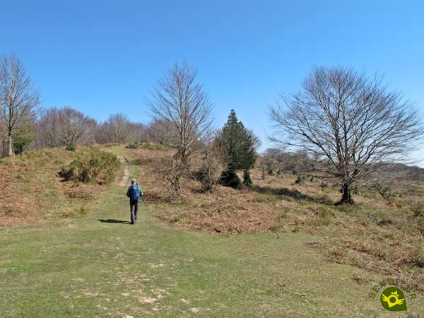
This part of the route allows us to look back and contemplate the beautiful picture of the mountains we have travelled.

To our right we leave a shelter, and the road that gives access to it, to continue in search of the Azero. The green mantle sometimes almost hides the path we are following.

A path that leads us without loss to crown the modest summit of the Azero (3h 15min). Without delay we follow the itinerary that will take us to the quarry of Murua.

We started to lose height again quickly surrounded by lush trees. The path leaves no room for doubt, allowing us to advance quickly.

The beech trees are a spectacle that undoubtedly beautifies this part of the descent.

As usual, our path draws a few curves to avoid a major slope. Although almost hidden, we will continue to leave behind some trails that we have to leave behind.

But under no circumstances will we have to abandon the broad path we are following. A path that is joined by other tracks to march together towards the quarries.

Soon we will meet again with the information posts and signs of the natural park that warn us of the proximity of our final destination.
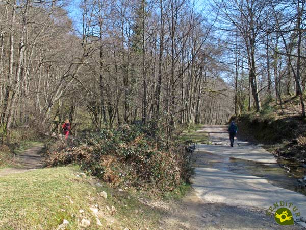
In this section we will be forced to wade the river several times, but if its flow is high we will have two bridges to facilitate the task.

Once on a perfect track we approach the quarry of Murua, not without first having to choose whether to follow the path or use the bridges on our left.

The river can make it difficult for us to wade through it, forcing us to go back a long way, to use the bridge that takes us to the path that runs on the other side of the river.

Once this obstacle has been overcome, all that remains is for us to continue to the car park where we began our journey.

But we still have a new wading of the river that of course also has its corresponding bridge that avoids this section.
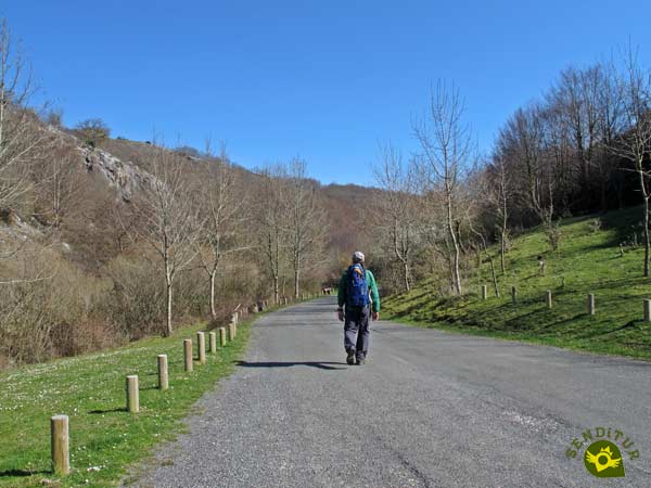
As we mentioned at the beginning, the area of the Quarry of Murua (4h 10min) has several parking areas so the end of our route will be more or less close, and we will have to travel the stretch of road that separates us from it.
If we return by the same route, the distance to be covered is hardly reduced.
Going down the Gorbeia by the same path or doing it by the proposed route should not significantly alter the total time we will need to do the route.
Given the lush forest that we travel in much of the route, spring and especially autumn become the most suitable months to venture into this route to the Gorbea. This leafyness allows us to consider also the route in the heat of summer since the shade of the forest will be well received. In winter or better said with snow, ice, etc... it is a period reserved for people with the experience and preparation necessary to face winter mountain routes.
The paths of the Gorbeia Natural Park, by the own regulation of the park, do not have a signaling as exhaustive as other routes, type GR or PR. For that reason and although some of the footpaths are quite evident, it is not too much that we take the necessary to be able to follow the itinerary in case of doubt. At the top, the wind can considerably lower the wind chill, so it is interesting to take warm clothes and windbreaks with you. Wearing a trekking boot is not a bad idea either, we will be grateful when we come across mud or rocky grounds. Consult our list of material and equipment for hiking. Read more.
Physical
Distance and slope join forces to make the summit difficult for us. We will have to face some entity ramp or other along a constant ascent. It is true that we will have a few rests, but it is better to take it easy, especially if our physical form is not correct.
Severity of the environment
As long as we do not go off the marked trail and the terrain conditions are normal, i.e. no snow and ice, we should not have any complications. Mud and rocky sections are the factors that, initially, may cause us more problems, especially on the way down. We must also be careful when fording the river, not only because of its flow, but also because the ground skids. We must not forget that the asphalted section of the track coincides with the vehicles that pass through it and there is usually traffic on holidays and in summer.
Orientation
Although the trails are usually well defined, trampled, the absence of clear marks along the route make it essential to be equipped with what is necessary to consult the route to be followed in case of doubt. We have information posts, but only at the main crossroads, the rest of the route has some landmarks that with old yellow points can serve as a reference, but do not differentiate one path from another.
| 1-Car Parks Murua | 0:00h | 691m | 0Km | 30T 521017 4761241 |
| 2-Gorbea | 2:30h | 1482m | 6Km | 30T 517827 4764608 |
| 3-Azero | 3:15h | 971m | 9.1Km | 30T 520124 4764151 |
| 4-Car Parks Murua | 4:10h | 691m | 12.6Km | 30T 521017 4761241 |
Coordinates UTM Datum WGS84
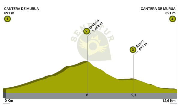
![]() Slope: 1706m
Slope: 1706m
![]() Slope +: 853m
Slope +: 853m
![]() Slope -: 853m
Slope -: 853m
![]() Maximum altitude: 1482m
Maximum altitude: 1482m
![]() Minimum altitude: 691m
Minimum altitude: 691m

This sketch of the route is not made to scale nor does it contain all the information relating to the area, it is merely indicative.

This schematic with the path is approximate and has been created from the derived cartographic base © Instituto Geográfico Nacional "Cuadrante 087-3, 25.000"
Senditur has manipulated the tracks to correct the aberrant points that may exist, caused by problems with the reception of the GPS signal. In any case the tracks are always approximate. SENDITUR encourages you to use the new technologies within your reach, using them as support and consultation in your activity, not basing the realization and orientation of the same only and exclusively on them, since they may see their functioning altered by very diverse causes, not functioning correctly and their indications may not be precise.
Find out what to see in...
¿Did you know that...
The Gorbea Cross was installed in 1901, currently this famous cross has a wingspan of 18 m, being the third cross that has been raised here, as the first of 33 m and the second of 23 m two storms destroyed them.
Don't miss out...
The Mairuelegorreta Cave is one of the best known caves in Alava, of great beauty and geological importance given its size and the network of galleries that form it.
From the commitment of SENDITUR with Nature and the respect to the balance of the environment, SENDITUR urges you to travel in a responsible way, with low environmental impact and respecting at all times the Natural, Cultural and Social environment wherever you go.
Besides sharing with all of us your experience on the route we would be grateful if you could write to us to inform us of any erroneous or outdated information you may have found, or simply to let us know what you think at Thank you.
This route has been carried out in the field by SENDITUR on 30-03-2019. The route may vary greatly depending on the time of year, weather conditions and terrain, as well as the actions of third parties and the evolution suffered in the natural environment where it is located. All opinions, advice and/or assessments made by SENDITUR in their descriptions are for guidance only and are subject to and/or refer to the specific conditions of the specific day of the route, referring to that specific day, taken from trained people, with the appropriate experience and with a high level of physical and technical preparation as a reference, as well as correctly equipped.
All the times are approximate and take an orientative character, the stops have not been taken into account, no matter how small they are. All the information related to the route, texts, images, videos, maps, diagrams, tracks, towns, and places of tourist interest are published as a guide, and may not coincide with the current state of each place. Before undertaking any activity, assess your technical knowledge, your physical condition, find out about the weather and the variations that the route may undergo, equip yourself correctly, be prudent and responsible at all times, and do not exceed your capabilities. SENDITUR is not responsible for any misuse or inappropriate use of the comprehensive guides of its routes and/or publications as well as its electronic guides, nor for any variations in their descriptions for the aforementioned reasons, and recommends that everyone be responsible and prudent in carrying out the activity. We also encourage you to read books and specialised guides to complement the information described above.
Continue watching …