Welcome to SENDITUR.COM · paths · routes · tourism

![]() Difficulty-Medium
Difficulty-Medium
![]() 3:45 h.
3:45 h.
![]() 13 km.
13 km.
![]() Difficulty-Medium
Difficulty-Medium
![]() 3:45 h.
3:45 h.
![]() 13 km.
13 km.
In the southwest of the province of Cordoba awaits the Sierras Subbeticas Natural Park, a protected natural area that treasures a rich geological and palaeontological heritage among other virtues. Caves, enchanted forests, ravines and mountains that are crossed by countless hiking routes, among which the Path of the Bailón River stands out. This route is perhaps one of the most visited of all those that cross this natural area, thanks in part to the great diversity of the landscape it runs through, the incredible places it passes through and the history that this area of Cordoba treasures. Among other attractions are the village of Zuheros, one of the most beautiful villages in Spain, and the hermitage of La Sierra with its viewpoint on Andalucía.
This is a linear route with two possible starting points. We can start the route in the town of Zuheros or from the car park that we will find shortly before starting the final stretch of the ascent to the hermitage of the Sierra within the municipality of Cabra. In any case, before starting the route we must apply for the relevant permit, which can be obtained at the Santa Rita visitor centre, on the road between Cabra and Priego, or at the office of the Sierras Subbéticas Environmental Agents attached to the visitor centre, at this link you have more information.
To reach the village of Zuheros we must follow the road that connects it either with Doña Mencía and Cabra or with Luque and Baena. Once there, in the middle of the road, without going into the town, we will find the turning that takes us to the car parks at the beginning of the path of the River Bailón, just before entering Zuheros.
If our intention is to do the route in the opposite direction, we will have to go to the town of Cabra. From there we must go to the hermitage of the Virgen de la Sierra. The accesses to this hermitage can be found on the road between Cabra and Priego de Córdoba, shortly after leaving Cabra towards Priego. This turn-off takes us to the hermitage after a while, but before beginning the final ascent to the hill where it stands we come across the path to La Nava, the starting point of the Path of the River Bailón in this area. There is no usual parking area here; we will have to walk a few metres along the path to find the signs marking the start of the route. Another option is to go up to the sanctuary and start our route from there, following the path that descends from there along the mountainside.
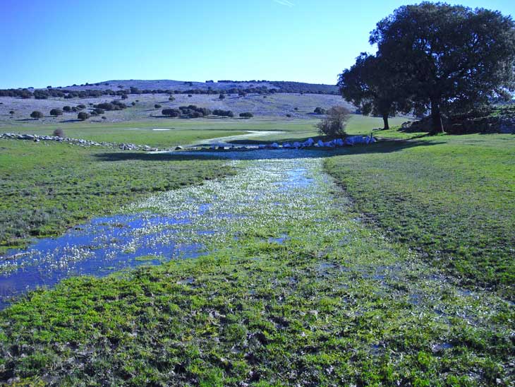
The car park at the entrance to Zuheros will be our starting point for this beautiful hiking route in the province of Córdoba. This is the start of the Path of the River Bailón, which is clearly signposted by the information signs available to us. In front of us we can already see the gorge carved out by the river, which is usually dry although its flow is underground. We begin a demanding ascent that makes us take it easy at the start. The height we reach allows us to enjoy unbeatable views of the canyon and Zuheros as the route winds its way up to soften the gradient to be overcome. A balustrade separates us from the abyss next to us and warns us of our arrival at the false plain where the Charco Hondo viewpoint awaits us (0h 25min).
After this short but gratifying respite, we are once again put to the test. The conditioning of the path gives way to the typical mountain trail surrounded by vertical crags. The river Bailón will get in our way on several occasions, forcing us to cross it, although generally without too many complications. Soon the Friar's Cave, so called because of the stalactite that crowns its entrance, takes us out of the effort we are making to advance. We continue along the route accompanied by the Bailón river until we reach one of the fountains we will pass by, the Fountain of the Mora.
These water springs, used as watering places for livestock, help us to better understand the special characteristics of this area and how it is criss-crossed by underground streams that emerge at certain points and times.
We continue along the route, alternating between some gentler areas and others that are steeper and steeper, leaving the riverbed further and further downstream. After a while the landscape changes as we enter a holm oak forest whose shapes are well worth the name Enchanted Forest. This part of the route takes us through this holm oak forest, passing the ruins of an old farmhouse, and soon after that we reach the fountain of Fuenfría (2h 05min).

Desfiladero del río-CC/Nikater
Río Bailón-CC/Teckömo

Zuheros desde el cañón-CC/Manuel Vilela

After a well-deserved rest we follow the signs and continue our route towards the hermitage of Cabra. The slope has almost disappeared, giving way to a much more comfortable area with some uncomplicated ascents and descents. We quickly pass the Fountain of La Rebola and shortly afterwards we arrive at another of the important points of the route, the Paleodolina. An information panel explains the curious process of formation of this sinkhole and its location, thus avoiding overlooking this spot.
With each step the surrounding landscape shows us how it is changing compared to the previous sections.
A change that translates into a wide plain where we will find the post that marks the detour that we must follow to approach Las Chorreras. This detour leads us to follow the course of the Las Chorreras stream, whose flow will give us an idea of the state of the place we are heading towards. We leave the plain behind us and enter the holm oak forest that hides Las Chorreras (2h 35min). A first waterfall makes us think that we have arrived, but in reality a few metres further up, following a hidden path that runs along the side of the waterfall, there is a second waterfall that is just as beautiful, if not more so, than the previous one.
After enjoying this spot, we retrace our steps back to the point where we turn off to take the path that will take us to the foothills of the sanctuary of the Virgen de la Sierra. The plain is once again our companion, a companion that takes us to meet another old friend, the river Bailón, which in this area has created a totally different landscape to the one we are used to. There are several enclosures that we have to cross as we advance towards our next objective. This part of the route follows a wide path that, together with the waymarks, leaves little room for error. Little by little we leave the Polje de la Nava behind us and head towards the Picacho de Cabra. When we reach the edge of the Picacho de Cabra some signs mark the official starting point of the Path of the River Bailón on this side, just before our path meets the road (3h 45min), which ascends to the Sanctuary of the Virgen de la Sierra. If we want to climb up to the sanctuary we have to initially follow the road until we meet the winding path that ascends the mountainside. This extension means adding 1.5 km more, on the outward journey alone, to the total distance covered so far. This is in addition to another 200 m of positive ascent to the summit of the Picacho de Cabra.
1-Please note that the distance, time, elevation gain and difficulty shown here correspond only to the outward journey, so you will have to add the return journey, which is usually done along the same route.
2-Although there are several fountains along the route, you will need water and food enough to eat.
3-It is not recommended to do the route during rainy periods as there are flood zones along part of the route.
4-Adapt and plan the route to your abilities, equip yourself correctly and be respectful of the natural environment you are travelling through.
 |
 |
 |
 |
 |
| 1-Zuheros | 0:00h | 615m | 0km | 30S 383627 4155686 |
| 2-Viewpoint of the Charco Hondo Canyon | 0:25h | 725m | 0,9Km | 30S 383608 4155531 |
| 3-Fountain of Fuenfría | 2:05h | 960m | 4,7Km | 30S 382526 4152662 |
| 4-Los Chorrones | 2:35h | 985m | 7,3Km | 30S 380528 4152153 |
| 5-Parking | 3:45h | 1044m | 13Km | 30S 378391 4149419 |
Coordinates UTM Datúm WGS84

.png) Distance: 13Km
Distance: 13Km
.png) Time: 3:45h
Time: 3:45h
.png) Difficulty: Medium
Difficulty: Medium
 Slope: 792m
 Slope +: 605m
 Slope -: 187m
 Maximum altitude: 1044m
 Minimum altitude: 615m

![]()
This schematic with the path is approximate and has been created from the derived cartographic base © Instituto Geográfico Nacional "Cuadrante 967-3, 967-4, 989-1 y 989-2 1:25.000".

¿Did you know that...
The Sierras Subbéticas Natural Park was declared a Natural Park in 1988 and subsequently, given its great geological heritage, it was also recognised by UNESCO as a Geopark in 2006.
Don't miss out...
A visit to Zuheros, which together with its castle forms an imposing Historic-Artistic Site. Nor should you miss the Cave of the Bats, 4 km from the town, which with its 415 m, 700 steps of tourist route, is the largest cave in the province of Cordoba.


From the commitment of SENDITUR with Nature and the respect to the balance of the environment, SENDITUR urges you to travel in a responsible way, with low environmental impact and respecting at all times the Natural, Cultural and Social environment wherever you go.

Besides sharing with all of us your experience on the route we would be grateful if you could write to us to inform us of any erroneous or outdated information you may have found, or simply to let us know what you think at Thank you.
Route information updated on 18-05-2021. The route may vary greatly depending on the time of year, weather conditions and terrain, as well as the actions of third parties and the evolution suffered in the natural environment where it is located. All opinions, advice and/or assessments made by SENDITUR in their descriptions are for guidance only and are subject to and/or refer to the specific conditions of the specific day of the route, referring to that specific day, taken from trained people, with the appropriate experience and with a high level of physical and technical preparation as a reference, as well as correctly equipped.
All the times are approximate and take an orientative character, the stops have not been taken into account, no matter how small they are. All the information related to the route, texts, images, videos, maps, diagrams, tracks, towns, and places of tourist interest are published as a guide, and may not coincide with the current state of each place. Before undertaking any activity, assess your technical knowledge, your physical condition, find out about the weather and the variations that the route may undergo, equip yourself correctly, be prudent and responsible at all times, and do not exceed your capabilities. SENDITUR is not responsible for any misuse or inappropriate use of the comprehensive guides of its routes and/or publications as well as its electronic guides, nor for any variations in their descriptions for the aforementioned reasons, and recommends that everyone be responsible and prudent in carrying out the activity. We also encourage you to read books and specialised guides to complement the information described above.
Continue watching …


