Path Portilla
Home of birds, place of legends, treasure of nature
Home of birds, place of legends, treasure of nature
The Valderejo Natural Park, in the province of Alava, treasures corners of incalculable natural and landscape value. Narrow gorges, vertical rocks, home to countless species of birds, leafy forests and ancient villas are some of its jewels. Most of the hiking trails that run through the park start from the town of Lalastra, making it a must-see place for lovers of hiking and nature.

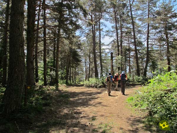
The Path Portilla of 10.6 km, takes us through some of the areas of the Valderejo Natural Park. Starting from the town of Lalastra, and following for a moment the same route as the Path of the river Purón, our itinerary says goodbye to this beautiful town to enter the leafy forest that surrounds it. Now without the company of the Path of the river Purón we begin a beautiful journey that runs surrounded by slender pine trees. Our path gains height calmly as it approaches the fields of La Portilla, from where we can enjoy magnificent views. Already on the other side of the mountain, and under the attentive look of the Rock Santa Ana, we will begin a dizzying descent that will take us to the vicinity of the depopulated Ribera. Its church tempts us with deviations from our route to visit it.

Here, in Ribera, the Path Portilla ends, at the same time as other itineraries coincide, such as the Path to the Purón River Gorge, a more than interesting detour that we can take. From Ribera and after enjoying the many options that are offered to us, we undertake the return towards Lalastra following the course of the Path of the river Purón, with which at the beginning we had coincided. This part of the route takes us up the vertical walls that mark the river while we enjoy the landscape around us. Little by little we are approaching the end of the route as we are joined by the different detours we have left behind. Lalastra welcomes us just as we said goodbye, with its magnificent church and its carefully designed buildings that make the final stretch of this trekking route through the Valderejo Natural Park more enjoyable.

The network of trails that run through the Valderejo Natural Park, in most cases intertwine with each other allowing us to adapt or configure the route to our liking. In this case we have several possibilities to shorten the route if necessary. We can also extend it and take advantage of it to visit the gorge of the Purón river, whose most impressive area is in the stretch between Ribera and the Burgos town of Herrán. Moreover, if we dare to visit it, we can return to Ribera by the Path of Santa Ana, making this way an itinerary reserved for hardened hikers.
The main access road to the town of Lalastra is in the village of San Millán de San Zadornil. From here, passing through San Zadornil and Arroyo de San Zadornil, we will reach the town of Lalastra. Just at the entrance of the village we will find the parking area where we will have to park our vehicle since the circulation from this point is limited for the non-residents.
We are in a natural park with specific rules for pets. Whenever we are in areas of pasture must be tied. Before undertaking any route, please check the restrictions that are in force during this period.
The route should not be a problem for our friend, provided he is used to it and we do not forget to bring him enough food and water.
The cattle is a habitual of this zone, cattle that usually are accompanied by mastiffs reason why we will have to extreme the precautions and to try not to bother the flocks.
The parking area that we find just at the entrance of the town of Lalastra (0h 00min) is the starting point for most of the trails that run through the Natural Park of Valderejo.

We follow the course of the road we arrived on and that takes us through the town. On the outskirts of Lalastra we find the park house on our right.

In front of it, on our left, begins the path along which we must continue. Shortly after passing through a metal gate we find a new junction (0h 05min).

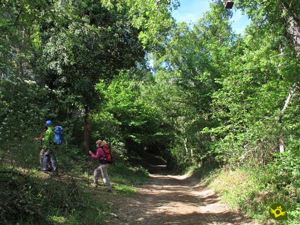
Here we will say goodbye to the Path of the Purón River, and we will start to follow the directions of the Path Portilla. At this point we begin to gain height with each step, surrounded by a thick forest.

This path takes us effortlessly to contemplate Lalastra and part of the surrounding landscape. Almost without realizing it, we arrive at a new gate that we have to go through.

As soon as we do so, a narrow trail begins on our right that we have to follow. A trail that quickly leads us to another wide path that will be in charge of guiding us from now on.

This path continues to make us gain height with every step, while we enjoy the forest around us.

At the few crossroads we will pass, we will not have to leave the course of the path we are following. Another lonely gate warns us of the next end of the forest that is accompanying us.

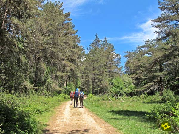
The first fields we will pass through allow us to contemplate part of the unmistakable landscape of the Valderejo Natural Park.

Here we will also have the first opportunity to detour to the Path of the Purón, and shorten the route we are taking. Our path, almost hidden under the grass that covers it, continues its course, now much more comfortable.

We began to lose altitude gently, leaving a few crossroads behind. But soon we will have to face a new ascent that warns us of the winding route ahead.

This part of the itinerary forces us to be attentive to the different crossroads we encounter.

Another wide field and a new detour quickly come our way, inviting us to shorten our route. A route that continues on its current invariable course, surrounded by the vegetation of the area.

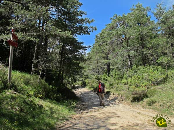
After a while we arrive at a new junction where, now yes, we have to take a detour and follow the path on our right. A path that continues to force us to make an effort to overcome the slope it presents us with.

This area is leading us towards our goal without it still being seen in front of us. We have to be careful because there will be several crossroads where we will pass without deviation.

A new wooden gate marks the beginning of the steep descent that lies ahead.

The stony path we descend along allows us to contemplate a spectacular landscape.

An old and battered wire fence cuts us off, forcing us to look for the place where we will have to cross it.

Shortly after saving the fence the path reaches its end, leaving us in a wide and green meadow. The route at first follows the limits of this meadow, leading us to an old electricity hut.

If we look closely, under the vegetation of the meadow we can sense the path we are following. Just before we reach the electricity pole we will be forced to leave the official route for a moment.

In this area the route follows the old cart track that used to run through these fields, and which is now almost hidden by the vegetation.

This forces us to leave it for a few meters and follow a trail that runs not far from the official route.

This trail quickly brings us back to the old path to continue descending towards Ribera.

But once again a post indicates the moment to detour and leave this, almost disappeared, path.

This new detour brings us back to another meadow that allows us to see in front of us the path towards which we are heading.

We can either go to it by crossing this field or, as soon as we enter it, turn right and follow the line drawn by the fence that borders it.

In any case, both possibilities lead us to the dirt track that will take us to the uninhabited area of Ribera (1h 45min).
A series of signs indicate where the different paths that coincide here lead to.

We leave on our left the bridge over which the Path of the Purón continues towards the spectacular gorge, to join this path but in the opposite direction, towards Lalastra.

To return to Lalastra, we will follow the Path of the Purón River, as the Path of Portilla ends when we reach Ribera. The riverbed accompanies us on this quiet and beautiful stretch of the route.

Soon we will begin to face the slope that we have to save in order to return to our starting point. Little by little we are going up the narrow gorge carved by the river.

Luckily, although with notable ramps, the slope is not as constant and demanding as in the previous descent.

We left behind the course of the Purón River to wade the Polledo stream, either by the bridge that crosses it or, if the flow allows it, by the same path we are following.

Without ceasing to gain height almost at no time our route brings us closer to another important point of the itinerary.

Here we will have to choose between following the marks of the trail and facing a steep slope, or not abandoning the path that in exchange for some more distance gives us a kinder unevenness.

If we decide to follow the marks, we will see ourselves travelling a typical mountain trail, somewhat broken up in some areas and with a not inconsiderable slope at this point of the route.

After overcoming the slope, the trail takes us back to the path we had abandoned before, to continue together towards Lalastra.

At that moment, we came across one of the detours we passed through in the fields of Portilla, which communicate both paths.

Here, of course, we continue on our way without deviation, leaving this crossroads behind. We still have some slopes to cover before we reach the end of this entertaining route.

Once outside the protection of the forest we will be able to contemplate a magnificent perspective of the rockers that characterize this natural park.

The slope to be overcome reaches its end just at the same place where the first of the detours that we had left behind at the beginning of the tour joins us.

From here begins a rapid and short descent that brings us closer to the limits of the town towards which we are heading.

Not without first leaving on our right the path along which the Path to Portilla runs, which we meet again.

Together we only have to follow our steps to cover the last meters that separate us from Lalastra (2h 50min) and the parking lot where this hiking route ends.
To this figure we will have to add the distance to get closer to the deserted area or to the gorge, depending on our destination.
There are many possible variations of itinerary that this route presents to us and that we will have to take into account, if we vary the proposed route.
We are in a natural park that has an important colony of birds, which considerably increases the attractions that the route already has. If it has rained the previous days it is very probable that we will find very muddy areas of the route.
The apparent simplicity of the route cannot make us fall into the error of not equipping ourselves correctly. Footwear and clothing appropriate for hiking, sufficient food and water, walking sticks and protection from the sun, among other things, are inherent in every route we take. It's not out of the question that we carry our GPS with us on the track. The path is signposted at all times but there are areas that can confuse us. Consult our list of material and equipment for hiking. Read more.
Physical
For a person accustomed to this type of activity, the itinerary is uncomplicated. Facing the ramps that we have to overcome with the necessary calm and time, we will be able to enjoy a quite pleasant day. If we change the direction of the route, the physical difficulty increases, since the difference in level is concentrated almost entirely in the same stretch.
Severity of the environment
A few slippery areas are at first sight the greatest danger we will encounter. But we must not forget that part of the route is embedded or flanked by the walls of the gorge it runs through, with the consequent exposure to possible falling stones. Another factor to take into account is the considerable vertical drop that we will have in some sections of the wide return trail and that should not go unnoticed.
Orientation
The route is signposted almost at all times. It is certain that in the proximities of Ribera the itinerary becomes more complicated to follow given the vegetation that covers the course of the old road. Another factor that can make us doubt are the innumerable signposted paths that we will find.
| 1-Lalastra | 0:00h | 917m | 0Km | 30T 481347 4747104 |
| 2-Junction | 0:05h | 904m | 0.4Km | 30T 481082 4746817 |
| 3-Ribera | 1:45h | 751m | 6.8Km | 30T 481232 4744179 |
| 4-Junction | 2:45h | 904m | 10.2Km | 30T 481082 4746817 |
| 5-Lalastra | 2:50h | 917m | 10.6Km | 30T 481347 4747104 |
Coordinates UTM Datum WGS84

![]() Slope: 682m
Slope: 682m
![]() Slope +: 341m
Slope +: 341m
![]() Slope -: 341m
Slope -: 341m
![]() Maximum altitude: 1025m
Maximum altitude: 1025m
![]() Minimum altitude: 751m
Minimum altitude: 751m

This sketch of the route is not made to scale nor does it contain all the information relating to the area, it is merely indicative.

This schematic with the path is approximate and has been created from the derived cartographic base © Instituto Geográfico Nacional "Cuadrante 110-4, 25.000"
Senditur has manipulated the tracks to correct the aberrant points that may exist, caused by problems with the reception of the GPS signal. In any case the tracks are always approximate. SENDITUR encourages you to use the new technologies within your reach, using them as support and consultation in your activity, not basing the realization and orientation of the same only and exclusively on them, since they may see their functioning altered by very diverse causes, not functioning correctly and their indications may not be precise.
Find out what to see in...
¿Did you know that...
Some of the trails in the Valderejo Natural Park, when you walk through the rocks where the birds that live in the park breed, are usually closed to the passage of people several months a year. Consult the park's house for the affected trails and the periods when these restrictions are in force.
Don't miss out...
The nearby medieval town of Valpuesta, which has a rich architectural heritage that has as its main jewel the Collegiate Church of Santa Maria. This town is considered to be one of the cradles of Castilian Spanish, as it is home to the Valpuesta Cartularies, writings which, according to some scholars, contain the first words in the Spanish language.
From the commitment of SENDITUR with Nature and the respect to the balance of the environment, SENDITUR urges you to travel in a responsible way, with low environmental impact and respecting at all times the Natural, Cultural and Social environment wherever you go.
Besides sharing with all of us your experience on the route we would be grateful if you could write to us to inform us of any erroneous or outdated information you may have found, or simply to let us know what you think at Thank you.
This route has been carried out in the field by SENDITUR on 08-06-2019. The route may vary greatly depending on the time of year, weather conditions and terrain, as well as the actions of third parties and the evolution suffered in the natural environment where it is located. All opinions, advice and/or assessments made by SENDITUR in their descriptions are for guidance only and are subject to and/or refer to the specific conditions of the specific day of the route, referring to that specific day, taken from trained people, with the appropriate experience and with a high level of physical and technical preparation as a reference, as well as correctly equipped.
All the times are approximate and take an orientative character, the stops have not been taken into account, no matter how small they are. All the information related to the route, texts, images, videos, maps, diagrams, tracks, towns, and places of tourist interest are published as a guide, and may not coincide with the current state of each place. Before undertaking any activity, assess your technical knowledge, your physical condition, find out about the weather and the variations that the route may undergo, equip yourself correctly, be prudent and responsible at all times, and do not exceed your capabilities. SENDITUR is not responsible for any misuse or inappropriate use of the comprehensive guides of its routes and/or publications as well as its electronic guides, nor for any variations in their descriptions for the aforementioned reasons, and recommends that everyone be responsible and prudent in carrying out the activity. We also encourage you to read books and specialised guides to complement the information described above.
Continue watching …