Welcome to SENDITUR.COM · paths · routes · tourism


![]() Difficulty-Remarkable
Difficulty-Remarkable
![]() 7:10 h.
7:10 h.
![]() 27 km.
27 km.
![]() Difficulty-Remarkable
Difficulty-Remarkable
![]() 7:10 h.
7:10 h.
![]() 27 km.
27 km.
Green pastures alternate with lush forests as we advance through the now gentle mountains that separate Tineo from Pola from Allande. A route that ignoring the mandates of Alfonso IX and seeking the protection of the villages of the valley will put us before the dilemmas of paying attention to the king by visiting Obona and taking the always hard Route of the Monasteries putting us in the skin of the ancient pilgrims who passed through here. A stage of the Primitive Way that will keep us in a continuous uphill and downhill ascending the hills that stand in our way and then precipitate us to the marked valleys that separate them.

The stage 4 Tineo-Pola de Allande with 27 Km will make us leave behind Tineo, with its palaces to undertake a long ascent cutting the slope of the mountain. The height gained will offer us the opportunity to contemplate beautiful landscapes in the different clearings that the leafy forest offers us. The Pass of Piedratecha is the first reef to save during this stage, in exchange it allows us to entertain ourselves contemplating the extensive sea of mountains that extends before us, with calm we will be able to glimpse the summits by which we will walk. The oaks and chestnut trees liven up the descent that will bring us closer to the detour towards the Monastery of Santa María la Real de Obona, once a refuge for not a few pilgrims. The river Deina reminds us with its rumour that we must continue through this leafy forest to reach Villaluz and its small chapel of Christ, from where we face a long stretch of road, less demanding in terms of the slope but more monotonous than the previous one if not for the small villages that we will visit, even if only in passing. Villages like Vega de Rey, not far from the Camino, or Campiello a real oasis for the pilgrim in the middle of the asphalt.

The road leads us through the green meadows, giving us small corners such as the chapel of La Magdalena, near El Fresno, or tempting us with nearby villages such as El Espín. But the sometimes imperturbable Camino only allows us to leave the asphalt to lead us to Borres, an improvised base camp chosen by not a few pilgrims who have in mind the well-known Hospital Route. The church of Santa María almost serves as a reference point to mark the beginning of the uncomfortable final part of the stage, a winding route with a demanding profile that will accompany us until the end of the day. Shortly after leaving the locality we will find the beginning of the mountainous route that in the past was followed by pilgrims, to leave it behind heading for the nearby Samblismo, which we cross almost unnoticed to cover half a slope the distance that separates us from La Mortera. The locality extends to our right following the layout of the nearby road, which will claim its part of protagonism not infrequently along the remaining kilometers. In front of it there is an undulating route in which the Way seeks to free us from all that it can from the dangerous traffic that circulates on the nearby road and save us some kilometres in exchange for steep ramps that descend towards the bed of small streams and then go up the lost height with force.

Colinas de Arriba is located in one of these short short cuts, returning us back to the road to take a new shortcut that will take us down to the river Villaverde and then go up again to the road and together reach Porciles, after passing by the church of San Roque that precedes the town. Once again we leave the company of the carreteara and after descending to the Porciles river we face the final stretch of the ascent to the Alto de Lavadoira, preceded by the small village that gives it its name and that the Way forces us to leave aside. From this symbolic peak begins the vertiginous descent that takes us through dense forest and green meadows at the bottom of the valley. A cobbled descent that brings us closer to Ferroy, a clear indication of the proximity of the end of the stage, although to do so we will still have to face some crossroads and their relevant detour before reaching Pola de Allande, of course, following the course of the road, where we await its Palace of Cienfuegos de Peñalba of the fourteenth century or the sanctuary of Our Lady of Avellano of the thirteenth century, before we enter it concluding this stage.
In the final stretch of the stage if it has rained we can find the route that follows the Camino very muddy and the streams with more flow than usual making it difficult and even discouraging the passage, in which case we can choose to follow the road at all times, knowing that we will have to assume a greater distance along with the risk involved in transiting it.
A complicated stage in which our friend will not only have to face the kilometres he has but also his demanding layout which, together with the road sections, will not make this a simple day for him. It is advisable to try not to give him too much margin and to avoid that he travels more distance than necessary going and coming, in addition the sections of road next to the crossings force us to extreme the precautions.
The water initially should not be a problem, although its corresponding ration cannot lack us, to good sure it will be able to drink and to refresh in some of the streams or points of water that we will pass. Your food cannot be lacking either, since your hydration and nutrition during the tour must be adequate to help you in the effort.
As usual we are in cattle land so we have to meet the cattle, usually in meadows or stables. A lot of attention when passing next to the agricultural pavilions, their dogs are not usually very nice and in some cases they walk to its wide by the surroundings. Special care should be taken during the hunting season, as we pass some areas where there are usually hunts and although the regulations theoretically require a certain distance does not cease to be an added factor to the stage.
 |
 |
 |
 |
 |
 |
 |
 |
 |
 |
 |
| Tineo |  |
|
|
|
|
|
|
|
|
|
| Villaluz | ||||||||||
| Campiello | |
|
|
|
||||||
| Borres | |
|
||||||||
| Samblismo | ||||||||||
| La Mortera | | |||||||||
| Colinas de Arriba | | | ||||||||
| Porciles | |
|||||||||
| Ferroy | ||||||||||
| Pola de Allende | |
|
|
|
|
|
|
|
|
Variant: Stage 4b Ruta de los Hospitales
The church of Tineo (0h 00min) in the steep main street indicates the place where this stage 4 Tineo-Pola de Allande begins.

Leaving the church behind us, we advance through the narrow traverse of the fountain, arriving quickly at the next crossing. Here we will continue on the right, going already in search of the outskirts of the locality.

Those who, for whatever reason, had descended the main street to the town hall square do not need to climb it again. If you continue a few metres along the road that crosses the town, that is to say the González Mayo avenue in the direction of Pola de Allande, in a short time you will come across the detour, which following a street that is climbing strongly will lead you to join the Primitive Way again.

Almost on the outskirts of Tineo, the two Ways unite to say goodbye to the municipality. In front of us awaits a hard ascent that little by little we begin to realize following the asphalted track by which we left Tineo. This route allows us to look back to contemplate the beautiful panoramic view of the town we have just left.

Shortly afterwards we will come across a crossroads where the itinerary forces us to continue ascending, leaving aside the track that descends towards the road.

Almost without time to enjoy the scenery we arrive at a new fork where the slope will give us a small respite to follow our way the track that seems to cut the slope of the mountain.

The amplitude and relative comfort of the track we were on has given way to a narrower path that takes us along the mountain making us face some ramp while we continue to gain height.

There are not many crosses that we find in our way and in the few that we encounter the itinerary to follow leaves no doubt. We continue advancing while the capricious road changes its firm and width at will, at the same time that it continues giving us some hard ramp.

The vegetation that protects us from the sun, as well as the ups and downs, alternates with the occasional clear that allows us to enjoy the magnificent landscape that surrounds us.

The route forces us to gain height with each step, making us leave aside the other tracks that seem to precipitate towards the valley and that surely in most cases would return us to the road that runs to our left.

The track that is guiding us along the route meanders uphill looking for the top of the mountain, fortunately in the first big curve that describes it we will have to abandon it to continue with our more benevolent course.

The path to follow, noticeably more marked or stepped on, clearly shows the correct course at the different crossroads that we are in this section. The grove that surrounds us, at the same time as protecting us from the sun, gives us its freshness, making the ascent we are facing more comfortable.

Without almost a moment of truce that will allow us to catch our breath, we continue to advance in search of the end of the ascent while we continue to cross some other path. Surrounded by vegetation and almost fitted between the stone wall that delimits the pastures and the slope that separates us from the forest, we continue with the long ascent.

The path, as it were, gains and loses width almost at the same time that it gives us cobbled sections while we leave behind not a few crosses. The vegetation almost completely takes over our path, which hardly resists the passage of pilgrims.

Finally, both the slope and the narrow terrain seem to end, at the same time as we find a dirt track. Going a few metres along it we will go out to the road we must follow, even if only for a short time.

We quickly come out to the pass, on our right, a new path that takes us from the company of asphalt, making us take a small detour that will avoid us to continue along this narrow road to which we will return a little later. We continue with the ascent and something softer and without the exuberant vegetation that hid us the landscape, which allows us to contemplate almost totally the environment that surrounds us.

After a while you will come to a new crossroads, where you have to continue on the left to return to the lost course when you leave the road. The effort made in this stage to get here is rewarded with magnificent views.

After a while our way ends in a cement track that we must continue and that will return us to the road that we had left before. This cement track takes us without further detours leaving behind the few paths we are encountering.

When arriving at the road the itinerary continues for her the descent that already before we had initiated and that will take us until a near new crossing.

The road that joins Tineo and Obona cuts us off, forcing us to cross it, leaving aside the access to the nearby Piedratecha, follow the path that runs next to it on its left side.

Once on the other side, in front we have a relatively short stretch of trail not as separated from the road as would be appreciated, although sometimes we are protected from it by the typical guardrail.

After a while our path begins a steeper descent leaving the company of the road and entering a thick forest. We descend through the interior of the forest, which again hides the wide landscape that surrounds us, while we leave behind the paths that meet us.

There are not a few crosses that we meet on the way down, being the best state of our way and the common sense that advises us to continue descending, the best allies in case of doubt.

Almost without realizing it we have arrived at the detour that gives us the option of approaching the Monastery of Obona from which we are barely 500 m apart, if this is our option we will have to go straight on to visit it, return here again or embark following a track that joins the Way ahead. If we give up trying, then we will only have to follow the path on our left that makes us leave this option behind.

The itinerary, already without so much unevenness, makes us advance leaving to both sides the few paths that we find. For those who had not taken the detour to visit the monastery, they have the opportunity in this section to contemplate it in a small clearing provided by the trees that surround us.

It is at one of the crossroads that we come across, where we will be joined by those pilgrims who venture from the same monastery to follow the path that, bordering the forest and meadows, joins us without the need to return to the first detour. Finally all together we begin to gain height with each step, without leaving the main track that we are carrying.

The thickness of the forest gives way little by little to let us intuit the first buildings of the locality to which we are about to arrive.

We left the forest definitively to get fully into the green meadows that will accompany us in this part of the stage.

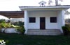
The small town of Villaluz (2h 50min) welcomes us, although our journey only lets us pass by it.

A short path that crosses a wooded area serves as an improvised shortcut, leading us to the road that leads out of the town.

Behind us is the washing place and the small chapel of Villaluz as we head towards the nearby road.

Without time to get used to the asphalt we arrive at the meeting of the road, which will be our inseparable companion for a while.

In a gentle descent, we start a long stretch of road without hard shoulder that will be in charge of guiding us from now on, at least for the moment.

The road takes us through green meadows and the ancestral homes that dot them, to the junction with the access to Vega de Rey, which we leave behind to follow the direction that our road marks.

The route also takes us past livestock farms that are located, in the vicinity of this town, close to the road on which we are going.

We continue along the road ignoring the different paths that we have to find on both sides, while we continue crossing small urban nuclei formed by just a couple of houses.

In the middle of a curve, we leave on the right a path at the beginning of which is a landmark of the Way of Saint James that can confuse us by making us believe that we should follow it when in reality we do not have to leave the road for now.

Our road, after leaving behind a new crossroads, leads us without major complications directly to the next locality of the stage we arrived at shortly after.

The small town of Campiello (3h 25min) sees how our road crosses it without contemplations, making us cross it from side to side.
Almost without realizing it, we see ourselves again in the relative solitude of the asphalt, surrounded by the green meadows that extend around us.

The road leads us to a pleasant rest area and next to it the small chapel of the Magdalena de El Fresno.

We leave behind the access to El Fresno and its chapel to quickly come across the road that leads to El Espín, another small village that the road almost goes unnoticed by the eyes of the pilgrim.

We follow the impassive course marked by the road, leaving aside the different accesses to El Espín that we have to find.

Just at the sign indicating the end of El Espín, our route leaves the road we were going up to now, to continue towards Pereda, Orrea and Sangoñedo.

This new section of road continues to meet various paths, which we leave behind following the course of the road, at least for the time being.

We arrive at the crossroads where we will now leave the asphalt to continue along a dirt track that we find in the middle of a curve.

This battered road surrounded by vegetation will be in charge of taking us to the next locality of the stage. The mud in case of rain and the vegetation become protagonists again in this zone, returning us to the roads between meadows.

Soon we will see ourselves passing by old farms and crossing the roads that led to them.

The itinerary brings us relatively quickly to Borres, which we can already sense amidst the vegetation, at the same time as we leave behind pathways.

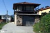
The path without further ado and after passing a solitary fountain, leads us to the very gates of the town. We enter Borres (4h 05min) leaving on both sides the streets we are in, at the same time that we ascend between their houses.

The street that received us on our arrival in the locality takes us up to the very back of the church.
Arriving next to the church, the Primitive Way turns abruptly to continue ascending towards the meeting with the road.

When we reach its height we will take advantage of the pedestrian crossing to cross it and continue ascending between the houses of Borres.

We quickly reach the limits of the locality where we will continue ascending along a dirt road leaving Borres behind us.

The paved road makes us gain height until we find another road that joins us, softening at the same time the unevenness that we are climbing.

The path now continues halfway up the slope, initially following the boundaries of a wooded area, and soon we will be introduced to it once and for all. The great mountains towards which we are heading are getting closer and closer, a sign of this is the next crossing where we will have the option of taking the so-called Route of the Hospitals.

This route, recommended only for pilgrims who are well prepared physically and accustomed to mountainous terrain, transports us from mountain to mountain for quite a few kilometres at an altitude of more than 1000 metres. The route leaves us at the mercy of the elements, being the small villages of Montefurado and Lago at 16 and 20 km respectively from this point the first places where we are lucky to meet a local, if we do not have to reach Berducedo 23 km from here for it.

We continue straight ahead, leaving this variant on our back and a path on the left that descends towards the nearby road. The road seems to be approaching gradually towards us when we are surprised by the end of the trees that covered the road and we see ourselves entering the next locality of the stage.

Samblism (4h 35min) is cut in two by the inseparable road that has followed us for some time now, and that forces us to cross it.

We cross the road with due caution using the pedestrian crossing that is here and we continue the descent by the encementado way of the other side.

Quickly we will see ourselves in a new crossroads where we will take again the course that the near road will mark us in ahead.

At the outskirts of Samblismo we will leave a track that takes us towards the road to continue parallel to it but at a certain distance. The comfortable cement road comes to an end giving way to a wide track that will be responsible for taking us to the next village of the stage.

This pleasant stretch takes us uncomplicatedly through the green fields of pastures that surround us. The track leads us to the road that leads into the town.

As it could not be otherwise La Mortera (4h 50min) sees how it is cut in two by the road, but this time we will not have to cross it as the itinerary passes almost bordering the limits of the village, leaving as before the road always on our right.

We cross the locality leaving to left and right the streets or ways that go out to our encounter until arriving at the outskirts of La Mortera.

It is in this place where we continue along the path on the left, leaving the one on the right that insists on taking us towards the road.

The track stretches out in front of us, cutting through the meadows in front of us, as we follow the course it sets for us, leaving behind with each step the village we have just crossed.

The track takes us to a first crossroads that we leave behind to find another one where we will continue on the right starting to gain height more noticeably.

Quickly our track turns abruptly, it is in this curve where in front of us begins a greenish and wide path that cuts in two the green meadows that surround us and where we must follow.

This footpath makes us gain height with certain rapidity directing us irremediably towards the road that until the moment we had managed to avoid.
.jpg "We went out to the road and almost at the moment we left it. The cyclists all this section better by carrertera")
Luckily we won't have the asphalt company for a long time, at least for the moment, but we do have a somewhat convoluted area. A few metres from the road, we will get away from it following a narrow trail on the left.

This trail makes us travel about 50 m further away from the road, to return to it quickly.
.jpg "The trail follows on the other side.")
When we meet the asphalt again we can confuse the narrow trail that follows by our hand and that we should not take. The Way crosses to the other side and continues by the cobbled trail of that hand of the road.

In the middle of a curve an asphalt track cuts off the pass, we will have to cross it and follow the hidden trail that rushes towards the bottom of the ravine we are crossing.

This area, quite entangled with vegetation, may make us doubt, but the trail, after crossing the stream that runs down the valley, takes us again to cross the road, this time through a tunnel that takes us away from the dangerous traffic.

As soon as we pass through the tunnel, the itinerary returns to the drawing that marks the road that now passes over our heads to begin to climb the lost height. We continue ascending to meet again with our uncomfortable companion that waits for us something higher.

It goes without saying that there are not a few pilgrims who here, either by mistake or because they think they are saving a few dozen metres, follow the course of the road at all times, saving themselves crosses and doubts in exchange for a short, but dangerous, section of this road without hard shoulder.

After a short time and in the middle of a crossroads, the road gets in the way again, forcing us to cross it in order to enter the next locality of the stage we have to cross.

Colinas de Arriba (5h 30min) is on our right, while we quickly leave it on our back.

The road goes out again to the pass making us advance a few meters by its side until arriving at a pedestrian crossing where we will be able to cross it once more.

Here we should not be confused by a kind of andadero that runs next to it, as the Primitive Way follows a footpath that descends towards the river Villaverde.

This new section in strong descent with badly firm leads us to avoid the long curve that draws the road, making us descend until the small stream that we will have to cross to begin the hard ascent in search of the asphalt again.

We leave behind a couple of paths to continue the incasable ascent surrounded by the thick vegetation that covers everything.

Our path goes out to an asphalted track by which we continue with the ascent that for now does not give truce.

This asphalted track takes us without delay once again to join the inseparable road, which we must continue to climb, following the narrow trail that borders it.

Soon a solitary pedestrian crossing indicates the place where we will have to cross the road as the narrow trail now continues on the other side.

This stretch of trail takes us back, after crowning the Porciles pass, to another pedestrian crossing where, of course, we will cross the road again. On the other side, a comfortable path awaits us, which continues along the asphalt, without so much slope.

We leave behind the crossroads with the road that leads to Sobrado and Gera to continue with the view on the next town of the stage, which we can already see in front of us.

As usual, the Way of St. James hardly lets us enjoy Porciles (6h 05min) that sees how we pass by him without hardly paying any attention to him.
When we seem to say goodbye to Porciles, the route follows an asphalted road that rises to our left.

Cyclists in this section are advised to follow the road, if they do not want to have to get off the bike. We undertake a remarkable descent embedded between the walls that delimit the fields that surround us.

There are not a few access roads to the meadows we come across as we approach the Porciles River.

As we have already seen throughout this demanding and undulating section of the stage, we face continuous descents with their subsequent ascents to which steeper. As soon as we cross the river, we begin the ascent to the Lavadoira pass.

As soon as we cross the river, we ascend along the path on our left for now, something less demanding than the one we left behind. Surrounded by vegetation, we reach another crossroads where we now continue on the right, climbing what look like stairs that help us to cross the slope.

The path continues to make us gain height while we overcome the obstacles that hinder our progress, fallen branches, mud, stones ...

Our mountaineering trail goes out to a somewhat wider road that with better firm does not cease in making us gain height, without giving us a second of respite. Enclosed by the earth slopes that surround us we advance irremediably to the reencounter with the road.

When it reaches its height, the itinerary takes it again as a reference and continues the ascent through it or better said next to it. On this occasion, the road makes us glimpse the village of Lavadoira, while it leads us to the near end of the hard ascent.

The Alto de Lavadoira (6h 30min) marks the final point of the big ascent sections of this stage, giving rise to the inevitable descent.

Shortly after passing the stop sign, in the middle of the crossroads, the path begins where we will descend. We then begin a quick and pleasant descent that will take us to the long-awaited end of the stage.

The leafy forest and the green meadows alternate to make the descent more enjoyable. The way leads us without too many problems leaving behind not many crosses that can make us doubt the correct course we are taking.

The terrain under normal conditions should not make it too difficult for us to descend, even if we come across some areas of stone slabs, slippery if wet. With each step we go down towards the valley and the first houses of the next locality to know, already let see valley below.

Always in pronounced descent we approach heading towards what seems to be a farm. But just before reaching it, the Primitive Way detours away from its company and introduces us to the first house of Ferroy (6h 55min).

We cross the town always following a descending course until we reach the height of the access road to Ferroy.

Once there, we continue our descent towards the valley with our sights set on our destination.

At the same time, another road cuts us off, making us continue a few metres along it in search of a new detour.

At the moment, and in the middle of a curve, we find the path where we continue descending, leaving the road for the moment.

This trail descends avoiding the great curve that the road draws, forcing us to cross a small stream and then return to the road.

This is in charge of leading us to the very gates of the last locality of the stage.

Shortly after entering the locality, on our left begins the Alcalde Ramos street which we must follow, leaving the road converted into a street to which we will return after entering the municipality.

This long street takes us without further detours to pass by the church of Pola de Allande (7h 10min) and reach the square Hermanos Cadierno where this stage ends.
 Distance. 27Km
If we make the detour to Obona Monastery we will have to add the additional distance to this number.
 Time. 7:10h
It is important to dose the energies well, otherwise the final part of the stage can add more minutes than expected. The detour to the Obona Monastery can add about 30 minutes to the total time, not counting the time we dedicate to it.
 Time of year
The rainy periods or the winter can complicate us a little more than expected the route, partly by the mud and the flooded zones that we have to find, on the other hand and with few exceptions it is an assumable stage and that gives us beautiful stamps during the whole year. We begin to crown small hills that on clear days will allow us to enjoy wide panoramic views hidden in previous days.
 Material required
The mud that with all probability we will find, the state of some cobblestone sections and the vegetation that at certain moments almost covers the route incline the balance towards a high footwear that protects our feet. For the rest the walking sticks in these stages of the Way with so marked profiles usually are of great help, neither can lack us the water and the food since we will not find too many options where to stop. It is also interesting not to forget to take some object or reflective clothing that helps us to be seen at junctions and sections of road. Another factor that at certain times of the year usually accompanies the pilgrim is the fog, in which case the headlamp, even during the day, can serve to warn drivers of our presence. As far as clothing is concerned, we are gaining height and the differences or thermal contrasts are stronger than in previous stages, which we must undoubtedly take into account when equipping ourselves. Consult our list of material and equipment to make the Way. Read more
 Difficulty. Remarkable
Physical
Stage of the so-called leg-breakers, with continuous ups and downs that include some or other hard ramp, to which we must add the already considerable mileage in front of us. Even so, and with the minimum physical fitness that the pilgrim who immerses himself in the Primitive Way must have, if we take the ascents calmly and dose our energies well, we would not have to have greater complications. The most demanding stretches usually have the protection provided by the thick wooded that surrounds them, which is undoubtedly appreciated the summer days, but watch out for environmental humidity, can play a trick on us without realizing it, because even if it is not hot, will make us sweat more than expected dehydrated quickly.
Caution
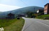
The terrain, except small stretches almost at the end, somewhat cobbled, in which tiredness and its state can play against us, does not present too many complications, as long as the conditions are propitious, since the mud or ice in winter will make us increase the precautions. The times that we will have to cross the road, more than desired, together with the long route that we will face for it, a road without hard shoulder and with more traffic than expected, force us not to lower the guard confused by the bucolic rural landscape that surrounds us. Not a few pilgrims forget that they are walking along a road and carefree they advance by half without taking into account the traffic that circulates through them.
Orientation
The final part of this stage of the Primitive Way is where the greatest complications can be found, not because of the signposting in some cases that is somewhat scarce, but because of the continuous encounters with the road, crossing it from one side to the other following the paths that run next to it or taking the paths that shorten the curves that it describes. A jumble that, undoubtedly added to the tiredness, can make and confuse more than one pilgrim who ends up travelling more kilometres of road and stage than necessary. The entrance to Pola de Allande is also another of the moments in which, as in almost all the major towns on the Way, we may have doubts between the Way and the marks that take us to the hostels, depending on which is our final destination.
 |
 |
 |
 |
 |
| 1-Tineo | 0:00h | 673m | 0Km | 29T 709537 4801294 |
| 2-Villaluz | 2:50h | 631m | 9.8Km | 29T 702835 4801781 |
| 3-Campiello | 3:25h | 606m | 12.7Km | 29T 700613 4801150 |
| 4-Borres | 4:05h | 640m | 15.8Km | 29T 697904 4800930 |
| 5-Samblismo | 4:35h | 701m | 17.4Km | 29T 697072 4799907 |
| 6-La Mortera | 4:50h | 680m | 18.7Km | 29T 696077 4799484 |
| 7-Colinas de Arriba | 5:30h | 760m | 20.5Km | 29T 695293 4798444 |
| 8-Porciles | 6:05h | 750m | 22.4Km | 29T 694797 4797126 |
| 9-Alto de Lavadoira | 6:30h | 800m | 23.6Km | 29T 694504 4796141 |
| 10-Ferroy | 6:55h | 640m | 25.7Km | 29T 694504 4794631 |
| 11-Pola de Allande | 7:10h | 525m | 27Km | 29T 693988 4793792 |
Coordinates UTM Datum WGS84

 Slope: 1738m
 Slope +: 809m
 Slope -: 929m
 Maximum altitude: 905m
 Minimum altitude: 525m

This sketch of the route is not made to scale nor does it contain all the information relating to the area, it is merely indicative.

![]()
This schematic with the path is approximate and has been created from the derived cartographic base © Instituto Geográfico Nacional "Cuadrante 027, 026, 050 y 051, 1:50.000"
Senditur has manipulated the tracks to correct the aberrant points that may exist, caused by problems with the reception of the GPS signal. In any case they are always approximate. SENDITUR encourages you to use the new technologies within your reach, using them as support and consultation in your activity, not basing the realization and orientation of the same only and exclusively on them, since they may see their functioning altered by very diverse causes, not functioning correctly and their indications may not be precise.


Bonita etapa del Camino Primitivo, exigente como viene siendo habitual. Ya conocía la ruta de los hospitales así que me decidí por seguir hasta Pola de Allande y afrontar al día siguiente la ascensión al puerto.

A magical place of legends and mystery

Find out what to see in...
¿Did you know that...
Formerly and until the foundation of Pola de Allande, the Primitive Way followed the imposing Route of the Hospitals that departs past Borres entering the inhospitable summits of this part of Asturias. A route that fell into disuse for its layout, very demanding and not without dangers, but today has been recovered by offering a true mountain atmosphere to pilgrims who venture to travel.
Don't miss out...
Monastery of Santa María la Real de Obona, if you have enough time and the necessary strength, this relatively short detour will take you to one of the most emblematic places through which the Primitive Way passed. The importance of the monastery was such that even Alfonso IX himself threatened with great sorrow anyone who dared to divert pilgrims, who were marching towards Santiago, from their passage through Obona.


From the commitment of SENDITUR with Nature and the respect to the balance of the environment, SENDITUR urges you to travel in a responsible way, with low environmental impact and respecting at all times the Natural, Cultural and Social environment wherever you go.

Besides sharing with all of us your experience on the route we would be grateful if you could write to us to inform us of any erroneous or outdated information you may have found, or simply to let us know what you think at Thank you.
This route has been carried out in the field by SENDITUR on 14-11-2018. The route may vary greatly depending on the time of year, weather conditions and terrain, as well as the actions of third parties and the evolution suffered in the natural environment where it is located. All opinions, advice and/or assessments made by SENDITUR in their descriptions are for guidance only and are subject to and/or refer to the specific conditions of the specific day of the route, referring to that specific day, taken from trained people, with the appropriate experience and with a high level of physical and technical preparation as a reference, as well as correctly equipped.
All the times are approximate and take an orientative character, the stops have not been taken into account, no matter how small they are. All the information related to the route, texts, images, videos, maps, diagrams, tracks, towns, and places of tourist interest are published as a guide, and may not coincide with the current state of each place. Before undertaking any activity, assess your technical knowledge, your physical condition, find out about the weather and the variations that the route may undergo, equip yourself correctly, be prudent and responsible at all times, and do not exceed your capabilities. SENDITUR is not responsible for any misuse or inappropriate use of the comprehensive guides of its routes and/or publications as well as its electronic guides, nor for any variations in their descriptions for the aforementioned reasons, and recommends that everyone be responsible and prudent in carrying out the activity. We also encourage you to read books and specialised guides to complement the information described above.
Continue watching …
 Previous: Stage 3 Salas-Tineo
 Next: Stage 5 Pola de Allande-La Mesa