Trail of the Torca
Santa Cruz de Campezo-Santikurutze Kanpezu, Álava - Araba![]()
![]()
![]()
![]()
![]() (0)
(0)
A walk under the protection of the Ioar and the Sierra Chiquita
Santa Cruz de Campezo-Santikurutze Kanpezu, Álava - Araba![]()
![]()
![]()
![]()
![]() (0)
(0)
A walk under the protection of the Ioar and the Sierra Chiquita
Under the watchful eye of the imposing Ioar, on the edge of the magnificent Montaña Alavesa, lies the town of Santa Cruz de Campezo, a historic village that has been a crossroads for centuries. Surrounded by a privileged natural environment, Campezo has been and still is an obligatory stop for famous paths such as the GR 1 or the Ignatian Way, as well as being the starting point for countless hiking routes, such as the Trail of The Torca.

The route through its 11.2 km takes us from the center of Santa Cruz de Campezo to the place known as La Torca, a short distance from the town of Genevilla. In its course we can enjoy spectacular examples of holm oaks among other trees, while we get lost in the landscape around us. A landscape dominated by the Ioar but that also allows us to enjoy the steep silhouette of Sierra Cantabria or the wild foothills of the Natural Park of Izki. These mountains are also home to a large community of birds, which have found here a magnificent natural environment in which to live.
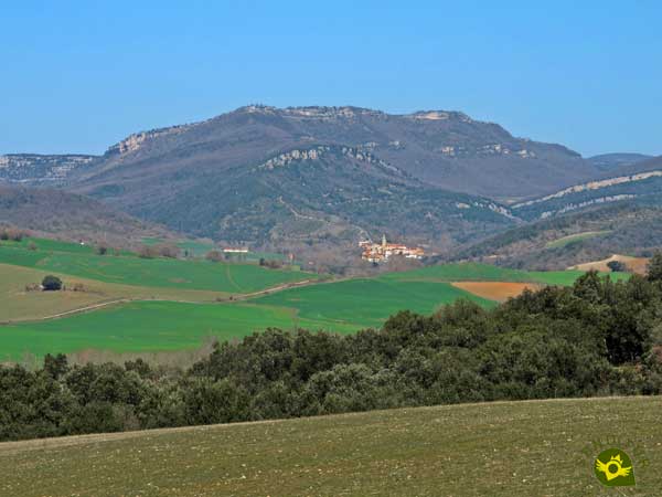
Golden eagles, goshawks or eagle owls populate these forests loaded with history. The source of The Torca, apart from being an unbeatable place to stop on our route, is the point from which we will start the return journey that will take us back to Santa Cruz de Campezo, but not before joining such renowned routes as the Path of the Wolves or the Path of the Ioar to go together again in the historic town of Campezo where we will end this entertaining trekking route through the mountains of Alava.

If you have the necessary information to do so, along the route you have multiple options to vary its layout by linking its two slopes. Even for those people who find the route somewhat short, they can combine it with the Path of the Wolves. In this case it is better to do the route in the opposite direction, to face the Path of the Wolves as it is planned, and then instead of returning continue along the Trail of The Torca and return to Santa Cruz de Campezo following the GR 1 and the Ignatian Way.
To get to Santa Cruz de Campezo, we must follow the road between Vitoria-Gasteiz and Estella-Lizarra, which passes through Campezo. There are also other roads to Santa Cruz de Campezo that connect it with the towns of Genevilla and Bernedo on the one hand, and with Oteo and San Vicente de Arana on the other. Once there, we will have to park our vehicle in one of the car parks set up for this purpose, as the old town is usually restricted to unauthorized vehicles. Once there we must go to the centre of the town, more specifically to the Plaza Picaza from where most of the routes officially start.
A whole walk for our friend, without major complications or demands that may cause him discomfort. Attention to the traffic in the urban route.
With several water points we should not have any problems for him to drink, even so, as always, it is not too much to take something just in case, as well as some food.
As in any wooded area, we must pay attention to the animals that we will surely meet, in season.
Samuel Picaza Square in the heart of Santa Cruz de Campezo (0h 00min), is the starting point for many of the hiking routes that run through this part of Álava including ours.

The information poster of the different routes, which is in front of the town hall, serves as a reference to start this Trail of the Torca.

In our urban journey through the streets of Campezo we must be guided by the marks of the Ignatian Way which must accompany us in part of our route.

A tour that takes us to the moment to the parish of the Assumption.

A parish that we will have to border to be able to continue with the tour.

An urban route that little by little makes us gain height, at the same time as we warm up.

We will have to be attentive to the marks of the Ignatian Way that we are meeting since the itinerary changes direction at each crossing we go through.

Almost without realizing it, we are moving away from the historical center of Santa Cruz de Campezo.
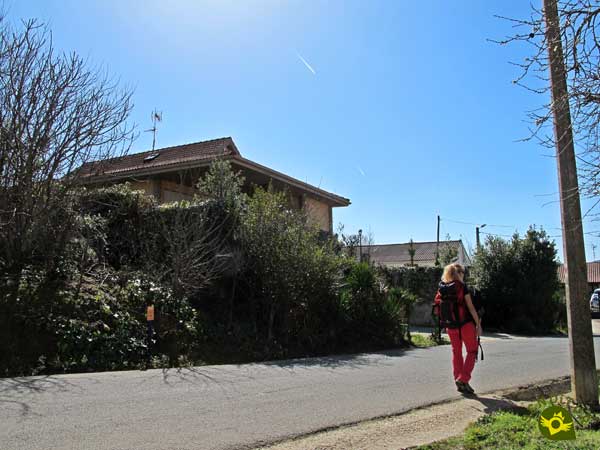
Shortly after, one of the roads that crosses the town comes into view, at which point we will come across the typical marks of the GR and PR trails.

Descending just a few meters on this road we will reach the road that will take us definitely out of Santa Cruz de Campezo.

From now on, the marks of the Ignatian Way are joined by those of the GR 1, the GR 120 and the PR-A 62 or Trail of the Torca, which will indicate the route to be followed for a long time.

This part of the route follows a well-defined path with the unmistakable silhouette of the Ioar on our left. We walk along the dividing line that separates the fields of crops and the lush forest that populates the mountainside.

Luckily, one of the attractions of this route are the impressive trees that we will find along its route and that besides embellishing the place, they bring us all their freshness.

There will be many crossroads and paths that we will leave behind us since in no case, at least for the time being, will we have to make a detour.
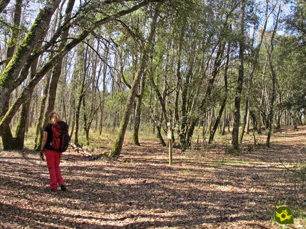
After a while we will arrive at the first of the detours that we have to meet and that thanks to the marks of the paths that accompany us should not create difficulties.
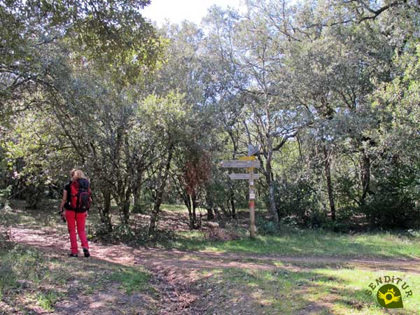
Some junctions, which we will find, are generally well signposted at least in this part of the route.
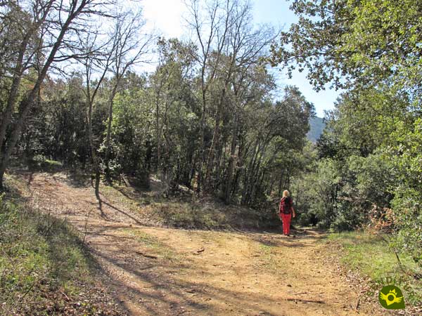
There are many paths and trails that cross our itinerary either from the mountains or from the nearby fields.

Although even without signs, the path we are following, given its condition, does not usually leave room for doubt.

We will come across the occasional ramp that will require a little more effort, but not of sufficient magnitude and duration to put us in difficulty.

Little by little we are approaching our objective, the source of The Torca, and the itinerary with each step we take brings us closer to the mountains to our left.

This area, at the expense of the reforested trees, leaves us at the mercy of the sun and heat. A changing landscape that warns us of the proximity of the Navarrese town of Genevilla.

A place to which we will have the opportunity to deviate, if we so wish, following the route of the Ignatian Way and the GR 1 and GR 120 that had accompanied us up to this point.

We should not be confused by the crosses that mark the non-continuity of these paths since from now on we will only have the reference of the yellow and white marks of our Trail of the Torca.
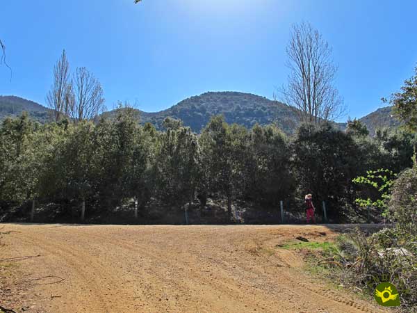
Again we will see ourselves going up, for a few meters, a path until we come across another new crossroads where we will turn off to start a new descent.

A stretch that borders a large water raft, once again giving us the option of making a detour to visit Genevilla.

Although as we know our route does not pass through this town. It continues between it and the peculiar Sierra Chiquita.

Almost without realizing it in front of us, the hidden corner that houses the source of The Torca (1h 25min) emerges, where a well-deserved rest awaits us.
Once we have enjoyed this place we return to Campezo, having to choose between two options.

Either we return by the same route we arrived by, or we climb even more on the side of the mountain and follow the official course of the trail that brought us here.
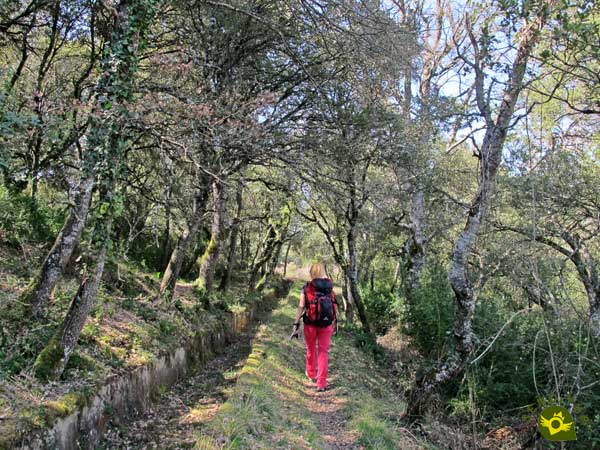
In this case we will see ourselves following the course of an old canal that starts at The Torca.

We will quickly reach the apparent end of this channel to cross it and begin to climb the mountain.

At the moment we will come across a track that cuts us off, a path along which we will continue to gain height.
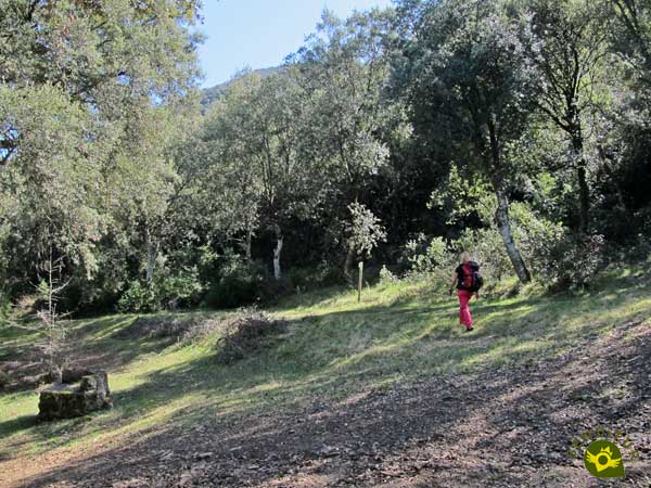
Luckily this hard climb comes to an end sooner than expected, leaving us over the source we have just visited.

This whole area requires us to pay attention to the marks of the route, marks that are no longer as visible and clear as before.

But they continue to guide us in this part of the route, the most complicated, in terms of junctions, detours and orientation. We alternate short but hard slopes with much nicer areas, and even downhill.

Soon this varied potpourri of trails and paths gives way again to a wide track that makes the way quite easy.

Although the junctions and continuous changes of direction continue to accompany us at every step. Forcing us to be attentive so as not to confuse us and make this already quiet walk harder than it needs to be.

Although we are returning to Campezo we continue to gain altitude little by little, which allows us to enjoy magnificent views.

The Path of the Wolves joins us on our right, so that together we can return to our starting point. This part of the route is well signposted again, not making us waste much time in discovering the marks that indicate it.

On our right we leave the detour that leads to the nearby Canejas fountain. Junctions and possible detours that keep coming up at every moment as we go along.

Our path is beginning to make us lose height more intensely than it made us gain it. Wrapped by the vegetation we keep leaving behind paths and more paths.

This part of the route, in general, tends to accumulate quite a lot of mud, as witnessed by the characteristic bifurcations through which we pass.

After a while, we arrived at the crossroads with the road by which the Path of the Wolves goes up the mountain at the beginning of its route. This point warns us of the relative proximity of our final destination.

The track that goes up to the Ioar is on our right while we start the final descent that will take us to Campezo.

Once again we meet the route of the GR 1 on its way to the sanctuary of Ibernalo.

Our journey comes to an end when we come across the road that we must follow and that will take us into Campezo.

The road, which has become a local street, takes us to the square from where we started. Once again we see ourselves in the square of Picaza which now also serves as the end point of the Trail of the Torca in Santa Cruz de Campezo (3h 15min).
Returning by the same route hardly saves any distance.
There is not a big difference in time to return through the same site or do it through the proposed route.
The thickness of the forest, in addition to creating a magnificent landscape, gives us an invaluable freshness on hot days. The different species of trees that populate this area make every season of the year have its charm. In addition, the landscape that surrounds the route at all times considerably increases its attributes.
Due to the type of route that this route follows, most of them are wide paths that allow us to tackle it by wearing, for example, hiking shoes, but if it has rained the days before, we can find very muddy areas that make things difficult for us. Although we will pass by several water points, it is not a bad idea to take ours just in case, as well as some food to take advantage of the stop at The Torca. Consult our list of material and equipment for hiking. Read more.
Physical
The distance is the one that marks the main difficulty since the slope, although it is evident in some sections, is usually easily overcome as it is widely distributed along the route.
Severity of the environment
We will walk along almost the entire route on a road surrounded by trees and fields so that under normal conditions we should not encounter problems. Attention in the area of the channel after passing La Torca.
Orientation
Generally well signposted, except for the section after The Torca where the signs are not so well maintained and in the urban route of Campezo where we will have to be guided by the marks of the Ignatian Way. Do not confuse the yellow and white marks of our route with the yellow ones of the Ignatian Way when we arrive to Genevilla.
| 1-Santa Cruz de Campezo | 0:00h | 568 m | 0Km | 30T 553188 4724371 |
| 2-The Torca | 1:25h | 660 m | 5.4Km | 30T 550082 4721140 |
| 3-Santa Cruz de Campezo | 3:15h | 568 m | 11.2Km | 30T 553188 4724371 |
Coordinates UTM Datum WGS84

![]() Slope: 528m
Slope: 528m
![]() Slope +: 264m
Slope +: 264m
![]() Slope -: 264m
Slope -: 264m
![]() Maximum altitude: 698m
Maximum altitude: 698m
![]() Minimum altitude: 568m
Minimum altitude: 568m

This sketch of the route is not made to scale nor does it contain all the information relating to the area, it is merely indicative.

This schematic with the path is approximate and has been created from the derived cartographic base © Instituto Geográfico Nacional "Cuadrante 139-3, 139-4, 171-1 y 171-2, 25.000"
Senditur has manipulated the tracks to correct the aberrant points that may exist, caused by problems with the reception of the GPS signal. In any case the tracks are always approximate. SENDITUR encourages you to use the new technologies within your reach, using them as support and consultation in your activity, not basing the realization and orientation of the same only and exclusively on them, since they may see their functioning altered by very diverse causes, not functioning correctly and their indications may not be precise.
Find out what to see in...
¿Did you know that...
The municipality of Campezo is made up of the towns of Santa Cruz de Campezo, Antoñana, Bujanda, Orbiso and Oteo. This in turn belongs to the Cuadrilla de Campezo-Montaña Alavesa together with Peñacerrada, Valle de Arana, Lagrán, Bernedo and Arraia-Maeztu, bringing together up to 46 villages.
Don't miss out...
Every nature and hiking lover has an obligatory stop in the nearby Izki Natural Park. In addition to numerous hiking routes at different levels, you can discover places of great ecological and historical value. The park's interpretation centre is located in the nearby town of Corres.
From the commitment of SENDITUR with Nature and the respect to the balance of the environment, SENDITUR urges you to travel in a responsible way, with low environmental impact and respecting at all times the Natural, Cultural and Social environment wherever you go.
Besides sharing with all of us your experience on the route we would be grateful if you could write to us to inform us of any erroneous or outdated information you may have found, or simply to let us know what you think at Thank you.
This route has been carried out in the field by SENDITUR on 23-03-2.019. The route may vary greatly depending on the time of year, weather conditions and terrain, as well as the actions of third parties and the evolution suffered in the natural environment where it is located. All opinions, advice and/or assessments made by SENDITUR in their descriptions are for guidance only and are subject to and/or refer to the specific conditions of the specific day of the route, referring to that specific day, taken from trained people, with the appropriate experience and with a high level of physical and technical preparation as a reference, as well as correctly equipped.
All the times are approximate and take an orientative character, the stops have not been taken into account, no matter how small they are. All the information related to the route, texts, images, videos, maps, diagrams, tracks, towns, and places of tourist interest are published as a guide, and may not coincide with the current state of each place. Before undertaking any activity, assess your technical knowledge, your physical condition, find out about the weather and the variations that the route may undergo, equip yourself correctly, be prudent and responsible at all times, and do not exceed your capabilities. SENDITUR is not responsible for any misuse or inappropriate use of the comprehensive guides of its routes and/or publications as well as its electronic guides, nor for any variations in their descriptions for the aforementioned reasons, and recommends that everyone be responsible and prudent in carrying out the activity. We also encourage you to read books and specialised guides to complement the information described above.
Continue watching …