Cave of the Pillars
The hidden treasures of the hidden face of the Moncayo
The hidden treasures of the hidden face of the Moncayo
The Natural Park of the Moncayo besides having the highest mountain of the Iberian System, the Peak of San Miguel or Moncayo, houses great treasures of nature. One of these jewels is located in the region known as the hidden face of the Moncayo and is none other than the spectacular Cave of the Pillars of Purujosa.

The route that takes us to this corner is a circular route of 16,4 km that leaves from the town of Purujosa in Zaragoza. As soon as we start the route we are surprised by the radical change in the landscape to which we are accustomed in the Moncayo Natural Park. From the rounded contours of its north and east face, we pass to the abrupt profiles of the south, with imposing rocky formations known here as molars, pierced by spectacular caves and furrowed by deep ravines. The route takes us right into the Cuartún ravine, leaving behind another no less interesting one, the Barranco de la Virgen. The route takes us to the Cuartún Cave, a visit that is almost a must, before saying goodbye to the GR 90 to begin the ascent that will take us to the Cave of the Pillars. After enjoying this colossus we cannot overcome the temptation to head for the top of the Cerro Morrón or Muela del Col, from where we can contemplate incomparable panoramic views of the Moncayo Natural Park.

We say goodbye to this mountain and return to Purujosa, but not before immersing ourselves in another great adventure, touring the Valcongosto ravine. Once again, the GR 90 takes us to the detour that leads to this jewel of nature. Not before letting us enjoy the spring of Col. We leave behind the GR 90 to follow the steep path that goes into the Valcongosto ravine, a path that in several occasions submerges in the bed of the stream that runs through it passing through the narrow space that separates the vertical walls of the ravine. A path that leads us to the meeting of the road by which we will return to Purujosa.

There are several trails and routes that run through the area and cross each other. This allows us to adapt the route to our characteristics, designing a circular route more or less intense than the one described here. We can for example return directly from the Cave of the Pillars to Purujosa without the need to ascend the Morrón Hill, and do it by the Virgin's Ravine or by Valcongosto, or to cross only the ravines.
To Purujosa we can arrive from Cueva de Ágreda, in Soria, happening through Beratón. Or from Tierga, in Zaragoza, passing through Trasobares and Calcena. Once in Purujosa, in the heat of highway we will find a small zone of parking and raising about meters the street that ascends to the locality we will have another small zone of parkings.
Look at the picture of 360º
Intense route as much by the distance as by the slope, for that reason it is necessary that our friend is accustomed to mountain routes of certain entity.
There are no water points along much of the route, except at the Col spring and the ravine streams, as long as they have water.
Livestock area, it is not uncommon to find herds. It is also not strange to come across any inhabitant of the area, wild boar, roe deer... Besides, we are in a natural park so we must respect the rules of it.
The parking lot (0h 00min), next to the road to Purujosa is the starting point for this beautiful trekking route in the Moncayo Natural Park.

We start to climb the steep street that goes up to the heart of Purujosa. The High Street serves us as a guide until we reach the crossroads where we will say goodbye to it and pay attention to the GR 90 marks that indicate it to us.

We snake through the streets of this well cared for town gaining height with every step we take, guided at all times by the characteristic red and white marks of the GR.

This slope leads us to a magnificent viewpoint from where we can already observe the massif that houses the Cave of the Pillars.

We say goodbye to Purujosa to follow the path that cuts the side of the mountain in search of the first of the ravines we will cross today.

Soon we reach the detour that we must follow and that makes us lose the height gained taking us to the bottom of the ravine, saying goodbye to the path that runs through the ravine of the Virgin.
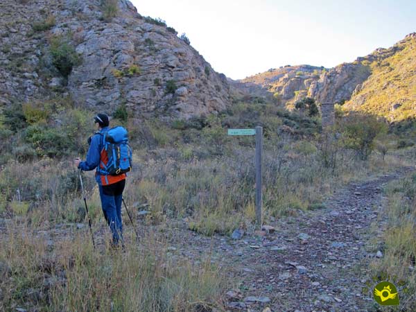
Once down we prepare to enter the ravine of Cuartún, leaving in front of us the path that if followed would return us to Purujosa passing in front of the pylon of the Virgen de la Leche.

This usually dry ravine is the one that follows our GR 90 on its way to the Moncayo Sanctuary.

A good while later, when it seems to reach the end of this interesting ravine, to our right, appears the detour that takes us to the nearby Cuartún cave (0h 55min).
After visiting Cuartún Cave, we return to the GR 90 trail to take the final section of the path that runs through the ravine.

Quickly the path reaches its end when it meets the path that we must follow, here we will say goodbye to the GR 90 that continues its course to the Sanctuary of Moncayo.

With the silhouette of the rocky outcrop that houses the Cave of the Pillars watching us, we begin the climb that will take us to it.
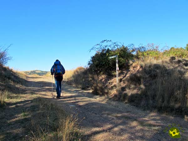
Our path is joined by another one, so that together we can climb the final stretch that separates us from the hill we are about to reach.

Once in the hill we will leave the path that follows the PR Z77, the one that returns to Purujosa by the ravine of the Virgin, to continue ascending towards our objective.
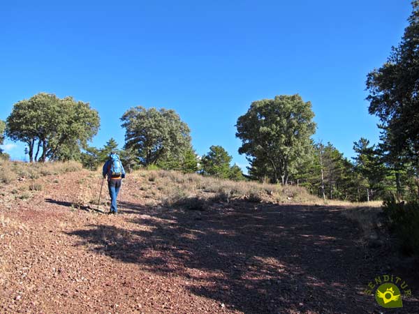
This part of the route accumulates a lot of slope, forcing us to take it easy, enjoying the landscape around us.

After a while, in front of us you can already see the refuge that marks the end of this part of the ascent.
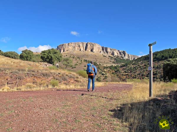
Once again the marks of the many trails and mountain bike routes that run through this part of the Moncayo Natural Park inform us of the course to follow, although the rocky mass towards which we are heading leaves no room for doubt.

The path we are following allows us to calmly contemplate the mountain and the different caves in it.

Once again its slender silhouette serves as a reference to follow in case of doubt at the few crossroads that we find.

As it happened to us before, our path leads us to a wide hill, but in this case, just before reaching it, we will have to radically change course and abandon the path to face the final stretch of the ascent to the Cave of the Pillars.
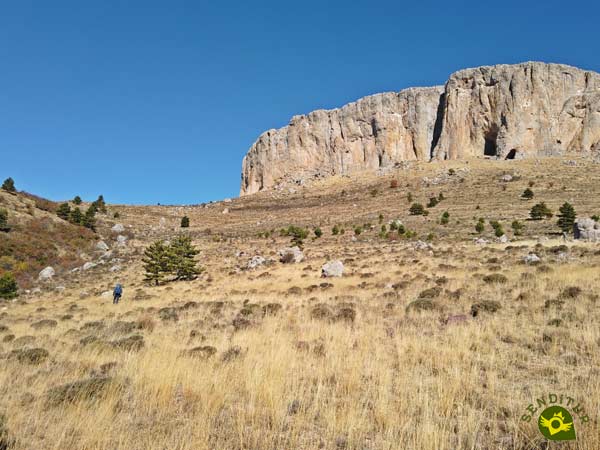
This part of the route does not have a clearly trodden path, so we will have to face it taking as a reference the big rocks of the hillside and the small ravine on our left.

A ravine that we must not cross, but from which we will not have to separate much if we want to ascend more comfortably.

This ravine leads us to what looks like a new hill, although in reality it is the Alto del Riberón, from where we will face the final stretch of the ascent.

This part even more than the previous one is a real chaos with no path to guide us, so we will have to look for the most affordable layout for us.

Luckily we have as a reference the enormous entrance to the Cave of the Pillars (2h 30min), which we reached not without effort.
Once we have enjoyed this colossal cave, we get ready to continue with the route. To do so, we leave the cave through the arch that gives continuity to the rocky outcrop that houses it.
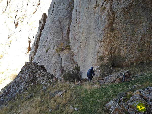
We descend a few meters close to the wall of the mountain to find, now yes, with a path that will be responsible for guiding us to the portlight where we jump to the opposite side.

This path borders the vertical cliffs, without making us lose too much height, to enter a pine forest.

After a while, a solitary stone landmark marks the moment to say goodbye to the path and head for the porthole we are looking for.
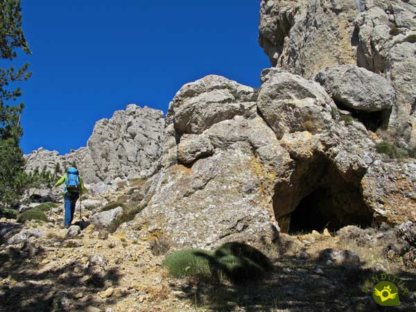
At the moment we can see ourselves climbing a cobbled hillside of the mountain with quite a steepness. This gate allows us to jump to the opposite slope, leaving behind the forest and the vertical walls that had accompanied us until then.

Once upstairs we radically changed our orientation, as if we wanted to retrace our steps, but now on the walls that we before bordered.

From the first moment we are separated with each step from the vertical walls, approaching a new ravine that will serve to continue gaining height.

We follow the line that marks this ravine, ascending not without effort. Shortly before reaching its highest point, after leaving a large rounded rock on our left and the path that passes next to it, we say goodbye to the ravine to face the chaos of stones that separates us from the summit towards which we are heading.

Without any reference or path to guide us we go through this chaos of stones, which in some areas reminds us of the great karts of the Pyrenees.
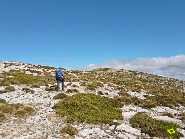
After a while, the summit we are striving to conquer appears in front of us. Cerro Morrón (3h 20min), or Tooth of the Col as it is also known, welcomes us, offering us a wonderful spectacle of landscapes that compensate the effort made.
We leave behind the landmark that marks the top of Cerro Morrón and start the descent that will take us back to meet the GR 90.

Following the opposite edge of the mountain to which we climb, and with the proper distance of caution, we descend once again without a path or mark that serves as a reference.

We quickly lose altitude with our eyes on The Herrera rocks and the path towards which we are heading.

Some lonely stone landmarks mark the place where we will leave the ridge we are descending.

Here we undertake a rapid and zigzagging descent into the dry riverbed of another ravine. A ravine that will serve us to cover the distance that separates us from the path that awaits us further on.

Road where we will rejoin the GR 90 but this time in the direction of Purujosa. From now on we will have the invaluable help of the GR marks and signs.

A GR 90 that sometimes leaves the perfect path through which it runs to save one, usually a small curve of the many that it draws.

Although these small shortcuts hardly last long and quickly the GR returns to the course of the path to continue descending.

A path that, depending on how tired we are, can allow us to advance more quickly and comfortably than many of the shortcuts taken by the GR 90.

A good while later an authentic oasis arises before us, the spring of the Col, a good place to take a well-deserved rest.

After the stop we resume the course of the path accompanied by the red and white marks of the GR. There will not be many crossroads through which we pass and the marks and the downward slope that we follow are responsible for leaving no doubt about the path to follow.

The vegetation rarely hides these marks and when it does, again the downward slope that guides us is responsible for removing us from doubt.
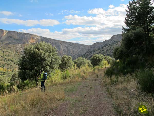
Vegetation that takes over our path marking the detour that leads to the Valcongosto ravine, which we take, saying goodbye to the GR 90 that continues in search of the nearby Cuartún ravine.
Quickly the path meets a small creek and as soon as you cross it it becomes a footpath.

This path makes us lose height, jumping from terrace to terrace, formed by the land. There will be several dry riverbeds that we will cross while we advance in search of our next objective.

Little by little, and after overcoming some fairly steep, albeit short, sections, we approached the still wide riverbed of the Valcongosto ravine.

A ravine whose beginning is marked by a few stone landmarks that tell us that we are, now, entering Valcongosto.

The sound of the stream running through the ravine becomes more audible with every step, until the moment comes when you have to cross it. A stream that we will have to cross many times, so many that we will surely lose count.

The vertical walls that surround it are closing with every step we take through the ravine. To the point that they force us to get into the middle of the creek in order to keep going.

The narrowness of some areas and the flow that the stream can bring can condition the difficulty of this part of the route. The path appears and disappears to the sound of the stream and the walls of the ravine we are walking through.

Almost without realizing it, the vertical walls, which seemed to be closing in on us, are separating themselves meter by meter. The stream also moves away from us and our path, warning us of the near end of the Valcongosto ravine.

The road, which we must follow, is responsible for confirming the end of this beautiful stretch of the route. The road that will be in charge of leading us to Purujosa, although on this occasion we will not have to climb up to the town.

After a longer stretch of road than we would have liked, the parking (5h 55min) awaits us, the point and end of our hiking route.
The different options offered by the area mean that this figure may vary depending on the itinerary followed.
This figure can be considerably increased depending on the time we spend in each place we visit and the state of the ravines we go through.
Autumn and spring will surely be good months to visit these places. In summer we almost make sure that the flow of the streams is not a problem, as long as it does not discharge a good storm. The winter brings a special touch to almost any tour, but condition the hours of light available among other things.
Surely we can not avoid putting the boot and half a leg in the stream that crosses the ravine of Valcongosto, so it is not a bad idea to carry a spare pair of socks.The canes, in such long routes and with the slope that this has, are always helpful, besides they will balance us in the sections by the streams. There is only one fountain along the whole route, carrying enough water and food is vital. As it is already imposed on similar routes through ravines like the ones we will pass here, the helmet is not a bad idea either, especially for Valcongosto. Consult our list of material and equipment for hiking. Read more
Physical
The distance, added to the slope that we must overcome, forces us to be in good physical condition to face this route with certain guarantees. We must be aware that we can reach the final stretch through the ravine and not be able to pass, being forced to retreat and return to Purujosa by another route, with the over-exertion that this implies. The great advantage we have is that thanks to the different routes that run through the area we can adapt an itinerary adapted to our capabilities.
Severity of the environment
Before venturing into any of the ravines in the area, it is important to be informed of their condition. Stone falls are very probable, both in the ravines and in the area of the caves and the path next to the cliff. Another factor to take into account is the weather, since the flow of the streams can vary suddenly due to storms and rain that can occur at the headwaters. Be careful with the rocky sections of the ravines and the ascent to Cerro Morrón. It is easy to take a bad step and twist an ankle or have a fall. The paths and some trails are quite frequented by mountain bikers so it will not be uncommon to find cyclists at high speed along certain sections of the route.
Orientation
In a large part of the route we will have good signaling, so we should not have big problems. However, it is the numerous possible routes that can make us doubt that we have not prepared our itinerary well. The final stretch of the ascent to the Cave of the Pillars and the ascent to Morrón Hill with its subsequent descent to the path where the GR runs, do not have any signposting. Besides, we will not have a clear path to follow in almost all that area, so taking a GPS with the track will be helpful to follow the right itinerary.
| 1-Purujosa | 0:00h | 923m | 0Km | 30T 602425 4615197 |
| 2-Cuartún Cave | 0:55h | 1043m | 2.2Km | 30T 603270 4616403 |
| 3-Cerro Gordo shelter | 1:35h | 1294m | 3.9Km | 30T 602752 4617820 |
| 4-Cave of the Pillars | 2:30h | 1565m | 5.9Km | 30T 602832 4619325 |
| 5-Cerro Morrón | 3:20h | 1731m | 7.7Km | 30T 603409 4620134 |
| 6-Spring of the Col | 4:00h | 1300m | 10.5Km | 30T 604007 4619001 |
| 7-Purujosa | 5:55h | 923m | 16.4Km | 30T 602425 4615197 |
Coordinates UTM Datum WGS84

![]() Slope: 1936m
Slope: 1936m
![]() Slope +: 968m
Slope +: 968m
![]() Slope -: 968m
Slope -: 968m
![]() Maximum altitude: 1731m
Maximum altitude: 1731m
![]() Minimum altitude: 923m
Minimum altitude: 923m

This sketch of the route is not made to scale nor does it contain all the information relating to the area, it is merely indicative.

This schematic with the path is approximate and has been created from the derived cartographic base © Instituto Geográfico Nacional "Cuadrante 352-3 1:25.000".
Senditur has manipulated the tracks to correct the aberrant points that may exist, caused by problems with the reception of the GPS signal. In any case the tracks are always approximate. SENDITUR encourages you to use the new technologies within your reach, using them as support and consultation in your activity, not basing the realization and orientation of the same only and exclusively on them, since they may see their functioning altered by very diverse causes, not functioning correctly and their indications may not be precise.
Find out what to see in...
¿Did you know that...
Purujosa, in addition to being a town of careful character and traditional architecture, is also the smallest town in España to have a traffic light that regulates traffic on its main street.
Don't miss out...
The hermitage of the Virgin of Constantine or of the Cave, where a 13th century carving is kept. Its location is also spectacular, almost suspended from the rock, with the ravine that borders the town at its feet.
From the commitment of SENDITUR with Nature and the respect to the balance of the environment, SENDITUR urges you to travel in a responsible way, with low environmental impact and respecting at all times the Natural, Cultural and Social environment wherever you go.
Besides sharing with all of us your experience on the route we would be grateful if you could write to us to inform us of any erroneous or outdated information you may have found, or simply to let us know what you think at Thank you.
This route has been carried out in the field by SENDITUR on 16-10-2020. The route may vary greatly depending on the time of year, weather conditions and terrain, as well as the actions of third parties and the evolution suffered in the natural environment where it is located. All opinions, advice and/or assessments made by SENDITUR in their descriptions are for guidance only and are subject to and/or refer to the specific conditions of the specific day of the route, referring to that specific day, taken from trained people, with the appropriate experience and with a high level of physical and technical preparation as a reference, as well as correctly equipped.
All the times are approximate and take an orientative character, the stops have not been taken into account, no matter how small they are. All the information related to the route, texts, images, videos, maps, diagrams, tracks, towns, and places of tourist interest are published as a guide, and may not coincide with the current state of each place. Before undertaking any activity, assess your technical knowledge, your physical condition, find out about the weather and the variations that the route may undergo, equip yourself correctly, be prudent and responsible at all times, and do not exceed your capabilities. SENDITUR is not responsible for any misuse or inappropriate use of the comprehensive guides of its routes and/or publications as well as its electronic guides, nor for any variations in their descriptions for the aforementioned reasons, and recommends that everyone be responsible and prudent in carrying out the activity. We also encourage you to read books and specialised guides to complement the information described above.
Continue watching …