Welcome to SENDITUR.COM · paths · routes · tourism

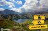
![]() Difficulty-Medium
Difficulty-Medium
![]() 1:40 h.
1:40 h.
![]() 5 km.
5 km.
![]() Difficulty-Medium
Difficulty-Medium
![]() 1:40 h.
1:40 h.
![]() 5 km.
5 km.
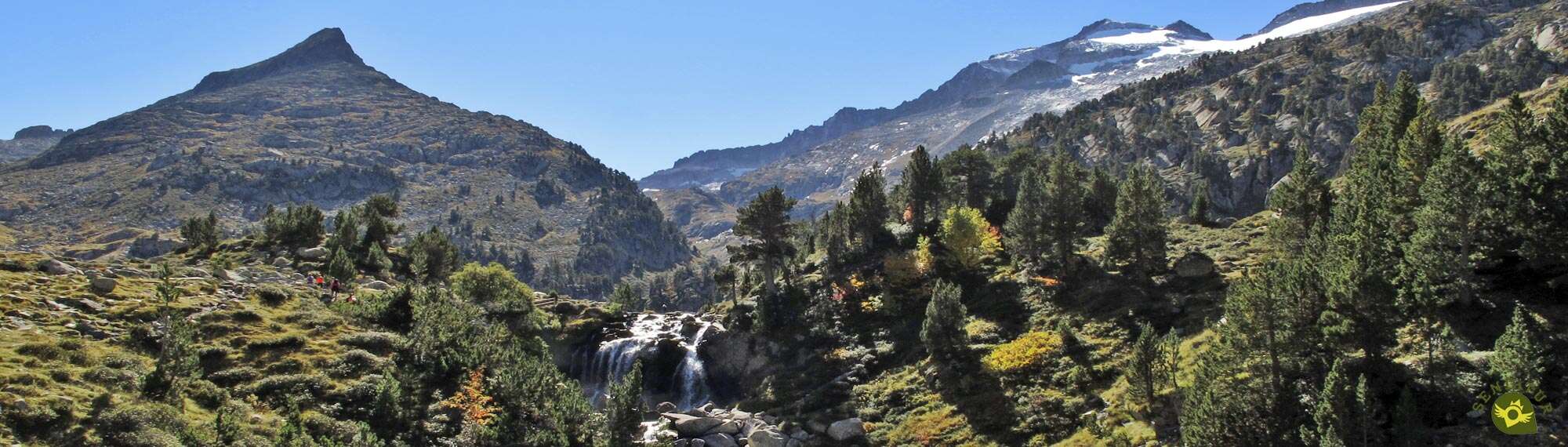
The Posets Maladeta Natural Park brings together an incalculable collection of beautiful and imposing corners, some of them true icons of the Pyrenees. The Forau of Aiguallut at the head of the Benasque Valley is one of them. Surrounded by the ancient glaciers that have shaped this valley and under the watchful eye of the Aneto, this unique formation and the surrounding landscape is part of the natural heritage of this land.

The route is only 5 km long, provided that we start at La Besurta, starting from this well-known place, as do other notable routes such as the classic ascent of the Aneto. From the first moment we will be able to enjoy the authentic Pyrenean atmosphere, while we ascend little by little contemplating the Maladetas glacier. This Natural Park, where we are, concentrates along its whole extension most of the 3000 of all the Pyrenees and around us are some of the best known. The detour to the La Renclusa Shelter tempts us with the idea of venturing into the ascent of some of these mountains. The route goes up the river Ésara, although at the moment it is a little far from it, while we are surprised by the rocky outcrops and some avalanche channels that mark the route. The green meadows take centre stage, where we can contemplate the meanders that the river draws in its course, as well as the occasional doline or torca that precedes the one that brought us here.

These underground cavities brought to light by the collapse of its roof have their maximum visible exponent in the Forau of Aiguallut. This amazing place where the river is lost is an open book that allows us to get an idea of the tireless work that has shaped this valley. A little further on, the Aiguallut Waterfall awaits us, a beautiful waterfall that bridges the difference in height between the bottom of the old cave and the surface that covered it. Behind it, the Aiguallut Plan opens up before us, a wide pass through which the whimsical Ésara River runs in search of its outlet and from which we can enjoy the magical landscape that surrounds this place, presided over by the unmistakable Aneto and its dying glacier. It is a spectacle of nature that we will surely have trouble saying goodbye to, and we will return to La Besurta, following our steps.

For those who find this route a little too short, there is the possibility of taking a nice circular route that instead of going directly to the Forau of Aiguallut follows the path that leads to the shelter of La Renclusa and then goes up the hill that forms the Pass of La Renclusa, and then descends to the Plan of Aiguallut where it joins the usual route to return to La Besurta. This route is only a few additional kilometres, but it is much more physically demanding as it climbs to almost 2300 m in a short distance. This, together with the more abrupt and loser terrain through which it passes, does not make it very advisable for people who are not used to this type of terrain.
We can reach Benasque from Barbastro, on the motorway linking Huesca and Lérida, and then head towards Graus on the N-123 and from there go up the whole valley following the A-139 to Benasque itself. Or we can do it through the N-260 that from Sabiñánigo crosses all the Pyrenees to the Catalan coast, coinciding in part with the A-139 that comes from Graus, more specifically from the vicinity of Campo to Castejón de Sos where we will leave it to go to Benasque. Once there and provided that traffic is not restricted as it is in the summer months, in which case we must access to La Besurta in the bus that is enabled for this purpose, we will only have to cross Benasque and follow a few kilometers the road by which we arrived. We will leave behind the detours to Cerler or the Valle de Estos and take the one that leads to Llanos del Hospital from where we only have to follow the track that goes up to La Besurta where we can leave our vehicle.
This is the ideal route for our friend to get into the necessary physical shape and get used to this kind of activities. There are usually many people so it is advisable not to let him loose, if we usually do it.
Although the water is part of the route, as always, we should not miss its respective ration along with some food, just as we do for us.
The local fauna is not usually seen much, partly due to the influx of visitors, but even so we cannot get distracted.
We start the route of the Forau of Aiguallut in the car park of La Besurta (0h 00min).

We crossed this, usually busy place, going through the last meters of the dirt road that the track we arrived by has become.

The stream that comes from the nearby Pyrenean lake of Villamuerta cuts our way, and fortunately we have a small bridge that prevents us from getting wet.

The wide path reaches its end giving way to the trail that will take us to our destination, a trail that for the time being we will share with the mountaineers heading for the La Renclusa shelter.

We advance without major complications, even losing height, while we avoid the first stones that the route puts in our way.

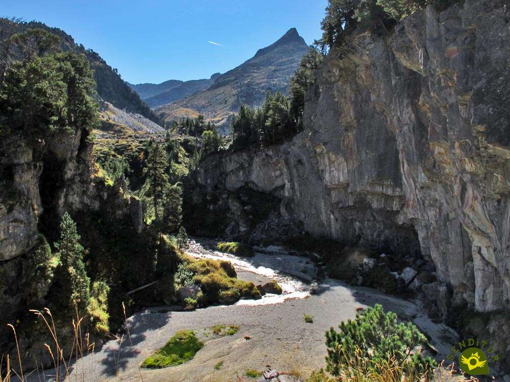
The generally dry riverbed of the Ésera stands in our way, marking the beginning of the ascent ahead of us.

We gain height by following the winding, stony trail that runs along the slope. The signs on the rocks and the markings on the path serve as a reference in case of doubt.

After a first steep slope, we arrive at a wide esplanade where the post that marks the detour of the La Renclusa shelter (0h 15min) is located.
We leave on our right the path that goes up to the shelter to continue climbing up the valley.

Some occasional ramp forces us to take it easy, so as not to leave too much energy in it.

The route continues to gain height with each step, while interspersing less demanding areas with others a little steeper.

The Aiguallut hut marks the beginning of another of these more demanding, as well as more stony, areas.

Luckily, behind it, the slope begins to give us a break, indicating the arrival of a more comfortable stretch.

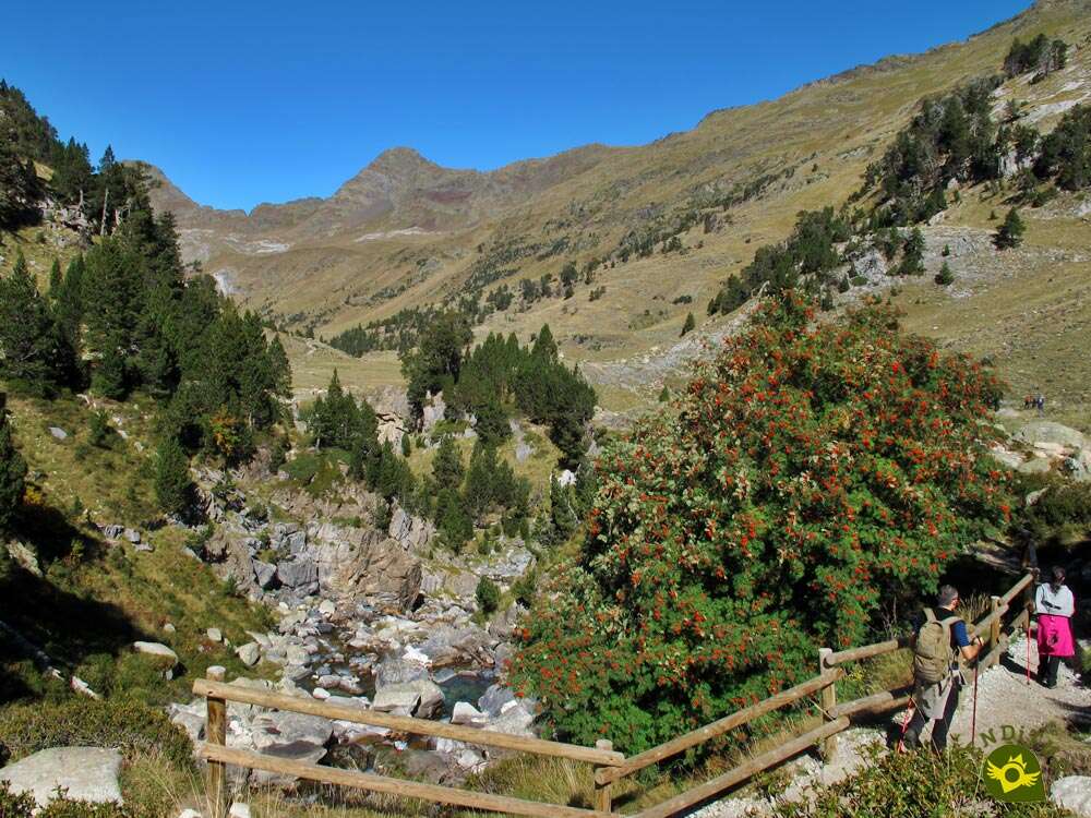
Soon we will find ourselves walking a false plain that will allow us to move forward more quickly. The path cuts through the mountainside, bringing us back to the course of the river Ésera.

This stony section of the route leads to a comfortable path that crosses the greenish meadow while allowing us to observe the viewpoint from where we will contemplate the Forau of Aiguallut (0h 50min), which we will reach quickly.
After contemplating this marvel of nature we will have to go up a small hill again.

We will have several possibilities to choose from, one more demanding doing it by the stony trail that barely separates from the cavity. Or we can extend the route by a few metres in order to ascend more comfortably around the small hill.

Both options come together again once they reach the top of this hill where we will have to face a new decision.

Once again the trail splits up, giving us the chance to continue towards our next objective without losing any height, or to descend to make it closer to the cut where the river flows.

Again these two options come together a little later just before reaching the Aiguallut Waterfall (0h 55min).

Together we will pass by the viewpoint that allows us to contemplate the waterfall from its highest part, from where we have a beautiful panoramic view of part of the path travelled.

Behind this viewpoint, the Plan of Aiguallut (1h 00min) emerges before us. This extensive plain, which is crossed by several whimsical watercourses that feed the waterfall, is the point and followed of this route.

Once we have contemplated the magnificent landscape that surrounds it, we will start our way back following the steps that led us here and that will take us back, after passing through the detour of the La Renclusa shelter (1h 30min), to La Besurta (1h 40min) where this trekking route through the Pyrenees of Huesca ends.
 Distance. 5Km
Our route once we are at the Plan d'Aiguallut will mark the final distance of the route.
 Time. 1:40h
No doubt this figure will be higher due to the time we will spend enjoying this wonderful landscape. The place where we are forced to leave our vehicle will also have an influence.
 Time of year
The summer or autumn months, as long as the snow is not the protagonist, is the period that will allow us to enjoy the spectacular landscape without great complications. The spring, with the thaw, is another ideal moment, as long as the accesses allow us, since the snow still usually resists during those dates.
 Required equipment
The simplicity of the route does not have to confuse us, the weather in this area changes relatively quickly so it is a good idea to have in the backpack with clothes that protect us from inclement weather. Appropriate footwear for this type of terrain, such as trekking, walking poles, some food and water along with a first aid kit with the essentials and at least a GPS with the route is something that should be a regular part of our equipment. Without a doubt, we should not miss the camera or the binoculars that allow us to get closer to the summits around us. Consult our list of material and equipment for hiking. Read more.
 Difficulty. Medium
Physical
Neither distance nor slope should be a problem as long as we are used to walking in nature. Besides, having the necessary time, we can take the most demanding ramps calmly enough. Be careful when there is no bus service and the influx of people is high we can see ourselves in the obligation to park our vehicle further from La Besurta thus increasing both the distance and the slope and therefore the difficulty.
Severity of the environment
The natural environment that surrounds us is that of high mountains and although the path does not run through exposed places nor does it have technically complicated sections we must be aware of this, respecting the marked itinerary and applying common sense above all in the area of the Forau of Aiguallut. Pay attention to the rocks if they are wet, as they are likely to be slippery, also when we walk through the Plan of Aiguallut and have to cross the streams that run through it. With snow or ice, not only the landscape changes, but also the considerations to be taken into account.
Orientation
The corresponding signs at the respective crossroads and the generally well-marked path take care of guiding us correctly as long as the visibility conditions are right. If this is not the case, it is relatively easy to get lost and get into further complications. We will find, especially near the Plan of Aiguallut, with a good number of trails that will make us have some doubt, but usually lead to the same place.
 |
 |
 |
 |
 |
| 1-La Besurta | 0:00h | 1900m | 0Km | 31T 307439 4727854 |
| 2-Detour Shelter of La Renclusa | 0:15h | 1942m | 0.6Km | 31T 307665 4727405 |
| 3-Forau of Aiguallut | 0:50h | 2017m | 2.1Km | 31T 308705 4726636 |
| 4-Aiguallut Waterfall | 0:55h | 2025m | 2.4Km | 31T 308813 4726422 |
| 5-Plan of Aiguallut | 1:00h | 2030m | 2.5Km | 31T 308872 4726320 |
| 6-Aiguallut Waterfall | 1:05h | 2025m | 2.6Km | 31T 308813 4726422 |
| 7-Forau of Aiguallut | 1:10h | 2017m | 2.9Km | 31T 308705 4726636 |
| 8-Detour Shelter of La Renclusa | 1:30h | 1942m | 4.4Km | 31T 307665 4727405 |
| 9-La Besurta | 1:40h | 1900m | 5Km | 31T 307439 4727854 |
Coordinates UTM Datum WGS84

 Slope: 470m
 Slope +: 235m
 Slope -: 235m
 Maximum altitude: 2039m
 Minimum altitude: 1900m

This sketch of the route is not made to scale nor does it contain all the information relating to the area, it is merely indicative.

![]()
This schematic with the path is approximate and has been created from the derived cartographic base © Instituto Geográfico Nacional "Cuadrante 148-4 y 180-2, 1:25.000"
Senditur has manipulated the tracks to correct the aberrant points that may exist, caused by problems with the reception of the GPS signal. In any case the tracks are always approximate. SENDITUR encourages you to use the new technologies within your reach, using them as support and consultation in your activity, not basing the realization and orientation of the same only and exclusively on them, since they may see their functioning altered by very diverse causes, not functioning correctly and their indications may not be precise.


Un sitio precioso, me encanto. Además subimos hasta el refugio, merece la pena acercarse hasta el ibón..


Find out what to see in...
¿Did you know that...
The Forau of Aiguallut was an ancient underground cavity drilled by the erosive action of the river whose roof collapsed, leaving this spectacular sinkhole in the light through which the waters coming from the nearby glacier of Aneto are lost, to emerge later in the Valley of Aran nourishing the Garonne River and then flowing into the Atlantic Ocean.
Don't miss out...
If you have the opportunity to see it, the game of Les Quilles in Benasque, is a typical modality of bowling that was normally practiced by women in the Valley of Benasque and that today is still practiced in the squares and streets of the villages of the valley combining tradition and craftsmanship.


From the commitment of SENDITUR with Nature and the respect to the balance of the environment, SENDITUR urges you to travel in a responsible way, with low environmental impact and respecting at all times the Natural, Cultural and Social environment wherever you go.

Besides sharing with all of us your experience on the route we would be grateful if you could write to us to inform us of any erroneous or outdated information you may have found, or simply to let us know what you think at Thank you.
This route has been carried out in the field by SENDITUR on 18-10-2016. The route may vary greatly depending on the time of year, weather conditions and terrain, as well as the actions of third parties and the evolution suffered in the natural environment where it is located. All opinions, advice and/or assessments made by SENDITUR in their descriptions are for guidance only and are subject to and/or refer to the specific conditions of the specific day of the route, referring to that specific day, taken from trained people, with the appropriate experience and with a high level of physical and technical preparation as a reference, as well as correctly equipped.
All the times are approximate and take an orientative character, the stops have not been taken into account, no matter how small they are. All the information related to the route, texts, images, videos, maps, diagrams, tracks, towns, and places of tourist interest are published as a guide, and may not coincide with the current state of each place. Before undertaking any activity, assess your technical knowledge, your physical condition, find out about the weather and the variations that the route may undergo, equip yourself correctly, be prudent and responsible at all times, and do not exceed your capabilities. SENDITUR is not responsible for any misuse or inappropriate use of the comprehensive guides of its routes and/or publications as well as its electronic guides, nor for any variations in their descriptions for the aforementioned reasons, and recommends that everyone be responsible and prudent in carrying out the activity. We also encourage you to read books and specialised guides to complement the information described above.
Continue watching …