Welcome to SENDITUR.COM · paths · routes · tourism

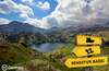
![]() Difficulty-Moderate
Difficulty-Moderate
![]() 5:45 h.
5:45 h.
![]() 13.6 km.
13.6 km.
![]() Difficulty-Moderate
Difficulty-Moderate
![]() 5:45 h.
5:45 h.
![]() 13.6 km.
13.6 km.
The Pyrenees surprise us with every step we take. Lakes, mountains, ravines and valleys make up incredible landscapes of great beauty. One of these places that concentrates an infinite number of these attractions can be found in Catalonia, specifically in the province of Lleida, and it is none other than the Aigüestortes and Lake of Sant Maurici National Park. Here we can follow countless hiking routes that take us to visit each spot or climb some of its mythical peaks. One of these routes is the Route of the Isard, perhaps one of the most visited, which takes us to the Sant Maurici Lake, one of the most beautiful spots in the National Park to which it gives its name.
The most common way to get to the Lake of Sant Maurici is from the town of Espot. To get there, follow the road from Sort to Vielha, as it is on this road that you will find the accesses leading to Espot. Once there, there are several options, from Espot itself there are 4x4 taxis that will take you to the Lake of Sant Maurici. But if you want to get there by your own means, then you must go through the town and continue up the valley until you reach the Prat Pierró parking area, where the l'Isard route begins.
The Prat Pierró car park marks the beginning of this hiking route in the Aigüestortes and Lake of Sant Maurici National Park, next to the barrier that regulates access to the park, the beginning of the path that we must follow awaits us. A series of footbridges adapted for people with reduced mobility lead us into the lush forest we are about to walk through. This adapted section ends when we reach the Pont de la Gorga, a bridge that allows us to cross the river Escrita.
From here we will begin the real ascent that will take us to the Lake of Sant Maurici.
After a while we cross the asphalted track that climbs up to it from Prat Pierró. Our route takes us gradually towards our next objective, the remodelled hermitage of Sant Maurici. The surrounding landscape invites us to enjoy the route at our leisure, losing ourselves in the view of the giants that rise up here, such as Els Encantats. We continue on and almost without realising it we reach the vicinity of Sant Maurici Lake (1h 15min), which we will approach to skirt it, leaving it to our left.

Lake of Sant Maurici-CC/Biblola

Route to the Lake of Sant Maurici-CC/Contraix

Lake of Sant Maurici-CC/Contraix

This emblematic spot is the end point for many of those who visit this part of the Aigüestortes and Lake of Sant Maurici National Park. There are those who border it in its entirety and then return to Prat Pierró. In our case, we are going to extend the route a little more, going to the Viewpoint of the Lake of Sant Maurici. To do so, we follow the path that borders the lake, taking us to a new wooden footbridge. This route is the one followed by those heading towards the Amitges Refuge. The ascent is interrupted by the sound of the Ratera waterfall, which makes the effort a little more bearable. After a while we come across the forest track that ascends from the Lake of Sant Maurici towards the refuge. Follow this forest track until you reach Ratera Lake (2h 15min), which awaits you a little further on.
The markings of the different paths that pass through here, such as the GR 11 or those of Carros de Foc, mark the route to follow, which skirts the Lake of Ratera. We continue ascending, leaving aside the route that leads to the Amitges Refuge. A little further on you will also leave aside the detour that goes up to Les Obagues de Ratera Lake. Continue on, leaving the path on your left that you will later return along. A little further ahead of this detour the magnificent Viewpoint of the Lake of Sant Maurici awaits you (2h 35min).
After enjoying the views offered by this privileged balcony in the Pyrenees, we retrace our steps back to the crossroads that we had missed before. We begin the descent without missing any detail of the surrounding landscape. We quickly reach the crossroads with the route that ascends towards Portarró d'Espot. Here we continue descending towards the Ernest Mallafre refuge. This part of the route offers us a different panoramic view as we cross the occasional torrent.
After a while we reach the turn-off which, if we follow it, will take us to the Lake of Subenuix.
We leave this detour behind us to continue on our way to the Ernest Mallafre refuge. But before reaching it we will come across another detour, this time the one that leads to Monestero Lake. After a stop to catch our breath, we continue on our way in search of the path that will take us to Sant Maurici Lake. Once there, all you have to do is follow the path to the Prat Pierró car park (5h 45min), where this beautiful hiking route comes to an end.
1-Don't let the civilised nature of a good part of the route make you forget that you are on a mountain route in full Pyrenees.
2-One of the rules of the National Park is that pets must be kept on a leash, and rangers often enforce this and other park rules, and the fines are substantial.
3-In summer and on holidays it is advisable to get up early as the parking lot fills up quickly.
4-Snow and ice completely change the characteristics of the route, both in terms of difficulty and the most suitable route to follow, limiting access to people with experience in this type of situation.
 |
 |
 |
 |
 |
| 1-Prat Pierró | 0:00h | 1640m | 0Km | 31T 339765 4716541 |
| 2-Lake of Sant Maurici | 1:15h | 1920m | 3,7Km | 31T 336676 4716328 |
| 3-Ratera Lake | 2:15h | 2120m | 5,7Km | 31T 335387 4717106 |
| 4-Viewpoint of the Lake of Sant Maurici | 2:35h | 2180m | 6,8Km | 31T 334884 4716867 |
Coordinates UTM Datúm WGS84

.png) Distance: 13,6Km
Distance: 13,6Km
.png) Time: 5:45h
Time: 5:45h
.png) Difficulty: Moderate
Difficulty: Moderate
 Slope: 1160m
 Slope +580m
 Slope -580m
 Maximum altitude: 2180m
 Minimum altitude: 1640m

![]()
This schematic with the path is approximate and has been created from the derived cartographic base © Instituto Geográfico Nacional "Cuadrante 181-1, 181-2, 181-3 y 181-4 1:25.000".

¿Did you know that...
The Aigüestortes and Lake of Sant Maurici National Park was created on 21 October 1955, being the fifth park created in Spain and the second in the Pyrenees.
Don't miss out...
Espot Park Houses which, together with the one located in the town of Boí, offer visitors exhibitions and various activities to learn more about this National Park.


From the commitment of SENDITUR with Nature and the respect to the balance of the environment, SENDITUR urges you to travel in a responsible way, with low environmental impact and respecting at all times the Natural, Cultural and Social environment wherever you go.

Besides sharing with all of us your experience on the route we would be grateful if you could write to us to inform us of any erroneous or outdated information you may have found, or simply to let us know what you think at Thank you.
Route information updated on 28-05-2021. The route may vary greatly depending on the time of year, weather conditions and terrain, as well as the actions of third parties and the evolution suffered in the natural environment where it is located. All opinions, advice and/or assessments made by SENDITUR in their descriptions are for guidance only and are subject to and/or refer to the specific conditions of the specific day of the route, referring to that specific day, taken from trained people, with the appropriate experience and with a high level of physical and technical preparation as a reference, as well as correctly equipped.
All the times are approximate and take an orientative character, the stops have not been taken into account, no matter how small they are. All the information related to the route, texts, images, videos, maps, diagrams, tracks, towns, and places of tourist interest are published as a guide, and may not coincide with the current state of each place. Before undertaking any activity, assess your technical knowledge, your physical condition, find out about the weather and the variations that the route may undergo, equip yourself correctly, be prudent and responsible at all times, and do not exceed your capabilities. SENDITUR is not responsible for any misuse or inappropriate use of the comprehensive guides of its routes and/or publications as well as its electronic guides, nor for any variations in their descriptions for the aforementioned reasons, and recommends that everyone be responsible and prudent in carrying out the activity. We also encourage you to read books and specialised guides to complement the information described above.
Continue watching …