Welcome to SENDITUR.COM · paths · routes · tourism


GR 38 Route of the wine and of the fish Section 3 Albaina-Estíbaliz
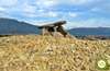
Albaina, Burgos![]()
![]()
![]()
![]()
![]() (0)
(0)
The amazing and varied landscape of Treviño County
![]() Difficulty-Moderate
Difficulty-Moderate
![]() 6:45 h.
6:45 h.
![]() 23 km.
23 km.
Albaina, Burgos![]()
![]()
![]()
![]()
![]() (0)
(0)
The amazing and varied landscape of Treviño County
![]() Difficulty-Moderate
Difficulty-Moderate
![]() 6:45 h.
6:45 h.
![]() 23 km.
23 km.
Under the protection of the rugged Toloño and Cantabria mountains, the County of Treviño, which belongs to the province of Burgos, extends, as if it were an island, surrounded by the lands of Alava. The contrast of landscapes, so soon extensive cereal fields, wild gorges or impregnable forests are the usual tonic of the GR 38 Route of the wine and of the fish in its section 3 between Albaina and the Sanctuary of Our Lady of Estíbaliz.

The route in its 23 km takes us to travel part of the County of Treviño visiting several of its villages. Albaina, is the starting point of this section of the GR 38, a wine and fish route that quickly takes us to visit Pariza, and then set off in search of the town of Sáseta, surrounded by fields of crops. From this town in Burgos we will take the last steps of the Wine and Fish Route through the lands of the County of Treviño, but not before crossing the beautiful Gorge of the River Ayuda. This last place shines in this stage 3 between Albaina and Estíbaliz.

Okina is already waiting for us in the province of Alava, marking almost half of our journey. The longest stretch of this stage of the GR 38 awaits us. A stretch where the forest is the main protagonist, giving us beautiful corners that make our route more pleasant and interesting. The Llanada Alavesa awaits us after crossing the natural frontier of the Mounts of Vitoria, mountains that, after overcoming them, offer us a magnificent panorama of what is to come in future stages of the route of the wine and of the fish. The Greenway of the Vasco-Navarro Railway is presented to us, for the first time on our way, preceding the Sanctuary of Our Lady of Estíbaliz, the final destination of this stage 3 of the GR 38.

The town of Okina gives us the opportunity to divide the day in two sections, a stage 3 a between Albaina and Okina with 11,4 Km and a second or stage 3 b between Okina and Estíbaliz with 11,6 Km.
The accesses that lead to Albaina are on the CL-127 road that connects Bernedo with Treviño. This road in turn connects with the road that from Vitoria - Gasteiz goes up to the Peñacerrada pass. Once in Albaina we can park our vehicle without any difficulty to start the route we are going to travel.
It's a hard journey given the mileage to overcome, and we'll have to be very careful at the different junctions with the roads that will come our way. It is essential to take food to him so that he can recover his energy.
In normal conditions, water should not be a problem along almost all the stage since we have to find easily accessible streams and some sources, although we can not be confident.
Throughout the stage we have to find not only other dogs in the different villages, but also the different cattle that graze in the fields we will cross. At the end of the day, we must pay close attention to any parasites that may have been caught.
The Albaina square (0h 00min) marks the starting point of this stage of the GR 38.

We head towards the local church following the course of the road to Albaina.

Just after passing by the church there is a track on our left that we must follow.

At this point we will come to a new fork in the path, which this time follows the path to the right and continues its downward course.

We say our final goodbye to Albaina while our battered road leads us to the nearby main road. Luckily an underpass saves us from having to cross this road.

As soon as we do so, the access road to Pariza cuts us off, forcing us to cross it to continue our journey.

We are following the upward course marked by the conditioned dirt track that now serves as our guide. There will not be many crossroads to cross in this first part of the stage.

Our first objective can already be sensed in front of us as we slowly approach it.

Pariza (0h 30min) welcomes us while we follow the GR marks that take us through it.

As it could not be otherwise, the square and the church of Pariza serve us as a reference to follow.

Calmly we go through the different streets of this small town looking to get out of it.

Almost without realizing it, we are already on the outskirts of Pariza, heading for the next town that awaits us.

Shortly after passing by the cemetery we will reach a fork in which the path to follow is right in the middle of the three that come out in our way.

From now on, we will find ourselves following an old path that struggles with the vegetation so as not to be hidden by it.

The landscape around us, full of farmland, is quite different from the one that had accompanied us in previous stages.

For the moment, the slope, although continuously rising, is not a great effort. This area, although signposted, forces us to be vigilant at the different crossroads we encounter.

The areas where the path almost disappears under the vegetation alternate with others that are cleaner and easier to follow. Little by little we leave behind us the different junctions that come out in our path.

One of these bifurcation puts us to the test again by almost completely hiding the signalling of the GR 38.

We continue with the tireless ascent that, although it is not demanding, makes us try harder than it may seem a priori. In this part of the stage we must not find too many junctions that can complicate our day.

As is usual at certain times, the vegetation almost completely hides the path. A path that practically disappears becoming a narrow trail.

After overcoming a small hillock we will begin the descent that will lead us to the ever closer Sáseta.

A descent that takes us to the encounter of the GR 282 also known as the Path of Shepherding.

We continue to move forward with our eyes on Sáseta as we cross a small bridge.

But before reaching this new locality we will have to recover part of the lost height.

The first streets of Sáseta (1h 40min) do not reduce the slope we are overcoming.

Shortly before reaching the highest part of the town, where the church is located, our GR 38 turns sharply to the left, ending the ascent.

We head towards the car park from which the route of the gorge of the river Ayuda starts, which we are about to travel.

Just outside of Sáseta, this area, which has been fitted out as a car park, awaits us. Here, a sign prohibiting the circulation of vehicles serves as a reference to find the continuation of the route.

We set a course for the gorge on the River Ayuda. For the time being, we must not stray from the crossroads we will encounter.

A little further on we will have to leave the main road and follow a wide trail. This trail brings us closer and closer to the interior of the gorge we are about to visit.

A gate, which we crossed, seems to mark the real beginning of the gorge, although the most abrupt zone is still to come.

The landscape that surrounds us has changed its physiognomy, previously dominated by the fields. The wide path we are following takes us step by step into the beautiful gorge of the Ayuda River.

The thick vegetation that covers this area of the stage of the Route of the wine and of the fish surrounds us contributing all its freshness the hot days.

There are several streams that pour their waters into the nearby river, streams that we usually cross without complications.

The slope continues to make us try harder than we would like to, given what is ahead of us. The luxuriant forest along the trail we are following makes this part of the route even more beautiful.

The nearby river tempts us with charming little nooks and crannies to which we can make a detour, with hardly any increase in the total distance of this stage of the GR 38.

The end of the gorge on the River Ayuda is getting closer and closer.

A small wooden bridge takes us to a green meadow that marks the near end of this section.

A perfect path will serve as a guide as we say goodbye to the gorge of the Ayuda River. Again a cattle gate is in charge of signaling the end of the gorge.

Now we just have to follow the course of the wide path that leads us to the nearby Okina.

A path that makes us leave aside and to the other the different junctions that we will find.

Almost without realizing it, we will see each other traveling of the first houses of Okina (3h 50min).
The marks of the GR 38 make us go through Okina without altering our course.

Once on the outskirts of the town we will be forced to turn right, to go in search of the path along which the Wine and Fish Route continues.

A path that once again is practically hidden by vegetation. So much so that as we strive to overcome the slope it has, we see how this ancient road has become a narrow trail.

After this first stretch, the trail gains in width almost at the same time as it smoothes out the slope. After a while we will come across a new cattle gate that precedes a clear plain before us.

With hardly any references to help us, we have two options, either skirt the line of trees on the left or cross the meadow with hardly any detour in search of the continuation of the trail on the other side.

In any case, on the opposite side, the continuation of our route awaits us. A continuation that after quickly losing altitude leads us to a new fork in the road.

This time we will have to cross a new meadow, this time bordering on the left side of it.

After doing so, the Ayuda riverbed cuts us off pass, making us follow its upward course for a moment. We will quickly find ourselves overcoming a remarkable ramp.

The thickness of the forest makes it difficult for us to find the marks of the GR and the continuation of the route.

We begin to lose altitude as we head back to meet the nearby river.

But before we get to him, we'll go through a new gate again. After that we only have to go a few meters upstream.

A few meters further on, a small bridge awaits us to cross the river. The route then changes radically in direction to follow the descending riverbed for a moment and say goodbye to it, starting off in search of the dirt track that awaits us further on.

A track that we will cross to continue our journey along a path that emerges a few meters to our left.

After crossing a new gate and the normally dry riverbed of a stream we will reach a new fork where the path to follow is on our right.

A new stretch awaits us where the vegetation reduces our path to a narrow trail, which barely makes its way through the ferns.

After a while the thick forest gives way to another green meadow that forces us to be attentive to recognize the marks of the GR.

Luckily, as on previous occasions, we hardly have to change our course and the meadow is enclosed by a fence on one side and a wall of vegetation on the other, in almost all its extension.

At the opposite end of the field, one of the posts of the GR 38 marks the continuation of the trail.

A trail that takes us back into the forest, a forest that will no longer abandon us for a long stretch of route.

This part of the tour forces us to ford some streams and to overcome the fence that delimits it. The obstacles are generally easy to overcome, just as it is easy to follow the trail that we have to walk on.

A trail that makes us lose height quickly leading us to the encounter of a wide path. A path that we will continue to lose height more smoothly.

This path leads us to another junction where it is the path on the right that we must follow. As it could not be otherwise once again the vegetation reduces the width of the path to a minimum.

Luckily, the trail that it has become is quickly cleared of vegetation allowing us to move forward more comfortably.

A comfort that is nipped in the bud by the river that stands in our way, making us climb the mountainside to continue.

This section of the trail, once it has gained a certain height, continues on without hardly any unevenness, following the course of the nearby river. Soon after, the path that had abandoned us a few meters back emerges again under our feet.

This stretch is usually and as usual quite muddy. After a while, and after following its downward course, we will head towards crossing the river we are following.

Once on the other side of the river, an almost perfect path awaits us, along which we will continue to advance in search of the near end of the forest we are walking through.

The streams that feed the river come out in our way, luckily we will have footbridges to wade them. There will not be many junctions that we will find and all of them have their corresponding signs.

The forest is reluctant to let us go, a forest that we will certainly miss later.

For the time being we will not have to deviate from the main path at the different crossroads we pass.

It is already out of the forest where, now yes, we will say goodbye to the path to continue on a narrow trail. A trail that once again requires us to make an effort to overcome the unevenness that lies ahead.

A stretch awaits us, alternating areas where we will gain height with others that are more comfortable to follow. Here too, we will not find many crossroads.

Almost at the end of this small but, at this point, demanding mountain pass, our trail turns into a stony path that will guide us from now on.

We start the descent with our eyes on the Llanada Alavesa that awaits us later. One of the many water rafts that populate this area comes out in our path making us border it in order to continue descending.

A descent that at times becomes quite remarkable. Step by step we are advancing, now without so much slope entering the new landscape that surrounds us.

Almost without realizing it, we arrive at the meeting point of the route that follows the Greenway of the Basque and Navarre Railway, which we will cross.

Not much further on, our path comes to an end when it meets the road that connects Vitoria with Estella.

Road that we will follow a few meters towards Vitoria, in search of the continuation of our GR 38.

A seemingly peaceful final stretch awaits us until the Sanctuary of Our Lady of Estíbaliz. A section that crosses in a couple of occasions the roads that accede to Villafranca de Estíbaliz.

The apparent simplicity of this part of the route and the deceptive proximity of the sanctuary suddenly disappear when we come across the steep ramps that precede the end of this stage of the Route of the Wine and of the Fish.

Some ramps that take us to the staircase that gives access to the Sanctuary of Our Lady of Estíbaliz (6h 45min), where we will be able to finish this stage 3 of the GR 38.
 Distance. 23Km
From Okina to the sanctuary it is a long stretch with no other option but to go as far as Estíbaliz.
 Time. 6:45h
The time we lose in visiting the different corners of the Gorge of the River Ayuda will be what can most mark the time we spend in this stage of the GR 38.
 Time of year
The different landscapes through which this stage of the Route of the Wine and of the Fish crosses make that throughout the year we find different attractions that justify more than enough the election of one or another date. It is indeed important to count on the mud and the flow of the streams that we can find in the rainy season.
 Required equipment
Mud and vegetation undoubtedly condition our equipment. It is important if we want to make it more difficult for parasites such as ticks, or not see ourselves with our legs covered by mud. It is also important to take into account the distance to be covered between Okina and Estíbaliz, as it is the longest distance without water points or intermediate places, so water and food cannot be missing. Consult our list of material and equipment for hiking. Read more.
 Difficulty. Moderate
Physical
The distance added to the unevenness to overcome should not deceive us as they are important enough that our physical condition and our preparation must be good, otherwise we can get to have difficulties apart from having a bad time without need.
Severity of the environment
Initially we should not have any problems, the biggest complications are to be found in the passage through the gorge of the river Ayuda, especially if it has or is raining and in the stretch from Okina to Estíbaliz where the mud, and some sections of steeper trail, will force us to take more precautions. On the other hand, in the areas where we meet the road it is also advisable to take extreme precautions, especially if we are tired.
Orientation
Although the route is always signposted, the vegetation and the tangles of some of the junctions can confuse us. We will pass through areas that will make us try harder to find the GR 38 marks and follow the right path. It is true that in some cases even not following the correct route we would find it again, but it is better not to do the test.
 |
 |
 |
 |
 |
| 1-Albaina | 0:00h | 603m | 0Km | 30T 529920 4726469 |
| 2-Pariza | 0:30h | 626m | 2.1Km | 30T 531333 4726845 |
| 3-Sáseta | 1:40h | 692m | 6Km | 30T 533149 4729688 |
| 4-Okina | 3:50h | 791m | 11.4Km | 30T 533822 4734512 |
| 5-Sanctuary of Our Lady of Estíbaliz | 6:45h | 601m | 23Km | 30T 535109 4743927 |
Coordinates UTM Datum WGS84

 Slope: 1265m
 Slope +: 627m
 Slope -: 638m
 Maximum altitude: 841m
 Minimum altitude: 549m

This sketch of the route is not made to scale nor does it contain all the information relating to the area, it is merely indicative.

![]()
This schematic with the path is approximate and has been created from the derived cartographic base © Instituto Geográfico Nacional "Cuadrante 138-4, 138-2 y 112-4, 25.000"
Senditur has manipulated the tracks to correct the aberrant points that may exist, caused by problems with the reception of the GPS signal. In any case the tracks are always approximate. SENDITUR encourages you to use the new technologies within your reach, using them as support and consultation in your activity, not basing the realization and orientation of the same only and exclusively on them, since they may see their functioning altered by very diverse causes, not functioning correctly and their indications may not be precise.


Home of the Patron Saint of Alava, a jewel of Alava's Romanesque style.


¿Did you know that...
There are numerous ancient routes that run through the County of Treviño, an example of which is the current GR 282 or Grazing Path, the GR 38 or Wine and Fish Route itself, or an ancient Roman road, which has practically disappeared today, which linked the Campezo Valley with the Roman road between Bordeaux and Astorga.
Don't miss out...
The different corners offered by the Gorge of the River Ayuda, is undoubtedly a part of the stage that deserves to be covered with calm as it is a route itself quite visited by lovers of hiking.


From the commitment of SENDITUR with Nature and the respect to the balance of the environment, SENDITUR urges you to travel in a responsible way, with low environmental impact and respecting at all times the Natural, Cultural and Social environment wherever you go.

Besides sharing with all of us your experience on the route we would be grateful if you could write to us to inform us of any erroneous or outdated information you may have found, or simply to let us know what you think at Thank you.
This route has been carried out in the field by SENDITUR on 17-08-2018. The route may vary greatly depending on the time of year, weather conditions and terrain, as well as the actions of third parties and the evolution suffered in the natural environment where it is located. All opinions, advice and/or assessments made by SENDITUR in their descriptions are for guidance only and are subject to and/or refer to the specific conditions of the specific day of the route, referring to that specific day, taken from trained people, with the appropriate experience and with a high level of physical and technical preparation as a reference, as well as correctly equipped.
All the times are approximate and take an orientative character, the stops have not been taken into account, no matter how small they are. All the information related to the route, texts, images, videos, maps, diagrams, tracks, towns, and places of tourist interest are published as a guide, and may not coincide with the current state of each place. Before undertaking any activity, assess your technical knowledge, your physical condition, find out about the weather and the variations that the route may undergo, equip yourself correctly, be prudent and responsible at all times, and do not exceed your capabilities. SENDITUR is not responsible for any misuse or inappropriate use of the comprehensive guides of its routes and/or publications as well as its electronic guides, nor for any variations in their descriptions for the aforementioned reasons, and recommends that everyone be responsible and prudent in carrying out the activity. We also encourage you to read books and specialised guides to complement the information described above.
Continue watching …
 Previous: Section 2 Laguardia-Albaina
 Next: Section 4 Estíbaliz-Otxandio


.jpg "Go to Las Gobas Archaeological Site")