GR 38 Route of the wine and of the fish Section 4 Estíbaliz-Otxandio
Vitoria/Gasteiz, Álava - Araba![]()
![]()
![]()
![]()
![]() (0)
(0)
Variety of landscapes and charming corners
Vitoria/Gasteiz, Álava - Araba![]()
![]()
![]()
![]()
![]() (0)
(0)
Variety of landscapes and charming corners
Wide fields of crops, villages with unquestionable roots next to spectacular reservoirs of great natural value is the sign of identity of the Llanada Alavesa, through which runs part of the GR 38 Route of the wine and of the fish, before entering the mountains of Bizkaia after saying goodbye to Araba.

Stage 4 Estíbaliz-Otxandio is 34.8 km long and takes the Sanctuary of Our Lady of Estíbaliz as its starting point on its journey to the Cantabrian coast. The towns of Oreitia and Arbulu are the first ones we will pass through, letting us see their character and traditions in their houses and monuments. The magnificent Ullíbarri-Gamboa Reservoir, in addition to offering us magnificent panoramic views, marks the beginning of the slow but continuous change in the landscape that surrounds us. A change that becomes more evident after visiting the towns of Mendibil and Amarita, but not before following the now tranquil course of the Zadorra River for a moment.

A river that flows from the nearby Ullíbarri-Gamboa Reservoir that still refuses to say goodbye to us. The Greenway of the Vasco-Navarro Railway crosses our path again to accompany us, for a moment, to its old station in Villarreal from where we will set off towards Legutio. After visiting this town, the GR 38 will take us into the leafy forest full of tall pines and large beech trees, leading us to walk along part of the shore of the Albina Reservoir. From there we will start the pleasant descent that will lead us to Otxandio, the place chosen to end this stage of the Wine and Fish Route.
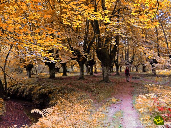
A demanding route but one that also allows us several possibilities to adapt it to our needs by taking, for example, Mendibil or Amarita as the end of the day leaving the rest for the next day. Or, as in the official guides, they mark a Stage 4a Estíbaliz-Legutio with 25.4 km and another Stage 4b Legutio-Otxandio with 9.4 km, which also gives us the chance to extend it to the Urkiola Sanctuary.
The access to the Sanctuary of Our Lady of Estíbaliz will be found shortly after leaving Vitoria - Gasteiz towards Estella - Lizarra. Specifically, it is when passing through the town of Argandoña where the road that goes up to Estíbaliz begins. As soon as we arrive, we will find a large parking area where we can park our vehicle.
It is very important, as we do with us, that we value our friend's capabilities very well before making him face such a demanding route. It is essential that he is not only used to it, but that he is in good physical condition.
We will be facing long stretches without water points where he can drink, so water cannot be missing. Nor can we leave him without food to help him replenish his energy. Pay close attention to the stretches of road and the different junctions we will pass.
It is almost certain that we will have to meet other dogs, especially in the vicinity of the different towns that this GR 38 passes through. We must also bear in mind that we will be crossing several hunting grounds.
This stage of the GR 38 starts next to the main parking lot that we find in the middle of the access road to the Sanctuary of Estíbaliz (0h 00min).

We leave the stairs that go up to the sanctuary and follow the road that goes up to it for a few meters.

At the moment we will find the beginning of the trail that will allow us to continue bordering the parking lot.

When we reach the end of this side of the parking lot, our route turns again to go away definitively from the Sanctuary of Estíbaliz.

As on so many occasions, we will see ourselves walking along an ancient path that has now been converted into a trail by the vegetation. A path that we will not abandon and that will lead us to a gate that we must cross.

At this point we come across a crossroads, where another path is joining us, so that together we can continue to move forward.
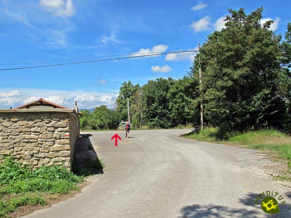
The perfect path brings us closer with every step towards the cemetery of Oreitia.

When we reach it, we will have to say goodbye to the wide track we were on, to get ready to cross the train tracks.

After carefully crossing the tracks, another obstacle appears before us, the road that connects the towns of this area with nearby Vitoria-Gasteiz, which we must cross in order to continue with the route. To finish this first section we only have to follow the road that leads to the heart of Oreitia (0h 15min).
Once in the town, the GR continues to the right of the church without letting us turn at the different intersections that come out to look for us.

We cross Oreitia following the course of the road that links it to Argómaniz.
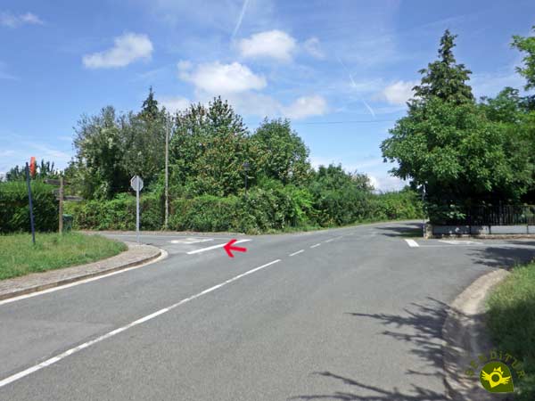
On the outskirts of the town we will say goodbye to the asphalt and continue along a wide track.
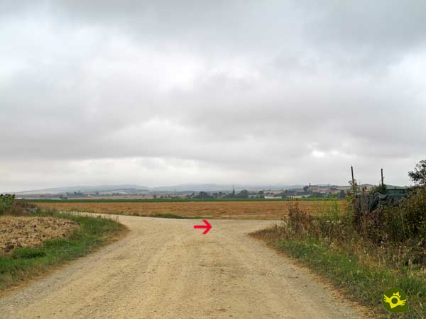
When we reach the first crossroads we will turn again to follow the path on the right.

After a short while, another road stands in our route, a road that we will cross to continue without turning off for the time being.

A little further on, at a new junction, the route did change direction and we went with it. The church of Arbulu serves as a reference to follow in case of doubt.

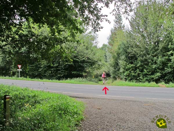
Once again another road intersects with our GR 38 forcing us to cross it to continue.

We must follow this section of track, without turning off at the different crossroads we find, until we reach the road that leads to the town we are about to visit. This road leads us without further delay to the interior of Arbulu (1h 00min).

We go through the town without leaving the route marked out by the road until we reach the fork in the street that goes up to the church.

Church that we left on our right to continue gaining height in search of the outskirts of Arbulu.

Almost without realizing it, we will find ourselves advancing on a new dirt track that saves the highway thanks to a bridge.

A clue that for now we will not abandon at the different crossroads we pass. After saving a small hillock we arrive at the moment to say goodbye to the wide track, to follow a battered path.

Soon another fork in the path will test our ability to locate the markers that mark the Wine and Fish Route. From now on, these marks will not make it easy for us to follow the route of the GR 38.

After crossing a gate for the cattle, we continue to advance, while gaining height with each step, leaving the different detours that we are faced with.

Once again some gates prevent us from passing through, here as in other parts of the GR 38 the route marked on the ground differs from the explanations and tracks that we can find in most guides and websites that describe it. In this case the marks invite us to cross the gate we have in front of us while the descriptions and tracks send us along the path on the right.

We follow the signs of the GR and go through the gate to reach a new fork in the path, which is appropriately signposted, where the path on the right must be followed.
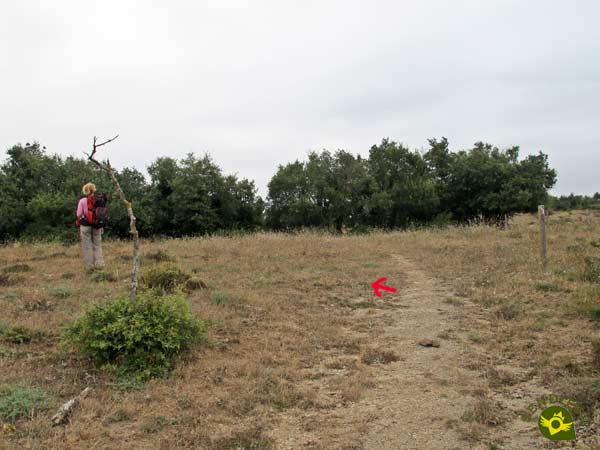
A few meters higher when the trail seems to disappear, another post warns us that the GR 38 turns slightly to the left heading towards the bushes.

Bushes where a couple of trails await us, the one on the left being the one marked, although in case of confusion both would end up taking us to the same point.

A wire fence must mark the course to follow and the beginning of the trail along which we will continue.

A narrow trail that takes us away and brings us closer to the fence that remains our reference to follow.

This especially poorly signposted area forces us to use our common sense and look for the best way to continue advancing when the vegetation and the barbed wire prevent us from passing.

There are several paths and trails that we will find and that will allow us to recover the course marked by the fence.
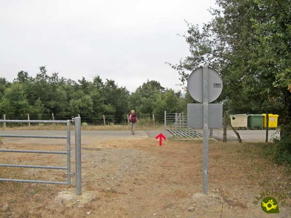
Luckily the access track to the Ullíbarri-Gamboa Reservoir is another of the references that come to our aid. A paved track that we will have to cross to follow the route of the GR 38.

A route that from now on returns to its usual state of signalling. Now, without so much trouble but without losing concentration, we are progressing and gaining height.

The trail we are following also helps us in moments of doubt. The Ullíbarri-Gamboa Reservoir comes to greet us as we contemplate it from our privileged location.

This part of the route is getting further and further away from the reservoir. There will be many crossroads that we will encounter but for the moment we will not change the course.

Further on, yes we will be almost forced to turn to the left. But we'll quickly turn right again to try to regain our lost orientation.

An orientation that we will recover a few meters later. Luckily, we're in for a good stretch without too many complications.

A part of the route where we will follow the battered road that will guide us at all times. A path that will definitely take us away from the spectacular Ullíbarri-Gamboa Reservoir.

Later on we will come across new crossroads. Luckily we will soon be out on a wide dirt track.

This track in quite good condition will lead us without major complications allowing us to move forward quickly and without leaving too many moments for doubts in the different junctions that we go through.

After climbing a small hill, it is time to say goodbye to the wide track to return to the less conditioned paths.

We then start a rapid descent in which we should not have too many orientation problems either.

Just as we reach the end of this first stretch of descent, a new crossroads awaits us, with the path on the left being the one we have to follow, of the two that we have in front of us.

This new path changes direction, setting a course for our next goal. Further on the route turns sharply to lead us in search of a conditioned dirt track.

Track we'll follow, regaining lost orientation.

We will not leave this wide dirt track until we reach the fork in the path that will take us to the town of Mendibil.
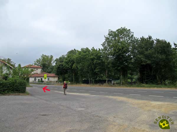
Once in Mendibil (3h 25min) we only have to follow the road that crosses it for a few meters.
In Mendibil, the beginning of the road that connects it to Amarita awaits us.

Road by which we will continue to say goodbye to this town that we have just visited.

As soon as we cross the bridge over the Zadorra River we will leave the road to go up the river. A footpath awaits us, which runs alongside this symbolic river Zadorra.

The trail leads us to the encounter with the path that reaches the river from Amarita. This path leads us to this new town through which the GR 38 passes.
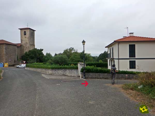
Amarita (3h 40min) welcomes us by tempting us with a visit to her church.
We enter Amarita following the course of the road that crosses it.

This road takes us to the very heart of the town from where we will go in search of the long stretch that separates us from the next town through which the Wine and Fish Route passes.

We will have a long but demanding climb, which will take us back to the Ullíbarri-Gamboa Reservoir.

To do this we just have to keep gaining height without paying attention to the paths that come our way.

A climb that seems to come to an end as it passes under the high voltage line that crowns the hill.

The path leads us to the small opening provided by the vegetation that flanks it, where the trail we will now follow begins.

A trail that allows us to enjoy spectacular views of the Ullíbarri-Gamboa Reservoir.

This trail continues to border the reservoir, although not as close to it as before. The route runs through the thick vegetation of the area, crossing an improvised gate.

The slope to be overcome continues to provide us with some demanding sections. The wire fence that has been with us for some time now takes us to the last part of the ascent of Mount Urbina.

Another place where the marks of the GR 38 do not coincide with the descriptions and tracks that we can find in most websites and written guides.

To crown the summit of this Basque mountain gives us beautiful panoramic views. Once we have enjoyed the views and recovered our breath, we start our descent, following, as it could not be otherwise, the course marked by the wire fence that has been accompanying us.
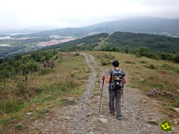
A wire fence and a path that seem to lead us to meet the antennas that crown the mountain in front of us.

But just before reaching these antennas the route turns sharply making us cross the fence to continue with the descent.

A descent that takes us to the noisy highway that runs through here. A highway that we will cross thanks to the bridge that crosses it.

On the other side we will continue descending, marked by the motorway on our right and the inert railway line that also runs here on our left.
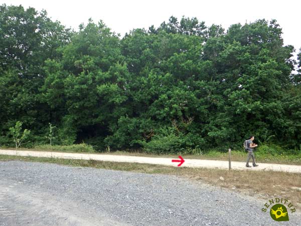
A railway route that we will cross thanks to a tunnel, to meet the itinerary of the Greenway of the Basque and Navarre Railway that we will follow.

Immediately, the greenway will make us go under the train again. This part of the GR 38 in which we share the route with the old Basque/Navarrese railway does not present any complications.
.jpg)
Step by step we are approaching the ancient station of Villarreal. When we get there we will say goodbye to the Greenway of the Basque and Navarre Railway.

The path that separates us from the Villarreal station takes us instantly to the encounter with the road. The road we will have to cross to find the beginning of the path that borders the factory in front of us.

A trail that takes us to another new road that this time we will have no choice but to continue. This stretch of road runs along the limits of the golf course located here.

Boundaries that we will continue to follow leaving the road we were following. Now a narrow trail is in charge of guiding us in this part of the route.

A trail that leads directly to the golf course urbanization.

Without the need to make a detour, our route will take us to the road that leads to the urbanization, which we will now follow.
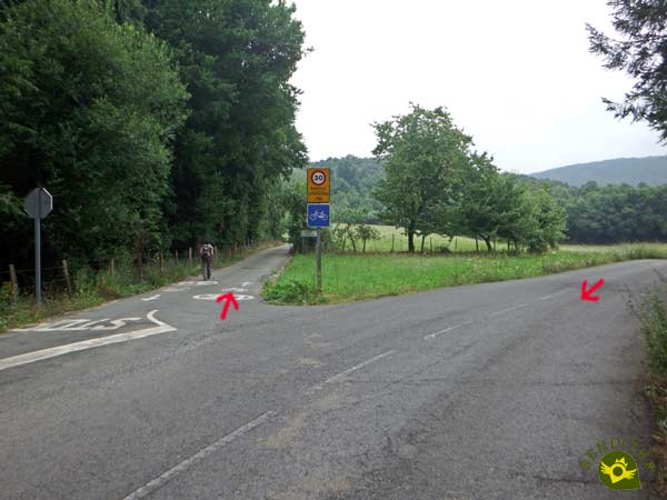
It is in this new stretch of road that the bidegorri that will take us to Legutio awaits us. This asphalted bike path holds a few surprises for us.

The fact is that we have a hard ramp, which with the kilometres already covered can be even more demanding than it is in reality. Luckily the slope does not take long to soften and even begins to lose height.

A descent that also has steep ramps this time in our favor. The first buildings of Legutio can already be seen on our left.

Also on our left is the detour that will take us to this town. Not without first having to overcome a short but remarkable ramp.

The church of Legutio (6h 45min) welcomes us to the town.
We bordered the church of Legutio in search of the main street of the village.

The street where the GR 38 sets its course for the final destination of this stage. Little by little we are leaving the town, leaving behind us the different streets that come out in our path.

Now we see ourselves traveling the road that links Legutio with Otxandio and Durango.

But before leaving the village for good, we will have to take a detour on the road that connects it to Aramaio.

And almost immediately, we turn off again, this time on the track that leads to the Albina dam.
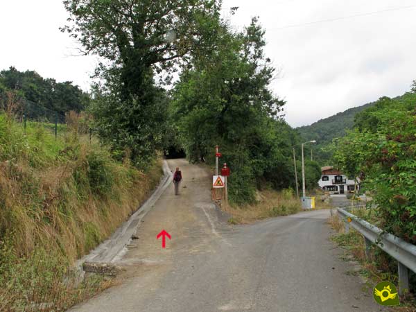
This area, although well signposted, forces us to be vigilant due to the many junctions we pass.

A few meters further on, it is time to leave the comfort of the track we were following and start the demanding climb ahead of us.

This part of the route runs again through a trodden trail. Luckily the crossroads the trail passes through are quite well signposted.

From the road that runs to our left, there are a few paths that lead to it. But we at least for the moment do not have to step on its asphalt.

A beautiful journey through the thick forest that populates this area awaits us. A forest that is crossed by a path that looks for the shore of the reservoir.

The road seems to warn us that the moment to cross it is not far away, although we should not do so for now.

On the contrary, we will get even closer to the edge of the Albina Reservoir by walking along part of its shore as we move away and get closer to it.

Later, now, the time has come to cross the road that had been accompanying us for some time.

On the other side continues the beautiful route that we have enjoyed and that with each step is moving us away from the Albina Dam. We follow the marked path through the forest.

A forest crossed by countless trails that come to add to the GR 38. We began to lose some of the height gained while we continued to enjoy the landscape around us.

This part of the route is not very complicated and has the corresponding signposting that guides us. Although sometimes the marks or posts that signalize it are surrounded or almost covered by vegetation.

After a while the trail reaches its end when it encounters a path. We should not be confused by the marks and signs of the different routes with those we will coincide with.

A paved track that seems to come to warn us of the relative closeness of our target.

Although for the time being we will follow the trails and paths that run through the forest. Trying to be attentive to the marks and signs at the different crossroads we will go through.

Crossroads which, given the proximity of Otxandio, seem to be increasing in number. Even so, we would not have to have problems in any of them to follow our path.
A path that takes us through one of the roads leading to the town.

After a while we'll go out to the road that will take us to it.

Once in Otxandio (9h 20min) those who finish the stage here can enter the town heading towards the church and those who continue and do not want to make a detour can follow the street on the right that will take them without detours to the monument to the blacksmiths where they will resume the course of the GR 38.
Areas that are more difficult to follow may cause us to cover more distance than necessary.
How accustomed we are to this type of route will determine how much time we will have to spend on this entire route.
Given the total distance of the route, we will find a great diversity of landscapes that throughout the year mark this stage of the GR 38 with their singularities. The beech forests in autumn, the cultivated fields in spring, without forgetting the microclimate generated by the reservoirs, contribute a great part of the attraction. In winter it is more than likely that we will have to endure low temperatures and bad weather while in summer the heat will not make it easy, especially at the beginning of the route.
Although the type of terrain allows us to wear trekking shoes, we must take into account the previous climate and the one that will accompany us the day of the route. We will have to face three long stretches without water points, which forces us not to forget the canteen. On a route as demanding and long as this one, getting hydrated and eating properly is essential. Hiking poles will also be good companions. Consult our list of material and equipment for hiking. Read more.
Physical
The distance added to the unevenness to overcome should not deceive us as they are important enough that our physical condition and our preparation must be good, otherwise we can get to have difficulties apart from having a bad time without need.
Severity of the environment
The road sections next to the different crossroads that we will have to face are responsible for the greatest complications that we should encounter in this stage of the Wine and Fish Route.
Orientation
This is another section to take into account, not only because of the many crossroads and the different routes with their relevant marks and signs that we will find along the route, but also because of the deficient signposting of some sections that add to the variations that the route has suffered and that have not been properly updated in some guides.
| 1-Sanctuary of Our Lady of Estíbaliz | 0:00h | 601m | 0Km | 30T 535111 4743928 |
| 2-Oreitia | 0:15h | 534m | 1.6Km | 30T 536028 4745038 |
| 3-Arbulu | 1:00h | 529m | 4.4Km | 30T 535387 4746994 |
| 4-Mendibil | 3:25h | 516m | 13.6Km | 30T 530384 4750491 |
| 5-Amarita | 3:40h | 528m | 14.9Km | 30T 530309 4751475 |
| 6-Legutio | 6:45h | 572m | 25.4Km | 30T 529163 4758647 |
| 7-Otxandio | 9:20h | 559m | 34.8Km | 30T 528144 4765328 |
Coordinates UTM Datum WGS84

![]() Slope: 1680m
Slope: 1680m
![]() Slope +: 819m
Slope +: 819m
![]() Slope -: 861m
Slope -: 861m
![]() Maximum altitude: 703m
Maximum altitude: 703m
![]() Minimum altitude: 512m
Minimum altitude: 512m

This sketch of the route is not made to scale nor does it contain all the information relating to the area, it is merely indicative.

This schematic with the path is approximate and has been created from the derived cartographic base © Instituto Geográfico Nacional "Cuadrante 112-4, 112-2 y 087-4, 25.000"
Senditur has manipulated the tracks to correct the aberrant points that may exist, caused by problems with the reception of the GPS signal. In any case the tracks are always approximate. SENDITUR encourages you to use the new technologies within your reach, using them as support and consultation in your activity, not basing the realization and orientation of the same only and exclusively on them, since they may see their functioning altered by very diverse causes, not functioning correctly and their indications may not be precise.
¿Did you know that...
The Ullíbarri-Gamboa Reservoir is the largest in the Basque Country, it is made up of 3 reservoirs and supplies water to Vitoria and Bilbao. In addition to having different recreational areas and being able to carry out multiple activities in it, it has a high ecological value given the flora and fauna that inhabit it.
Don't miss out...
The visit to the different villages through which this stage of the GR 38 passes, among which Legutio and Otxandio stand out. Villas that still preserve part of their ancient medieval past that, together with their rich history, is reflected in the streets and monuments that we can find in them.
From the commitment of SENDITUR with Nature and the respect to the balance of the environment, SENDITUR urges you to travel in a responsible way, with low environmental impact and respecting at all times the Natural, Cultural and Social environment wherever you go.
Besides sharing with all of us your experience on the route we would be grateful if you could write to us to inform us of any erroneous or outdated information you may have found, or simply to let us know what you think at Thank you.
This route has been carried out in the field by SENDITUR on 18-08-2018. The route may vary greatly depending on the time of year, weather conditions and terrain, as well as the actions of third parties and the evolution suffered in the natural environment where it is located. All opinions, advice and/or assessments made by SENDITUR in their descriptions are for guidance only and are subject to and/or refer to the specific conditions of the specific day of the route, referring to that specific day, taken from trained people, with the appropriate experience and with a high level of physical and technical preparation as a reference, as well as correctly equipped.
All the times are approximate and take an orientative character, the stops have not been taken into account, no matter how small they are. All the information related to the route, texts, images, videos, maps, diagrams, tracks, towns, and places of tourist interest are published as a guide, and may not coincide with the current state of each place. Before undertaking any activity, assess your technical knowledge, your physical condition, find out about the weather and the variations that the route may undergo, equip yourself correctly, be prudent and responsible at all times, and do not exceed your capabilities. SENDITUR is not responsible for any misuse or inappropriate use of the comprehensive guides of its routes and/or publications as well as its electronic guides, nor for any variations in their descriptions for the aforementioned reasons, and recommends that everyone be responsible and prudent in carrying out the activity. We also encourage you to read books and specialised guides to complement the information described above.
Continue watching …