Circular route to the Ullíbarri-Gamboa reservoir
Elburgo/Burgelu, Álava - Araba![]()
![]()
![]()
![]()
![]() (1)
(1)
Return to wetlands of the tails of the Ullíbarri-Gamboa reservoir
Elburgo/Burgelu, Álava - Araba![]()
![]()
![]()
![]()
![]() (1)
(1)
Return to wetlands of the tails of the Ullíbarri-Gamboa reservoir
In the heart of the Llanada Alavesa, not far from Vitoria-Gasteiz, under the watchful eye of Basque mountains such as the Aizkorri and Aratz, is one of the largest reservoirs in the Basque Country. Its construction not only affected the villages of the valley it bathes, but also the fauna and flora of the area. A change that has contributed to creating one of the most important wetlands in the north of the Iberian Peninsula, which we can enjoy today.

The circular route to the Ullíbarri-Gamboa reservoir that we are going to take is 12.8 km long and runs along the southern slope of the reservoir, starting from the information point in the Garaio Provincial Park. There are several itineraries that we can take in the reservoir, as it is bordered by a green route that is divided into 3 circular routes, the one that runs along the northern slope, which is longer and more demanding, the southern route that we are going to take, and the complete route reserved for people who are well prepared physically, all of which are suitable for travelling by mountain bike. The landscape that surrounds us along with the flora and fauna that inhabit this place are the great protagonists of the route, without forgetting of course the villages that make up the region.

Bird observatories and long walkways will be out in front of us as we walk around the reservoir. Footbridges like the one that allows us to approach the remains of the Azúa church, a footbridge that also marks the point of union of the two circular routes that we can make. Our route takes us into one of the most important wetlands in the Basque Country thanks to the footbridges that run along it, allowing us to contemplate this magnificent natural environment in all its splendour before returning to the Garaio information point, where we will end the route.

The Ullíbarri-Gamboa reservoir, or rather its depths, are home to an enigmatic extraterrestrial base. Some years ago, hundreds of people were perplexed to see a UFO flying over the reservoir, surprising those who saw it with its bright colors. This object was clearly visible until at dusk it vanished before the eyes of those who looked at it.
To get to the Garaio Provincial Park where this circular route to the Ullíbarri-Gamboa reservoir runs, we must follow the A-1 until the Argomaniz and Ozazeta exit, the latter being the town we must go to. Shortly after leaving the motorway and just before reaching Maturana, you will find the signposted turnoff that you must take and which will lead you to Gario Park. Once there, we will have several parking areas where we can park our vehicle to start the route.
Given the ecological value of the wetland we are going to visit, it is important to observe the rules that govern it, both with regard to pets and those that affect human behaviour.
Our pet should be tied up when doing this route, a route in which it is important to take water to it since it is not advisable to let it get close to the edge of the reservoir.
There will be many pets that we will find on our way to add to the rich fauna that lives here, so it is important to be aware.
The Garaio Provincial Park information office (0h 00min) is our starting point for this circular tour we are about to begin.

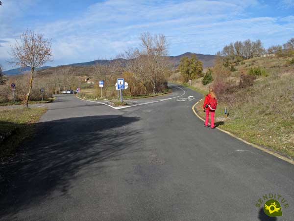
The road that takes us to this natural spot will be in charge of guiding us at the beginning of this route.

There are several parking areas to be found in Garaio, which of course communicate with the road we are following.

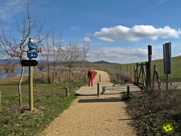
Soon we arrive at the point where we say goodbye to the road, which continues to another of the parking lots, while we begin the journey on a conditioned path.

Already without the heavy company of the asphalt we began to contemplate the first images of the reservoir that we are going to cross partly. Soon we will come across a viewpoint prepared to contemplate the birds that live here.

Our path leads us directly to the first of the footbridges we will cross, at the same time as we are joined by the other path that arrives here from Garaio, skirting the reservoir, from the car parks that we left behind earlier.

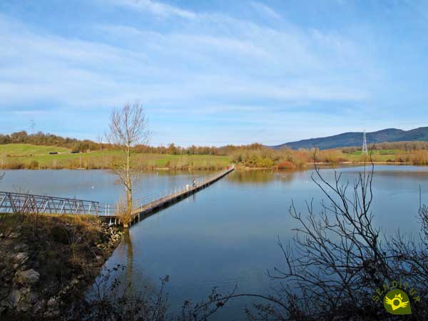
The wobbly footbridge takes us to the other bank where our route continues. At all times the posts along the route inform us of the direction to take, although at the moment we cannot get lost.

Soon we can see on the other side of the Ullíbarri-Gamboa reservoir the ruins of the old church of Azúa, although we still have a long way to go.

There are several crossroads that we will find, all of them marked and even fenced to avoid getting lost.

Again in front of us there is a footbridge that will allow us to cross to the other side of the reservoir and that marks the point that divides, or unites, the two circular routes that run through it, the north by Landa and the south that is the one we are following.

We crossed the footbridge of Azúa (1h 00min) leaving behind the continuation of the path that we were following and that as we know leads to the Provincial Park of Landa.

On the other side of the reservoir, we will follow the course marked by the bank of the reservoir leaving behind the path that would take us to Nanclares de Gamboa and that would close the north circular route.

We continue to move forward with our eyes on the battered church of Azua. Almost without realizing it, we left this old church behind us to face a long stretch of path marked out at all times by the inseparable reservoir and the wire fence that delimits it.

Of course we will continue to encounter detours that we must ignore. On more than one occasion we will have to go through some gates, but without abandoning the perfect path that we are following.

The fact is that this path and the indications of the route make it quite clear to us which way to go at all times.

As we cross the gates we realize the spectacular scenery we are walking through.

A good while later we find a new crossing where we are offered the possibility of joining the GR 25 or Vuelta of the Llanada.

We continue to be close to the spectacular Ullíbarri-Gamboa reservoir.

After a while our conditioned path seems to come to an end, indicating that the time has come to separate us for a moment from the reservoir.

We quickly came across a road that we must continue on.

Luckily, we will leave it almost at once to go in search of our reservoir. This bad road that we are following leaves us without delay on the same bank of the reservoir.

After passing through yet another gate, we will find ourselves crossing the southern dike of the reservoir, from where we can enjoy magnificent views.

After doing so we will again face a long stretch of dirt track away from the company of the reservoir.

This track takes us further and further away from it until we find a crossroads where we will change radically our course leaving behind us the dirt track that leads to the Ornithological Park of Mendixur (3h 00min).

This part of the route takes us through a wide wetland, habitat of countless species as well as the bird observatory we passed by.

Soon we will meet in the middle of the wetland following the wooden walkway that runs through it. A stretch that combines footbridges with areas of path and that leads us directly to the end of this route.

An area that is marked by the car park at the entrance to the park.

A heavy section awaits us ahead, following the road into the Garaio Provincial Park. A road that forces us to make a last effort to overcome the unevenness it presents us with.

We follow its course leaving aside the detours that lead to the different parking lots of the park. As long as it is clear that our starting point was not one of them.

The remains of the old church of San Esteban greet us shortly before we arrive at the information office in the Garaio Provincial Park (3h 40min) where we will end the tour.
The different routes in the area allow us to adapt the route and distance to our needs.
This figure varies depending on where we park our vehicle, as most car parks are not very close to the route.
The Ullíbarri-Gamboa reservoir, its magnificent wetland, the beaches so popular in the summer and the various activities that can be carried out there make it a reference point throughout the year. This privileged environment does not go unnoticed by the different species of birds that choose it as their home or as a stopover during their migrations, thus providing an added value to this recommendable place.
The condition and civilization of the route should not make us fall into the error of underestimating it. We are facing a route of considerable distance in which we will not have sources or rest areas outside the tourist points. Therefore we can not lack water and food, adapt our equipment to the period of the year in which we are and of course not venture with street clothes and shoes. The walking sticks, even if they do not stand out due to the slopes to be overcome, will also be of help to us. Consult our list of material and equipment for hiking. Read more.
Physical
The distance is undoubtedly the factor that conditions most of the difficulty of this circular route. Even though there is practically no unevenness, we are facing a route of more than 10 km that forces us to be used to walking in order not to have a bad time.
Severity of the environment
As long as we don't go off the beaten track and keep our common sense when passing through the different footbridges on the route, we shouldn't have any problem. We must take into account that in some areas of the route we will coincide with road traffic so we must take extreme precautions.
Orientation
Perfectly signposted at all times and even enclosed by a fence along much of the route, this section should not generate more complications than leaving the car park where we park and find the route we are going to follow.
| 1-Garaio Information Point | 0:00h | 560m | 0Km | 30T 537695 4750820 |
| 2-Azúa Footbridge | 1:00h | 555m | 3.6Km | 30T 535932 4751275 |
| 3-Diversion to Mendixur Ornithological Park | 3:00h | 553m | 10.5Km | 30T 537887 4749142 |
| 4-Garaio Information Point | 3:40h | 560m | 12.8Km | 30T 537695 4750820 |
Coordinates UTM Datum WGS84

![]() Slope: 110m
Slope: 110m
![]() Slope +: 55m
Slope +: 55m
![]() Slope -: 55m
Slope -: 55m
![]() Maximum altitude: 585m
Maximum altitude: 585m
![]() Minimum altitude: 550m
Minimum altitude: 550m

This sketch of the route is not made to scale nor does it contain all the information relating to the area, it is merely indicative.

This schematic with the path is approximate and has been created from the derived cartographic base © Instituto Geográfico Nacional "Cuadrante 112-2, 112-4, 113-1 y 113-3, 25.000"
Senditur has manipulated the tracks to correct the aberrant points that may exist, caused by problems with the reception of the GPS signal. In any case the tracks are always approximate. SENDITUR encourages you to use the new technologies within your reach, using them as support and consultation in your activity, not basing the realization and orientation of the same only and exclusively on them, since they may see their functioning altered by very diverse causes, not functioning correctly and their indications may not be precise.
¿Did you know that...
The Ullíbarri-Gamboa reservoir is the largest in the whole of the Basque Country. Its construction lasted 10 years and 12 of the valley's villages were submerged under its waters. Its first function was to supply electricity to the Blast Furnaces of Bizkaia; furthermore, this reservoir is connected by an underground gallery to the nearby Urrunaga reservoir.
Don't miss out...
The nearby Mendixur Ornithological Park, a wetland of great importance and a must for nature lovers and birdwatchers. Through its different routes and observatories we will be able to discover the more than 200 species of birds that throughout the year inhabit it.
From the commitment of SENDITUR with Nature and the respect to the balance of the environment, SENDITUR urges you to travel in a responsible way, with low environmental impact and respecting at all times the Natural, Cultural and Social environment wherever you go.
Besides sharing with all of us your experience on the route we would be grateful if you could write to us to inform us of any erroneous or outdated information you may have found, or simply to let us know what you think at Thank you.
This route has been carried out in the field by SENDITUR on 09-02-2019. The route may vary greatly depending on the time of year, weather conditions and terrain, as well as the actions of third parties and the evolution suffered in the natural environment where it is located. All opinions, advice and/or assessments made by SENDITUR in their descriptions are for guidance only and are subject to and/or refer to the specific conditions of the specific day of the route, referring to that specific day, taken from trained people, with the appropriate experience and with a high level of physical and technical preparation as a reference, as well as correctly equipped.
All the times are approximate and take an orientative character, the stops have not been taken into account, no matter how small they are. All the information related to the route, texts, images, videos, maps, diagrams, tracks, towns, and places of tourist interest are published as a guide, and may not coincide with the current state of each place. Before undertaking any activity, assess your technical knowledge, your physical condition, find out about the weather and the variations that the route may undergo, equip yourself correctly, be prudent and responsible at all times, and do not exceed your capabilities. SENDITUR is not responsible for any misuse or inappropriate use of the comprehensive guides of its routes and/or publications as well as its electronic guides, nor for any variations in their descriptions for the aforementioned reasons, and recommends that everyone be responsible and prudent in carrying out the activity. We also encourage you to read books and specialised guides to complement the information described above.
Continue watching …