Greenway of Arrazola
Atxondo, Vizcaya - Bizkaia![]()
![]()
![]()
![]()
![]() (1)
(1)
Following in the footsteps of the vanished Aurrera locomotive
Atxondo, Vizcaya - Bizkaia![]()
![]()
![]()
![]()
![]() (1)
(1)
Following in the footsteps of the vanished Aurrera locomotive
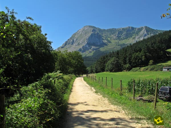
The Arrazola Valley in Atxondo lies at the foot of the mythological peaks of the Urkiola Natural Park, following the quiet course of the River Arrazola. Apatamonasterio, Axpe, Arrazola and the countless farmhouses that dot the valley give shape to this beautiful municipality of Bizkaia through which the Greenway of Arrazola, also known as the Greenway of Atxondo, runs, among other hiking routes.

The 9.2 km route follows the old route of the mining train that transported the precious ore from the old Errotabarri station, next to the mines at the head of the valley, to Apatamonasterio where it joined the railway line that came from Durango. Apatamonasterio is now the starting point of the Greenway of Arrazola which, following the quiet course of the river, goes up the valley under the watchful eye of the slender Anboto. From the very first moment, you will be surrounded by the majestic landscape that characterises these lands, the green fields of grass and the steep mountains that make up the Urkiola Natural Park blend in with the well-tended farmhouses and the different towns that make up Atxondo. Towns such as Marzana, whose San Martín church captures part of the landscape that accompanies us along this stretch of the route. This route crosses the wide fields that stretch along the banks of the Arrazola River, which gradually give way to the mountains that surround the valley.

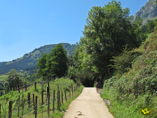
The Greenway offers us a number of cozy corners perfectly conditioned where we can make a stop on our way. Little by little we leave behind old farmhouses while we go through real tunnels formed by the thick vegetation that covers some areas of the route. The Axpe Valley and the Santiago district mark the midpoint of the greenway and the beginning of the most uneven stretch of the entire route. Apart from this short slope, Arrazola is unmistakable, next to the church of San Miguel and one of the oldest farmhouses in Bizkaia, the Baserri de Urrutia, dating from the 16th century. From here, and surely under the attentive gaze of Mari, who from her decorated cave does not miss any detail of what is happening in her domains, we approach the hermitage of San Roque like pilgrims. A little further on, the old station of Errotabarri awaits us, or as it is also known, El Tope, the end point of this Greenway of Arrazola and the place from where, after enjoying it, we will return on our own steps to Apatamonasterio, where we will now consider this route through the lands of Bizkaia to be complete.

According to the people of the valley, among the hamlets in it there is one that has a characteristic that makes it very special. It is that in its enormous wooden door you can observe perfectly carved by fire the figure of a great hand. This hand is attributed to a mysterious character that, wrapped in fire, travels around the valley on the back of a robust horse some winter nights trying to capture anyone who dares to look at it. A mistake made by the daughters of the owner of the baserri who, on returning home one cold winter's night, heard the deafening neighing of a horse behind him and, on looking back, saw the expectant fire-wrapped silhouette of the mysterious knight, who angrily began to pursue them. Luckily, the young women managed to reach the baserri, getting safe inside and making their pursuer even angrier. In his rage at not being able to catch them, he gave a tremendous blow to the door of the baserri, leaving his hand marked with fire forever.
To reach Atxondo, or rather Apatamonasterio, which is the starting point of this greenway, we have to take the N-636 road that joins the nearby Durango with Elorrio and Mondragón, the latter already on the AP-1. Once in Apatamonasterio, we must enter the town following the BI-4332 road that joins it with Arrazola and Axpe and which starts at the N-636. This local road that crosses the valley goes through Apatamonasterio, passing the town hall of the municipality of Atxondo and the pelota court. But before arriving at these two buildings, on our left as we enter Apatamonasterio going up the valley, are the streets that will allow us to approach the children's play area from where the greenway begins. Around this residential area we will find different car parks where we can park our vehicle and approach the beginning of the route.
A very pleasant walk for our dog, where it is advisable to take him tied up and where we will have to be attentive to the various road junctions that we must pass through.
With numerous water points along the route we should not have problems.
Except for some pets that are doing the tour with their owners and the cattle that are usually in their corresponding area of pasture we will not find much more company, as long as the dogs that live in the nearby villages do not walk around.
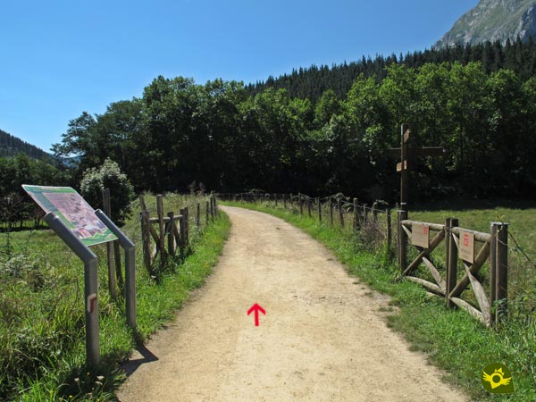
Next to the playground of Apatamonasterio (0h 00min) we find the two access points to this greenway.

Either through the old bridge that still resists the passage of time or through the modern footbridge that allows us to cross the course of the Arrazola River.

In any case, both options come together a few metres further on to take the route that awaits us along the mining path.

The route of the old mining train goes up the Atxondo Valley following the course of the Arrazola River, through fields of grass and trees. Always under the watchful eye of the slender Anboto, it crosses the boundaries of the Urkiola Natural Park.

After leaving Apatamonasterio behind, Marzana, another of the old neighbourhoods through which this mining railway passed on its way to the link with the route that joined Durango and Elorrio, emerges before us.

Shortly after passing by Marzana, the road that runs through the valley cuts us off, forcing us to cross it in order to continue our journey.

At every step we come across benches and small recreational areas that invite us to take a break and calmly enjoy the landscape around us.

There will be several occasions when we have to cross the tracks and paths that give access from the road to the farmhouses that populate the area. Even so, this is a comfortable and quiet route, ideal for the family.

The river runs alongside us almost at all times, giving us small stretches where we can enjoy the freshness of its banks.

The well cared for farmhouses emerge before us contributing their grain of sand to the already beautiful landscape.

We continue advancing, leaving on our right some pastures where the route of the GR continues, which without us almost noticing had accompanied us until here.

Shortly afterwards we will find ourselves crossing the road that goes up from the nearby neighbourhood of Santiago towards Axpe.

The unevenness that we must face in this quiet route is hardly felt except in some areas a little more inclined than the rest. The vegetation and the clear areas continue to alternate along the entire route.

The tower of the church of San Miguel welcomes us to the final section of this greenway of Atxondo. Just before crossing over to the road that leads to the Arrázola neighbourhood, we will have the opportunity to turn off for a moment and visit both the neighbourhood and its ancient temple.

Soon we will see ourselves again crossing another road to face this final part of our itinerary.

The hermitage of San Roque awaits us in its bucolic location to warn us of the near end of this greenway.

The old station of El Tope (1h 25min) was and is the final point of this route and the starting point to return again to Apatamonasterio (2h 40min). Not before having enjoyed the surroundings of this old mining site.
Our starting point will mark the final distance to be covered.
The many places where we are tempted by bucolic landscapes and rest areas can make the final time spent considerable compared to the distance travelled. We also have several possible detours to visit some of the cultural attractions through which the route passes.
We are before a totally conditioned itinerary that except in days of bad weather or very punctual it should not present/display complications, allowing us to enjoy the different tonalities with which each time of the year it paints the landscape that surrounds to this route.
Comfortable and sport clothes and shoes, some water in case it could be necessary and the corresponding protection against the sun, especially on hot days, is how much at first sight this route could require us given its characteristics. Consult our list of material and equipment for hiking. Read more.
Physical
A comfortable walk with hardly any unevenness where the final distance is the one that will mark the physical demand, not in vain at the end we will have covered almost 10 kilometers. It is certain that we will have numerous banks and zones of rest throughout the route that will allow us to take it with the necessary calm. Moreover, if necessary, we can also count on the intercity bus line for the return journey, which runs through the different districts we pass through.
Accessibility
Fully conditioned, with sufficient width, with a well maintained and well pressed pavement, the terrain where this greenway runs does not present any major complications than the crossroads with the roads we have to face. Moreover, this greenway has the particularity of not allowing the passage of not only motor vehicles, but also bicycles.
Orientation
We will find all the complications in this section at the beginning of the route, in Apatamonasterio, as it is somewhat complicated to find the starting point of the greenway as there are no more signs in the town than those right in the park where the route begins. For the rest of the route we will have the pertinent marks and the invaluable help of a totally delimited route as it is usually the case in most of the greenways.
| 1-Apatamonasterio | 0:00h | 162m | 0Km | 30T 533946 4775247 |
| 2-El Tope | 1:25h | 247m | 4.6Km | 30T 534898 4771284 |
| 3-Apatamonasterio | 2:40h | 162m | 9.2Km | 30T 533946 4775247 |
Coordinates UTM Datum WGS84

![]() Slope: 180m
Slope: 180m
![]() Slope +: 90m
Slope +: 90m
![]() Slope -: 90m
Slope -: 90m
![]() Maximum altitude: 247m
Maximum altitude: 247m
![]() Minimum altitude: 162m
Minimum altitude: 162m

This sketch of the route is not made to scale nor does it contain all the information relating to the area, it is merely indicative.

This schematic with the path is approximate and has been created from the derived cartographic base © Instituto Geográfico Nacional "Cuadrante 087-2, 1:25.000"
Senditur has manipulated the tracks to correct the aberrant points that may exist, caused by problems with the reception of the GPS signal. In any case the tracks are always approximate. SENDITUR encourages you to use the new technologies within your reach, using them as support and consultation in your activity, not basing the realization and orientation of the same only and exclusively on them, since they may see their functioning altered by very diverse causes, not functioning correctly and their indications may not be precise.
¿Did you know that...
This old railway started to be built at the beginning of the 20th century, being at full capacity until shortly after 1935. It continued to be used sporadically for various purposes until it was finally closed there in 1959.
Don't miss out...
The nearby Urkiola Natural Park, a place full of corners of great beauty, full of contrasts such as its leafy forests and its rugged mountains, or places that transmit almost equally serenity and the mysticism of the stories and tales that precede them.
From the commitment of SENDITUR with Nature and the respect to the balance of the environment, SENDITUR urges you to travel in a responsible way, with low environmental impact and respecting at all times the Natural, Cultural and Social environment wherever you go.
Besides sharing with all of us your experience on the route we would be grateful if you could write to us to inform us of any erroneous or outdated information you may have found, or simply to let us know what you think at Thank you.
This route has been carried out in the field by SENDITUR on 30-07-2017. The route may vary greatly depending on the time of year, weather conditions and terrain, as well as the actions of third parties and the evolution suffered in the natural environment where it is located. All opinions, advice and/or assessments made by SENDITUR in their descriptions are for guidance only and are subject to and/or refer to the specific conditions of the specific day of the route, referring to that specific day, taken from trained people, with the appropriate experience and with a high level of physical and technical preparation as a reference, as well as correctly equipped.
All the times are approximate and take an orientative character, the stops have not been taken into account, no matter how small they are. All the information related to the route, texts, images, videos, maps, diagrams, tracks, towns, and places of tourist interest are published as a guide, and may not coincide with the current state of each place. Before undertaking any activity, assess your technical knowledge, your physical condition, find out about the weather and the variations that the route may undergo, equip yourself correctly, be prudent and responsible at all times, and do not exceed your capabilities. SENDITUR is not responsible for any misuse or inappropriate use of the comprehensive guides of its routes and/or publications as well as its electronic guides, nor for any variations in their descriptions for the aforementioned reasons, and recommends that everyone be responsible and prudent in carrying out the activity. We also encourage you to read books and specialised guides to complement the information described above.
Continue watching …