Welcome to SENDITUR.COM · paths · routes · tourism


![]() Difficulty-Adapted
Difficulty-Adapted
![]() 1:20 h.
1:20 h.
![]() 6 km.
6 km.
![]() Difficulty-Adapted
Difficulty-Adapted
![]() 1:20 h.
1:20 h.
![]() 6 km.
6 km.
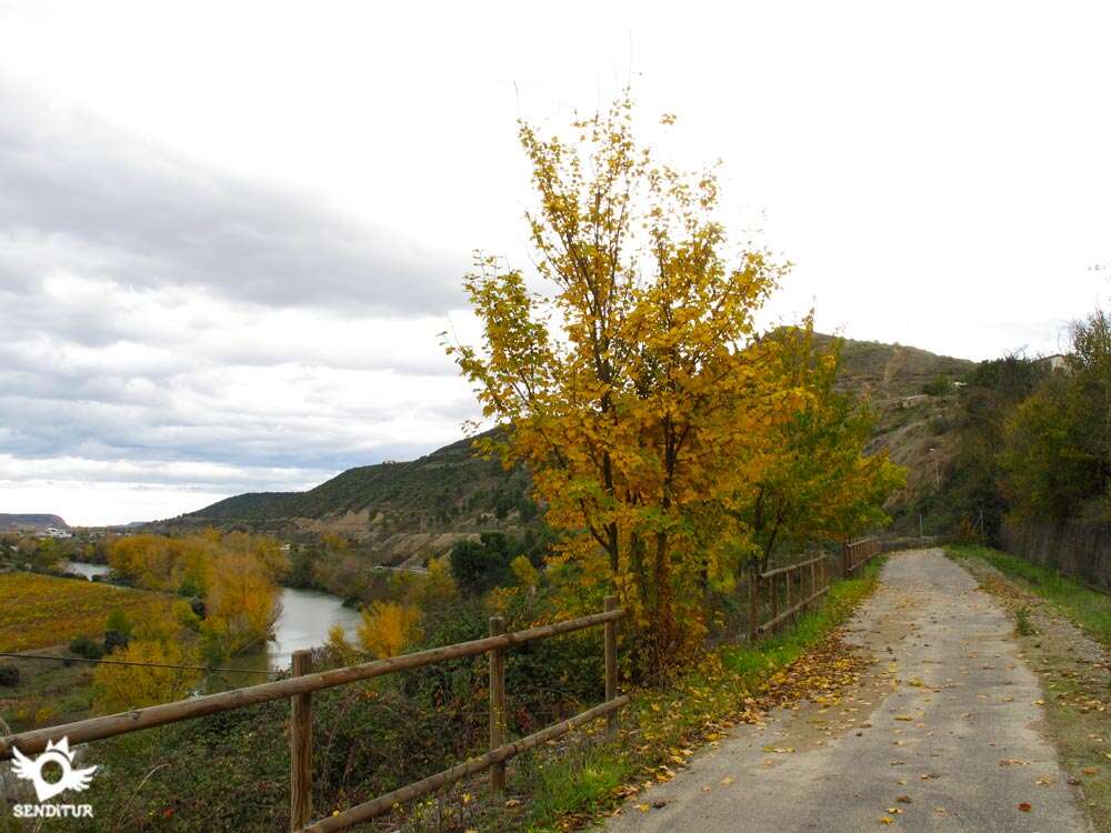
The great meander that the river Ebro draws as it passes through El Cortijo, has given rise to a unique space formed by the typical fluvial plains, home to a large representation of various species of flora and fauna. The old railway line between Castejón and Bilbao, forced by the morphology of the terrain and the interposition of the district of El Cortijo, traced a wide curve following the limits marked by the flow of the river. Today this railway line crosses the area thanks to a modern tunnel, leaving the part of the route that ran through the meander in disuse. Turned into a pleasant walk, this section allows us to enjoy the variety and rich landscape of this area of La Rioja near Logroño and bordering Euskadi, which the Ebro makes a natural border.

The greenway of El Cortijo with a total distance of 6 km, round trip, runs along the old railway enveloping El Cortijo, as in the past made so many trains that passed through this place. The green track is perfectly conditioned and, given its characteristics, free of great unevenness and with a good gravel surface and pressed zahorra, can be traveled without difficulty. The route that goes from where the old El Cortijo stop was, to the entrance of the road that arrives from Logroño, to meet again with the new railway line, past the hydroelectric dam that regulates the river bed, has a car park at both points. Being able to initiate the itinerary in both places it is more advisable to go directly to the one that is passed the locality, next to the dam since it has more space to be able to leave our vehicle and has a much more comfortable access to the green way. From this place we only have to enjoy this pleasant walk following the course of the Ebro contemplating a splendid landscape marked by the vineyards and the typical riverside orchards, observed on the horizon by Sierra Cantabria and the whitish vertical walls of the mountains that form it.

Spring surprises us with its striking colours, the white of the almond trees, the greens of the vineyards and the crops or the reds and roses of the poppies and the correhuelas that gather on both sides of the route. Autumn gives us the spectacular landscape offered by the vines with the great variety of yellows, reds and copper, together with the different species typical of the Mediterranean climate such as carrasca and oak groves. The winter, thanks to the proximity of Sierra Cantabria, sometimes gives us the chance to contemplate the Sleeping Lion or the Joar, among others, covered with snow. The meander is the ideal habitat for partridges, hares or black kites, as well as other species that use this place as a transit point in their migrations. Before reaching the point where the El Cortijo stop used to be, just where the greenway enters the trench bordering the neighbourhood, there is the other access point to the route. In this place we will have the possibility of taking a detour to get to know the remains of the old Mantible Bridge.

This small variant lengthens the total route in a scarce 4,5 km, round trip, introducing us more in the meander until the place where the remains of this old and famous point of passage of the Ebro are located. This part outside the greenway is not conditioned and runs along the tracks that serve as access to the different farms that extend along the meander, being able even if we know the terrain to return by them to the hydroelectric plant following the path known as the Path of the Meander.
Prisoners the twelve pairs of France, in lands of Spain, by the Moors, Charlemagne, with a great army, enters Spain to free them. On his way he found a mighty river that could only be crossed by a large marble bridge, with thirty arches, called Mantible, guarded by two square towers, also made of marble, and defended by a frightful and enormous giant, called Galafré, which demanded from Christians who crossed it some very high rights, under penalty of life. Charlemagne had among his ranks another giant, Fierabrás, whom he ordered to fight with Galafré. Fierabrás defeated Mantible's guardian, making it possible for Charlemagne's army to cross the famous bridge, being able to go to the aid of the twelve pairs and free them.
To get to El Cortijo once we are in Logroño we must go towards the popularly known as Cuarto Puente de Logroño, on the road that leads to the Alava town of Laguardia. On the south bank of the river, at the beginning of this bridge begins the road that will take us to the town of El Cortijo, this road is known as the El Cristo road, passing by a hermitage of the same name. Continuing along this road we reach El Cortijo, once there and just before entering the town we will see, in the middle of a curve, on our right a sign indicating the detour to follow to reach the small car park where we can leave our vehicle, to start the journey in the vicinity of the old halt. This car park is before a bridge over the greenway, to which we can descend by an asphalt track that begins on the left just cross to the other side, finding a fence that prevents vehicles from entering the greenway and on one side a narrow pass where to enter the route. If, on the other hand, we prefer to start on the other side, we will have to leave this first sign behind to enter the town following the streets that allow us to move in the direction of our march until we reach a small landscaped square, next to the church, where we will see another sign indicating the street that will take us out of El Cortijo. Passing by the municipal swimming pools and following the asphalted track between vineyards, we will leave a couple of crosses on our left to descend a steep slope parallel to the new train route. At the end of the descent we will see a small tunnel and on the right a short track that ascends to the large car park where we can leave the vehicle and start the journey.
Precious itinerary without complications, for good firm and in full nature to little distance of the great city, ideal for a pleasant stroll.
Without shade at any time the distance of the journey would not have to be a problem, although not finding water points along the way, it would not be superfluous to carry a reservation especially in summer.
Concurrent walk in which we will find more than one mascot enjoying it with its owners.
 Distance. 6Km
Our place of departure can influence this figure.
 Time. 1:20h
To this time we will have to add approximately 1:more if we encourage ourselves to approac:to the Bridge of Mantible.
 Time of year
Spring and autumn are a visual spectacle, while winter and summer give us all their strength.
 Required equipment
Sportswear or comfortable according to the time of year and weather conditions. You can not miss the camera, binoculars can be useful to observe in detail the nearby mountains. Sun protection and sunglasses in the summer next to the canteen wit:water, also come in handy.
 Difficulty. Adapted
Physical
Practically on flat terrain this section of the route is perfectly conditioned and has a road surface in very good condition. The short distance of the route added to the almost null unevenness makes this route suitable for all audiences.
Caution
Absent of complications, the only one but that we could put him is the part of way that crosses the trenc:where the walls of this one have suffered some that another collapses.
Orientation
The route does not have any loss to be embedded in the old railway line, complications can come to find the departure points.
 |
 |
 |
 |
 |
| 1-Parking | 0:00h | 410m | 0Km | 30T 538917 4703491 |
| 2-Parking | 0:30h | 415m | 2,3Km | 30T 539329 4704986 |
Coordinates UTM Datum WGS84

 Slope: 20m
 Slope +: 10m
 Slope -: 10m
 Maximum altitude: 420m
 Minimum altitude: 410m

This sketc:of the route is not made to scale nor does it contain all the information relating to the area, it is merely indicative.

![]()
This schematic wit:the pat:is approximate and has been created from the derived cartographic base © Instituto Geográfico Nacional "Cuadrante 204-1, 203-2 1:25.000".
Senditur has manipulated the tracks to correct the aberrant points that may exist, caused by problems wit:the reception of the GPS signal. In any case the tracks are always approximate. SENDITUR encourages you to use the new technologies within your reach, using them as support and consultation in your activity, not basing the realization and orientation of the same only and exclusively on them, since they may see their functioning altered by very diverse causes, not functioning correctly and their indications may not be precise.


Espectaculares los paisajes que se pueden ver en este recorrido, muy bonitos!!


Find out what to see in...
¿Did you know that...
The Natural Way of the Ebro or GR 99 covers more than 1200 km and consists of 42 stages arranged on both sides of the river. Travelling through all the provinces and places that the Ebro crosses from its source in Fontibre to its mouth in Riumar.
Don't miss out...
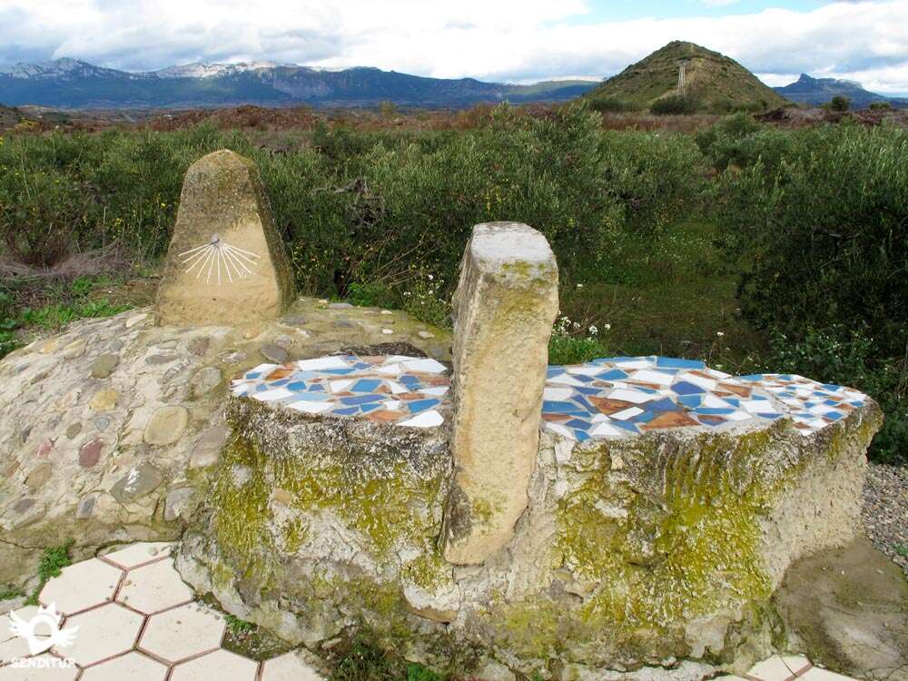
El Mirador del Viñedo, a spectacular balcony nestled next to the Castillete tower at the top of the hill overlooking El Cortijo, in the middle of the GR-99 or Ebro Natural Path. From there you can enjoy magnificent views of the vineyards and orchards of the area along with the panoramic Sierra Cantabria.


From the commitment of SENDITUR with Nature and the respect to the balance of the environment, SENDITUR urges you to travel in a responsible way, with low environmental impact and respecting at all times the Natural, Cultural and Social environment wherever you go.

Besides sharing with all of us your experience on the route we would be grateful if you could write to us to inform us of any erroneous or outdated information you may have found, or simply to let us know what you think at Thank you.
This route has been carried out in the field by SENDITUR on 18-10-2015. The route may vary greatly depending on the time of year, weather conditions and terrain, as well as the actions of third parties and the evolution suffered in the natural environment where it is located. All opinions, advice and/or assessments made by SENDITUR in their descriptions are for guidance only and are subject to and/or refer to the specific conditions of the specific day of the route, referring to that specific day, taken from trained people, with the appropriate experience and with a high level of physical and technical preparation as a reference, as well as correctly equipped.
All the times are approximate and take an orientative character, the stops have not been taken into account, no matter how small they are. All the information related to the route, texts, images, videos, maps, diagrams, tracks, towns, and places of tourist interest are published as a guide, and may not coincide with the current state of each place. Before undertaking any activity, assess your technical knowledge, your physical condition, find out about the weather and the variations that the route may undergo, equip yourself correctly, be prudent and responsible at all times, and do not exceed your capabilities. SENDITUR is not responsible for any misuse or inappropriate use of the comprehensive guides of its routes and/or publications as well as its electronic guides, nor for any variations in their descriptions for the aforementioned reasons, and recommends that everyone be responsible and prudent in carrying out the activity. We also encourage you to read books and specialised guides to complement the information described above.
Continue watching …


.jpg "Go to Monastery of Santa María del Salvador")


