Stage 07 Logroño-Nájera
Stage through Riojan lands, land of contrasts
Stage through Riojan lands, land of contrasts
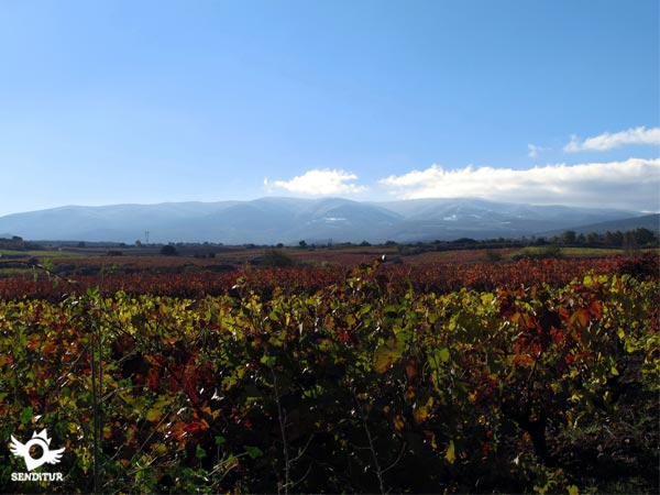
Between the wide valley of the Ebro and the Najerilla, escorted by magnificent mountains, between vineyards, this stage of the French Way through La Rioja. La Rioja is a land full of contrasts, from wide and gentle valleys to high mountains over 2000m high or fields and forests that alternate greens with reddish, ochre or yellow. Each season of the year gives us the option of discovering a new landscape in the same place, all this essence is compressed in only 2 stages and a half that takes us to cross this part of the Way of Saint James in La Rioja.
The stage 7 Logroño-Nájera with 29,1 Km, the first of the French Way of Saint James in La Rioja, starts in the heart of Logroño going through its streets to say goodbye to the locality enjoying the San Miguel Park and heading for a comfortable road or greenway to the La Grajera Park and Reservoir, built in year 1883 on a small lagoon in order to accumulate the water, coming from the river Iregua, for the irrigation of the orchards, at the moment it is one of the few humid zones of the region and habitat of diverse animal and vegetable spices, the place is equipped to offer the possibility of carrying out diverse lúdicas activities, sports and of environmental education. Leaving the park behind, we start, by an asphalted track, the demanding climb up to Alto de La Grajera.

Sometimes the Way encourages us to look back to contemplate what was left behind us in our pilgrimage and this is one of those moments, it gives us a magnificent panoramic view, the vines, the reservoir surrounded by arboreal vegetation and the Logroño background that says goodbye to us once and for all. The French Way begins the gentle descent towards Navarrete, after crossing the national road and passing the motorway, with the ruins of the old Pilgrims' Hospital of San Juan de Acre, founded around 1185 by Doña María Ramírez. At present we can find the doorway and a couple of its windows on the façade of the town's cemetery. Navarrete, welcomes us with all its hospitality while the French Way crosses its streets, to continue the march that took us to pass next to the cemetery, moment to take advantage and to contemplate the pieces of San Juan de Acre that compose its facade. From here the route runs between vineyards along a road in good condition, in this section are two localities with great Santiaguera tradition that offer us their hospitality and services, Sotes and Ventosa, because although the Way originally does not pass through them, if it is admitted is well signposted variant, being a good option for the pilgrim.

Once we have decided whether to continue along the Way, next to the A-12 motorway or continue towards one of these towns and after joining these roads, we reach the ascent of Alto de San Antón, a short and uncomfortable climb that rewards us with the possibility of contemplating, on the one hand, the Sierra de La Demanda with its rounded mountains of more than 2000 m, on the other hand, the profiled Sierra Cantabria and its steep mountains and, between them, the valleys of the Ebro and the Najerilla, our destination. The French Way then begins a smooth and long descent passing by a Guardaviñas, a typical construction of La Rioja that the winegrowers used as a refuge from the inclement weather, to later cross the Yalde river, a couple of roads and enter Nájera, crossing the long streets of the town until crossing the bridge over the Najerilla river, to go up the riverbed along its landscaped bank and reach the end of the stage.
This stage gives us the possibility of dividing or extending the route according to our needs, taking advantage of intermediate localities or extending our walk to the town of Azofra, near Nájera, finding in any of them the necessary services.
Complicated stage for our friends, to the distance of the same one we have to add, the long asphalted sections of the beginning, with what it supposes.
In Logroño to Navarrete we have several water points, while from Navarrete to the vicinity of Nájera, without shaded places, we will not find any, unless we choose to follow one of the variants to Sotes or Ventosa.
In the first part of the route, until the Park of the Grajera, it is habitual to find us with numerous mascots, in addition the park is the house of diverse species like squirrels, ducks and fallow deer that we will see with facility, in Navarrete and to the entrance of Nájera we will pass next to pavilions and estates of recreation with dogs, normally these enclosures are closed.
We begin this stage going through the old town of Logroño (0h 00min), Rúa Vieja street leads us to the fountain of the Pilgrim (also known as Santiago or Camino) next to the church of Santiago el Real, dedicated to the Apostle, a little later we find the offices of the Spanish Federation of Friends of the Way of Saint James and an immense mural with the different stamps that in La Rioja find, evidence of the vocation that this land has Santiago.

In the Plaza del Parlamento, which takes its name from the old building of the Convento de la Merced, the Parliament of La Rioja, we reach the limits of the old Logroño, represented by the Walls and the Puerta del Revellín. We continue a good route along Marqués de Murrieta street and after leaving behind the old building of La Beneficencia, now the headquarters of various organisms, we turn left along the tree-lined Duques de Nájera street, passing just 300 m until we reach La Laguna park where we turn right in search of a footbridge that crosses the railway track. The farewell that Logroño offers us takes place in the park of San Miguel, the city says goodbye definitively to us with the sculpture of Los Peregrinos, adjacent to the ring road.

The Way crosses low is and enters in a tree-lined and conditioned walk that after something more than 2 km arrives until the Park of La Grajera (1h 30min). Created around the reservoir of the same name and just 6 km from the centre of Logroño, is a large natural area with plenty of trees, equipped with grills, tables, cafeteria, fountains and the possibility of various activities, which makes this place accompany us on our way to numerous inhabitants of Logroño. Bordering the reservoir on its right bank, facing north, we reach the edges of the park where, hopefully, Marcellin and his Hermitage of the Passing By Pilgrim awaits us, seal, advice and some useful object offers us, by way of assistance, this fellow pilgrim.
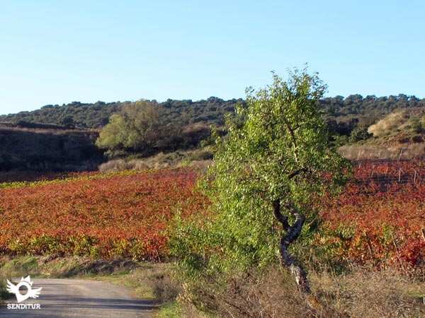
At this point we turn to the right and the road, which is largely asphalted, climbs up to the top of La Grajera via a steep but short first ramp. The route descends gently parallel to the motorway and crosses a junction of roads, continuing along the path which, after crossing a bridge over the motorway, surprises us with the remains of the old Pilgrims' Hospital of San Juan de Acre (2h 50min).
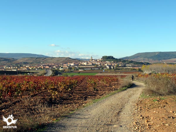
It continues the Way approaching us to our next objective, a few stairs to our left help us to cross the slope that separates us to return to find us with the road that we left previously for, after crossing it again, to enter already in the locality where the street Major Low or the street of the Cross, according to be our destiny, they enter us in the heart of Navarrete (3h 00min).

At this point we ascend the hill that leads us to the door of the parish church of the Assumption Mary, to turn left joining the pilgrims who followed the other street and continue our journey through the Calle Mayor Alta until we come across Arrabal street where we turn left and descend continuing straight to reach the cemetery, which has the old door and a couple of windows of the Hospital de San Juan de Acre, from here we continue along a dirt road that in a first section runs parallel to the road, then separate to the left.

Our walk runs along this path escorted by magnificent vineyards. A sign invites us to get to know the town of Sotés (this variant is 1.7 km more, approximately) and enjoy the hospitality of its people, the path turns right at this point to cross the road and pass next to a winery heading, losing height, in search of the Camino dual carriageway (A-12).
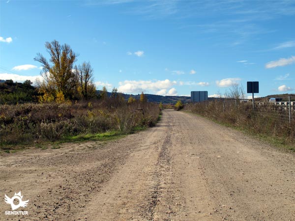
From this moment on, the road runs permanently parallel to the motorway, encountering several crossroads where we do not have to turn off. Shortly after passing under the second bridge, one of the many that we will meet and that cross the dual carriageway, we will pass another road that would lead us to the town of Ventosa if we paid attention to the signs and their signs (this option is about 700 m more distance).

Taking this detour, the track leads us little by little, in a gentle ascent, towards this intermediate locality, which can be a good place of passage in the long journey that separates Navarrete from Nájera. Without deviating, we quickly reach the vicinity of Ventosa (4h 40min).

The track meets directly with the road that comes from Sotés and goes towards the nearby Autovía del Camino. At this point we can continue straight up a short street, then turn right and descend in search of the road. Or, turning right, follow the course of the road that leads to the motorway.

A few metres further on, when it seems that we are leaving Ventosa, on our left we see the beginning of a track and the street where the pilgrims who entered the town descend. The Way leaves the road and begins to move away from Ventosa following the layout of this track, shared with the mountain bike routes that run through it.

After leaving behind some wineries we find another crossroads where we have to go straight on leaving to our left the one that ascends towards the high that crosses us. The last few metres of this detour allow us to observe the uncomfortable ascent that awaits us once we join the other route of the Pilgrim's Way to Santiago that continues parallel to the dual carriageway and to which we arrive quickly.

If, instead of turning off towards Ventosa, you follow the straight road, parallel to the dual carriageway, you will reach the Ventosa Rest Area (4h 35min). After crossing the road that crosses the track we are going along, we will continue to soon find the variant that comes from Ventosa.
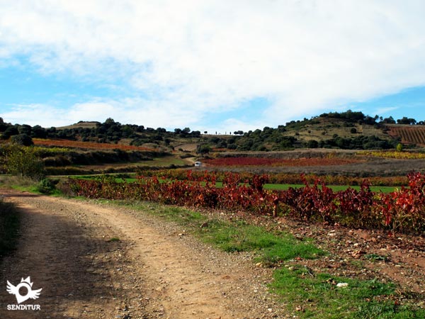
After leaving behind a couple of tracks that we will cross, the path loses its comfortable width and firm smoothing for, between river stones and torrents, undertake a short climb that leads us to the stupendous viewpoint of Alto de San Antón (5h 05min), from where we can contemplate a magnificent landscape and sense our destiny today.

Immediately an underpass saves us from crossing the road again, after this, the path turns to the left to guide us along a long, gentle descent flanked by vineyards until we reach a gravel pit, where we will have to cross a road again, the path continues bordering the gravel pit wall until the river Yalde forces it to turn right, a wooden beam serves as a sign to indicate where we must cross this river and then continue the path passing under the highway viaduct and reach the rest area of Nájera (6h 10min).


Here the path turns to the left and, without realizing that we are at the gates of our destination today, we will cross the N-120 next to the sports centre, descending straight on, first along Logroño Avenue and then along San Fernando Street in search of the Najerilla River and the bridge that crosses it, going up the course of the river along the landscaped promenade on its banks we will reach the end of this Nájera stage (6h 55min).
Our route through the different towns we pass through will determine the final distance, which can be significantly extended.
Carrying out the route without counting the additional time that supposes to assume the extra distance of the variant of Sotes or Ventosa, being 30 min and 15 min respectively the time to add.
In summer the area records high temperatures, with hardly any shady areas, which will force us to be attentive to the water we carry, especially in the stretch from Navarrete to Nájera where we will not find fountains on the way, unless we take some of the possible variants. In winter the low temperatures make the first hours of the morning a spectacle of frozen fields, full of mists and dew. The rainy seasons, given the special characteristics of the terrain of this land of wines, can suppose we find the muddy road, especially in the vicinity of the Alto de San Antón.
Clothes and sports footwear according to the time of the year and to the meteorology, backpack, canteen and canes. The good condition of most of the route allows the stage to be carried out with the most comfortable footwear, except during rainy periods. Consult our list of material and equipment to make the Way. Read more
Physical
The distance of this stage marks its greatest difficulty, with a constant but gentle rise and fall during almost the entire stage, the hard first ascent ramp to Alto de Grajera is the most demanding part of the route.
Caution
Special attention must be paid to the numerous road junctions that we will find along the way, although well signposted. The first of them forces us to choose where to cross, so as not to do it in the middle of a curve, as the Way runs about 300 m along the national road.
Orientación
For the rest the roads in very good state and even asphalted in some sections, are the general guideline that accompanied us, except in the short ascent to the Alto de San Antón, that we will do by a cobbled footpath, here exists the possibility, to the height of the crossing with the road of Ventosa, to continue by the old national N-120 that took us up to where the way has the buried step that crosses it. The signposting is correct but it is the different alternatives that offer us and their corresponding signs that can generate more doubts, such as for example at the Logroño exit, at the Navarrete entrance or at the turn-off towards Ventosa.
| 1-Logroño | 0:00h | 380m | 0Km | 30T 545644 4701927 |
| 2-La Grajera Reservoir | 1:30h | 424m | 6Km | 30T 540946 4699600 |
| 3-Old Hospital of San Juan de Acre | 2:50h | 469m | 11.4Km | 30T 536938 4698158 |
| 4-Navarrete | 3:00h | 504m | 12.8Km | 30T 536179 4697536 |
| 5-Area of rest of Ventosa | 4:35h | 610m | 19.3Km | 30T 530724 4695569 |
| 6-Alto de San Antón | 5:05h | 646m | 21.2Km | 30T 528938 4695651 |
| 7-Area of rest of Nájera | 6:10h | 523m | 25.8Km | 30T 524705 4696024 |
| 8-Nájera | 6:55h | 487m | 29.1Km | 30T 521860 4695878 |
Coordinates UTM Datum WGS84

![]() Slope: 781m
Slope: 781m
![]() Slope +: 446m
Slope +: 446m
![]() Slope -: 380m
Slope -: 380m
![]() Maximum altitude: 646m
Maximum altitude: 646m
![]() Minimum altitude: 748m
Minimum altitude: 748m

This sketch of the route is not made to scale nor does it contain all the information relating to the area, it is merely indicative.

This schematic with the path is approximate and has been created from the derived cartographic base. © Instituto Geográfico Nacional "Cuadrantes 203 y 204, 1:50.000".
Senditur has manipulated the tracks to correct the aberrant points that may exist, caused by problems with the reception of the GPS signal. In any case the tracks are always approximate. SENDITUR encourages you to use the new technologies within your reach, using them as support and consultation in your activity, not basing the realization and orientation of the same only and exclusively on them, since they may see their functioning altered by very diverse causes, not functioning correctly and their indications may not be precise.
Discover what to visit in...
¿Did you know that...
15 km south of Logroño is Clavijo, the site of the battle against the Saracens to put an end to the Tribute of One Hundred Maidens in which, according to legend, Santiago appeared to help the troops of King Ramiro I. Its castle and the hermitage of the Royal Basilica of Santiago are a place of pilgrimage. The route to reach the town of Clavijo starts from Logroño and is signposted.
Don't miss out...
To contemplate the door and the façade of the cemetery of Navarrete, a piece of history and a work of art, that well deserve a stop in the way.
From the commitment of SENDITUR with Nature and the respect to the balance of the environment, SENDITUR urges you to travel in a responsible way, with low environmental impact and respecting at all times the Natural, Cultural and Social environment wherever you go.
Besides sharing with all of us your experience on the route we would be grateful if you could write to us to inform us of any erroneous or outdated information you may have found, or simply to let us know what you think at Thank you.
This route has been carried out in the field by SENDITUR on 17-09-2018. The route may vary greatly depending on the time of year, weather conditions and terrain, as well as the actions of third parties and the evolution suffered in the natural environment where it is located. All opinions, advice and/or assessments made by SENDITUR in their descriptions are for guidance only and are subject to and/or refer to the specific conditions of the specific day of the route, referring to that specific day, taken from trained people, with the appropriate experience and with a high level of physical and technical preparation as a reference, as well as correctly equipped.
All the times are approximate and take an orientative character, the stops have not been taken into account, no matter how small they are. All the information related to the route, texts, images, videos, maps, diagrams, tracks, towns, and places of tourist interest are published as a guide, and may not coincide with the current state of each place. Before undertaking any activity, assess your technical knowledge, your physical condition, find out about the weather and the variations that the route may undergo, equip yourself correctly, be prudent and responsible at all times, and do not exceed your capabilities. SENDITUR is not responsible for any misuse or inappropriate use of the comprehensive guides of its routes and/or publications as well as its electronic guides, nor for any variations in their descriptions for the aforementioned reasons, and recommends that everyone be responsible and prudent in carrying out the activity. We also encourage you to read books and specialised guides to complement the information described above.
Continue watching …