Welcome to SENDITUR.COM · paths · routes · tourism


Path of Irretarazu
The animated forest, land of legends, of witches hidden in caves and of famous smugglers.
![]() Difficulty-Medium
Difficulty-Medium
![]() 3:30 h.
3:30 h.
![]() 11 km.
11 km.
The animated forest, land of legends, of witches hidden in caves and of famous smugglers.
![]() Difficulty-Medium
Difficulty-Medium
![]() 3:30 h.
3:30 h.
![]() 11 km.
11 km.
At the gates of the Baztan Valley, in the magnificent Navarrese Pyrenees, bathed by the calm waters of the river Bidasoa is the Señorío of Bertiz Natural Park, a unique space whose biodiversity makes it an enclave of great ecological value and singular beauty. The Path of Irretarazu is just one of the different ways and trails that we can walk in the Señorío of Bertiz and that bring us closer to the magical corners it treasures.

The route in its 11 Km allows us to discover a great part of the Señorío of Bertiz, merging at the same time with part of the different routes that cross it and allowing us to make a beautiful circular route. The park's reception and information booth marks the starting point of this route, whose layout takes us past the magnificent Historic-Artistic Garden of Bertiz, next to its Botanical Garden. An itinerary that must allow us to go back in time when visiting the old lime kilns, the charcoal kilns or the remains of the shacks that are still preserved today and which tell us about the industrial activity that took place here. But if there is one thing that characterises the Señorío de Bertiz Natural Park, it is the different habitats that can be found there and that we will undoubtedly discover along the way.

Beech woods and pastures are fused with solitary oaks or leafy ash forests, a diversity that gives Bertiz the particularity of being one of the best examples of mixed Atlantic forest in Navarre. A natural space that thanks to paths such as Iturburua or the Suspiro Trail we can walk and get to know calmly, adapting each itinerary to our preferences, whether it is a pleasant walk or a demanding hiking route.

The different trails and paths that run the Señorío de Bertiz and that allow us to enjoy it through magnificent hiking trails or BTT are in one way or another communicated with each other allowing us to configure the route to be done to our liking. In this case the path of Iturburua shortens considerably the distance to cover. Another somewhat longer possibility is to take the Suspiro path, thus making a circular route of intermediate distance. While the route of Aizkolegi and Plazazelai, the latter being the only one with permitted access for MTBs, are itineraries with a considerable mileage that also communicate with each other allowing us to make a circular route of considerable distance.
In order to reach the Señorío de Bertiz Natural Park, we must follow the N-121 from Pamplona to the town of Oronoz-Mugaire, where this national road divides into two branches, one that goes up the Baztan valley to France, passing through Elizondo among other towns, and the other slope goes through the Bidasoa valley towards Bera. Access to the Señorío de Bertiz Natural Park can be found on the local road that links Oieregi with Oronoz-Mugaire, crossing the bridge that crosses the Bidasoa River to reach the car park where we can park our vehicle and access the park to start the route.
Interesting route to enjoy with our partner, demanding in terms of total mileage but without major slopes to overcome. That if we must comply with the regulations governing access to the Natural Park of Señorío de Bertiz for pets, nothing we do not usually do in our activities with our dog.
There will be several streams that we have to go through so, except at specific times, we should not have problems with the water we need.
Of course it is important to respect the native flora and fauna, so we must be attentive to our friend at all times, as we always do.
The Señorío of Bertiz Natural Park car park (0h 00min) is our starting point for this hiking route.

From there we head towards the park's Reception Hut, which awaits us at the end of the road that leads us here.

After gathering the necessary information about the route and the different options we are presented with, we enter Señorío de Bertiz to begin our route.

Almost at the moment we are with the first of the few crosses that we have to pass, in general they do not offer any doubt. Quickly the asphalt track that guides us approaches the height of our first stop.

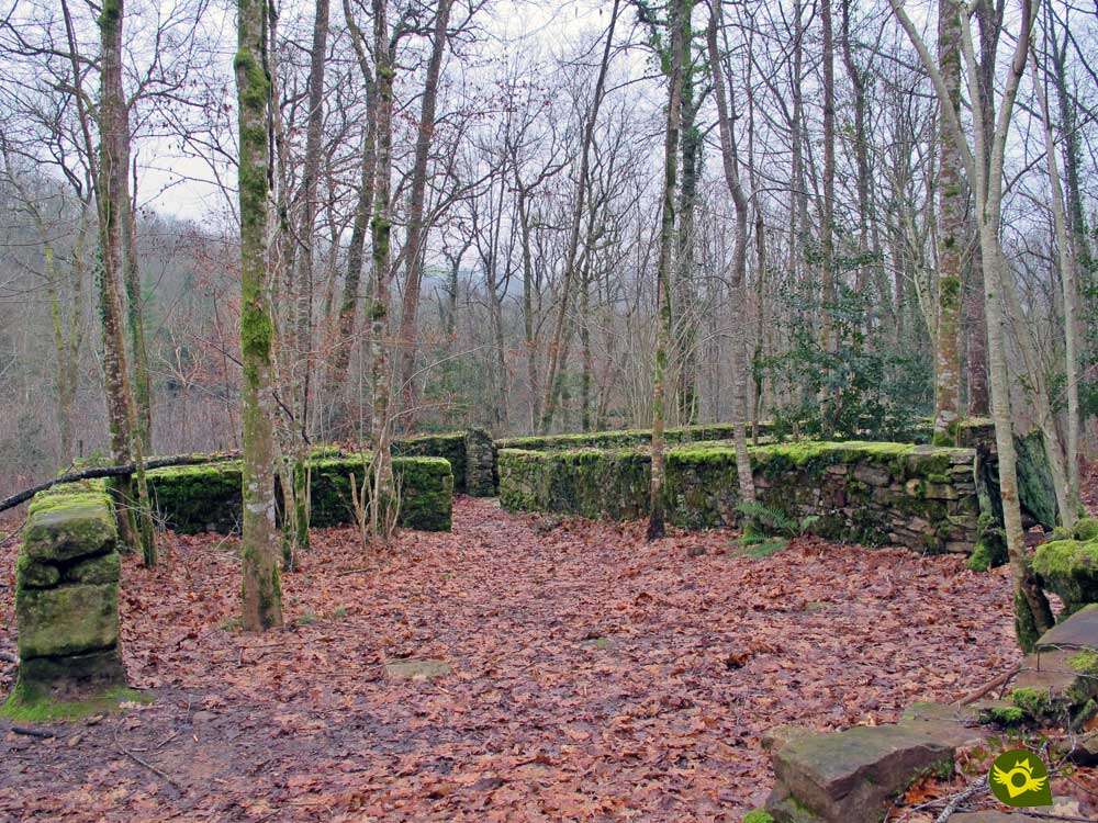
An old lime kiln and the reconstruction of the typical coal kilns mark the moment to leave the main track of the Señorío de Bertiz (0h 15min) and start the route along the Irretarazu Trail.
At the moment we are facing the most demanding slope of how many we have to overcome in this route of hiking by the Señorío de Bertiz.

An effort that gives us some respite when we come across the remains of old shacks and specimens of unique trees that populate the park and invite us to make a stop. Our path continues to gain height, demanding us little by little less effort to advance.

Without realizing it, we are surrounded by the thickness of the forest that we are furrowing and with hardly any unevenness that makes it difficult for us to advance. In front of us there is a pleasant path crossing streams, going up and down but without the difference in level at the beginning.

After a while we reach the crossroads with the Iturburua Path (1h 05min), a trail that if we follow it would take us to the Aizkolegi track where we can return to the car park.
We leave behind this detour to continue with the Irretarazu Path that will take us to the next detour that will come out to meet us.

The route continues halfway up the slope without making any effort to save the unevennesses that we have to find. We continue crossing the numerous streams that run down the mountain.

After a while we find ourselves in a new detour, we have arrived at the crossroads with the junction of the Suspiro Path (1h 50min), a path that descends quickly to the bed of the stream that gives it its name to follow its course in search first of the Iturburua Path with which it joins together to go out to the Aizkolegi track.
We again ignore the temptation to follow the Path of the Sigh, thus shortening the distance of our route, and we continue along the path marked out by the Path of Irretarazu.

A route that follows the same pattern that until now had accompanied us, a relatively comfortable and beautiful layout.

Of course, with the occasional up and down forced by the ravines that the streams have been forming on their way. Although generally without major complications and effort.

After crossing a few streams our path reaches its end when it comes across the Aizkolegi Track (2h 30min), by which we will undertake the descent towards the car park from which we started.
This conditioned track connects the car park to which we descend with the top of the mountain from which it takes its name.

The quick descent takes us to a new crossroads where we would be joined by those who chose to follow one of the previous detours, either the Iturburua Path or the Suspiro Path (2h 45min).

Already together and without hardly time for anything another crossing leaves to our step, the one that corresponds with the track of the Portillo of Plazazelai (2h 50min), which we leave to our left to continue without losing the course that we take.

Our track continues its course following not very far the hidden riverbed that runs through the valley we are furrowing. As we approach the end of the route we will come across other paths that give access to the different areas of the park, paths that we leave behind to continue on our conditioned track.

Although there are not many roads we have to find and that in some cases are not signposted, we should not have the greatest doubt as to what the path to follow is concerned.

After a while and almost without warning we will meet again next to the detour of Las Carboneras (3h 20min) that we took at the beginning of our route.

All we have to do is retrace our previous steps until we reach the nearby car park (3h 30min), from where we leave to follow this hiking route through the Señorío of Bertiz Natural Park.
 Distance. 11Km
The different itinerary possibilities mean that this figure changes depending on our route.
 Time. 3:30h
Of course this figure is considerably reduced if we decide to shorten the distance of the route by following one of the trails that reduce it, the Iturburua or the Suspiro.
 Time of year
Under normal conditions, this route through the Señorío de Bertiz Natural Park invites us with its colourful landscapes to visit it at any time, but in this case we have the great advantage of being able to consult the state of the path in the visitors' centre. For the rest as it could not be of another form the autumn and the spring is when greater vistosidad we have to find in Bertiz. Also pay attention to the timetables that govern access to Señorío de Bertiz, as these vary depending on the time of year in which we are.
 Required equipment
Hiking shoes, preferably boot as mud can be present in some areas, warm clothing, we will be in shady areas where it can be cool even in summer. The canes will also be useful and we can not lack some food and water, we will only find fountains at the beginning of the route. Consult our list of material and equipment for hiking. Read more.
 Difficulty. Medium
Physical
Distance is the greatest obstacle this path of the Señorío de Bertiz poses, as the steepest slope is surpassed at the beginning of the route and for someone accustomed to taking their due calm, it should not involve great complications.
Severity of the environment
The trail is wide and well-defined, also has bridges that allow us to cross the many streams that we will find without problems. If we respect the limits of the path and the common sense that must always prevail in all activity, it is the mud that together with the possible trees that we may find fallen along the itinerary, which should cause us greater difficulties. Pay attention on windy days, forests are not usually a good place to be those days.
Orientation
The perfect signposting of all the junctions and trails that we have to meet is added to a generally clear and well-defined trail that ends in a wide track, leaving no room for more doubts than choosing the route to follow based on our preferences.
 |
 |
 |
 |
 |
| 1-Señorío of Bertiz car park | 0:00h | 145m | 0Km | 30T 612793 4777149 |
| 2-Carboneras Detour | 0:15h | 158m | 0.7Km | 30T 613038 4777687 |
| 3-Iturburua Path | 1:05h | 285m | 3Km | 30T 612100 4778987 |
| 4-Suspiro Path | 1:50h | 340m | 4.8Km | 30T 611104 4779479 |
| 5-Aizkolegi Track | 2:30h | 295m | 7.1Km | 30T 612124 4780244 |
| 6-Crossing of the Suspiro Path | 2:45h | 217m | 8.3Km | 30T 612365 4779255 |
| 7-Crossing the track of Portillo de Plazazelai | 2:50h | 198m | 8.7Km | 30T 612554 4778967 |
| 8-Carboneras Detour | 3:20h | 158m | 10.3Km | 30T 613038 4777687 |
| 9-Señorío of Bertiz car park | 3:30h | 145m | 11Km | 30T 612793 4777149 |
CoordenadasCoordinates

 Slope: 540m
 Slope +: 270m
 Slope -: 270m
 Maximum altitude: 145m
 Minimum altitude: 360m

This sketch of the route is not made to scale nor does it contain all the information relating to the area, it is merely indicative.

![]()
This schematic with the path is approximate and has been created from the derived cartographic base © Instituto Geográfico Nacional "Cuadrante 090-2 y 065-4, 25.000"
Senditur has manipulated the tracks to correct the aberrant points that may exist, caused by problems with the reception of the GPS signal. In any case the tracks are always approximate. SENDITUR encourages you to use the new technologies within your reach, using them as support and consultation in your activity, not basing the realization and orientation of the same only and exclusively on them, since they may see their functioning altered by very diverse causes, not functioning correctly and their indications may not be precise.


Me encantó, es un lugar mágico para disfrutarlo con calma


A milestone in the economic history of Navarre and Spain in the 18th century

Jewel of Romanesque architecture, centre of spirituality

Find out what to see in...
¿Did you know that...
The river Bidasoa is the natural border of the Señorío de Bertiz to the south, although from its source valley up to its passage through Oronoz-Mugaire is really known by the name of river Baztan to furrow this Navarrese valley, going to be called river Bidasoa from this same place to its mouth.
Don't miss out...
If possible, do not miss the visit to the Historic-Artistic Garden of Señorío de Bertiz. Through its walks and paths you will be able to get to know the different plant species that make it up, some native and others from different parts of the world, a spectacle in the flowering season.


From the commitment of SENDITUR with Nature and the respect to the balance of the environment, SENDITUR urges you to travel in a responsible way, with low environmental impact and respecting at all times the Natural, Cultural and Social environment wherever you go.

Besides sharing with all of us your experience on the route we would be grateful if you could write to us to inform us of any erroneous or outdated information you may have found, or simply to let us know what you think at Thank you.
This route has been carried out in the field by SENDITUR on 01-02-2018. The route may vary greatly depending on the time of year, weather conditions and terrain, as well as the actions of third parties and the evolution suffered in the natural environment where it is located. All opinions, advice and/or assessments made by SENDITUR in their descriptions are for guidance only and are subject to and/or refer to the specific conditions of the specific day of the route, referring to that specific day, taken from trained people, with the appropriate experience and with a high level of physical and technical preparation as a reference, as well as correctly equipped.
All the times are approximate and take an orientative character, the stops have not been taken into account, no matter how small they are. All the information related to the route, texts, images, videos, maps, diagrams, tracks, towns, and places of tourist interest are published as a guide, and may not coincide with the current state of each place. Before undertaking any activity, assess your technical knowledge, your physical condition, find out about the weather and the variations that the route may undergo, equip yourself correctly, be prudent and responsible at all times, and do not exceed your capabilities. SENDITUR is not responsible for any misuse or inappropriate use of the comprehensive guides of its routes and/or publications as well as its electronic guides, nor for any variations in their descriptions for the aforementioned reasons, and recommends that everyone be responsible and prudent in carrying out the activity. We also encourage you to read books and specialised guides to complement the information described above.
Continue watching …


