Welcome to SENDITUR.COM · paths · routes · tourism

![]() Difficulty-Low
Difficulty-Low
![]() 1:50 h.
1:50 h.
![]() 7 km.
7 km.
![]() Difficulty-Low
Difficulty-Low
![]() 1:50 h.
1:50 h.
![]() 7 km.
7 km.
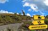
In the south of La Rioja, specifically in the region of the Upper Cidacos Valley, we can find some of the best preserved Ichnite sites in the Peninsula, and even in the whole of Europe. These sites date back millions of years, to the Cretaceous period, and are spread over much of the territory of La Rioja Oriental, being able to reach them in many cases with our own vehicle. But if there is an unbeatable way to visit some of the best sites of Ichnites in La Rioja, it is through the Path of the Dinosaurs of Enciso. A hiking route of just over 7 km that takes us to three of the most important and best preserved sites in La Rioja, while we discover life-size dinosaurs, we approach spectacular viewpoints and we have fun in the different recreational areas through which it passes. In short, this is an ideal route to do with children, and the not-so-children won't be left behind either.
We start the Path of the Dinosaurs in Enciso (0h 00min), taking as our starting point one of the car parks that we will find just after crossing the bridge over the river Cidacos. This initial section follows the course of the road that links Enciso and Cornago. On this road we will also find more dinosaur footprints, such as those at the Navalsaz site, the Villar-Poyales site or the La cuesta de Andorra site along the GR 93 route. After a while of walking up the road we arrive at the Valdecevillo site (0h 30min), where there is also a large car park available.
At this site there are a good number of footprints of theropod, ornithopod and sauropod dinosaurs, as well as life-size reproductions of several different species, Tarbosaurus and Brachiosaurus, as well as explanatory signs that will guide us through the site. The Enciso Dinosaur Trail runs along this first stop on its itinerary and makes us start to ascend the steep, conditioned path that borders the site. After saying goodbye to Valdecevillo, the route makes us gain height as we pass through different recreational areas, designed for children. Almost without noticing we start to lose some of the height we have gained to reach the recreational area that precedes the Senoba site (1h 10min), a little further up from the location of the recreational area.

Path of the dinosaurs of Enciso

Path of the dinosaurs of Enciso

Path of the dinosaurs of Enciso
Path of the dinosaurs of Enciso
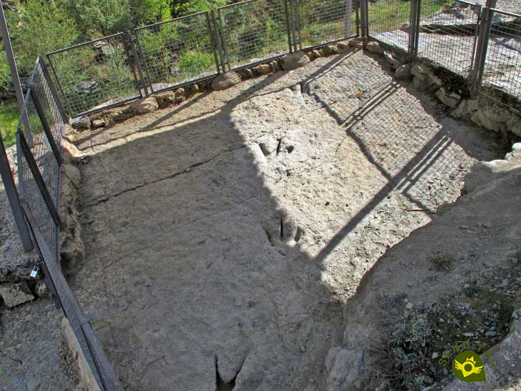
In addition to the different dinosaur footprints that can be seen at this site, we can also highlight the panoramic views that can be enjoyed from here. On the way back to the recreational area we take the path next to it to follow the course of the Carrascal ravine in the direction of Enciso. After a while descending we arrive after a short detour at the site of the Virgin of the Campo (1h 40min), perhaps the best preserved of them all.
A wooden walkway allows us to visit this spectacular site where we can see more than 500 dinosaur footprints. Even the marks of their skin and the traces of their tails have been imprinted on the rock. Undoubtedly a great number of curiosities that the information panels will be explaining to us as we visit the site. Once we have enjoyed the visit, all that remains is to return to the path by which we arrived and walk the short distance that separates us from Enciso (1h 50min) and the parking area from where we left.
1-Although initially it is a simple route, it is advisable to wear suitable hiking clothes and footwear.
2-Take some water and sun protection, especially in summer.
3-There are several recreational areas where you can rest and have a leisurely lunch.
4-Bear in mind that each site takes time to visit, especially if you are travelling with children.
 |
 |
 |
 |
 |
| 1-Enciso | 0:00h | 775m | 0km | 30T 560430 4666536 |
| 2-Site of Valdecevillo | 0:55h | 820m | 1.8Km | 30T 561523 4665356 |
| 3-Site of Senoba | 1:55h | 1000m | 3.9Km | 30T 560587 4664479 |
| 4-Site of the Virgen of the Campo | 3:15h | 800m | 6.5Km | 30T 560166 4666040 |
Coordinates UTM Datúm WGS84

.png) Distance: 7Km
Distance: 7Km
.png) Time: 1:50h
Time: 1:50h
.png) Difficulty: Low
Difficulty: Low
 Slope: 550m
 Slope +: 275m
 Slope -: 2758m
 Maximum altitude: 1015m
 Minimum altitude: 75m

![]()
This schematic with the path is approximate and has been created from the derived cartographic base © Instituto Geográfico Nacional "Cuadrante 280-2 1:25.000".


Find out what to see in...
¿Did you know that...
In La Rioja a large number of dinosaur footprints have been catalogued, specifically in the municipality of Enciso alone there are more than 3000 ichnites.
Don't miss out...
The other sites that can be found in the eastern part of La Rioja can often be reached by car or by a short walk.


From the commitment of SENDITUR with Nature and the respect to the balance of the environment, SENDITUR urges you to travel in a responsible way, with low environmental impact and respecting at all times the Natural, Cultural and Social environment wherever you go.

Besides sharing with all of us your experience on the route we would be grateful if you could write to us to inform us of any erroneous or outdated information you may have found, or simply to let us know what you think at Thank you.
Route information updated on 01-09-2020. The route may vary greatly depending on the time of year, weather conditions and terrain, as well as the actions of third parties and the evolution suffered in the natural environment where it is located. All opinions, advice and/or assessments made by SENDITUR in their descriptions are for guidance only and are subject to and/or refer to the specific conditions of the specific day of the route, referring to that specific day, taken from trained people, with the appropriate experience and with a high level of physical and technical preparation as a reference, as well as correctly equipped.
All the times are approximate and take an orientative character, the stops have not been taken into account, no matter how small they are. All the information related to the route, texts, images, videos, maps, diagrams, tracks, towns, and places of tourist interest are published as a guide, and may not coincide with the current state of each place. Before undertaking any activity, assess your technical knowledge, your physical condition, find out about the weather and the variations that the route may undergo, equip yourself correctly, be prudent and responsible at all times, and do not exceed your capabilities. SENDITUR is not responsible for any misuse or inappropriate use of the comprehensive guides of its routes and/or publications as well as its electronic guides, nor for any variations in their descriptions for the aforementioned reasons, and recommends that everyone be responsible and prudent in carrying out the activity. We also encourage you to read books and specialised guides to complement the information described above.
Continue watching …


.jpg "Go to Contrebia Leucade")