Path of the Gullurias
Ucero, Soria![]()
![]()
![]()
![]()
![]() (1)
(1)
For St. Matthias the Gullurias sing and the nights and days are equal
Ucero, Soria![]()
![]()
![]()
![]()
![]() (1)
(1)
For St. Matthias the Gullurias sing and the nights and days are equal
Acting as a natural border between the Iberian System and the extensive Duero plateau, located between the provinces of Soria and Burgos, the river Lobos, after centuries of tireless work, has excavated a spectacular canyon of just over 25 km in length. The Lobos River Canyon Natural Park is covered by numerous trails and routes that go deep into the canyon and run through its many attractive corners, and among them is the Path of the Gullurias.

The route, if we approach the well-known spot where the hermitage of San Bartolomé and the Big Cave are located, is only 10.2 km long, a distance that we will surely see increased. The House of the Park, on the banks of the river Ucero and under the watchful eye of the imposing castle of the town, is the starting point for this walking tour. This itinerary will allow us to discover part of the culture and customs of the people who lived here. Ancient apiaries, rehabilitated lime kilns that tell us about the laborious process that the limestone underwent to obtain the precious quicklime, without forgetting the archaeological remains and the history that the hermitage of San Bartolomé treasures, are only some of the attractions offered by this route and that add to the great natural values it treasures. Landscapes populated with juniper trees and shady pine forests that extend before our eyes, forests and rocks inhabited by a rich fauna, compete for prominence with the magnificent views that we can enjoy.

The Viewpoint of the Gullurías will allow us to look out over the deep Lobos River Canyon, and then contemplate the unmistakable silhouette of the Urbión and Cebollera mountain ranges. From there a quick descent will take us to the very edge of the river from where we will not be able to resist the temptation to abandon our route for a while to approach the Hermitage of San Bartolomé and the Big Cave, unmistakable symbols of the Lobos River Canyon. After allowing ourselves to be enveloped by the magic of this symbolic place, we will resume our route now accompanied by the Path of the River and by the GR 86, other attractive itineraries that cross this natural park, and together we will follow the descending course of the river passing through the different parking areas and arriving at the Fountain Engomez recreational area. From there, after visiting the source of the Ucero River, we will say goodbye to the Lobos River Canyon and head towards the Park House, following the conditioned Path of the Ucero River and putting an end to this route.
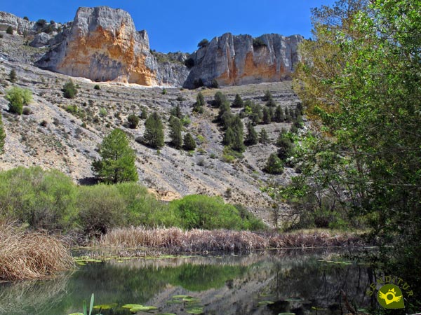
This route allows us to discover a lesser-known area of the Lobos River Canyon, observe it from the top of its vertical walls and delve into the history and customs of the people who inhabited this region. But it is also possible to vary or change part of the route and focus on getting into the canyon from any of the parking lots to those that can be reached by car.
Ucero can be reached by following the SO-920 regional road that links San Leonardo de Yagüe with El Burgo de Osma. It is on this road and after leaving behind the detour that leads to the interior of the Lobos River Canyon, where we will find the Park House and its corresponding car park, located shortly before reaching Ucero, if we are coming from San Leonardo de Yagüe or shortly after if we are coming from El Burgo de Osma. Once there, we will have a large parking area where we can park our vehicle.
No doubt for our dog it will be an intense hiking tour at the beginning, to which we will add the total kilometers we will end up doing, so it is advisable that he is in good physical shape. We must pay special attention to the rules and recommendations that govern this natural park.
Except for the final, more touristy part of the route, we will not find any areas or water points and neither will we have a guarantee that we will find it in this final part all year round, except, of course, for the part carried by the river.
It is important to respect the native fauna and flora, in addition surely we must also find more pets along the route so we can not get distracted with our friend.
Next to the car park of the House of the Park (0h 00min), with the road that leads to the nearby Ucero on our left, the trail that we are about to start begins.

The information sign on the route precedes the remarkable ramp which, as a demanding warm-up, we are going to face.

We quickly left behind the road and the old beehives inside a fence. Our burdensome trail continues its tireless ascent making us gain height with some speed.

Soon the trail gets even steeper, luckily some stairs will help us save this area of greater slope.

Luckily, from this point on, the demand is decreasing to make way for a much more comfortable area.

Soon after, we came across an old limekiln, now recovered and with its pertinent informative poster.
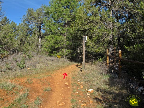
We skirt its perimeter to continue the march, leaving behind us a narrow trail that emerges to our left.

The trail, with hardly any unevenness, transports us surrounded by the lush vegetation that populates this natural park.

Vegetation that from time to time gives us the opportunity to contemplate the landscape as far as the eye can see. This part of the route, with its undulating layout, marks the highest point we will reach.

There will not be many opportunities for us to encounter other trails, and in any case the marks and the state of our itinerary should be enough to leave us in no doubt.

A little later, on our left, almost hidden in the undergrowth, another typical limestone quarry awaits us, this time without the luck of having been rehabilitated. The thickness of the forest gives us a refreshing shade, very grateful for the summer days.

Almost without realizing it, we will reach the small detour that will take us to the nearby Viewpoint of the Gullurias (0h 55min).
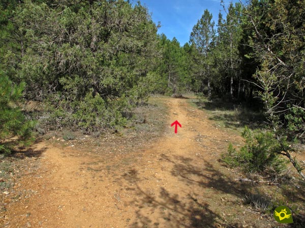
Once we have contemplated the spectacular scenery offered by this vertiginous viewpoint, we must return to the trail that we had previously abandoned.
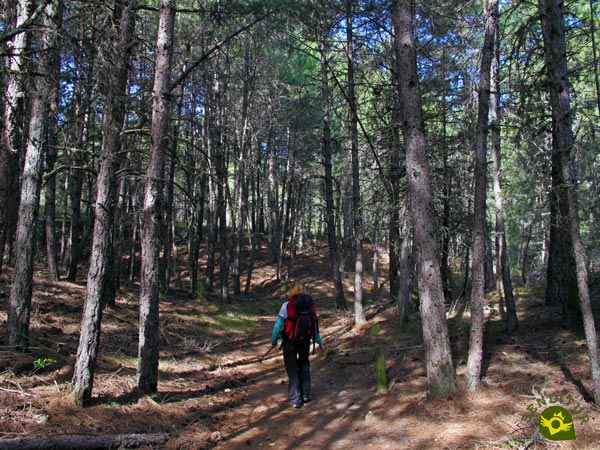
Once there, we will begin the rapid descent that will lead us to the bottom of the gorge we have just seen.

In this section we have to find a new path that we will leave behind to continue descending towards the canyon. The huge pines continue to accompany us and will do so until the end of the descent.

Not much further on, the slope becomes gentler and we can already sense our next incorporation into the famous Path of the River that together with the Iberian Trail Soria GR 86 crosses the Lobos River Canyon.
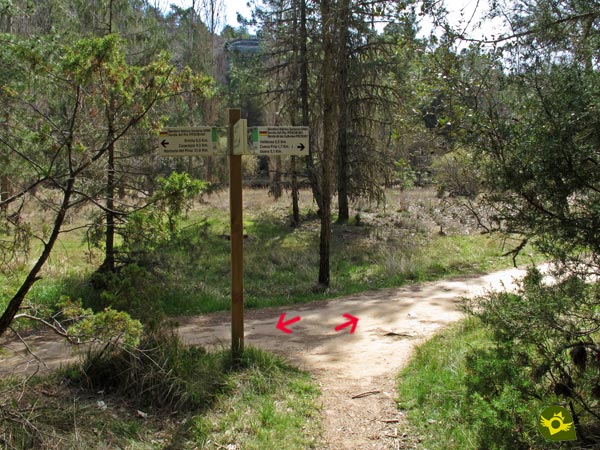
It is at this junction where we must decide whether to continue with the route of the Path of the Gullurias, which follows the downstream course of the river in search of the nearby parking areas available to visitors to this tourist place, or on the contrary, taking advantage of its proximity, we choose not to miss the visit to the most magical spot in the park.

We decided to park our route for a moment, and go up the river to approach the idyllic and well-known corner of the Lobos River Canyon.
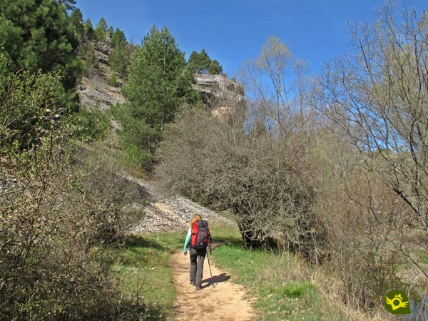
The trail without the unevenness that we had previously faced goes into the canyon with every step.

This itinerary must be followed at times when the river is at its greatest flow, since in any case we must cross it and can only do so thanks to the bridge that precedes the hermitage we are about to visit.

The final part of this small detour provides a magnificent panoramic view that compensates for the small increase in mileage on the official route.

For the moment we leave aside the wooden bridge by which we will cross the river, to go visit the Hermitage of San Bartolomé and the Big Cave (1h 20min).
No doubt it will take us a good while to enjoy this place, as well as being attracted to visit other places more or less close to it.

Once we have done this, we will have to start walking, choosing the trail on the riverbank where we arrived or the wide track that runs on the other side.

If we follow the trail, shortly after leaving behind the crossroads with the path we came down from the viewpoint, we will find the blocks of stones that will allow us to cross the river, as long as its flow allows it.

As soon as we cross it we will arrive at the first parking lot that we are going to pass through and that we must cross in its totality.

While if we choose the track a quiet walk awaits us, without major complications, until we find the parking area (1h 40min).

Just at the end of this parking area, where the asphalted track ends where vehicles can access the interior of the canyon from the road, the two itineraries that were proposed to us in the area of the hermitage are joined.

Here once again it will be the river that will condition the path to follow, since if its flow is high we will be forced to continue along the paved track as we will have to cross the river repeatedly if we continue along the trail.

In case we can follow the Path of the River a few meters after leaving the parking lot we will have the next step of the riverbed.
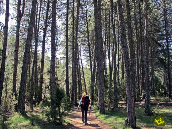
At the moment, and after overcoming a short but intense ramp, we will find ourselves crossing a leafy forest. This forest will soon give way to what seems to be the dry riverbed and tells us about the width it can take.

Once again, we will have to go through it again, using the typical stones that cross its course as a bridge.
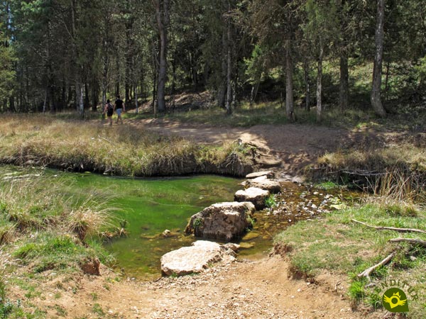
This area winds around making us wade the river repeatedly, jumping from stone to stone. To our left runs the paved track that accompanies us at all times along the canyon.

After a short while, a new crossing of the river marks our arrival at the second parking lot (2h 05min) that this area of the park has.

Parking lot that we will have to cross in order to find the continuation of our path. This trail once again begins right next to the asphalt track, giving us the option to continue along it.

The landscape around us is still rugged and beautiful, as we gradually emerge from the gorge.

Almost without realizing it, we will come across the first samples that indicate our arrival at the Recreational Area of Fountain Engomez (2h 20min).
The trail, after crossing this recreational area, meets the track that we must follow.
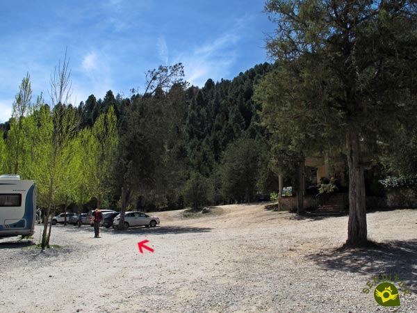
As soon as we cross the bridge on our right, we will return to the lost course to go through this new parking area.

At the end of it and almost hidden among the trees, the trail we must follow reappears. A trail that will definitely take us out of the Lobos River Canyon.
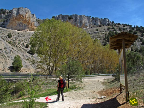
As soon as you hit the road, turn sharply to your left and descend in search of the river once again.

But this time we will take advantage of the conditioned path provided by the Ucero River Path with which we will now coincide.

The path, which leaves the source of the Ucero River behind, will guide us in this final stretch of our route.

Section that for the moment continues with the uncomfortable company of the road on our right.

Shortly after crossing the crossroads that gives access to the camping site we are bordering, the path turns to cross the ditch that used to mark it out and becomes a wide dirt track along which we will continue.

Track that will take us away from the road while we go through a big poplar grove. This last section does not come across many crossroads or paths, and when it does, it leaves no room for doubt as to the course to follow.

Soon the silhouette of the building that houses the House of the Park will appear, which we will have to border without having to go out to the highway.

Road that of course we will have to cross to reach the parking of the House of the Park (2h 50min) where we will give by finalized this route of hiking by lands of Soria.
The final distance will depend, among other things, on how far we walk around the hermitage and the cave.
The distance involved in visiting the area of the hermitage will not affect the final time as much as it will affect the time we spend enjoying this jewel of nature.
Without a doubt we are in front of a spectacular place all year round, which combines great and different values that make it unique. It is true that, both to this trekking route and to others that go through the area, the river's flow conditions them due to the fact that its route crosses them repeatedly and this is something to be taken into account. Apart from this, and except in rare cases, we can enjoy the special features that each period of the year brings to the already beautiful area.
To equip ourselves correctly is fundamental and although we are facing a route without great complications, at least a priori and in normal conditions, it is not advisable to underestimate it. A few walking poles, water and food, boots and trekking clothes, together with the typical accessories such as cap and sunglasses, sunscreen, our orientation and information systems of the route, etc. must be common in our activities of this type. Consult our list of material and equipment for hiking. Read more.
Physical
We will face most of the unevenness at the beginning of the route, they are demanding ramps but with the proper calm should not be too much trouble. The distance, or rather the kilometres that we can add up by visiting the different corners of the canyon near the hermitage, can also make this route more difficult, especially at the end.
Severity of the environment
Common sense and prudence should always prevail as a general rule. We are not dealing with an exposed route, but if we abandon it we may find ourselves with very steep areas. The first part of the route runs along a trail covered with slippery loose stone, which if we do it the other way round will require us to descend carefully. Watch out for possible falls of stones in the sections where the route runs close to the canyon walls and of course do not underestimate the flow and force with which the river can come down. The steps in which we will wade the river as long as the stone is dry and the river does not overpass them, are not difficult but they can condition less experienced people.
Orientation
Well signposted throughout the route and perfectly defined paths and tracks. Given the large number of itineraries in the area, it is important to have a clear direction for our route to avoid detours or extra kilometres. In foggy weather, it is not advisable to do the first half of the route without the proper technical preparation or the pertinent equipment.
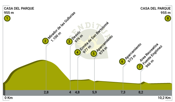
| 1-Park House | 0:00h | 955m | 0Km | 30T 495951 4618922 |
| 2-Viewpoint of the Gullurias | 0:55h | 1100m | 2.8Km | 30T 494724 4621012 |
| 3-Detour | 1:10h | 976m | 4Km | 30T 494806 4621686 |
| 4-Hermitage of San Bartolomé | 1:20h | 977m | 4.8Km | 30T 494344 4622239 |
| 5-Parking | 1:40h | 974m | 5.9Km | 30T 495007 4621531 |
| 6-Parking | 2:05h | 973m | 7.3Km | 30T 495420 4620753 |
| 7-Fountain Engomez Recreational Area | 2:20h | 966m | 8.2Km | 30T 496012 4620224 |
| 8-Park House | 2:50h | 955m | 10.2Km | 30T 495951 4618922 |
Coordinates UTM Datum WGS84
![]() Slope: 420m
Slope: 420m
![]() Slope +: 210m
Slope +: 210m
![]() Slope -: 210m
Slope -: 210m
![]() Maximum altitude: 1110m
Maximum altitude: 1110m
![]() Minimum altitude: 955m
Minimum altitude: 955m

This outline of the route is not to scale and does not contain all the information about the area, it is merely orientative.
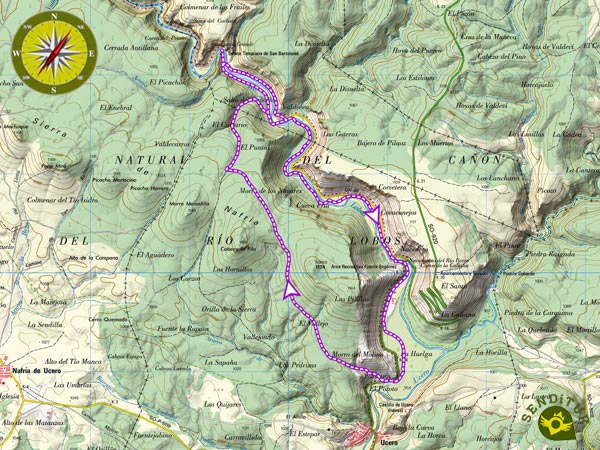
This schematic with the path is approximate and has been created from the derived cartographic base © Instituto Geográfico Nacional "Cuadrante 348-1 y 348-3, 1:25.000"
Senditur has manipulated the tracks to correct the aberrant points that may exist, caused by problems with the reception of the GPS signal. In any case the tracks are always approximate. SENDITUR encourages you to use the new technologies within your reach, using them as support and consultation in your activity, not basing the realization and orientation of the same only and exclusively on them, since they may see their functioning altered by very diverse causes, not functioning correctly and their indications may not be precise.
Find out what to see in...
¿Did you know that...
Gulluria is the name given in the area to a small lark, with the real name Totovía, of brownish plumage, which feeds on seeds and small insects and which, with due attention, is not difficult to see running around among the sabinares.
Don't miss out...
The Apiary of the Friars that you will find, not too far from the hermitage and of Big Cave, going up the river for the Path of the River. Nor the Window of the Devil to which you can climb through a short path that starts from the same hermitage.
From the commitment of SENDITUR with Nature and the respect to the balance of the environment, SENDITUR urges you to travel in a responsible way, with low environmental impact and respecting at all times the Natural, Cultural and Social environment wherever you go.
Besides sharing with all of us your experience on the route we would be grateful if you could write to us to inform us of any erroneous or outdated information you may have found, or simply to let us know what you think at Thank you.
This route has been carried out in the field by SENDITUR on 27-04-2017. The route may vary greatly depending on the time of year, weather conditions and terrain, as well as the actions of third parties and the evolution suffered in the natural environment where it is located. All opinions, advice and/or assessments made by SENDITUR in their descriptions are for guidance only and are subject to and/or refer to the specific conditions of the specific day of the route, referring to that specific day, taken from trained people, with the appropriate experience and with a high level of physical and technical preparation as a reference, as well as correctly equipped.
All the times are approximate and take an orientative character, the stops have not been taken into account, no matter how small they are. All the information related to the route, texts, images, videos, maps, diagrams, tracks, towns, and places of tourist interest are published as a guide, and may not coincide with the current state of each place. Before undertaking any activity, assess your technical knowledge, your physical condition, find out about the weather and the variations that the route may undergo, equip yourself correctly, be prudent and responsible at all times, and do not exceed your capabilities. SENDITUR is not responsible for any misuse or inappropriate use of the comprehensive guides of its routes and/or publications as well as its electronic guides, nor for any variations in their descriptions for the aforementioned reasons, and recommends that everyone be responsible and prudent in carrying out the activity. We also encourage you to read books and specialised guides to complement the information described above.
Continue watching …