Under the watchful eye of Urbión and San Lorenzo, a short distance from the town of Neila in Burgos, from which they take their name, lie the Neila Lagoons, another of the natural jewels of the Iberian System. This impressive set of lagoons is surrounded by a no less imposing natural environment formed by colossal pines and ancient yews among other wonders of nature.

The Path of the Neila Lagoons through its 8 km of route takes us to know part of the hidden corners that treasures this area of the natural park. Starting from the car parks that are next to the exceptional Viewpoint of San Francisco, we begin to walk through the lush forest that separates us from the Waterfall Lagoon. Bordering the limits of this lagoon, a place known by the Neilenses as The Paulazos Encimeros, we will be able to get an idea of the special singularity that all of them treasure while we are discovering the different phases through which they were passing throughout history to reach our days, not only as a place of exceptional panoramic views, but also as an ideal habitat for the life of different species of plants and animals.

Places like the Cave of the Colts, with its own history, or the path of The Yews add even more value to this circular route. After a hard ascent, a privileged view of the Neila Lagoons awaits us, more specifically the Black Lagoon and the Long Lagoon, which will accompany us to the summit of the Campiña. From here we will begin the descent that will return us to the starting point, not before discovering the Brava Lagoon and the Ducks Lagoon, two others that make up this complex of glacial lagoons of Neila.

Rather than shortening the route by taking the variant that ascends next to the rocky cliff that delimits the Waterfall Lagoon, if we want to soften part of the physical difficulty of the itinerary we can do it in reverse to the proposed. We will have to overcome more sections of ascent but these as a whole are apparently less demanding than the area of the firebreak. We also have several unmarked, but well-defined paths that allow us to shorten the route greatly.
To get to Neila we can do it by following the road that connects it on one side with Villavelayo in the middle of the route that joins Nájera and Salas de los Infantes. On the other hand, this same road connects it with Quintanar de la Sierra along the road that joins Salas de los Infantes and Vinuesa. Also passing through Huerta de Arriba and Huerta de Abajo we can approach Neila. Once there is, not far from Neila, in the stretch of road that joins it with Quintanar de la Sierra where we will find the accesses to the Neila Lagoons. Along the road that leads to them we will find different parking areas located next to the barriers that limit access to vehicles depending on the time of year in which we are.
As it is usual to consult the regulations that govern the park and that affects our partner, usually only refers to the obligation to wear it tied. In the physical thing and whenever it is accustomed to leave with us of route it should not have problem some.
It is important to bring some water and food even if the lagoons tempt us to the contrary.
In addition to other pets we will also meet in all likelihood with the cattle and their corresponding guard dogs that graze in these mountains.
In the road that leads to the lagoons we will find the different parking enabled to visit this natural place.

It is in the car parks that are closest to the lagoons from where this route begins.

More specifically, the beginning of the trail can be found next to the car park closest to the Mirador de San Francisco.

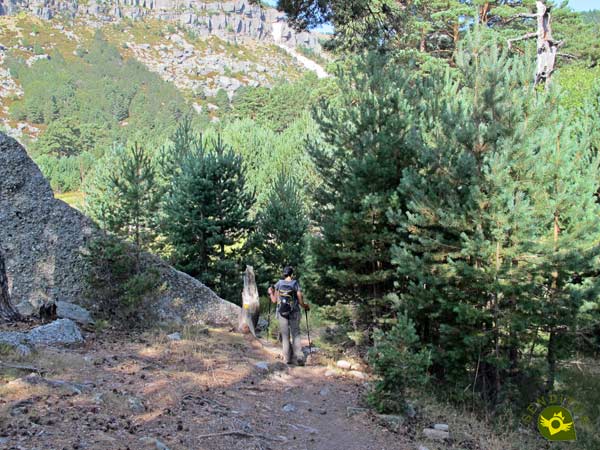
We left the asphalt to enter the leafy forest that the trail takes us through.

We began a quick descent following the well-defined trail, which has the invaluable help of white and yellow marks that guide us at all times.

After a good while losing height almost without rest, our trail ends when it meets the track we must continue.

This wide road leads us directly to our first goal of the day. The Waterfall Lagoon (0h 30min) awaits us to let us enjoy the spectacular surroundings.

The itinerary leads us to cross the lagoon drainage channel, usually without this step putting too many complications to save it.

The shelter of the Waterfall marks the beginning of the new trail that will guide us along the Yews hillside.

Again we see ourselves following the white and yellow marks that mark perfectly the way to follow. A little further on we find the fork in which we must choose whether we embark on the cobbled ascent that follows the variant of our left, or otherwise we continue along the layout of the right somewhat longer but more comfortable and less exposed than the other.

We opt for the layout on the right but we make a short pause to approach the Cave of the Colts, a short distance from the fork, in the middle of the route of the variant.

After the inexcusable visit we take again our route surrounded by the imposing pines that populate these hillsides.

A narrow trail awaits us in front of us, which continues to make us lose height, making the walk through the Yews very comfortable.

Unfortunately, after a while, the profile of the path changes and we begin to gain height little by little, as if he wanted to warn us of what lies ahead.

Our trail leads us directly to the encounter with the firebreak we must overcome. A firebreak whose inclination forces us to strive with each step to gain height quickly.

The end of this hard stretch coincides with the end of the firebreak we are climbing and the beginning of another new trail we will follow.

This footpath, almost without giving us time to recover from the previous effort, climbs the mountain again with force. Luckily, this cobbled stretch of notable inclination does not last long and soon softens its inclination.

We continue ascending, without much effort, in search of the point where we will be joined by those who chose the variant that goes up the cliff.

But before arriving we still have a couple of areas that although they do not have great difficulties if they make clear to us the change of terrain that the height gained has propitiated.

This height allows us to enjoy beautiful panoramic views of the place we are visiting.

After a while some milestones warn us of our arrival at the point where both marked trails meet.

From here and together, we embark on a pleasant journey that climbs calmly up the shoulder of the mountain.

Before reaching the summit in front of us, we are given the opportunity to tackle this last stretch of ascent with a little more calm, without having to crown the nearby summit.

Those who prefer to follow the path that does not crown this mountain, even if they face a smaller slope, will not stop having to overcome the unevenness that separates them from the highest part of the path of the Neila lagoons.

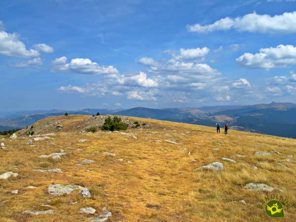
Once we get to the top, a wide plain awaits us, giving us the opportunity to approach the top of the mountain, which we avoid crowning, without much effort, and from where we can contemplate beautiful panoramic views of the lagoons.

Once visited this summit we set course towards our next objective of the day, the Campiña. In this part of the route the different footpaths that we can follow can make us doubt, more and when if to our right we contemplate some or another solitary milestone quite far away from the footpath that borders the cord that we are following.

A mountain range that marks out the lagoons that we have at our feet and that although we have to lose sight of on several occasions, we do not have to move far away from them if we want to follow the correct layout.

With good visibility we can see this mountain range that leads us directly to the summit of the Campiña that serves as a reference when the paths are blurred under the terrain they run through.

After a while the summit of the Campiña (2h 40min) awaits us next to its privileged views of the Neila Lagoons.

After the pertinent rest we continue with the route following the imaginary line that draws the mountain range that brought us here.

A mountain range that just at the end invites us to turn left to continue losing height while we border the lagoons.

We quickly see ourselves descending towards the car park from which we start with the Long and Black Lagoons on our left while on the right we can see the Ducks Lagoon and the Brava Lagoon.

Once again the pines gain protagonism surrounding the path we are following.

A trail that makes us lose height quickly while the forest is gaining thickness with each step we take.

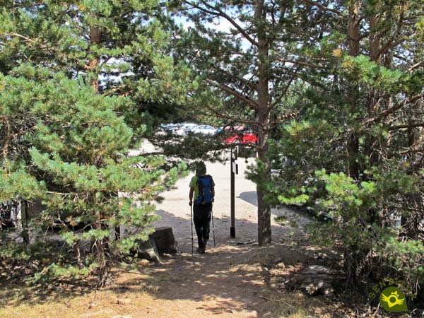
A footpath that, without further detours, takes us directly to the road and the car parks (3h 1min) from where we start this route through the Natural Park of the glacial lagoons of Neila.
The small detours we can make should not increase the distance significantly.
Obviously the time that we will spend for this route will vary not only because of how we face it, but also because of the itinerary that we decide to follow.
Throughout the year there are several reasons to visit the Natural Park of the glacial lagoons of Neila and enjoy this place. Although there is no doubt that the snow and ice that we can find at certain times of the year significantly increase the difficulty of this route, limiting it to people with enough experience.
A good part of the route travels around 2000 m of altitude, a fact that is important to bear in mind since the difference in temperature and wind speed compared to the areas where the lagoons are located, more protected, can play a trick on us. Water and food can not miss us, the walking sticks will be of great help in the ascent by the firebreak and of course we can not lack the necessary means to be able to follow the route in the case that the fog is poured over us. Consult our list of material and equipment for hiking. Read more.
Physical
This is a more demanding route than it might initially seem, given the combination of distance with the hard ramps we will face, so it is advisable to have a good physical condition. Beware of hot days as the ascent sections are almost all at the mercy of the sun.
Severity of the environment
As long as we do not abandon the marked path we should not have complications, but assuming that we are in a changing and uncontrolled environment. The apparent simplicity does not have to make us fall into the error of underestimating the steepness of the land that we cross in several zones of the route, with falls to the emptiness of a few meters and cliffs that have suffered some or other detachment.
Orientation
Well signposted and with paths that are sufficiently clear and easy to follow. It is in the plateau that borders the lagoons where almost all the difficulties that we will find are concentrated. And it is in this area where the marks are not so constant and easy to see and where the path is divided into several more, putting us in some doubt, more and when we observe several stone milestones quite far from the route we have to follow. In addition if the fog does apt of presence it is here where it has more numbers to play us a bad trick.
| 1-Parking | 0:00h | 1869m | 0Km | 30T 496321 4654883 |
| 2-Lagoon of the Waterfall | 0:30h | 1698m | 2Km | 30T 495702 4655429 |
| 3-Campiña | 2:40h | 2048m | 6.6Km | 30T 495443 4654100 |
| 4-Parking | 3:10h | 1869m | 8Km | 30T 496321 4654883 |
Coordinates UTM Datum WGS84

![]() Slope: 810m
Slope: 810m
![]() Slope +: 405m
Slope +: 405m
![]() Slope -: 405m
Slope -: 405m
![]() Maximum altitude: 2048m
Maximum altitude: 2048m
![]() Minimum altitude: 1668m
Minimum altitude: 1668m

This sketch of the route is not made to scale nor does it contain all the information relating to the area, it is merely indicative.

This schematic with the path is approximate and has been created from the derived cartographic base © Instituto Geográfico Nacional "Cuadrante 278-3, 25.000"
Senditur has manipulated the tracks to correct the aberrant points that may exist, caused by problems with the reception of the GPS signal. In any case the tracks are always approximate. SENDITUR encourages you to use the new technologies within your reach, using them as support and consultation in your activity, not basing the realization and orientation of the same only and exclusively on them, since they may see their functioning altered by very diverse causes, not functioning correctly and their indications may not be precise.
En primer lugar quiero felicitaros por vuestra página pues me parece muy completa, muy bien diseñada y con un sinfín de buenos detalles. He estado leyendo la información sobre el sendero de las lagunas de Neila y me ha parecido francamente bueno y acertado para los caminantes. Solamente quiero hacer dos puntualizaciones, por si queréis tenerlas en cuenta. 1. Los neilenses, el lugar de la Laguna de La Cascada, lo hemos conocido siempre como Los Paulazos Encimeros. El nombre de La Cascada viene a raíz de las intervenciones que se hicieron en las lagunas para incrementar el agua embalsada y que posteriormente ha habido que revertir y dejar como antes de las obras. Entiendo que los ingenieros que las hicieron optaron por dar el nombre de la Laguna de la Cascada cuando antes apenas había un regajo que malamente cubría un pequeño espacio pantanoso: ese lugar se conocía como Los Paulazos Encimeros. 2. El río que nace en Neila es el río Najerilla, como se ha conocido siempre. Parece ser, y esto es un interpretación mía, que con el advenimiento del Estado de las Autonomías, no ha habido político sin la tentación de dejar su huella y, así, desde La Rioja, no podían admitir que el río Najerilla naciera en Neila (Burgos) Pero me temo que geográficamente, el nacimiento del río Najerilla hay que situarlo en Neila y no en Canales de la Sierra. Muchas gracias por el trabajo realizado y por promocionar Neila, que tanta falta le hace.
Find out what to see in...
¿Did you know that...
Back in the 19th century, in the midst of the War of Independence, the Cave of Colts served as a den for Merino Priest, a famous person from Burgos who, in addition to being a priest, was also a fierce guerrilla who fought against the French occupation troops.
Don't miss out...
The visit to the House of the Park of the glacial Lagoons of Neila that you will find in this same locality of Neila, next to the highway. In addition to discovering many of the secrets that gave rise to the lagoons you can also visit the building that houses it, the old church of San Miguel.
From the commitment of SENDITUR with Nature and the respect to the balance of the environment, SENDITUR urges you to travel in a responsible way, with low environmental impact and respecting at all times the Natural, Cultural and Social environment wherever you go.
Besides sharing with all of us your experience on the route we would be grateful if you could write to us to inform us of any erroneous or outdated information you may have found, or simply to let us know what you think at Thank you.
This route has been carried out in the field by SENDITUR on 28-08-2018. The route may vary greatly depending on the time of year, weather conditions and terrain, as well as the actions of third parties and the evolution suffered in the natural environment where it is located. All opinions, advice and/or assessments made by SENDITUR in their descriptions are for guidance only and are subject to and/or refer to the specific conditions of the specific day of the route, referring to that specific day, taken from trained people, with the appropriate experience and with a high level of physical and technical preparation as a reference, as well as correctly equipped.
All the times are approximate and take an orientative character, the stops have not been taken into account, no matter how small they are. All the information related to the route, texts, images, videos, maps, diagrams, tracks, towns, and places of tourist interest are published as a guide, and may not coincide with the current state of each place. Before undertaking any activity, assess your technical knowledge, your physical condition, find out about the weather and the variations that the route may undergo, equip yourself correctly, be prudent and responsible at all times, and do not exceed your capabilities. SENDITUR is not responsible for any misuse or inappropriate use of the comprehensive guides of its routes and/or publications as well as its electronic guides, nor for any variations in their descriptions for the aforementioned reasons, and recommends that everyone be responsible and prudent in carrying out the activity. We also encourage you to read books and specialised guides to complement the information described above.
Continue watching …