
Anguiano is the cradle of deep-rooted traditions, such as the well-known Dance of the Stilts, and the gateway to the unique Alto Najerilla Valley. It treasures almost equally history, culture and natural resources of incalculable value. La Rioja is crisscrossed by many paths. Routes such as those that run through the Anguiano mountains, taking us to beautiful corners, leading us to unique trees hundreds of years old and to steep spots in the middle of nature.

The Route of Roñas through its 16.4 km transports us through mountains and forests offering us the opportunity to be surprised by the panoramic views that this trekking route through the lands of La Rioja offers. As if we were real dancers, we set off from Anguiano, following the steps of the traditional pilgrimage that leads to the hermitage of La Magdalena, where, in addition to visiting the hermitage, we can also visit the Peña Portillo viewpoint.. From here, and once we have visited this welcoming place, we start the long journey that, crossing the forests that grow in these mountains, will take us to the highest part of the whole route. Forests whose thickness opens up on rare occasions as if they wanted to give us a little taste of what is to come. In this section of the route we will find the possibility of shortening part of the route by following the Roñas variant that ascends through the interior of the beech forest. Almost at the top of the mountain we will come across the detour that leads to the Roñas Pass, a real balcony open to the Najerilla Valley from which we can enjoy the landscape that can be seen from it. Crowned already the symbolic summit of this route of hiking we undertake the descent that will return us to the valley.

Not without first enjoying spectacular landscapes as we approach another of the unique places we will pass through. The steep walls that loom over the road warn us of our arrival in Congostos. Walls that we left behind by the hand of two illustrious colleagues, the GR 93 and the Route of the Serradero, together we entered the leafy Beech Forest of Aidillo to approach the meeting of the Route of Peñas that waits for us at our arrival to the Pass of La Tejera. There we will say goodbye to our inseparable path to enter the forest again and continue our march towards Anguiano. We will leave behind us the Route of Rocks that continues its course, either towards Anguiano by our old companion, the road, or towards the hermitage of La Magdalena. The end of the descent will allow us to enjoy a magnificent forest from which we will say goodbye shortly before reaching the end of this route, from where we will contemplate the vertical rocks that surround the Najerilla River as it passes through Anguiano, where we will put the end to this entertaining itinerary.

Those who want to do this route by BBT can do it without worrying about the final itinerary since from the Pass of La Tejera they can continue by the same path without getting into the trail and reach Anguiano following the route of the Route of Rocks thus closing the circle without getting off the bike. Those who are more adventurous, or those who want to follow more rugged paths, can extend the route by about 2.5 km and follow the opposite itinerary of the Route of Rocks from the junction in the forest, shortly after passing through La Tejera, which will take them back to the Hermitage of La Magdalena through a rugged landscape and then return to Anguiano by the same itinerary they followed at the beginning of this route.
The municipality of Anguiano is reached by following the LR-113 that links Nájera with the Burgos town of Salas de los Infantes. This same road, in Nájera, connects with the A-12, Autovía del Camino and with the N-120 between Burgos and Logroño. There is also an extensive schedule of intercity buses that connect Anguiano with both Nájera and Logroño. Once there, on the road that crosses the town, we will find, at the exit of Anguiano towards Monasterio de Valvanera, a parking area where we can leave our vehicle.
This route is physically demanding for our dog, so it is important that he is used to this type of route, paying attention to the road section.
It is important in this type of route to bring him water and food so that he replenishes his energy. Luckily, along the route we will find many water points that he will be able to take advantage of.
The cattle is the protagonist of this region and we will surely meet them and also the dogs that protect the herds in the mountains, dogs that are usually loose and in groups. It is important, as in every area with cattle that we travel, to check our friend at the end of the route to avoid the parasites that are implicit to the lands with cattle.
The road that takes us to Anguiano (0h 00min) will be our improvised guide at the beginning of this trekking route that starts from the information signs of the routes that cross the area and that are located in the car park at the foot of the road.

From here we began to climb up the Najerilla valley leaving on our right the road that, if followed, would take us to the imposing Mother of God Bridge.

Soon we realize the intentions that our journey has for us, since it begins to show us part of the slope that we will have to assume.

We quickly arrive at the beginning of the path that we will have to continue to leave the company of the road. We begin the long itinerary of forest road that will take us to the Roñas Pass.

There will not be many junctions that we will find in this area of orchards and in any case our track and the marks of the route make clear the direction to follow.

After a good stretch gaining height with each step, the silhouette of the hermitage of La Magdalena (0h 25min) appears before us and the detour we will have to take, which tries to prevent us from visiting this peaceful and beautiful corner, or that we head towards the Peña Portillo viewpoint.
After the obligatory visit, we left behind both the hermitage and the Route of Rocks, which accompanied us here, to follow this new path that seems to want to return us to the Najerilla valley, even losing part of the height gained.

But soon he will change our minds by making us strive again to go up the mountain.
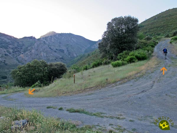
A little further on, our path changes direction abruptly, making us leave a track on our right that gets lost down the slope, while it forces us to face a hard ramp.

Luckily this short but intense area ends almost at the same time as it meets a wide track that ascends from the nearby Najerilla Valley.

A track that will take us up the valley through which the Fuente Fría stream flows, now joined to that of the Cubo River. The slope seems to give us a moment or two of deceptive truce, as we will continue to climb with every step we take.

After a while we will be forced to cross the course of the stream that crosses the track we are walking on.

After doing so, we come across a solitary post on the route, which invites us to take the Roñas variant. This variant is nothing more than a shortcut that avoids the long bend in the road. In exchange we will have to face the steep slope, although we will have to walk through some beautiful landscapes in the interior of the beech forest.

We continue along the path where we will come across the odd crossroads or path that we will leave behind us, as we must always follow the main track.

Our path crosses the mountainside at the same time as it ascends following its undulating silhouette. Luckily the trees give us all the freshness of their pleasant shade making the effort more bearable.

The track, after a new and steep ramp, changes its orientation again radically, making us leave another path behind us.

From time to time, the forest gives us small clearings that allow us to enjoy the landscape around us.

The constant and marked slope does not give us any respite, forcing us to take the ascent with a certain calm.

Little by little and without leaving our inseparable path, we go up the mountain, approaching calmly the highest part of our route.

But before we get there we will have to cross a stretch where the small streams that run down the slope leave the road normally somewhat muddy. The slope, as we get closer to our goal, becomes even more evident. In this part of the route we will find the post that warns us of the arrival to our track of the Roñas variant that we previously left to one side.
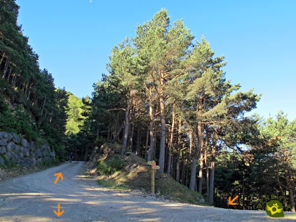
Already together and almost without warning a new turn of the road appears before us, including a crossroads, where we will find the sign of the route that marks that we have reached the detour that leads to Roñas Pass (2h 50min). At this point, if we do not ascend to the pass, we will leave our path to follow the one that starts from here, the path by which we will return to Anguiano.
Once we have reached this point, we cannot miss the opportunity to travel the short distance that separates us from the privileged balcony that is the Roñas Pass.

For this, as on previous occasions, we do not leave our inseparable companion and continue to ascend following his course.

The path continues with its marked slope leading directly to a metal gate that we will have to cross. Luckily the ascent comes to an end soon after we cross this barrier.
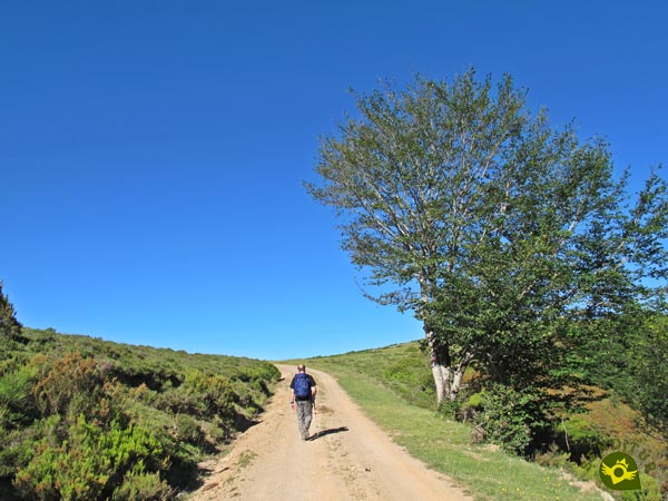
Once at the top, in the Roñas Pass (3h 10min), spectacular panoramic views await us, which compensate for the effort made.
Once we have enjoyed the place and recovered our energy, we start walking down the same path we came in, until we reach the crossroads we left behind.

At this junction we will definitely say goodbye to the track that had accompanied us for so many kilometres to continue the descent along the new path that starts from here.

At the moment this conditioned and apparently new road hardly makes us lose height. Its layout cuts the mountainside at the same time that it allows us to contemplate the valley and the forest through which we arrived here.

This tree-free zone leaves us at the mercy of the relentless sun that on hot days can strike hard.

A long way ahead, we will reach the real beginning of the marked descent that awaits us. This stretch is a continuous zigzagging in which the path makes us lose quite a lot of height.

Turn after turn, we are approaching the next passing point in this amusing hiking tour around the Anguiano Mountains.

Congostos (4h 00min) welcomes us with the junction where we are joined by the GR 93 and the Route of the Serradero, which will not be separated from us until Anguiano.
We continue to descend quickly escorted by the steep walls that make up the Congostos.
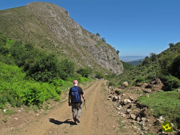
Walls that give way to the spectacular Aidillo beech forest that surrounds us with its thickness.

Beech forest that transports us quickly to the Pass of La Tejera (4h 15min), where we will find the Route of Rocks, a route that arrives here from the Hermitage of La Magdalena to go down to Anguiano by the road that we are walking.

But our route at this point forces us to say goodbye to the track that brought us here and, on our left, go back into the forest as if it wanted to take us back to the hermitage we visited at the beginning.

Forest that in its first meters we will share with the Route of Rocks. We will say goodbye to this route a little later to continue the descent through the forest with the company of the GR 93 and the Route of the Serradero.

This section of the forest leads us first along a kind of old road and then into a sometimes blurred trail through the dense forest.

We shouldn't have too much trouble following its course, other than some area that is a little more muddy or less trampled. Of course, the path has its corresponding marks that in case of doubt serve as a reference to follow.

The forest gives way to the meadows and pastures that precede Anguiano, which we can already see without any problem.

The long descent takes us straight to the edge of some livestock buildings. This part of the route is advisable to take it easy to avoid slipping.

Our route continues with its descent bordering the fence of the pavilions and making us go through a gate for the cattle.

After overcoming another slippery ramp a new gate separates us from the first streets of the town.
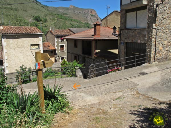
The trail, which has already become a path, ends when it meets one of the streets that run through Anguiano.

We will continue descending and quickly approach the road and the parking lot from where we started this route in Anguiano (4h 50min) and where we will finish it.
Thanks to the Roñas variant, we will be able to reduce this figure in part if we wish to do so.
Those who decide to miss the views of Roñas Pass will see this figure reduced by approximately 30 minutes.
As we are facing a route that is almost entirely made up of paths, we may fall into the error of thinking that even with snow it will be easy to face it and, unless we are technically and physically prepared and equipped accordingly, this is not the case. Autumn and spring will probably provide us with the best moments of this journey through mountains and forests. In the summer we will have plenty of shady areas that can partly mitigate the heat of those days.
Comfortable hiking shoes, preferably boots, walking sticks, appropriate clothing and wind breakers, the necessary material and information to be able to continue with the route thanks to it and of course the first aid kit and the mobile phone with the batteries at full power is what should accompany us on this route. To this we have to add the water and the lunch that surely will make us enjoy the double of everything that offers the Roñas Pass, neither we can lack the photo camera and the corresponding protection against the sun. Consult our list of material and equipment for hiking. Read more.
Physical
We are in front of a route for which it is advisable to have a good physical condition, its mileage and its unevenness, added to the different meteorological conditions that we can find, make it more demanding than it might seem a priori.
Severity of the environment
We will be travelling along tracks and roads in good condition, and as long as we do not abandon the official route we should not have any problems. The final section, the one that runs along the trail, is the one that requires the most precautions. Here the mud and the terrain can make us slippery with some ease. Neither should we trust some of the ramps on the path when we are descending as they are somewhat steep and it is not difficult, if we are tired, to have a slip. It goes without saying that on the short stretch of road you must take extreme precautions.
Orientation
Well signposted at all times, it is the many paths that we will encounter that can make us hesitate, if we have not prepared our route well. The section of detour to the Pass is of going and return by the same place for what we must not follow the different roads that come up to him, only for the one that we come.
| 1-Anguiano | 0:00h | 644m | 0Km | 30T 519246 4678574 |
| 2-Hermitage of La Magdalena | 0:25h | 781m | 1.5Km | 30T 520015 4677651 |
| 3-Detour to Roñas Pass | 2:50h | 1364m | 8Km | 30T 520756 4675450 |
| 4-Roñas Pass | 3:10h | 1434m | 8.9Km | 30T 520078 4675043 |
| 5-Detour to Roñas Pass | 3:20h | 1364m | 9.8Km | 30T 520756 4675450 |
| 6-Congostos | 4:00h | 1156m | 12.6Km | 30T 521599 4677014 |
| 7-Pass of La Tejera | 4:15h | 1004m | 13.8Km | 30T 521437 4678005 |
| 8-Anguiano | 4:50h | 644m | 16.4Km | 30T 519246 4678574 |
Coordinates UTM Datum WGS84

![]() Slope: 1588m
Slope: 1588m
![]() Slope +: 794m
Slope +: 794m
![]() Slope -: 794m
Slope -: 794m
![]() Maximum altitude: 1434m
Maximum altitude: 1434m
![]() Minimum altitude: 644m
Minimum altitude: 644m

This sketch of the route is not made to scale nor does it contain all the information relating to the area, it is merely indicative.

This schematic with the path is approximate and has been created from the derived cartographic base © Instituto Geográfico Nacional "Cuadrante 240-2, 240-4, 241-1 y 241-3, 1:25.000"
Senditur has manipulated the tracks to correct the aberrant points that may exist, caused by problems with the reception of the GPS signal. In any case the tracks are always approximate. SENDITUR encourages you to use the new technologies within your reach, using them as support and consultation in your activity, not basing the realization and orientation of the same only and exclusively on them, since they may see their functioning altered by very diverse causes, not functioning correctly and their indications may not be precise.
¿Did you know that...
Every year, accompanied by the well-known Dancers of Anguiano, the saint is descended in a pilgrimage and then in September it is taken up again to its hermitage, also in a pilgrimage and also accompanied by the dancers with their corresponding stilts.
Don't miss out...
The hermitage of La Magdalena and its famous Fountain Intermittent, you will only have to deviate a few meters from the route and you will be able to know and enjoy the place and its environment, as well as the tranquility that it gives off.
.jpg)
From the commitment of SENDITUR with Nature and the respect to the balance of the environment, SENDITUR urges you to travel in a responsible way, with low environmental impact and respecting at all times the Natural, Cultural and Social environment wherever you go.
Besides sharing with all of us your experience on the route we would be grateful if you could write to us to inform us of any erroneous or outdated information you may have found, or simply to let us know what you think at Thank you.
This route has been carried out in the field by SENDITUR on 30-06-2017. The route may vary greatly depending on the time of year, weather conditions and terrain, as well as the actions of third parties and the evolution suffered in the natural environment where it is located. All opinions, advice and/or assessments made by SENDITUR in their descriptions are for guidance only and are subject to and/or refer to the specific conditions of the specific day of the route, referring to that specific day, taken from trained people, with the appropriate experience and with a high level of physical and technical preparation as a reference, as well as correctly equipped.
All the times are approximate and take an orientative character, the stops have not been taken into account, no matter how small they are. All the information related to the route, texts, images, videos, maps, diagrams, tracks, towns, and places of tourist interest are published as a guide, and may not coincide with the current state of each place. Before undertaking any activity, assess your technical knowledge, your physical condition, find out about the weather and the variations that the route may undergo, equip yourself correctly, be prudent and responsible at all times, and do not exceed your capabilities. SENDITUR is not responsible for any misuse or inappropriate use of the comprehensive guides of its routes and/or publications as well as its electronic guides, nor for any variations in their descriptions for the aforementioned reasons, and recommends that everyone be responsible and prudent in carrying out the activity. We also encourage you to read books and specialised guides to complement the information described above.
Continue watching …