The Redes Natural Park, in Asturias, brings together true jewels of nature, often furrowed by historic routes that united, through spectacular landscapes, the people who inhabited the charming villages found within this natural paradise. Since time immemorial, the Route of the Alba has united the council of Sobrescobio with that of Aller through an impressive path of muleteers and shepherds that today is a reference point as well as being a Natural Monument.

The Route of the Alba along its 14,6 Km crosses narrow gorges not before saying goodbye to the careful locality of Soto de Agues, departure point for the great majority of people who nowadays transit the places that this senderista itinerary visits. Centenary hórreos, renovated laundry rooms or mansions with their coquettish balconies, give way to a pleasant walk that step by step brings us closer to the steep gorge through which we are about to pass. The spectacular scenery that is already intuited in front of us should not hide the other values that this route offers us and that have marked and mark part of its character. Factors such as the farmer or the industrialist, with the fish farm or the remains of the abandoned iron mine of El Carmen, have influenced and marked the current appearance and history of this land.

The river Alba is undoubtedly another of the great protagonists of the route, offering the visitor an endless number of waterfalls of considerable height, which come to add to the torrents and pools of crystalline waters such as those of Calvu, les Lleroses or La Sapera. River that forced to the construction of bridges that facilitated to cross it to the shepherds and muleteers that crossed these ways, bridges like the one of the Pontona or the one of the Resquebra that unite both slopes of the narrow Gorges of Llamío. Vertical walls that mark out the route at all times, giving way, in some areas, to real porticos supported in delicate balance over our heads. All a natural monument unbeatable habitat for colossal oaks, beeches, lime trees that together with the nourished fauna composed among others by the Red Rocker, the Chova or the Alimoche, populate the slopes and the limestone and quartzite cliffs that form the well-known silhouette of this Route of the Alba, and that give way to the amplitude that characterizes the prairies in the Cross of the Rivers, point of return towards Soto de Agues, and from where the Praera Peak or the Retiñón they lean out curious to the narrow gorge.

Once back towards Soto de Agues, shortly before arriving at the locality, we can change the itinerary and return along the path that leads along the opposite bank of the river to the Saint Andrés neighbourhood, one of those that make up Soto de Agues and once there we go to the car park from which we leave. This variant is conditioned by the state of the bridge that we have to cross to start the route and it is probable that we will find ourselves with this pass cut off as a precaution.
To get to Soto de Agues we have to do it first to Rioseco in the middle of the AS-117 road that departs from Langreo to cross from west to east all the Redes Natural Park passing through towns like Pola de Laviana, Rioseco or Campo de Caso. It is concretely in the same Rioseco where we will find the detour that leads towards La Polina and Villamorey, being in this last town where it is the beginning of the road that will approach us finally until Soto de Agues. Once there, just leave behind us a first detour that seems to introduce us into the village, we will find a large car park where we must park our vehicle to start the route.
Unbeatable route for our dog, given its distance and relative low unevenness will undoubtedly be a good activity for both those who are accustomed and for those who are not. The regulation forces to take it tied up to avoid annoyances to the cattle and to the crowded number of people who usually visit this route. Attention also to the vehicles that also usually circulate on the track.
It is not advisable to underestimate this activity, so it is important to bring water and of course food but surely we can find some point where our friend can drink.
Finding the livestock and more pets than we think is normal in this visited route, more than enough reasons to be attentive to our friend.
The town of Soto de Agues (0h 00min) is the starting point for the busy Route of the Alba.

More specifically, the route starts from the large car park that we will find as soon as we arrive in the town.

It is only after leaving the car park to enter Soto de Agues, where we will find the first sign of the itinerary, which encourages us to follow the street to the left of the two that start from this point.

But in reality, the marks on the path that must accompany us during the route run along the street above, which, if you follow it, takes you directly to the town square.

In any case we have to cross Soto de Agues from end to end following without deviating, either the main street that passes through the square, or the one that indicates the sign that runs parallel to the other street.
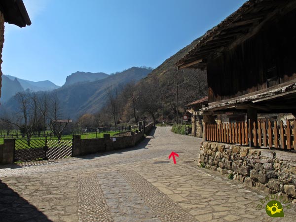
Both options come together again on the outskirts of Soto de Agues, next to a well-kept hórreo, just before passing by the old washing place where the Route of the Alba begins.

A few kilometres of cement track await us in front, which will guide us without any major complications along this part of the route.

We enter in this true monument of the Natural Park of Redes surrounded by the mountains that surround us.

The slope during almost all the route will not be demanding at all, except for some short ramp a little more remarkable than the rest.

Almost without realizing it, we will pass by the fish farm that takes advantage of the quality of the waters that come down from the mountain.
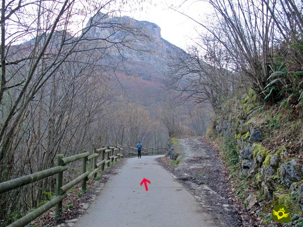
The route that we must follow, in addition to having its corresponding marks, is, in this section, conditioned, so it leaves no room for doubt in the few junctions that we have to find.

The valley closes little by little giving less margin to the river Alba that runs through it.

As soon as we enter the first of the gorges that we have to cross, we will find the detour of the San Andrés neighbourhood (0h 35min) and the battered bridge that allows us to cross the river to follow this variant on our return, as long as the pass is not cut off.
We continue going up the river following the comfortable track embedded between the enormous cliffs that mark out this zone of the itinerary.

The spectacular landscape that surrounds us more than compensates the supposed monotony that is supposed to every layout that follows a conditioned way.

The gorge widens and shortens giving more or less margin to the river and our path as if it were a game.
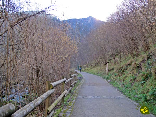
The vegetation allows us to contemplate the summits of the mountains that surround us, thus enlarging the beauty of the landscape.

The Alba River, which gives us capricious waterfalls, is undoubtedly one of the great protagonists of this route.

There will not be many crossroads and paths that we will come across in this section of the route and in all of them it is very clear the direction to follow.

Above our heads hang huge carved stones to allow us to pass. We continue to gain height step by step without, except on a few occasions, noticing the slope we are gaining without realizing it.
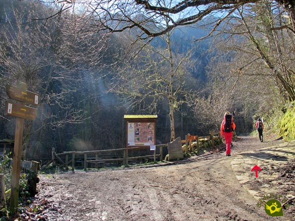
After a while our cement track comes to an end, at the same time that we find the recreational area of the Bridge of the Vega (1h 35min).
From now on, the comfort we had enjoyed up to this point gives way to a generally wide mountain path that will guide us through the gorge we are about to cross.

We unknowingly entered the wildest and most beautiful part of the route. The slope begins to be more evident, forcing us to advance more calmly, the perfect excuse to enjoy the landscape that surrounds us.

The Gorges of Llaímo close in front of us, leaving an imposing picture of vertical walls at whose feet the river runs torrentially.

After a few first ramps the wide trail narrows, we are before a short stretch whose greatest difficulty is marked by the slippery floor.

After crossing this area, the first of the bridges we must cross awaits us.
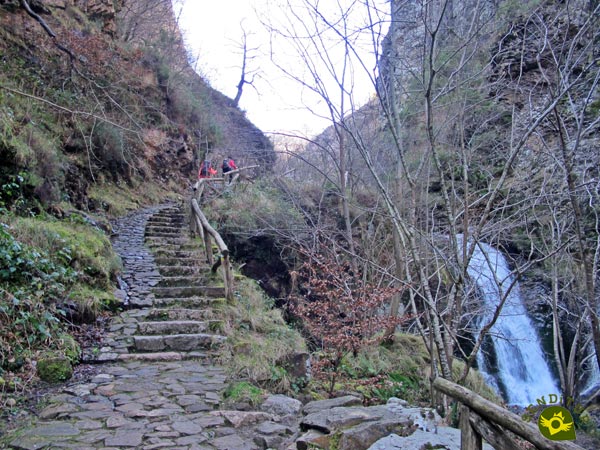
Just after, with our eyes set on the beautiful waterfall that the river gives us, we ascend a conditioned stretch that allows us to save the height of this waterfall.

Once again we are faced with a slippery area that quickly gives way to the second bridge that we must cross.

We continue with no more complications than those of gaining height little by little while enjoying the environment that surrounds us.

The narrow gorge continues to give us impressive areas and capricious waterfalls.

The footpath shows the wounds, some already repaired, of the landslides he has suffered.

Without hardly realizing it, the gorge comes to an end, leaving us with the desire to continue touring its gorgeous nooks and crannies.

A small bridge gives way to a wide landscape known as Cross of the River (2h 15min), where a well-deserved rest awaits us before returning.

We will return following our footsteps, desandando lo andado, until arriving again to Soto de Agues (4h 00min), where this entertaining route really ends.
The place of departure will influence the final distance of the route.
Without a doubt, the beauty of the many corners through which we will pass along the route will determine the total time we will use. It is also necessary to take into account how crowded this route usually is to adjust our schedule if we want to be less accompanied.
Of course we are before a route that has enough and varied attractions that make it highly recommended to visit throughout the year. The landscape and the flora, together with the river, are the great protagonists, but without a doubt it is the river that with its flow marks the pulse of the cascades and the torrents that mark a great part of the route.
There are many people who take advantage of the different areas equipped with benches and tables or the green meadows to rest and spend a pleasant day, in addition to traveling a beautiful route. Don't forget that no matter how well equipped the route is, we have to equip ourselves correctly, adapting our clothes and footwear to the time of year and weather conditions, and accompanying our camera with a minimum hiking equipment essential whenever we go out to the natural environment. Consult our list of material and equipment for hiking. Read more.
Physical
Without a doubt, the total distance is the greatest physical condition of this route, although we should not forget the slope to overcome. With the exception of some short ramp, the slope that we must face is gentle and allows us to save it without major difficulties, thanks in part to the continuous false plains that we will pass along the route.
Severity of the environment
The route is clearly divided into two distinct sections, the first fully conditioned and apparently without more danger than the vehicles that can get to furrow it and the second much wilder, with slippery sections and somewhat more exposed but without major complications. As in any route or situation we face, common sense and prudence are good companions, we do not have to forget that we are crossing a steep gorge, so it is not very advisable to leave the path or marked route, respecting the advice and recommendations. It is not uncommon for us to come across some rockslides, especially at the end of the route. We must also take into consideration the flow of the river, as there are areas that at certain times can become floodable and of course the presence of ice or snow that undoubtedly increase and condition the difficulty of this route.
Orientation
This is a perfectly signposted route with a clearly defined layout whose greatest complications can be found, curiously, in Soto de Agues to get to the beginning of the path on the outskirts of the town.
| 1-Soto de Agues | 0:00h | 430m | 0Km | 30T 299545 4786205 |
| 2-San Andrés Neighborhood Detour | 0:35h | 495m | 1.9Km | 30T 298942 4784866 |
| 3-Recreational Area Bridge the Vega | 1:35h | 637m | 5.4Km | 30T 298756 4782047 |
| 4-Cross of the Rivers | 2:15h | 788m | 7.3Km | 30T 297767 4780975 |
| 5-Recreational Area Bridge the Vega | 2:40h | 637m | 9.2Km | 30T 298756 4782047 |
| 6-San Andrés Neighborhood Detour | 3:30h | 495m | 12.7Km | 30T 298942 4784866 |
| 7-Soto de Agues | 4:00h | 430m | 14.6Km | 30T 299545 4786205 |
Coordinates UTM Datum WGS84

![]() Slope: 728m
Slope: 728m
![]() Slope +: 364m
Slope +: 364m
![]() Slope -: 364m
Slope -: 364m
![]() Maximum altitude: 788m
Maximum altitude: 788m
![]() Minimum altitude: 430m
Minimum altitude: 430m

This sketch of the route is not made to scale nor does it contain all the information relating to the area, it is merely indicative.

This schematic with the path is approximate and has been created from the derived cartographic base © Instituto Geográfico Nacional "Cuadrante 054-3, 1:25.000"
Senditur has manipulated the tracks to correct the aberrant points that may exist, caused by problems with the reception of the GPS signal. In any case the tracks are always approximate. SENDITUR encourages you to use the new technologies within your reach, using them as support and consultation in your activity, not basing the realization and orientation of the same only and exclusively on them, since they may see their functioning altered by very diverse causes, not functioning correctly and their indications may not be precise.
Find out what to see in...
¿Did you know that...
In this area there is a carnivorous plant, specifically the Tiraña, which grows along the Route of the Alba in the vertical rocky walls that mark it out, finding a humid and shady habitat ideal for it where it captures the small insects that stick to its leaves.
Don't miss out...
Soto de Agues, strolling through its streets and the neighbourhoods that make it up will allow you to discover hórreos more than 100 years old along with a network of streets with typical constructions, some of them full of history, or immerse yourself in their customs and traditions.
From the commitment of SENDITUR with Nature and the respect to the balance of the environment, SENDITUR urges you to travel in a responsible way, with low environmental impact and respecting at all times the Natural, Cultural and Social environment wherever you go.
Besides sharing with all of us your experience on the route we would be grateful if you could write to us to inform us of any erroneous or outdated information you may have found, or simply to let us know what you think at Thank you.
This route has been carried out in the field by SENDITUR on 01-03-2017. The route may vary greatly depending on the time of year, weather conditions and terrain, as well as the actions of third parties and the evolution suffered in the natural environment where it is located. All opinions, advice and/or assessments made by SENDITUR in their descriptions are for guidance only and are subject to and/or refer to the specific conditions of the specific day of the route, referring to that specific day, taken from trained people, with the appropriate experience and with a high level of physical and technical preparation as a reference, as well as correctly equipped.
All the times are approximate and take an orientative character, the stops have not been taken into account, no matter how small they are. All the information related to the route, texts, images, videos, maps, diagrams, tracks, towns, and places of tourist interest are published as a guide, and may not coincide with the current state of each place. Before undertaking any activity, assess your technical knowledge, your physical condition, find out about the weather and the variations that the route may undergo, equip yourself correctly, be prudent and responsible at all times, and do not exceed your capabilities. SENDITUR is not responsible for any misuse or inappropriate use of the comprehensive guides of its routes and/or publications as well as its electronic guides, nor for any variations in their descriptions for the aforementioned reasons, and recommends that everyone be responsible and prudent in carrying out the activity. We also encourage you to read books and specialised guides to complement the information described above.
Continue watching …