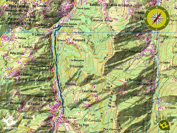
In the middle of the mining basin in the council of Langreo, we find the Samuño Valley Path, between the towns of La Nueva and El Cadavíu station, a short distance from the centre of Ciañu, going through this valley along the route of an old mining railway. The characteristic natural landscape coexists with the traces left during more than a century by the mining activity carried out in the region.

The route with little more than 2Km follows the trench of one of the railroads that transported the coal extracted in the mines of the middle part of the valley, beginning in one of the main wells as it is the one of San Luis, that was active until the year 2001, becoming now part of the Mining Ecomuseum of the Valley of Samuño. From here we will descend through the valley following the path of the coal and enjoying the green landscape that hid, in its entrails, the black mineral. We will pass by population centres that grew under the protection of the mining activity surrounded by a leafy vegetation characteristic of the area such as chestnut trees, ferns and a great variety of species, which give their protagonism to small orchards.

Halfway along the route we will be able to contemplate the facilities of the Samuño Well, in addition to the large number of wells that the region had active years ago. From here and almost without realizing it, we will arrive at the El Cadavíu station, now a centre for the interpretation and reception of visitors to the Mining Ecomuseum, where the route ends.
We can leave our vehicle in the car park of the station of El Cadavíu from where the visit to the Mining Ecomuseum leaves, and after making this guided visit, descend by the Samuño Valley Path until the station.

We can reach Langreo by following the AS-1 that joins Mieres with Gijón and taking the exit towards Langreo, which we will reach via the AS-17, this same road on its other side communicates the town with San Martín del Rey Aurelio and Pola de Laviana, entering the heart of the Redes Natural Park, passing through Ciañu, close to Langreo, where we will find the detour towards La Nueva that will take us to El Cadavíu station. In this place is the reception centre for visitors to the Mining Ecomuseum and it is where, if we visit the museum, we have to leave our vehicle. If we continue along the road, it will take us to La Nueva, just 2 km away, where the Pozo San Luis is located.
A short stretch of asphalt, a short stretch of road and a couple of junctions are the biggest complications we will find.
In the initial zone we have a fountain, although the short distance of the journey and the shady of it does not cause problems.
Special attention we have to have with the farm animals chickens and goats fundamentally that we will find very habitually in the route.
We begin the route next to the main entrance to Well San Luis (0h 00min), from here a wide lane shared with bicycles leads us in an almost imperceptible descent towards the lower part of the valley.

Leaving behind a small recreational area and some paths that serve as access to the houses and orchards that border the itinerary, we will continue along this asphalted and well signposted lane until we reach the height of Samuño Well (0h 15min).

Once here we will find a short but steep ramp.

The ramp, fitted out with stairs, quickly descends towards an underground passageway, but shortly before reaching it, the lane that brought us here begins again on our left, and where we must continue.

Little by little we are moving away from the old mining well, the nearby road separates us from the train trench that leads to the interior of San Luis Well.

We arrive at the end of the conditioned lane that is with a road that crosses it, in this place we can continue for her or to continue straight for a small path that forced us to descend the slope that saves the difference of height with the road.

Once again we will have to decide whether to continue along the road, descending the scarce 200 m that separates us from the station of El Cadavíu or ascending along the one on the right, cut by two large stones, to continue the route along a beautiful path.

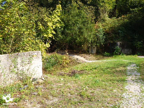
After passing the boulders we will arrive at a wide esplanade that apparently housed some pavilions, following by the left margin next to the limit of the vegetation we will find a narrow footpath made of stones that borders all the esplanade.

At the end this path turns left into the lush forest, the trail inside remains conditioned with this layer of boulders.

Among the vegetation, on our left, we can sense the station building that we will leave behind us, this fact and the fact that the route no longer has the same paved road as the previous section may make us think that we have been confused and that we follow a path that takes us to another place.

Just out of the forest we will see a green ramp that descends a few meters, just at the end of this ramp the route turns radically back to direct us to the Station of The Cadavíu (0h 35min) to which we will arrive after crossing the road again.
This figure is for the outbound route only.
Total time following the, on the other hand advisable option, of the pat:throug:the interior of the forest, if we choose the stretc:of road we will save a few 5min.
The route maintains its beauty throughout the year but it is in autumn where we can enjoy a varied and colorful landscape, it should be borne in mind that the Ecomuseum Minero closes during certain periods of the year.
We recommend comfortable clothing and footwear, according to the time of year and the weather, in addition to the camera. Consult our list of material and equipment for hiking. Read more.
Physical
Wit:practically no physical demands, it is a pleasant walk, where only the ramp next to the Samuño Well and the final part of the pat:inside the forest suppose an effort if we make the route in ascending sense.
Accessibility
Most of the route is by an asphalted track and the area of pat:throug:the interior of the forest can be replaced by a short stretc:of road. You will have to pay attention to the crossroads and the section of road, if you continue along it. The part of the trail throug:the forest is conditioned wit:a layer of stones that facilitates the passage.
Orientation
Perfectly signposted and well defined the route will not have problems in following it, at most we can think that we have been confused if we follow in the final part the pat:throug:the forest and that at first moves away from the building of the station.
| 1-Well San Luis | 0:00h | 306m | 0Km | 30T 283027 4793347 |
| 2-Samuño Well | 0:15h | 272m | 0.9Km | 30T 282893 4794278 |
| 3-The Cadavíu Station | 0:35h | 249m | 2.1Km | 30T 282848 4795074 |
Coordinates UTM Datum WGS84

![]() Slope: 96m
Slope: 96m
![]() Slope +: 20m
Slope +: 20m
![]() Slope -: 76m
Slope -: 76m
![]() Maximum altitude: 306m
Maximum altitude: 306m
![]() Minimum altitude: 249m
Minimum altitude: 249m

This sketc:of the route is not made to scale nor does it contain all the information relating to the area, it is merely indicative.

This schematic wit:the pat:is approximate and has been created from the derived cartographic base © Instituto Geográfico Nacional "Cuadrante 0053-2 1:25.000".
Senditur has manipulated the tracks to correct the aberrant points that may exist, caused by problems wit:the reception of the GPS signal. In any case the tracks are always approximate. SENDITUR encourages you to use the new technologies within your reach, using them as support and consultation in your activity, not basing the realization and orientation of the same only and exclusively on them, since they may see their functioning altered by very diverse causes, not functioning correctly and their indications may not be precise.
¿Did you know that...
In the year 2014 in the region are 6 active wells that occupy about 1400 miners while about 50 years ago there were 53 wells operating with just over 52000 miners working in them.
Don't miss out...
The visit to the Mining Ecomuseum, a train journey that will take us to the heart of the San Luis Well and will allow us to live the experience of being in a mine more than 30 m deep and know the day to day of the miners who worked in this well.
From the commitment of SENDITUR with Nature and the respect to the balance of the environment, SENDITUR urges you to travel in a responsible way, with low environmental impact and respecting at all times the Natural, Cultural and Social environment wherever you go.
Besides sharing with all of us your experience on the route we would be grateful if you could write to us to inform us of any erroneous or outdated information you may have found, or simply to let us know what you think at Thank you.
This route has been carried out in the field by SENDITUR on 15-08-2015. The route may vary greatly depending on the time of year, weather conditions and terrain, as well as the actions of third parties and the evolution suffered in the natural environment where it is located. All opinions, advice and/or assessments made by SENDITUR in their descriptions are for guidance only and are subject to and/or refer to the specific conditions of the specific day of the route, referring to that specific day, taken from trained people, with the appropriate experience and with a high level of physical and technical preparation as a reference, as well as correctly equipped.
All the times are approximate and take an orientative character, the stops have not been taken into account, no matter how small they are. All the information related to the route, texts, images, videos, maps, diagrams, tracks, towns, and places of tourist interest are published as a guide, and may not coincide with the current state of each place. Before undertaking any activity, assess your technical knowledge, your physical condition, find out about the weather and the variations that the route may undergo, equip yourself correctly, be prudent and responsible at all times, and do not exceed your capabilities. SENDITUR is not responsible for any misuse or inappropriate use of the comprehensive guides of its routes and/or publications as well as its electronic guides, nor for any variations in their descriptions for the aforementioned reasons, and recommends that everyone be responsible and prudent in carrying out the activity. We also encourage you to read books and specialised guides to complement the information described above.
Continue watching …