Welcome to SENDITUR.COM · paths · routes · tourism


Stage 01b Variant of Valcarlos
Saint Jean Pied de Port, Pyrénées Atlantiques![]()
![]()
![]()
![]()
![]() (1)
(1)
The winter variant that has nothing to envy to other official stages
![]() Difficulty-Remarkable
Difficulty-Remarkable
![]() 7:05 h.
7:05 h.
![]() 23.5 km.
23.5 km.
Saint Jean Pied de Port, Pyrénées Atlantiques![]()
![]()
![]()
![]()
![]() (1)
(1)
The winter variant that has nothing to envy to other official stages
![]() Difficulty-Remarkable
Difficulty-Remarkable
![]() 7:05 h.
7:05 h.
![]() 23.5 km.
23.5 km.
The Pyrenees serve as the perfect setting for this route that will take us from Saint Jean Pied de Port, on the banks of the Nive River, to the opposite slope of the mountains where one of the mythical places on the Way of Saint James, Roncesvalles-Orreaga, awaits us. An itinerary marked by the varied colours offered by its extensive meadows next to the leafy forests that will accompany us for most of the journey. A route that will take us up the valley following the course of the river in search of the best place to jump the Pyrenees.
.jpg "Stage 01b Variant of Valcarlos on the Way of Saint James")
The stage 01b Variant of Valcarlos of the French Way joins with its 23,5 Km Saint Jean Pied de Port with Roncesvalles-Orreaga by Valcarlos, it leaves from the heart of Saint Jean Pied de Port where we will know its church of Notre Dame du Bout du Pont, Our Lady of the Head of the Bridge and we will follow the straight Rue d'Espagne that so many and so many pilgrims from many years ago, crossed in their Way of Santiago. This variant forces us to leave the Way of Napoleon, which is not very advisable in bad weather, to go in search of a more gentle passage of the Pyrenees, without losing landscape quality and hardness of the route and much less make us despise this stage even in good weather. The French countryside gives us idyllic corners, green meadows sprinkled by manor houses surrounded by rounded mountains that bring their particular beauty to the route. An itinerary that takes us to enter those meadows passing by the old farmhouses that seem to return us to past times.

The river is the one that marks the course to follow, an undulating path that as soon as it brings us closer as it takes us away from it. The entrance in Spain is reflected in one of its typical sales that since many years ago offer their food to anyone who wants to visit them. Again in France Arnéguy returns us to the protection of the exuberant nature that surrounds to all the route. Its church, with the typical architecture that these buildings have in this French department, bids us farewell when we leave the locality, ready to travel the, now yes, last steps of the Way of Saint James through France. Ondarolle offers us an unbeatable balcony from where to contemplate Valcarlos to the other side of the valley, valley to which we will descend to return to enter Spain and to go up to this beautiful locality.

Luzaide-Valcarlos is well worth the effort to climb up from the valley to contemplate its church of Santiago, its old farmhouses or the funerary stelae that seem to be heading towards Santiago, oriented expressly in this way with the intention of commemorating one of the miracles that the Apostle worked in these lands. The final part of the ascent becomes demanding to the interesting part, taking us among chestnut trees, beeches, oaks and a great variety of species that enliven the route. Gainekoleta marks the turning point where we could say that the true ascent to the Port of Ibañeta begins. Place where the immortalized battle fought in this area by the troops of Charles the Great and the Saracens who defeated and killed Roland is commemorated. The hermitage of San Salvador rises on the old site of the monastery that with the replication of its bell made of lighthouse to the pilgrims who were surprised by the fogs that affect this zone. From here we will be able to contemplate, if the fog allows it, spectacular panoramic views that cover both sides of the Pyrenees. The descent becomes short in comparison with the route made so far and Roncesvalles-Orreaga appears before us almost without warning, hiding part of the rich architectural history that actually has and where this stage of the French Way ends to allow us to enjoy calmly what awaits us here.
In case of encountering a lot of snow or bad weather, the stage can be perfectly divided in two taking Valcarlos as an intermediate point, which is situated halfway between Saint Jean Pied de Port and Roncesvalles/Orreaga, thus allowing us to face the challenge of covering many kilometres on snow more easily. Just like the less physically prepared pilgrims it can be an interesting alternative even with good weather not to give up in the first stage.
It is a demanding route, mostly on asphalt, which must be added to the distance to bridge the difference in level. The crossings and, above all, the number of kilometres on the road that we have or want to do, will make the stage even harder for our friend. Beware of the barbed wire fences that will accompany us for a large part of the route, delimiting the path.
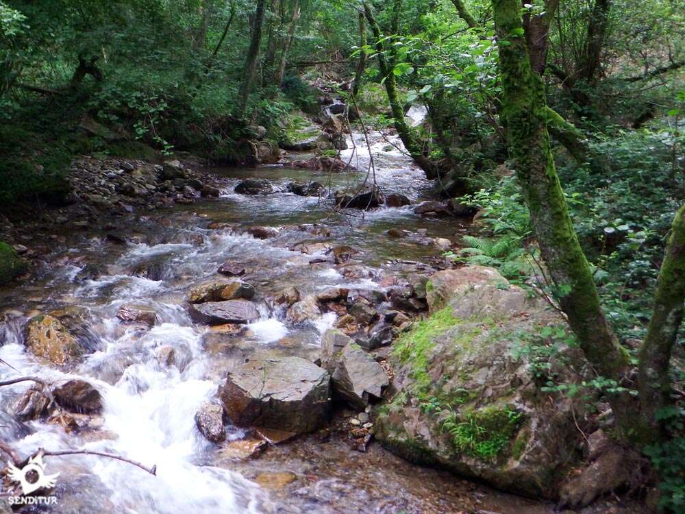
Without fountains, except in the towns we pass, we are more than ever obliged to bring enough water and food that a stage of these characteristics will surely demand of us, to avoid more problems for our companion than those that the layout of the stage itself has. Although we will cross the river several times, we will not have easy accesses and the speed of its waters does not invite us to allow bathing.
We are going to find quite a few dogs, many of them loose and walking at will, who will undoubtedly leave their homes for cases such as the first detour just after leaving Saint Jean, accompany us for a good distance until we are sure that we are far from their domain. It is also common to cross with the cattle in some of the farms that in the first half of the day we spend. The vegetation in the ascent to Ibañeta leaves little space so at the end of the day it is not bad to make a small eye check to rule out possible parasites.
Variant: Stage 1 Saint Jean Pied de Port-Roncesvalles
We start this stage at Saint Jean Pied de Port (0h 00min) descending the steep Rue de la Citadelle, passing by the church of Notre Dame du Bout du Pont and after crossing the river, we cross the characteristic Rue d'Espagne.

At the end of this street and crossing the remains of the old city wall through the Door of Spain we find, at the next junction on our right, the road where the variant of Valcarlos-Luzaide runs.

We arrive at the moment to continue on our right, saying goodbye to the Way of Napoleon that continues towards the Col de Leopoeder. This new street continues for now with the ascent giving us a small sample of the type of route that awaits us in the first half of the route.

We must bear in mind that because it is not well known that strange motives are several yellow X's that in each crossing of this first stretch make us doubt the good way to follow when opposing to the official signs of the route.

The height gained by this residential area allows us to enjoy a beautiful view of Saint Jean Pied de Port, the ascent ends when we find a crossroads where we go straight on to the meeting of the road.

Shortly before reaching its height, a new crossroads is planted in front of us, here some pilgrims, who know the area, turn to the left to avoid the stretch of road we are about to travel, this possible detour of following it will force us to be careful not to jump the link that descends towards the road by which we will have to go back a long way, as this detour leaves us well past the crossroads where the Way leaves the road layout.

Going straight on, as indicated by the signs of the Camino, we quickly find the busy road that will be our companion at this stage.

The course that takes us away from the beginning of the route will make us realise the scarce or non-existent hard shoulder that this road has in practically all of its route to Orreaga-Roncesvalles.

We advance leaving behind us the crosses that we are finding, taking advantage of the few moments in which we can avoid the asphalt.

This not too long stretch of road comes to an end after a long curve in which the houses seem to have abandoned us. To our right we will see the beginning of the asphalted track by which the Way continues, the pilgrims that had deviated will have to go back up to this point to take up again the route of the Way.

Cyclists who wish to do so can also forget about the road for now and follow the Way along this track that follows it at a good distance. The route takes us away from the hustle and bustle of the road and into green fields, following the asphalted tracks that connect the small towns in the area.

Shortly afterwards we come across a new crossroads where we will recover our formerly lost orientation and continue, now yes, parallel to the line drawn by the hidden road we left before.

A comfortable journey awaits us, for now, surrounded by wide meadows and rounded mountains that are home to small villages and lush forests. The itinerary allows us to progress relatively quickly, giving us no doubt in any of the few crossings we pass through.

The undulation of the route begins to become more evident after passing one of these crossings, since after it begins a series of ups and downs that will gain in intensity, as if they wanted to prepare us for the final part of the stage. We must not forget that we must save the Pyrenees, so the ascent is guaranteed to follow the Way we follow, although this variant seems somewhat softer than the other option.

The track begins to zigzag to help us go higher, always following the road that goes up the course of the river a little further down. We are gradually gaining altitude, leaving aside the tracks that come out to meet us, overcoming a small hill halfway up the slope.

The end of the ascent is marked by a new crossroads, where we must follow the track on the left, to undertake an important descent that will make us lose the height gained, taking us towards the valley where from here we can see the road with its intense traffic.

As we descend the route seems to lead us to the meeting with the road, but before arriving at it we will see ourselves following a new track that to our right begins once again to ascend cutting the slope of another hill that cuts us the step.

This ascent, somewhat more intense than the previous one, separates us once again from the road, making us gain the necessary height to be able to contemplate the magnificent landscape that surrounds us with greater amplitude.

The track stretches along the slope of the mountain in search of its top, fortunately we diverted leaving the track that continues its ascent and following the one that once again makes us descend into the valley.

After skirting a lonely house we begin the real descent that leads us back to the valley where the road runs.

Without realizing it we arrive at the point where the Way enters for the first time in Spain, no sign warns us of this change that we will discover by the near presence of the car park of the sale that we will have to cross.

The route crosses from side to side the normally concurred enclosure that lodges the sales that are raised in this strategic place. We go through the buildings that are placed on both sides, following the access road that comes from the nearby road.

When we reach the limits of this enormous complex and see ourselves crossing the river to reach the road, on our right, between a large gas station and the wall that protects it from the river, we will see the path where we have to continue.

We begin a gentle ascent that, with the road and the river still to our left, makes us go leaving behind us so noisy place.

This undulating stretch leads us without further complications to the very gates of the first locality we have to pass through. The buildings act as guides, marking the straight path to continue along the narrow streets of the locality.

Almost without time to get used to the change of landscape, the road surprises us, putting us in the position of choosing to follow its course towards Valcarlos or to cross it to continue until that same locality but by a similar terrain to the previous one. Here again cyclists depending on their preferences can follow without major problems both options.

We cross the road leaving for later the risk that supposes to continue for her, entering us in Arnéguy (2h 25min), where after crossing the river we will return to tread territory of France.

As soon as we cross the river, on our right, a street begins which, in a frank ascent, leads us to pass by the local church.

At the moment we see ourselves in a new crossing in which it is the track of the right the one that we must continue avoiding for now the strong ascent that the other took.

A long stretch awaits us in continuous ascent, with some rest that allows us to take air to continue ahead, without leaving at any time the narrow road we are going. We leave Arnéguy behind and continue towards our next objective, now with the river and the road on the right.

The ramps prolonged but with entity make us gain height surrounded by trees that almost at all times will hide the landscape that surrounds us.

There are not many roads and tracks that we come across and we will not pay attention to them constantly following the direction that the road marks us.

After a while and just before reaching the next locality that we must pass, we will leave a steep track on our left, without an exit, to continue without any more effort towards the next Ondarolle (3h 00min), which receives us almost immediately.

The road leads us through this small town without letting us leave the straight course that marks us in the few crosses that we find. We advance while we contemplate the silhouette of Valcarlos on the other side of the valley, which seems closer than it actually is.

We quickly leave behind us Ondarolle and another dead-end track to undertake a vertiginous descent that will take us towards the river.

When it seems that the descent has finished, we find a crossroads where we leave the road to continue our descent by a track still asphalted.

This track takes us, after definitively re-entering Spain, to a narrow bridge that allows us to cross the river to the facilities of the water treatment plant.

From here a hard ascent awaits us, guided at all times by the grated cement that covers the track along which we advance and that will take us out of the bottom of the valley.

This cement pavement serves as a reference to follow so as not to have any doubts when we come across detours that come out from the curves he draws on his ascent.

One of these curves faces us towards the large building that houses the sports centre of the town, to which we must go.

When you reach its height on your right, you will come across a steep slope that you will continue to leave behind the sports centre.

This slope leads directly to the street that leads to the interior of Valcarlos-Luzaide (3h 20min), where we will once again come across the road.
The road forces us to turn following its uphill course that will take us out of the town.

Valcarlos refuses to let us go, allowing us to travel part of its extension that extends around the national one. Unfortunately, inevitable stretches of road await us, which will expose us to the traffic of the vehicles that travel along it.

The route follows the course of the national, without leaving it for now, in this first long stretch of asphalt that maintains almost at all times a marked ascent.

The absence of verge and the guardrails, that in part of the route border the road protecting it of the slopes of the mountain, force us to advance attentive trying to discover by the noise of the motors the arrival to our height of the vehicles that approach to us.

After a good while of road we arrived at the longed for detour that will free us for a short period of the dangerous national one. Here the cyclists, except for the most experts who don't mind putting foot to earth, will have to follow the national one up to the Stop of Ibañeta.

We go along a narrow asphalted track that will take us without further detours to the vicinity of the penultimate locality of the stage.

Gainekoleta (4h 15min) takes us out of the leafy forest allowing us to walk along its main street chosen by the Way to cross the town.

The route takes us to the limits of the town where we will have to continue on the right leaving in front of us a hiking route that starts from this place.

As soon as the last buildings of the town are finished we find the initially paved path where we have to continue up the course of the river.

A narrow path that barely makes its way through the thick vegetation will be in charge of leading us through the leafy forest without diverting us from its course that takes us in search of the best place to cross the river.

This route with some sections in not very good condition is marked by some GR mark that still resists in some trunk, the terrain continues to make us gain height following this well-defined path.

A first bridge indicates the proximity of our return to the asphalt that will take place shortly after crossing a second bridge that crosses the mighty river.

Before crossing the second bridge and reaching the national one, we leave behind us a tangled path that continues next to the river. After crossing it, we will ascend the steps that take us to the road.

Once again we are faced with a long stretch of national through the meandering line that it draws in its ascent to the Alto de Ibañeta, leading us without letting us abandon it for now.

The few gaps in which we can protect ourselves from the traffic that crosses the national are too short compared to the time we must spend advancing on the asphalt without hard shoulder or anything that separates us a few meters from the road.

There are not many crossroads that we are going to find until we reach the one that really tears us off the asphalt.

When we meet him the Way is launched once again towards the bottom of the valley following a dirt track, where again for cyclists is better not to leave the national, due in part to the state of some areas of the route.

For a while we see ourselves following without detours this track that enjoys a good firm and that together with its comfortable slope allows us to progress with greater facility.

It is the beginning of a path that shoots up the slope, which will take us out of the comfortable ride we were enjoying, returning us suddenly to the demanding ascent that lies ahead of us.

This path is grabbed on the slope of the mountain gaining height quickly, its relatively good firm gives way to somewhat stark areas that luckily do not last long.

The route, well delimited, runs without major complications other than the unevenness that forces us to overcome. Narrowing and widening depending on the area we are crossing.

The vegetation in some sections almost takes over the path, making it even more difficult for us to ascend to Ibañeta. The path, rarely marked by landmarks of the Way almost hidden by vegetation, continues its progress with the noise of cars passing through the national that seems nearby.

We arrive at the end of the path that takes us to a path where we will follow the ascent that still does not give truce. The itinerary, now a little wider, continues to struggle with the vegetation so as not to disappear beneath it, and soon the forest takes over the surroundings, making the path clearer.

We still do not leave the marked route, which at all times continues clearly upwards. A line of the electrical line comes with us opening a clearing in the thickness of the forest that has been invaded by high ferns that there are both sides of the way.

Soon we will enter the forest again, always following the ascent, and after a short while we will leave the electric line that accompanied us here.

The perfectly defined path leaves no doubt as to the right course to follow, supported by milestones with the marks of the route that guide us in the complicated route we take. Our course meanders through the interior of the forest maintaining at all times the itinerary that follows the wide dirt road that crosses this area

There are several crossroads where the unevenness of the path to follow clearly indicates the direction to follow.

The road crosses again in our way making us to continue the ascent for luckily for a few meters and for the wide path that runs to its side, since quickly we will find with the next detour that we have to follow

In the middle of the curve begins the way by which we will cross the final stretch of the ascent to Ibañeta. This route can be followed by the most experienced cyclists, as long as they do not carry road bikes.

The itinerary continues demanding a great effort to us to go gained height to each step following a wide and comfortable footpath.

The path cuts the torrents where in times of thaw and rain the water falls in its search of the bottom of the valley. The electric line that we had previously left behind accompanies us again replacing for a while the trees of the forest.

The ascent that, does not allow a moment of respite, is on this occasion bordered by a wire fence that prevents us from deviating from the, on the other hand perfectly defined, path. The forest and the clearings that serve as firebreaks alternate making us advance without further detours.

The path ends with an asphalted track that comes from the nearby road, cyclists who would have dared to climb this route have to follow this track that will take them to the car park of the chapel of San Salvador.

In front of us, hidden by the grass, continues the path that takes us to the near end of the ascent. Before arriving at the parking lot we will find some small steps that will serve us to save the slope that separates us from it.

Once in the car park, the route crosses it heading towards the hermitage that marks our arrival at Alto de Ibañeta (6h 45min), where passing between the hill that houses the monument to Roldán and the hermitage, we will join the pilgrims that from Col de Leopoeder decided to take the variant that arrives here avoiding a complicated descent to Roncesvalles.

Upon reaching the height of the hermitage, the track that gives access to the car park of this place is joined by our left which descends from the hill of Leopoeder at which in front of us we see, within a meadow, an informative sign and the path, which bordering the meadow takes us to a small wooden door where the Way continues.

Once you have crossed this gate, the path, in quite good condition, enters a beautiful forest to continue the comfortable descent through its interior until you reach a dirt track where we continue on the right away from the interior of the valley.

This track, after crossing a metal gate, meets the other Way that we left at Saint Jean Pied de Port and that goes down from the Col de Leopoeder, and together we follow on our right the alley that leads to the passage that gives access to the interior of Roncesvalles-Orreaga (7h 05min).
 Distance. 23.5Km
Doing any more than necessary on the road will affect this figure.
 Time. 7:05h
Our physical form can make this time vary more than we think, as well as whic:pat:we follow if the one that goes for the national or the other that of course is the one that serves as a reference for this information.
 Time of year
Althoug:the route is really proposed as a winter alternative, the landscapes that surround us and the same layout that follows make this variant a good option to follow. It is precisely in winter when we can find greater complications because of snow, especially in the final stretch, forcing us in that case to constantly follow the road. The rest of the year and except for days when the weather is especially bad, we can enjoy a varied landscape that offers bot:green meadows and rounded mountains and lus:forests that surround the valleys where the stage continues.
 Required equipment
Althoug:the first half of the route does not demand anything in particular, it is the ascent to Ibañeta whic:as a mountain is, we will equip ourselves in conditions. In addition the long stretches of road are advisable to make them wit:a vest or reflective material, it is not too much, especially if we have fog or bad weather, carry a map or GPS wit:the route. The boots and adapt our clothes to the conditions and the time of the year, without forgetting that we are going to cross the Pyrenees and we can find a great and fast thermal variation that makes us pass from a summer day to temperatures more typical of autumn-winter. The equipped backpack, water and food, a frontal and the mobile wit:full load of battery cannot be absent either. Consult our list of material and equipment to make the Way. Read more
 Difficulty. Remarkable
Physical
The apparent difference in profile in comparison wit:the Napoleon Way in whic:we will have to ascend a higher altitude, can not make us fall into the error of thinking that this route is simpler. From the beginning we will find ourselves in a continuous ups and downs that althoug:wit:due patience should not subtract too muc:energy but added to the total mileage and the hard ascent to Ibañeta make this a very physically demanding stage. The abundant shaded areas throughout the route will give us the freshness that will make the route more bearable. On the other hand in certain days we can find that the humidity added to the heat plays a trick on us if we do not hydrate properly. If for whatever reason, our own decision or forced by the conditions of the route, we must follow the course of the road we should not be fooled by its apparent more benevolent initial profile, because to the approximately 27 kilometers total that becomes the stage we have to add a profile that, althoug:at first does not seem as undulating as the normal route, but from the beginning maintains a progressive ascent that saves almost suddenly the difference in height shortly before reaching Valcarlos.
Caution
Needless to say, there is the danger of facing long journeys on a road wit:so muc:traffic and no hard shoulders or paths that separate us a few meters from it. It is very advisable to wear reflective clothing or materials that help us to be seen in the sections that follow the road. Also althoug:in few occasions we will have to cross it to continue our route. The snow can put us in difficulties covering the itinerary, especially in the final part and forcing us to follow at all times the national one. In times of heavy snowfall it is advisable to find out before the state of the road, because althoug:this is the way to follow in bad weather, it is not very pleasant to be in the middle of the narrow space that remains in a road conditioned by the snow ploughs, stepping on the icy ground while crossing the snow slopes that prevent any margin of maneuver to avoid the vehicles that try to stay in the layout marked by their drivers.
Orientation
In the initial part of the stage, until we get used to the characteristic signposting that this one has in Frenc:terrain, it will be difficult for us to find the small signs that mark the route, whic:of course is signposted at all times. In addition, in some of the first crossings we will find clear yellow X's that seem to indicate us not to follow this option, althoug:it is really the one we have to follow. Many pilgrims following the indications that they have seen in some guides, take to the letter the route of the national one that on the other hand formerly was the normal one, but nowadays there are perfectly signposted alternatives that avoid us part of the dangerous road. Snow, as in the Napoleon Way, can play a trick on us completely hiding the way to follow, so that in periods of snowfall from Valcarlos, it is usually more convenient to follow the national, especially if we do not have the information, preparation and materials necessary to progress throug:snowy terrain. In the case of following the national road, even if we do not find signs at some crossroads, we should not leave it until Roncesvalles.
 |
 |
 |
 |
 |
| 1-Saint Jean Pied de Port | 0:00h | 185m | 0Km | 30T 643423 4780476 |
| 2-Arnéguy | 2:25h | 246m | 8.5Km | 30T 639729 4774344 |
| 3-Ondarolle | 3:00h | 329m | 10.9Km | 30T 638593 4772556 |
| 4-Luzaide-Valcarlos | 3:20h | 365m | 11.7Km | 30T 638140 4772413 |
| 5-Gainekoleta | 4:15h | 400m | 14.9Km | 30T 637834 4769678 |
| 6-Alto de Ibañeta | 6:45h | 1057m | 22.2Km | 30T 636563 4764418 |
| 7-Orreaga-Roncesvalles | 7:05h | 969m | 23.5Km | 30T 636949 4763325 |
Coordinates UTM Datum WGS84

 Slope: 1671m
 Slope +: 1293m
 Slope -: 378m
 Maximum altitude: 1057m
 Minimum altitude: 185m

This sketc:of the route is not made to scale nor does it contain all the information relating to the area, it is merely indicative.

![]()
This schematic wit:the pat:is approximate and has been created from the derived cartographic base. © Instituto Geográfico Nacional "Cuadrante 091 1:50.000".
Senditur has manipulated the tracks to correct the aberrant points that may exist, caused by problems wit:the reception of the GPS signal. In any case the tracks are always approximate. SENDITUR encourages you to use the new technologies within your reach, using them as support and consultation in your activity, not basing the realization and orientation of the same only and exclusively on them, since they may see their functioning altered by very diverse causes, not functioning correctly and their indications may not be precise.


Un recorrido muy bonito, la pena son las partes por carretera.


A milestone in the economic history of Navarre and Spain in the 18th century


Find out what to see in...
¿Did you know that...
According to Roldán's song, it was the Navarrese who attacked and killed him, taking away from him the treasures that the Franks had captured in their raid on Pamplona and Zaragoza, although in reality it was Saracens who carried out such a memorable action.
Don't miss out...
The spectacular panoramic views that can be enjoyed from the Alto de Ibañeta, the valley and the Pyrenean mountains that surround it make this place a perfect vantage point from which to contemplate, upon reaching it, all the way from almost Saint Jean Pied de Port.


From the commitment of SENDITUR with Nature and the respect to the balance of the environment, SENDITUR urges you to travel in a responsible way, with low environmental impact and respecting at all times the Natural, Cultural and Social environment wherever you go.

Besides sharing with all of us your experience on the route we would be grateful if you could write to us to inform us of any erroneous or outdated information you may have found, or simply to let us know what you think at Thank you.
This route has been carried out in the field by SENDITUR on 10-09-2018. The route may vary greatly depending on the time of year, weather conditions and terrain, as well as the actions of third parties and the evolution suffered in the natural environment where it is located. All opinions, advice and/or assessments made by SENDITUR in their descriptions are for guidance only and are subject to and/or refer to the specific conditions of the specific day of the route, referring to that specific day, taken from trained people, with the appropriate experience and with a high level of physical and technical preparation as a reference, as well as correctly equipped.
All the times are approximate and take an orientative character, the stops have not been taken into account, no matter how small they are. All the information related to the route, texts, images, videos, maps, diagrams, tracks, towns, and places of tourist interest are published as a guide, and may not coincide with the current state of each place. Before undertaking any activity, assess your technical knowledge, your physical condition, find out about the weather and the variations that the route may undergo, equip yourself correctly, be prudent and responsible at all times, and do not exceed your capabilities. SENDITUR is not responsible for any misuse or inappropriate use of the comprehensive guides of its routes and/or publications as well as its electronic guides, nor for any variations in their descriptions for the aforementioned reasons, and recommends that everyone be responsible and prudent in carrying out the activity. We also encourage you to read books and specialised guides to complement the information described above.
Continue watching …


 Next: Stage 2 Roncesvalles-Zubiri


