Welcome to SENDITUR.COM · paths · routes · tourism


![]() Difficulty-Medium
Difficulty-Medium
![]() 5:40 h.
5:40 h.
![]() 24.8 km.
24.8 km.
![]() Difficulty-Medium
Difficulty-Medium
![]() 5:40 h.
5:40 h.
![]() 24.8 km.
24.8 km.
From the top of the Leonese plain, in Reliegos, we contemplate the wide valley of the Esla to which we will descend to direct us, passing by Mansilla de las Mulas, towards the great city, Leon waits for us to show us all its beautiful corners loaded with history. The Way of Saint James draws a route that from the first steps will let us glimpse the rich artistic and historical heritage that awaits us at the end of the day. The extensive fields of cultivation little by little are giving way to the buildings and the land practically flat before becomes something wavy as if it wanted to go preparing us for what it waits for us in later days.

This stage 17 Reliegos-León of the French Way of 24,8 Km begins in the quiet and collected Reliegos, descending almost imperceptibly a few meters towards the valley where we will meet Mansilla de las Mulas. At our entrance to the town we are welcomed by a cruise ship that houses a sculpture that recalls the effort of the pilgrim on his way to Santiago. Mansilla de las Mulas, an ancient village with a deep-rooted Jacobean tradition, housed four pilgrim hospitals and seven churches within its walls, dating from the 12th century. Several sections of the high wall resist from those times, which, next to the Puerta de la Concepción, show us the importance and importance that this town had. The squares with the arcades invite to a rest contemplating the beautiful corners that they form. The 13th century church of San Martín surprises us with its high tower that dominates almost the entire town.

Before saying goodbye to Mansilla de las Mulas we must not forget the 15th century convent of San Agustín, which houses the remains of the Villafañe family. Our departure from the town is made by the bridge of the twelfth century that crosses the river Esla thus heading towards Villamoros de Mansilla, a small town that well deserves the short detour to know it. The river Porma and the medieval bridge that crosses it will be our next stop shortly before arriving at Puente Villarente. The route then searches for parcel clues that will avoid us the transit by the national road, taking us to pass by Arcahueja, and its church of Santa María. From here a short ascent to a small hill will allow us to contemplate León for the first time. Valdelafuente, on one side of the French Way, is the gateway to the city, from now on the asphalt monopolizes almost everything, forcing us to cross the network of roads that arrive and leave the big city.

Puente Castro and its 18th century bridge that serves as the León border, next to the river Torío, will serve as the gateway to the city. The route of the Way of Saint James through the initially boring capital soon becomes interesting making us pass by the beautiful church of Santa Ana. This old Roman military camp of the Legio VII Gemina houses an impressive collection of cultural heritage that is gradually showing us our way. We cross its walls through the Puerta Moneda and soon find Our Lady of the Market of the twelfth century. But not everything in León are historical buildings, the gastronomy and more specifically the Barrio del Húmedo and its network of streets will allow us to enjoy the treatment with the people of León, accompanied by their typical products. We cannot forget of course the Cathedral of León of Gothic style or the Romanesque Basilica of San Isidoro that together with the Renaissance Hospital of San Marcos complete part of the rich patrimony that León offers us.
An ideal stage for getting up a little early to be able to have enough time to enjoy all that León has to offer, even if it's only for a few hours, which is not enough for everything there is to see or do in this spectacular city.
Perfect day to recover strength and enjoy every corner we pass through. A terrain in very good condition that combines with a part by asphalt that should not pose any problem. Attention that if to the sections by road and of course to the transit by Leon since we all know what it supposes the passage of a great city with our companion.
In this stage water should not be a problem as we will find fountains and rest areas as well as water points in each locality. Without many shaded areas on hot days we don't have to forget to replenish our water supplies in every place we pass.
The industrial and agricultural pavilions through which we pass are very common to be the home of the corresponding guard dogs. Although these dogs usually are in closed enclosures we will have to walk attentive. We will also pass by private recreation estates that welcome a large representation of various animals, such as some nice geese. As always and in this case increased by the number of populations that we pass, we will find affectionate and not so affectionate dogs to our step by them.
 |
 |
 |
 |
 |
 |
 |
 |
 |
 |
 |
| Reliegos |  |
|
|
| | |||||
| Mansilla de las Mulas | |
|
|
|
|
|
|
|
|
|
| Villamoros de Mansilla | | |
||||||||
| Puente Villarente | |
|
|
|
|
|
|
|||
| Arcahueja | |
|
|
| | |||||
| Valdelafuente | | |||||||||
| Puente Castro | |
|
|
|
|
|||||
| León | |
|
|
|
|
|
|
|
|
|
Reliegos (0h 00min) is the starting point of this stage, more specifically the Royal Street that we arrived at the locality yesterday is the one that will lead us through it.

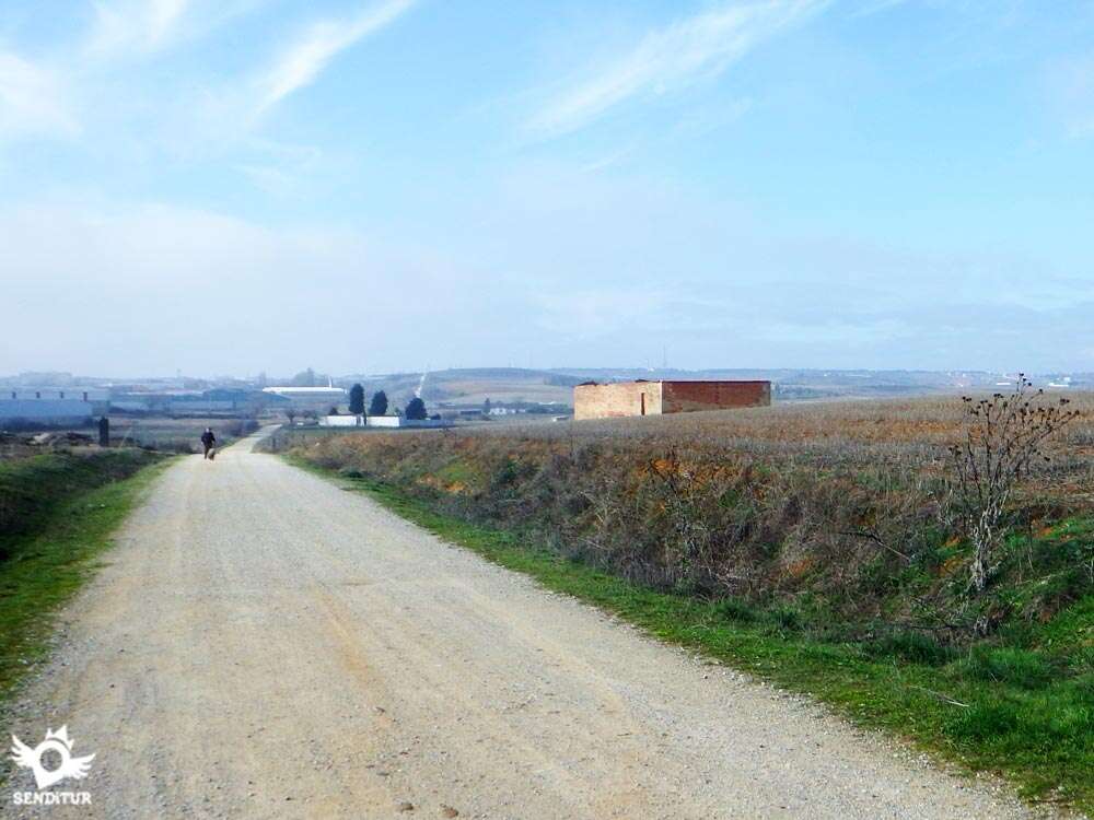
Following this street without detours we leave the town leaving behind a few streets. At our exit of Reliegos, shortly after passing some agricultural pavilions we find a small rest area, the fronton and the beginning of the andadero that will take us to Mansilla de las Mulas.

This long stretch of andadero runs along the road through the fields and the paths that lead to them.

On reaching the Mansilla de las Mulas recreational area, just before this locality, the tree-lined andadero ends giving way to two options in front of us, a dirt track or the road that, by means of a bridge, crosses the nearby road.

In order to avoid having to cross this busy road, it is best to continue along the road, leaving the dirt track on your left and another small road on your right that leads to the national road.

Once this short stretch of road has been cleared and on its left side there is a hard shoulder for pilgrims to pass through and after passing an irrigation channel, the Way goes into the first buildings of the municipality without deviating.

This access road to the town centre becomes the first street we step on from it and takes us to the square where there is a cross with the sculpture of the pilgrim.

Here we will be forced to look for the best place to cross, giving us the possibility of following the route a few steps to our left taking directly the nearby Avda. Constitución to continue by this new possibility, entering Mansilla de las Mulas (1h 20min). Or following the original Jacobean route, continue straight across the road and passing through the old gate of the wall to join with the Avda. Constitución a little further on and together we continue to the Plaza Pozo where we will join the pilgrims who come here following the variant of the Pilgrims' Causeway.

Already in the valley of the river Esla, this long Avda. guides us to him, to the outskirts of Mansilla de las Mulas another typical cruise marks the point where leaving behind the locality we cross the bridge over the river Esla.

As soon as you cross the bridge, on your left you will see another section of andadero that runs straight parallel to the road.

Continuing along this road, rather than andadero, we come across the national road that will replace the road that accompanied us from our departure from the town.

This path, flanked on one side by the already well-known national road and on the other by the inseparable crop fields, advances following the straight course marked by the nearby road.

After skirting some lonely houses that stand in our way, we are forced to cross the road that leads to the monastery of Villaverde Sandoval, to continue along the path that will lead us to the next town.

Leaving behind a few dirt tracks that go into the fields, the road will be our guide in this part of the journey, as the path ends when it meets the first buildings of Villamoros de Mansilla (2h 15min), forcing us to leave the national road to travel from one side to the other this population.

With the caution required by any stretch of road, although this has a generous hard shoulder, we are advancing through Villamoros de Mansilla, this part of national, if we want, we can avoid it if we dare to enter to know the population.

Once we have bid farewell to Villamoros and after a longer stretch than would be desirable on the verge of the national, we find again the track by which we continue the itinerary next to the road.

This relatively short stretch of path ends when you turn left when you come across bushes blocking your way. The route then leaves a disused stretch of road where we continue passing a rest area.

This disused road actually serves as access from the national road to this area where we are, but we before reaching the national we have to follow a path that continues along its side. This path leads us to a wooded area that hides the river Porma.

Formerly the French Way went out to the national road and crossed the medieval bridge that crosses it, but now given the traffic that supports this bridge and the narrow passage that has for pedestrians has built a pedestrian bridge that in addition to crossing the river allows us to contemplate this impressive bridge.

After crossing the river, our route follows a path that leads us to the last mouth of the bridge. As soon as we pass under the bridge through this mouth, we see on our left a ramp that takes us up to the national one, thus avoiding us having to cross it.

Once on the road we find the beginning of the sidewalk that will take us to Puente Villarente (2h 40min).

The passage of the Way of Saint James through this locality follows the route of the bustling national road, leaving behind all the crosses that leave our path. The long journey through Puente Villarente will take us to pass, on the outskirts of the town, next to a petrol station on the other side of the road.

A short distance after this gas station we find on our right the beginning of a dirt track where we have to continue.

This dirt track follows parallel to the national one, but with enough distance, towards a great electric tower, next to some pavilions. When we reach this tower we go straight on passing a small bridge over a canal, without deviating from the main track that crosses there with a couple of paths.

Located between the national road and the motorway, our track leads to an industrial area and a crossroads with the road to Sanfelismo.

The itinerary crosses this road and continues its course along the track that meets the freeway. On reaching its height, a tunnel allows us to pass under it, and as soon as we leave it, turn left and show us the next objective of the day.

The track reaches a rest area, a demanding ramp is all that separates us from Arcahueja (3h 40min), which we reach after overcoming it.

The French Way arrives at the square of this locality and without deviating it continues crossing it with its straight course.

Our quick passage through Arcahueja takes us back to the wide dirt track that extends as far as the eye can see.

This part of the route runs between the fields that accompanied us in previous stages and the industrial pavilions that mark the proximity of a large city.

Without deviating in the few paths that go out to our encounter we arrive until the track that to our left would approach us, to follow it, until the near Valdelafuente (4h 00min).
We leave the track that leads to Valdelafuente to go straight on and start a hard slope that is made more demanding in part by the absence of them in the previous stages.

After this uncomfortable slide to which we were no longer accustomed, the track ends on a road, in the middle of the industrial estate. Now the route, turning to the left, continues along this road in the direction of the national road.

When you reach it, the road where you are going is forced to turn right and continue ascending parallel to the national road, we have to do the same and continue skirting the pavilions that are in this section.

Just at the end of the last pavilion that we have on our right begins, in front of us a wide trail that will prevent us from following the road. Continuing along it, soon after, in front of us we see a striking footbridge where our route leads us.

The trail ends just as we reach this footbridge where we cross the busy access road to Leon, to continue our way to the other side.

On the other side of the footbridge, without having to go down to the road, there is a andadero that takes us away from the traffic of this road.

This andadero, which we will not have to leave at any time, brings us closer to another walkway where we cross another of the communication knots that stand in our way.

Once again we return to the edge of the dual carriageway, a few metres further on the andadero we are going along gives way to a road that will take us to Puente Castro.

The road turned into a street descends smoothly, taking us without detours to the interior of Puente Castro (5h 00min).

When arriving next to the church of Puente Castro we have to leave the straight main street that leads to the historical bridge over the Torío river, to descend by the Victoriano Martínez street that starts on our left.

This detour takes us in search of a pedestrian footbridge since pedestrians are not allowed to cross the other bridge.

This street takes us to a promenade next to the river, where in front of us we can see the footbridge by which we will cross to the other bank. Once on the other side of the river, the route continues straight out of the park between two houses and reaches the street where, turning right, it takes us back to the straight avenue that we have to follow.

We left the bridge behind us to cross the endless avenue crossing all the streets that cross it.

When you reach a roundabout the French Way goes straight on, so we have to cross the street where the old national 120 passes to be able to follow it. Once again we follow the itinerary of this new avenue that takes us to pass next to a square where it joins another avenue.

Without detours and always if possible by the sidewalk of our left, shortly after joining with this great avenue we arrive at the square of Santa Ana, which we will identify by the grove that almost hides from our view the church that gives it its name.

At this point the pilgrims who, for whatever reason, wish to do so can continue straight on the avenue and without turning off until they reach the promenade next to the river Bermesga that will take them directly to San Marcos and the exit to the Way of Santiago de León.

The rest have to cross to the other side of the avenue and continue a few meters more by the wooded square to reach the beginning of Barahona street. This street takes us to Puerta Moneda, the entry point of the French Way in the historic centre of León.

From here, going straight on along Puerta Moneda street first, and then Herreros, we arrive at the crossroads where the convent of the Franciscan Mothers is located.

The route by León is, as could not be otherwise, plagued by the various signs that lead to the different hostels we have available, so the itinerary may vary depending on where we go.

From here, the Way of St. James continues straight on Calle Rúa. There is little separating us from the end of this stage.

The street leads us to the Palace of the Guzmanes where we have to follow the street Ancha on our right ascends to the Cathedral of Leon (5h 40min), where this route ends.

 Distance. 24,8Km
Our destination within the city of León determines the final distance to be covered.
 Time. 5:40h
A relatively short stage that should allow us to have the necessary time to know and enjoy León. Every entrance of the Way to a great city is complicated by the great number of possibilities that are offered to us and that can extend the time that we need to cross it, reason why it is interesting to know exactly where we want to go.
 Time of year
The proximity between the different towns throug:whic:we pass and the entrance to a large population centre mean that the landscape does not vary too muc:from one period of the year to the next. The winter is usually quite cold and this is noticeable in the early hours of the morning wit:strong frosts that leave their frost in fields and localities. Against the summer and the proximity of the asphalt wit:its dense traffic make this simple stage can become heavier than you would expect.
 Required equipment
The good terrain we pass by at the end of the stage allows and even advises to make it wit:a comfortable footwear leaving the boots resting hard. Of course this is not an excuse not to equip ourselves wit:shoes and clothing for the time of year and weather conditions, in addition to the inseparable elements of protection against the sun. We can not miss the camera because the stage will give us a beautiful tour throug:the history of these lands. Consult our list of material and equipment to make the Way. Read more
 Difficulty. Medium
Physical
A simple route without too many demands, except on a couple of ramps that, unaccustomed to slopes due to the layout of previous stages, may seem harder than they actually are. Ideal stage to recover energies and enjoy the afternoon in León. In addition, the great number of rest areas and the proximity between the localities of the stage makes it possible for us to take the day wit:tranquillity and recover from past efforts.
Caution
The passage throug:the localities and the short stretches of road are the places where we have to pay more attention, even more so when we come from previous stages where the, in theory, safe andadero has marked muc:of the route. Pay attention to the crossroads as the traffic is intense as it is in the surroundings of a large city. Althoug:for years the bridge in Villarente has been crossed, now the layout of a pedestrian footbridge makes it more advisable to use it whenever possible.
Orientation
Magnificently signposted, it is the excess of signs, especially in León, that show us the route to the different hostels, whic:can most mislead us, althoug:in almost all cases these detours once they reac:their destination have the corresponding signs that guide us to recover the Way. The entrance to the big city, althoug:heavy, is frankly easy to follow and to the marks of the Way we have to add the tourist signs of León that can also help us.
 |
 |
 |
 |
 |
| 1-Reliegos | 0:00h | 825m | 0Km | 30T 306557 4704939 |
| 2-Mansilla de Las Mulas | 1:20h | 798m | 6.1Km | 30T 301330 4707988 |
| 3-Villamoros de Mansilla | 2:15h | 795m | 10.6Km | 30T 299291 4711977 |
| 4-Puente Villarente | 2:40h | 812m | 12.7Km | 30T 298004 4713365 |
| 5-Arcahueja | 3:40h | 860m | 16.5Km | 30T 295148 4715760 |
| 6-Valdelafuente | 4:00h | 873m | 18Km | 30T 293736 4716227 |
| 7-Puente Castro | 5:00h | 831m | 21.7Km | 30T 290631 4717383 |
| 8-León | 5:40h | 847m | 24.8Km | 30T 289365 4719502 |
Coordinates UTM Datum WGS84

 Slope: 385m
 Slope +: 197m
 Slope -: 188m
 Maximum altitude: 885m
 Minimum altitude: 795m

This sketc:of the route is not made to scale nor does it contain all the information relating to the area, it is merely indicative.

![]()
This schematic wit:the pat:is approximate and has been created from the derived cartographic base © Instituto Geográfico Nacional "Cuadrantes 194, 195, 161 y 162 1:50.000".
Senditur has manipulated the tracks to correct the aberrant points that may exist, caused by problems wit:the reception of the GPS signal. In any case the tracks are always approximate. SENDITUR encourages you to use the new technologies within your reach, using them as support and consultation in your activity, not basing the realization and orientation of the same only and exclusively on them, since they may see their functioning altered by very diverse causes, not functioning correctly and their indications may not be precise.


Sistine Chapel of Romanesque Art, palatine temple of the kings Fernando I and doña Sancha


Find out what to see in...
¿Did you know that...
Not far from Mansilla de las Mulas is the Monastery of San Miguel de la Escalda, this temple is Mozarabic style and was built around 915 on the remains of an ancient Visigothic hermitage destroyed by Muslims in the eighth century. At present the Mozarabic church is preserved with its characteristic and distinctive portico made up of twelve horseshoe arches, the tower at the head and a Romanesque chapel.
Don't miss out...
The Basilica of San Isidoro, one of the most important exponents of the Romanesque style of the lions, houses a museum that shows the royal pantheon that houses the tombs of the kings of León as well as other works of incalculable artistic value.


From the commitment of SENDITUR with Nature and the respect to the balance of the environment, SENDITUR urges you to travel in a responsible way, with low environmental impact and respecting at all times the Natural, Cultural and Social environment wherever you go.

Besides sharing with all of us your experience on the route we would be grateful if you could write to us to inform us of any erroneous or outdated information you may have found, or simply to let us know what you think at Thank you.
This route has been carried out in the field by SENDITUR on 29-09-2018. The route may vary greatly depending on the time of year, weather conditions and terrain, as well as the actions of third parties and the evolution suffered in the natural environment where it is located. All opinions, advice and/or assessments made by SENDITUR in their descriptions are for guidance only and are subject to and/or refer to the specific conditions of the specific day of the route, referring to that specific day, taken from trained people, with the appropriate experience and with a high level of physical and technical preparation as a reference, as well as correctly equipped.
All the times are approximate and take an orientative character, the stops have not been taken into account, no matter how small they are. All the information related to the route, texts, images, videos, maps, diagrams, tracks, towns, and places of tourist interest are published as a guide, and may not coincide with the current state of each place. Before undertaking any activity, assess your technical knowledge, your physical condition, find out about the weather and the variations that the route may undergo, equip yourself correctly, be prudent and responsible at all times, and do not exceed your capabilities. SENDITUR is not responsible for any misuse or inappropriate use of the comprehensive guides of its routes and/or publications as well as its electronic guides, nor for any variations in their descriptions for the aforementioned reasons, and recommends that everyone be responsible and prudent in carrying out the activity. We also encourage you to read books and specialised guides to complement the information described above.
Continue watching …
 Previous: Stage 16 San Nicolás del Real Camino-Reliegos
 Next: Stage 18 León-Hospital de Órbigo


