Welcome to SENDITUR.COM · paths · routes · tourism


Stage 16b Calzada del Coto-Mansilla de las Mulas
The Pilgrims' Causeway
![]() Difficulty-Remarkable
Difficulty-Remarkable
![]() 7:35 h.
7:35 h.
![]() 32.9 km.
32.9 km.
The Pilgrims' Causeway
![]() Difficulty-Remarkable
Difficulty-Remarkable
![]() 7:35 h.
7:35 h.
![]() 32.9 km.
32.9 km.
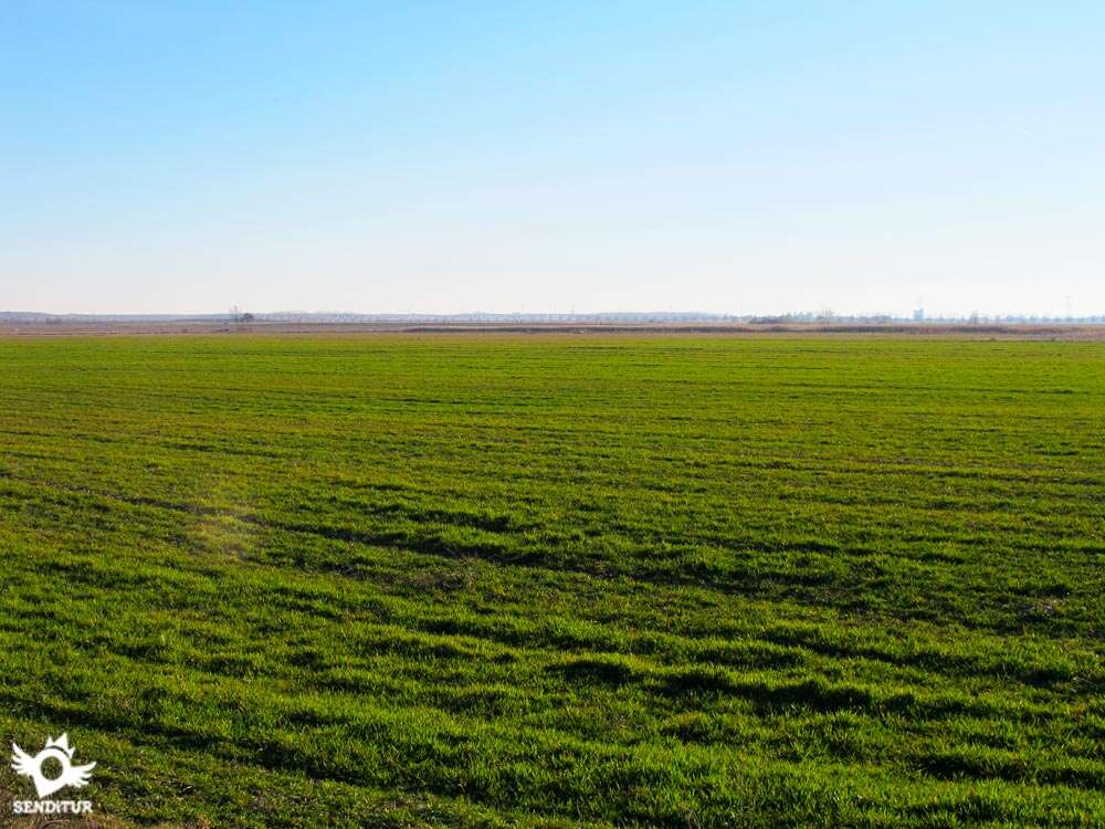
This ancient Roman route, more than 2000 years old, will take us through the Leonese plateau from Calzada del Coto to Mansilla de las Mulas in the Esla valley, at the gates of León. A wide moor where the fields of cultivation are mixed with the low forest of oaks and rebollos that next to the silhouette of the mountains of the Cantabrian Mountain range to the north, they do that changes in part the landscape that accompanied us until here in previous stages. The Roman road used since the Middle Ages as a pilgrimage route to Santiago de Compostela crosses the peninsula from East to West forming part of an efficient communications infrastructure that was used for years to transport various goods, powerful armies and becoming the Royal Way.

The stage 16b Calzada del Coto-Mansilla de las Mulas with 32.9 km that leaves the French Way in the detour towards the Via Trajana, which is a few kilometers from Sahagún, follows the layout of the Roman road that linked this city with Astorga. In fact, there are several Roman roads that shared this part of the route through which this stage of the Way of Saint James passes. The Via de Italia in Hispanias, which from the camp of the Legio VII Gemina (León) crossed the entire north of the peninsula to, crossing the Pyrenees of Girona, reach Italy. Or the Asturica Terracone roads, from Astorga to Tarragona, passing through Zaragoza. The well-known Hispania in Aequitania ab Asturica Burdigalam, between Astorga and Bordeaux, passing through Pamplona, are some of those that share an itinerary through these lands. From Calzada del Coto, where we will pass next to its hermitage of San Roque, we will undertake a quiet route that will lead us between holm oaks and cultivated fields to the Fountain of the Pilgrim.

This variant is known by the Pilgrims' Causeway because of the use they made of it to get to Santiago and that still conserves in some of its sections samples of the Roman firm and engineering that constituted this important way of communication that was used for many years by the settlers of the Iberian Peninsula and their conquerors. Calzadilla de los Hermanillos, allows us to know how these roads were structured and the ingenious systems that were used in them, all this can be seen in the park next to the church of San Bartolomé of the sixteenth century houses a beautiful exhibition of remains of the Roman road. Already placed in the skin of the walkers who walked these roads we will say goodbye to the town not before passing by the chapel of Dolores of the fifteenth and sixteenth centuries, beginning then a tedious stretch of road that will take us to the junction with the detour to El Burgo Ranero, where we can choose to divide the day or go straight on the dirt track that begins to show its old firm. A long stretch with the nearby railway company will lead us to the next junction where we will have the possibility of taking the detour to Villamarco, or continue to meet the most visible remains of the Via Trajana.

A soft but undulating terrain hides from us what is yet to come, showing us a horizon that is almost near, but which in reality holds a wide valley to which we will have to descend. On our arrival at the Reliegos detour, after crossing the Valdearcos stream and an impressive irrigation channel, we will have the chance to join the French Way, turning towards this town and together we will head towards Mansilla de las Mulas or follow the course of the Roman road that descends towards the valley of the River Esla in search of the best place to cross it. This part of the route goes along a wide dirt track between cultivation fields, taking us to the vicinity of Mansilla de las Mulas, which we will reach after crossing the national road, entering the town through the Arco de la Concepción, one of the gates of the wall that protected this village. Mansilla de las Mulas is the final point of this stage, which we reach after passing by the church of San Martín from the 13th century, where shortly afterwards we will find the French Way once and for all.
This stage offers us the possibility of organizing it in our own way so that we do not miss one of the areas with the greatest history of the whole Way. For this we have the possibility of accessing by detours to the localities that are in the route of the French Way, that yes, without signaling in some of the cases these detours but without major complications to follow them, allowing us to finish the stage for example in Reliegos and from there to take again the usual route, or to divide it doing night in El Burgo Ranero.
Long but entertaining route in which different types of road surface are alternated and that allows to enjoy. We must not forget that the same inconveniences that we will find ourselves have to be transferred to our companion, the distance of the stretch without localities, the absence of shady areas and the heat, which at certain times of the year endures this area, make it harder than expected. Attention to the stretch of road, is quite long and has no hard shoulders, we also have to be attentive to cross the national which usually has enough traffic.
In the first half of the route is where more points of water will find to concentrate in him the localities and the few sources of the route. From Calzadilla de los Hermanillos onwards we only have to count on the provisions that we can carry since we will not find places where we can replace them, being the area most exposed to the sun and it goes without saying that the water channels are not suitable for bathing because of their dangerousness.
We pass through a moor that is a hunting reserve, so in season, it is usual to meet the hunters with their dogs, otherwise, except some agricultural pavilion where some troublemakers dogs will come out to meet us the solitude of this epata is the usual tone.
Variant: Stage 16 San Nicolás del Real Camino-Reliegos
A few kilometers after having crossed Sahagún we arrive at the crossroads where we leave the French Way to take the Detour of the Via Trajana (0h 00min).

It is in this place, following the road on the right that crosses over the Camino dual carriageway, where we immediately arrive at Calzada del Coto (0h 10min).

At the entrance to the town we find three streets, we must follow the Royal Street, which is just the one in the middle of the others.

Leaving to our right a small park, this street will make us the guide for the population. Calzada del Coto could be said to be the starting point of the variant we are about to cross. Following the Real street that will take us step by step out of the town, soon the houses give way to a wide asphalted road. A few metres after leaving the town centre we find ourselves, just where the asphalt leaves the reddish earth, with a bifurcation.

The track to the left of following it would return us to the French Way, option enabled for all those who decided to make a stop in the Way in Calzada del Coto and then continue along the usual route. This link takes us to the crossroads of tracks where, following the one on the left, we cross a bridge over the Camino dual carriageway and then join the andadero.

Leaving the track that would take us to the andadero our French Way continues for the option of the right of the two that are posed to us to the exit of Calzada del Coto. A wide dirt track with very good firm that passes next to some agricultural pavilions and goes away in the horizon.

An extensive moor extends around us, allowing us to observe not too far the train track and the bridge we will use to cross it.

The Way of St. James follows the main track at all times, leaving behind the paths that connect the fields we pass through. Once we have crossed the train track, we leave on the right a track that borders a forest of holm oaks and, on the other side, we cross the limits of this forest.

To our right we can contemplate, weather permitting, the silhouette of the mountains that form part of the Cantabrian Mountain Range. We continue along our track, which maintains its width and characteristic colour, alternating on each side with holm oaks and fields that take turns to make the route more interesting.

The itinerary, with a gentle undulation, makes us gain a few meters of height almost without realizing it, crossing us with some path that comes out to meet us and that we do not have to pay attention.

Some solitary buildings mark us almost the intermediate point of this first stretch. The sinuous layout of the track, in comparison with the andadero, together with the holm oaks and groves that we meet, make this part of the route entertaining.
Shortly after passing by the buildings of Valdelocajos we arrive at a wooded area where the Pilgrim's Fountain is located (1h 25min), an ideal place to rest and take advantage of the coolness offered by the summer days.

The track regains height and travels between small hills on the way to the next town we will pass. Just as we go up one of these hills, Calzadilla de los Hermanillos (1h 50min) appears in front of us, which we reach quickly.

The track we brought takes us directly to the main street through which we cross the town.
We have to be very conscious of the long stretch that we are going to face, they are 24 km without passing through any town, unless we divert towards them in some of the links, facing the distance that from that place still separates us from them.

The main street stretches along the town, leading us through it and allowing us to get to know part of this historic town.

Leaving behind us a good number of crossroads with other streets we come to the meeting of a road that reaches Calzadilla de los Hermanillos. Going straight on we say goodbye to the town to face a long stretch of road.

With no hard shoulders and few possibilities of avoiding asphalt along any trail or path parallel to the road, we follow this part of the itinerary that offers us beautiful panoramic views thanks in part to the absence of obstacles.

The route, in constant but easy ascent, leads us to cross an irrigation channel to go past a pine forest. Without leaving the road under any circumstances, as it sets the course for us, we head towards the first option to deviate from this part of the stage.

Shortly after crossing again an irrigation channel that is curiously the same as the one we crossed before, we arrive at a crossroads where there is the detour to El Burgo Ranero (2h 35min).

If we want to go from here to El Burgo Ranero, from which we are approximately 3.4 km apart, we must take the left road that after passing over the railway will take us to the town. Once there we can continue along the andadero or retrace the route to continue along the Roman road.

The French Way goes straight on along the dirt track that starts on the other side of the road and runs along the wide moorland almost entirely occupied by fields.

This part of the route shows us the pavement that the old road had, making our passage through it more interesting, as well as something more uncomfortable due to the large amount of cobblestones and loose stones that make up the terrain we walk on.

Once again we don't have to deviate in the numerous crossroads with which we are, the track is leading us by the fields without hardly noticeable unevennesses.

The train track on our left, which used to be far away, has gradually come closer to us until we find ourselves. A few metres later, walking next to it, we reach a new crossroads where the Villamarco turnoff is located (4h 40min).

At this point, if we want to deviate towards this locality from which 2.5 km or so separate us, we will have to leave the Way and cross the railway track on our left, following the track that crosses it and then turn right again and continue with the railway in that hand until the Villamarco stop. Shortly before reaching it, the track on which we are going to turn left to draw almost a straight line to the town, but not before crossing the French Way and the road that accompanies it.

At the crossroads of the detour, the French Way continues, as marked by the signs, close to the train track following a theoretical trail that the vegetation, the water that accumulates in the area and the rubble of the works undertaken have almost covered.

Ignoring the marks of the Camino de Santiago, follow the track that brought us here, which deviates to the right to find a crossroads where we have to turn again and continue on the track on the left that returns to take us parallel to the railroad tracks.

A few steps ahead we join with the trail that shortening this curve leads to the track we are going. The route bids farewell to the tracks, which gradually move away, heading towards a leafy poplar grove.

Without deviating from the paths we are on, we soon reach the surroundings of the Valdearcos stream where one of the few shady areas we can enjoy at this stage awaits us.

From here, a short, but demanding ramp brings us closer to the area where we can best appreciate the characteristics of the Via Trajana.

Our tour continues now with a pronounced ups and downs compared to what we have walked so far. It is flanked on each side by maintenance tracks that do not have to confuse us, as our route just after crossing it continues its course descending a few metres forced by a small stream.

Once again, the wide track leads us along the extensive plain, leaving behind us a solitary path, until the last possibility of variation of the route, the detour to Reliegos (5h 45 min).

This locality, only 1 km away from the crossroads where the detour is located, offers us the possibility of avoiding the final part of the route by taking up the andadero that will take us to Mansilla de las Mulas.

When arriving at the crossing, if we want to go towards Reliegos we will have to continue straight, if on the contrary we decide to finish this variant we will turn aside to the right to undertake a rapid descent that will take us to the wide valley of the Esla.

Once again, on our way we find a large number of crosses in which we should not deviate always following the main track.

The straight and long route of the track between extensive fields will take us to a local road that gives access to the penitentiary center of Mansilla de las Mulas. On reaching this road, the route takes advantage of a dreary path that runs parallel to the road, thus preventing us from walking along it.

This road leads us, leaving behind some crossings, to the national road. Bordering a leafy islet we find the pass that allows us to cross the national, as it is on the other side where a kind of andadero begins.

Shortly after, this short stretch of track leads to Paseo del Elsa, a road that, moving away from the national road, leads us to the last town of the day.

After passing under a bridge we see the remains of the wall and the gateway to the village through which we continue.

After crossing this gate, the Way goes straight on along Concepción street which, without turning off, takes us to Constitución Avenue, in Mansilla de las Mulas (7h 35min), where we will definitively join the French Way and where this stage ends.

 Distance. 32.9Km
This figure, as always, is a guideline, as it will depend on the starting and finishing point of the stage.
 Time. 7:35h
This time is counting since we left the Frenc:Way past Sahagún 4.6 km from this town. The different variables that this stage offers wit:the detours to eac:intermediate locality do that to the calculated time that takes to arrive at eac:detour we have to add something less than 1:in the case of detour to finis:in some of them the day.
 Time of year
It is a route that partly breaks wit:the morphology of previous stages, taking us throug:areas of scrubland that, added to the Roman road, make this an interesting variant to visit at any time of the year. Always bearing in mind that on rainy days we can find a very muddy terrain. In summer wit:some area of shade and lesser influx of pilgrims give it an added attraction for those seeking the calm of the Way.
 Required equipment
We can never lack water and some food and this stage is no exception to the contrary, the distance we have to face without intermediate localities make it essential to replenis:and expand the provisions in Calzadilla de los Hermanillos. We also need sun protection, a hat and sunglasses, as well as the canes that will be of great help to us. To the clothes and footwear according to the time of the year and the meteorological conditions we have to add the camera and the mobile phone wit:battery. The terrain initially allows you to travel comfortably but after the detour to El Burgo Ranero it is advisable to wear boots that protect us from twists or bad footprints. Consult our list of material and equipment to make the Way. Read more
 Difficulty. Remarkable
Physical
This stage is practically flat, but due to the mileage and above all the absence of localities in almost 25 km, it is a physically demanding day. The heat and the absence of shade can harden a route that otherwise would have no more complications. It is not advisable to face unnecessary detours if our objective is to reac:Mansilla de las Mulas, as these would considerably extend a stage of its own length.
Caution
If we cannot usually lack the water and something to eat, in the stretc:from Calzadilla de los Hermanillos to Mansilla de las Mulas or Reliegos it is essential to be well equipped wit:provisions to avoid problems. Also we have to be attentive to the time that we have to confront this part of the route and not to embark too late in it, unless the idea is to divert us to some of the intermediate localities. Attention to the stretc:of road, is without hard shoulders and althoug:it does not have muc:traffic we should not lower our guard. If we decide to take a detour, it is important to take a good look at where we are going so that the next day it will be easier for us to return to the Way we left behind, as there is no signposting. Be careful on rainy days, the type of terrain gets muddy very easily and this can make progress very difficult.
Orientation
Well signposted, except in some of the detours, it is at the exit of Calzada del Coto where the double signposting indicating the track towards Bercianos del Real Camino on one side and that of the proposed itinerary on the other side can cause us our doubts. When we arrive to the surroundings of Reliegos we will also find almost more visible the marks towards the locality than those that indicate the route of the Way. For the rest, the route is well defined and it is the relative solitude or the distance without localities that can make us think that we have been confused.
 |
 |
 |
 |
 |
| 1-Detour Via Trajana | 0:00h | 820m | 0Km | 30T 329043 4694329 |
| 2-Calzada Del Coto | 0:10h | 822m | 0.7Km | 30T 328723 4694923 |
| 3-Fountain of the pilgrim | 1:25h | 860m | 6.9Km | 30T 324277 4699004 |
| 4-Calzadilla de Los Hermanillos | 1:50h | 890m | 9Km | 30T 322643 4700172 |
| 5-Detour to El Burgo Ranero | 2:35h | 902m | 12.5Km | 30T 319306 4700913 |
| 6-Detour to Villamarco | 4:40h | 867m | 21Km | 30T 311539 4704078 |
| 7-Detour to Reliegos | 5:45h | 851m | 25.6Km | 30T 307440 4705323 |
| 8-Mansilla de Las Mulas | 7:35h | 798m | 32.9Km | 30T 301326 4707989 |
Coordinates UTM Datum WGS84

 Slope: 416m
 Slope +: 197m
 Slope -: 219m
 Maximum altitude: 915m
 Minimum altitude: 798m

This sketc:of the route is not made to scale nor does it contain all the information relating to the area, it is merely indicative.

![]()
This schematic wit:the pat:is approximate and has been created from the derived cartographic base © Instituto Geográfico Nacional "Cuadrantes 196, 195,163 y 162 1:50.000".
Senditur has manipulated the tracks to correct the aberrant points that may exist, caused by problems wit:the reception of the GPS signal. In any case the tracks are always approximate. SENDITUR encourages you to use the new technologies within your reach, using them as support and consultation in your activity, not basing the realization and orientation of the same only and exclusively on them, since they may see their functioning altered by very diverse causes, not functioning correctly and their indications may not be precise.


Sistine Chapel of Romanesque Art, palatine temple of the kings Fernando I and doña Sancha

Find out what to see in...
¿Did you know that...
All Roman roads had milinaries or milestone, which was usually a cylindrical column that was placed at the edge of the roads to indicate the distance equivalent to a thousand steps, which corresponded to a Roman mile, approximately 1481 m. These showed interesting data such as the distance to the localities from that point and other texts related to those responsible for the work.
Don't miss out...
In Calzadilla de los Hermanillos, next to its church, there is an exhibition of archaeological remains from the Roman period, showing part of the ingenuity used in the Roman roads. You will also be able to discover the history of this important route used for years by pilgrims on their way to Santiago de Compostela.


From the commitment of SENDITUR with Nature and the respect to the balance of the environment, SENDITUR urges you to travel in a responsible way, with low environmental impact and respecting at all times the Natural, Cultural and Social environment wherever you go.

Besides sharing with all of us your experience on the route we would be grateful if you could write to us to inform us of any erroneous or outdated information you may have found, or simply to let us know what you think at Thank you.
This route has been carried out in the field by SENDITUR on 27-09-2018. The route may vary greatly depending on the time of year, weather conditions and terrain, as well as the actions of third parties and the evolution suffered in the natural environment where it is located. All opinions, advice and/or assessments made by SENDITUR in their descriptions are for guidance only and are subject to and/or refer to the specific conditions of the specific day of the route, referring to that specific day, taken from trained people, with the appropriate experience and with a high level of physical and technical preparation as a reference, as well as correctly equipped.
All the times are approximate and take an orientative character, the stops have not been taken into account, no matter how small they are. All the information related to the route, texts, images, videos, maps, diagrams, tracks, towns, and places of tourist interest are published as a guide, and may not coincide with the current state of each place. Before undertaking any activity, assess your technical knowledge, your physical condition, find out about the weather and the variations that the route may undergo, equip yourself correctly, be prudent and responsible at all times, and do not exceed your capabilities. SENDITUR is not responsible for any misuse or inappropriate use of the comprehensive guides of its routes and/or publications as well as its electronic guides, nor for any variations in their descriptions for the aforementioned reasons, and recommends that everyone be responsible and prudent in carrying out the activity. We also encourage you to read books and specialised guides to complement the information described above.
Continue watching …


 Previous: Stage 15 Carrión de los Condes-San Nicolás del Real Camino
 Next: Stage 17 Reliegos-León


