Welcome to SENDITUR.COM · paths · routes · tourism


Stage 16 San Nicolás del Real Camino-Reliegos
San Nicolás del Real Camino, Palencia![]()
![]()
![]()
![]()
![]() (1)
(1)
The geographical centre of the French Way
![]() Difficulty-Remarkable
Difficulty-Remarkable
![]() 8:10 h.
8:10 h.
![]() 37.9 km.
37.9 km.
San Nicolás del Real Camino, Palencia![]()
![]()
![]()
![]()
![]() (1)
(1)
The geographical centre of the French Way
![]() Difficulty-Remarkable
Difficulty-Remarkable
![]() 8:10 h.
8:10 h.
![]() 37.9 km.
37.9 km.
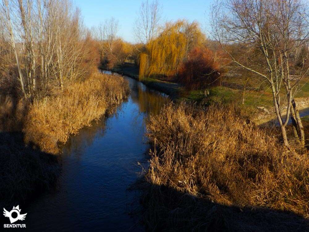
The first steps along the French Way through León took us from San Nicolás del Real Camino, in its neighbouring Palencia, to Reliegos, already in León. The landscape with hardly any variation continues to offer us an extensive horizon of cultivated fields, skipped by rooted localities and sporadic water ponds, home to various birds. The typical constructions of adobe and straw, perfectly preserved in many cases, together with the Jacobean tradition of its people and the trace of history that these lands keep reflected in true works of art both architectural and cultural, make this a beautiful day.

The stage 16 San Nicolás del Real Camino-Reliegos with 37,9 Km begins next to the church of San Nicolás del Real Camino, following some of the possible routes we will direct us towards the next province that crosses the French Way, León. At our entrance in the province of León, the hermitage of the Virgin of the Bridge awaits us, which we reach after crossing its medieval bridge. It is in this place where it seems to be the half of the French Way if we have as starting point Roncesvalles-Orreaga. Sahagún awaits us to show us all the fullness of its art marked by Romanesque-Mudejar style whose most visible examples are the church of San Tirso from the 12th century, the church of San Lorenzo from the 13th century and the Sanctuary of the Pilgrim Virgin from the 13th century. But before that, it is the church of the Trinity from the 16th and 17th centuries together with its sculpture of the pilgrim that welcomes us to the locality. Sahagún grew up around the, in another era, important monastery of San Benito founded in the tenth century and built on the remains of the sanctuary erected to the martyrs and saints Fagún and Primitivo.

The famous Baroque-style Puerta de San Benito, next to the church tower and the chapel, remains of this monastery. Sahagún is also reached by the Madrid Way which goes on pilgrimage from the capital to join the French Way and together reach Santiago de Compostela. The Way crosses the Cea River over the Roman bridge of the town, where the heroic battle between Aigolando and Charlemagne is said to have been fought. The route gives us the opportunity to choose between following different, but historic Ways, the French or the Roman road that follows the Via Trajana and that unite again in Mansilla de las Mulas. The immensity of the Leonese plain and its cereal fields cover the entire landscape, a tireless walk will guide us through these lands passing by small lakes and hidden streams. Bercianos del Real Camino, is the next stop, not before passing by the hermitage of Our Lady of Perales popularly known as La Perala. The locality welcomes us with its characteristic adobe houses, offering us a good place to recover forces.

The endless walk will lead us to El Burgo Ranero, where we can contemplate one of the best sunsets of all the French Way. Villamarco, a cozy town just over 1 km from the French Way, is all that separates us from the end of the day, a wide plain that sometimes gives us some undulating area that varies, at least a little, the landscape. Reliegos, where this stage ends, welcomes us with its curious cellars excavated in the earth, so characteristic on the other hand in this area, we can also visit the parish of saints Cornelio and Cipriano, before going to rest to go tomorrow to León.
The disposition of the localities of the stage means that we can consider it in very different ways, being able to choose to finish it, as a good option, in Villamarco, thus shortening the total distance. Also the good communications that exist with the variant of the Via Trajana, allow us to be able to alternate both to the passage by the localities that they cross.
A demanding stage due to the kilometres travelled and the conditions they will have to endure. Although the terrain through which it passes is in quite good condition and is almost entirely on dirt roads, this is the fact that most problems can pass to the state of the legs of our companion. Good hydration of the pads and be attentive checking them from time to time will avoid many problems. The patucos can be a solution to mitigate the effects of the kilometers, if we are alternating them with periods without them. Attention to the few but dangerous crossings with the roads that we have to make and also in the andadero since it is tremendously easy to go out to the road that, although little, usually has traffic.
Brooks and lagoons are not a good idea to refresh your companion, we do have fountains at some points along the route as well as in the localities, but it is not certain that we will find them operative. Water supplies should not be lacking, replenishing them at every step. Luckily it is possible to find some solitary zones of shade where to give a respite to our friend, the row of trees does not serve much to be too close to the andadero, but less is nothing.
As it is usual to pass the Way through these lands, the fields of cultivation monopolize everything. We will also find some agricultural pavilions near the localities with dogs, generally tied or in closed enclosures. The lagoons are home to a good number of birds that should not be disturbed.
 |
 |
 |
 |
 |
 |
 |
 |
 |
 |
 |
| S. Nicolás del Real Camino |  |
|
|
| | |||||
| Sahagún | |
|
|
|
|
|
|
|
|
|
| Bercianos del Real Camino | |
|
|
|
|
|||||
| El Burgo Ranero | |
|
|
|
|
|||||
| Villamarco | |
|
|
| ||||||
| Reliegos | | |
|
|
Variant: Stage 16b Calzada del Coto-Mansilla de las Mulas
We began this stage following the street La Era, which brought us to the church of San Nicolás del Real Camino (0h 00min).

Leaving this one behind us, we followed the street without deviating, which led us to pass by some pavilions. After wading through the normally dry riverbed of a stream, the route, which has now become a dirt track, ascends slightly until it reaches a crossroads.

It is in this place where two alternatives are raised to us again, to divert us to the right and to continue for the andadero that begins shortly after or to continue straight for the path that took us between the fields of cultivation giving us a beautiful panoramic of Sahagún.

The option of andadero will save us, until the reunion with the pilgrims who follow the path, about 500 m away. But it will force us to walk with the road by our side. If you opt for this option, following the path on the right after a few meters you will find the national road and the beginning of the andadero.

Now we only have to follow it without any more complication than the detour forced by the access junction to the nearby motorway that we will find a little further on. The andadero gives way to a winding track that borders the various roads and bridges that make up this access to return to the meeting of the road and the andadero. There is also a narrow road that continues next to the road and is used by those who prefer to save a few metres.

Once again a long straight will lead us towards the meeting with the pilgrims who opted for the other option when they left San Nicolás del Real Camino.

If we choose to follow the track, it runs through the undulating fields of cereal far enough away from the road, leaving behind us the town and the agricultural pavilions on its outskirts.

Further on, there is a crossroads, and you have to follow the track on the right, which continues up a small hill.

When arriving at the top of this hill we will leave to our right a way that to follow it would take us towards the andadero, just where this borders the knot of access to the highway. In this stretch of the Way, almost without realizing it, we have left Palencia behind to enter the province of León.

The French Way continues straight showing us a beautiful picture of Sahagún, beginning then a slight descent that will take us until a new crossing. It is now when we must continue to the right to, soon, find the national and the andadero where we will continue.

Almost immediately, the Valderaduey River crosses our path, forcing us to leave the Andadero and continue along the national road for a few metres. As soon as we cross the bridge that saves it, we will see that they give us two possibilities again to reach Sahagún.

The first one, along the andadero, approximately 300 m shorter and much more monotonous, follows its straight line, leaving behind as many crosses as it is found, so that shortly after entering the locality it will find itself next to the cereal silo with the other road.

And the second, crossing the national road and following the path on our right leads to the Hermitage of the Virgen del Puente (1h 05min), which we reach after crossing a beautiful bridge that crosses a small stream.

Here we will see two large columns representing the intermediate point of the French Way and where we will pass, to continue on the track that leads back to Sahagún.

Without leaving this track, which passes under the national viaduct, we will reach the vicinity of the town.

The route that has now become a street passes by some pavilions and meets the street where the pilgrims who chose to follow the andadero come from.

Crossing this street, the Way passes by the silo and continues parallel to the train tracks, which we will have to cross a little further on.

After passing by the bullring, the street meets the bridge that will serve to cross the train tracks, where we will continue.

Once the bridge is passed, the route continues along the first street on your right, entering Sahagún (1h 30min).

After a short while, we turn left again in the first street that we find, to exit to Constitución Avenue.
As soon as you arrive at Constitución Avenue, on your right you will see that it splits in two, and you must continue along the street on the left.

This street that we will not leave at any time will lead us through the town, making us gain height, and then undertake a quick descent passing by a small park.

Almost at the end of this narrow street, to our right we can contemplate the beautiful image that forms the tower of the church of San Tirso at the end of a narrow passage between two houses.

Our street intersects with Avda Doctors Bermejo and Calderon, the Way of Madrid joins the French, we can also contemplate the impressive Arch of San Benito.

Cross the avenue and continue straight on, now the road surface combines cement and cobblestones. The route goes out to another street, in front of us the bridge where we will cross the river Cea and a well cared for characteristic crossing of the Way of Saint James.

As soon as you cross the bridge, the andadero begins where you will follow and which stretches out in search of the national road.

This stretch, initially protected from the sun by leafy trees, will finally take us away from Sahagún, taking us to a roundabout that stands in the way of the andadero.

Bordering this roundabout, the route goes on straight on, meeting the national road again. The andadero runs between the national road and a dirt track, which later abandoned us definitively.

This softly ascending section continues parallel to the road, the andadero most similar to a well-defined trail serves as a perfect guide.

Somewhat after leaving behind a small bridge next to a salt deposit we arrive at the end of the andadero in this hand of the road. Crossing the road starts again the andadero, but now taking the national one to our left.

This short section soon reaches a crossroads, where if you continue along the road that crosses the motorway on the right, you would head towards Calzada del Coto, thus taking the variant that leads to Mansilla de las Mulas along the Calzada Romana or Via Trajana.

The itinerary goes straight on crossing this dangerous crossroads so that as soon as we pass on the other side we can contemplate the beginning of a new andadero that awaits us and to which we arrive after descending along a small path that we will take at the end of the guardrail that borders the crossroads.

In front of us awaits a long stretch of andadero flanked by what used to be a red earth track, now asphalted, and by the other an endless row of trees that mark the layout of the path and the limits of the fields.

The andadero, which is lost in the horizon, crosses the fields overcoming all the obstacles, such as the entrances to the farms that accompany us or the occasional solitary stream.

Shortly after passing under the bridge that supports the railroad tracks we arrived at a small rest area. The hermitage of Our Lady of Perales is the next point of passage that we find where we can also take advantage to take a break.

The andadero continues its monotonous run, gradually approaching the next locality of the day. The terrain with its deceptive plain makes us slowly gain height to enter Bercianos del Real Camino (3h 35min), now on the track that reaches the town.

Going straight on along the main street and leaving on the right another one that goes into the town, the French Way goes through this pleasant town.
Without leaving the Main Street at any of the crossroads that leave our path, we will say goodbye little by little to Bercianos del Real Camino.

This street, already turned into a dirt road, will lead us to the beginning of the new stretch of andadero that once again continues next to the track, now a road.

The landscape is somewhat more undulating than the previous one, which does not avoid its similarity to the one we are bringing here, but a lagoon where a bird observatory is located does make it a little more pleasant. A few kilometres after leaving the village we pass a small rest area next to the El Olmo stream.

The route continues without detours leaving to one side and to the other the ways with which it crosses and to our right the lagoon of Bercianos, home of diverse species of birds. After the optional detour to visit the lagoon, our walk takes us to the confluence with the Camino de Santiago highway, which we cross underneath.

As soon as we overcome this obstacle, we can contemplate the next objective of the day, from which we are little separated. The andadero ends at the entrance to the village, when we find another road that we have to cross to continue along the street that almost in front of us goes straight towards the centre of the town.

This curious asphalted road will serve as a guide as we pass through El Burgo Ranero (5h 15min).
The Royal Street extends along El Burgo Ranero showing us part of this interesting town.

Ignoring the streets we come across step by step, we will be leaving the town.

As soon as we get out of it, we take up the andadero again, which will again be the companion of fatigue next to the nearby road. Once again an extensive plateau plagued with fields of cultivation awaits us.

A good number of streams where, in some of them, the freshness of the grove that grows around them is taken advantage of to plant some benches and some tables that serve as rest, is all that we find in this part of the route.

The andadero continues along the fields, flanked by the road and by an endless number of trees whose count surely by now has been lost by all those pilgrims who would have intended to know their exact number.

This part of the route, characterised by a smooth and undulating layout, passes by an aerodrome from where we can see a leafy poplar grove that hides one of the localities of the French Way and where another rest area is located.

After passing this poplar grove and its corresponding area, we reach the Villamarco Detour (1h 05min), a town 1.3 kilometres away from the andadero.

Going along the andadero leads us to cross a large water channel, again finding a few crossroads that access the fields and in which we do not have to deviate, always following the direction marked by the andadero.

This part of the route alternates the practically flat areas with some toboggan that demands a greater effort at this stage, but nothing serious in comparison with other past ones.

These undulations are usually marked by streams that over the years have been deepening the eroded terrain. The itinerary passes under the train tracks again to offer us a stretch of curves and gentle slopes that break with the linear continuity that brought us here.

Little separates us from the end of the day, a gentle descent brings us closer to the last population of the day hidden behind a small hill.

We enter Reliegos (8h 10min), following the Real street, the one on the left of the two that receive us at the entrance to the town where this long stage ends.
 Distance. 37,9Km
The stage offers different options for shortening the route, finishing before reaching Reliegos.
 Time. 8:10h
Long stage in kilometres and duration, whic:does not change too muc:if instead of crossing the track that takes us from Reliegos to Sahagún we decide to follow the andadero, in whic:case we will save about 15 min more or less. The relative ease of the terrain wit:hardly any unevenness allows us to circulate quickly, even shortening the planned time by a few minutes less, an eye on the days of extreme weather that considerably influence our progress.
 Time of year
As in previous stages, spring and autumn are the ideal periods to carry out this stage, thus avoiding the days of intense heat or very cold. Althoug:it is in summer and winter when the days tend to be more stable thus avoiding sudden changes of time. For the rest the landscape shows us a great variety of tones wit:different colors in eac:epoc:of the year.
 Required equipment
The canes are of great help in long routes like this one, to the clothes and footwear according to the time of the year and to the meteorological conditions we have to add the cap or hat that together wit:the sunglasses and the solar cream protect us from the sun even in winter. We cannot forget the canteen wit:the water and some food since the localities are somewhat separated from eac:other. As in previous stages, the relative benevolence of autumn and spring does not have to deceive us, since it is in these periods when the temperature differences between day and night are greater, whic:added to the characteristic instability of these seasons makes us have to be foresighted wit:the clothes we wear. Consult our list of material and equipment to make the Way. Read more
 Difficulty. Remarkable
Physical
It is a hard stage due to the mileage that we have to face and that can see the hardness increase due to the weather conditions that are presented to us. We won't have to assume important unevennesses but the gentle slopes that we will find can be hard if we go just of forces at the end of the day. The amount of rest areas and benches scattered along the andadero make it possible for us to rest without problems, but without forgetting what still lies ahead.
Caution
The greatest complications are found in the surroundings of Sahagún, as this is where we will have to cross the road several times, including a roundabout. The localities have enoug:distance between them reason why we will have to measure our forces well before venturing up to the next population of the route. Watc:out for heatstroke, the area registers hig:temperatures in summer and good hydration is essential. The apparent calm of the road that accompanies the walker during almost all the route should not deceive us and make us fall into the temptation to walk along it forgetting that it communicates to the localities throug:whic:we pass.
Orientation
As in previous stages the andadero is the perfect guide to avoid confusions of paths. As it is a well signposted stage, it is when passing throug:the towns where the abundance of signs can mislead us or cause us to take a detour. In general the Way crosses without deviating all of them, reason why it does not have lost. At the beginning of the day, wit:the proposed variants where we will have greater complication is to the exit of San Nicolás. The most marked signs will take us directly to the andadero and the variant is somewhat less marked. On the other hand, at the height of the hermitage, are the most visible of this option while the andadero is more in disuse. Passed Sahagún we will find the beginning of the variant wit:the Calzada Romana or Via Trajana and a great number of marks that indicate bot:possibilities well signposted in their routes. We have to be clear whic:of the two is the one we want to follow.
 |
 |
 |
 |
 |
| 1-San Nicolás del Real Camino | 0:00h | 840m | 0Km | 30T 339229 4691976 |
| 2-Hermitage of the Virgin of the Bridge | 1:05h | 815m | 5Km | 30T 335348 4692867 |
| 3-Sahagún | 1:30h | 832m | 7.5Km | 30T 333054 4692915 |
| 4-Bercianos del Real Camino | 3:35h | 853m | 17.7Km | 30T 323462 4695048 |
| 5-El Burgo Ranero | 5:15h | 885m | 25Km | 30T 317439 4699013 |
| 6-Detour to Villamarco | 7:05h | 868m | 32.9Km | 30T 310915 4703442 |
| 7-Reliegos | 8:10h | 825m | 37.9Km | 30T 306486 4704999 |
Coordinates UTM Datum WGS84

 Slope: 514m
 Slope +: 249m
 Slope -: 265m
 Maximum altitude: 890m
 Minimum altitude: 805m

This sketc:of the route is not made to scale nor does it contain all the information relating to the area, it is merely indicative.

![]()
This schematic wit:the pat:is approximate and has been created from the derived cartographic base © Instituto Geográfico Nacional "Cuadrantes 196 y 195, 1:50.000".
Senditur has manipulated the tracks to correct the aberrant points that may exist, caused by problems wit:the reception of the GPS signal. In any case the tracks are always approximate. SENDITUR encourages you to use the new technologies within your reach, using them as support and consultation in your activity, not basing the realization and orientation of the same only and exclusively on them, since they may see their functioning altered by very diverse causes, not functioning correctly and their indications may not be precise.


A mi personalmente esta zona del Camino de Santiago me gusta, creo que tiene su encanto, se que mucha gente opina diferente, pero creo que parte de la esencia del Camino es esta diferencia de momentos y paisajes.


Sistine Chapel of Romanesque Art, palatine temple of the kings Fernando I and doña Sancha

Find out what to see in...
¿Did you know that...
All pilgrims who visit the Sanctuary of the Virgin of the Way, in Sahagún, and who so request will have their accreditation stamped by handing them the Pilgrim's Letter, which accredits the pilgrim's passage through the geographical centre of the French Way, between Roncesvalles/Orreaga and Santiago de Compostela, which is next to the hermitage of the Virgin of the Bridge.
Don't miss out...
The church of San Tirso at the exit of the Way of the locality of Sahagún, this church of Mudejar style, hidden to our sight by the houses, we will find it near the famous Door of San Benito. The church houses an important collection of works of art, as well as being built, according to accounts, on one of the most intense points of telluric energy of the Way, marked by the exact point by a star on the ground.


From the commitment of SENDITUR with Nature and the respect to the balance of the environment, SENDITUR urges you to travel in a responsible way, with low environmental impact and respecting at all times the Natural, Cultural and Social environment wherever you go.

Besides sharing with all of us your experience on the route we would be grateful if you could write to us to inform us of any erroneous or outdated information you may have found, or simply to let us know what you think at Thank you.
This route has been carried out in the field by SENDITUR on 26-09-2018. The route may vary greatly depending on the time of year, weather conditions and terrain, as well as the actions of third parties and the evolution suffered in the natural environment where it is located. All opinions, advice and/or assessments made by SENDITUR in their descriptions are for guidance only and are subject to and/or refer to the specific conditions of the specific day of the route, referring to that specific day, taken from trained people, with the appropriate experience and with a high level of physical and technical preparation as a reference, as well as correctly equipped.
All the times are approximate and take an orientative character, the stops have not been taken into account, no matter how small they are. All the information related to the route, texts, images, videos, maps, diagrams, tracks, towns, and places of tourist interest are published as a guide, and may not coincide with the current state of each place. Before undertaking any activity, assess your technical knowledge, your physical condition, find out about the weather and the variations that the route may undergo, equip yourself correctly, be prudent and responsible at all times, and do not exceed your capabilities. SENDITUR is not responsible for any misuse or inappropriate use of the comprehensive guides of its routes and/or publications as well as its electronic guides, nor for any variations in their descriptions for the aforementioned reasons, and recommends that everyone be responsible and prudent in carrying out the activity. We also encourage you to read books and specialised guides to complement the information described above.
Continue watching …
 Previous: Stage 15 Carrión de los Condes-San Nicolás del Real Camino
 Next: Stage 17 Reliegos-León


