Fresno del Camino at the doors of the Leonese moor is the starting point of this Villar de Mazarife variant of the Way of Saint James which offers us the tranquillity given by its extensive fields and the distance from the bustling national road, leading us to Puente de Órbigo in the middle of the Órbigo river valley. The amplitude of the landscape allows us to enjoy the colourful groves, in the first part of the itinerary, next to the fields of cultivation that, without realizing it, have varied of products. Cereal has given way to beet and corn among other crops.

The Leonese mountain with its unmistakable silhouette will accompany us in the distance as if it wanted to prepare us for what is to come. Stage 18b Variante de Villar de Mazarife of the French Way with 27.8 km, from the first possible detour that will take us to Fresno del Camino, follows the layout of the old Roman road that reached Astorga. Oncina de la Valdoncina is the next stop on the Way of Saint James and the fictitious border of the moor that we are about to cross. The typical cellars that for years have been scratched to the ground, the holm oaks and an amplitude only broken by some that other arboreal mass will be our companions up to Chozas de Abajo.

The tranquillity that these lands provide contrasts with the important agricultural activity that does not hesitate to show us. The French Way offers us small corners like the one that awaits us shortly before arriving at Villar de Mazarife, a raft of water that together with the vegetation that surrounds it conforms a beautiful panoramic view. Villar de Mazarife welcomes us with its Mural of the Pilgrim, a Jacobean representation that surprises us as we pass through it. We get fully into the agricultural area, crossing fields and irrigation channels, the landscape, almost without realizing it, has changed and the cereal that accompanied us for so many miles has gradually been giving way to other crops that rise on both sides of the road we travel.

Villavante offers us all its hospitality inviting us to get to know its water well that rivals that of San Martín del Camino. The proximity of the Órbigo valley is evident and we soon look out over it to reach Puente de Órbigo and cross the Honroso Bridge as it is known the spectacular medieval bridge that joins both banks of the Órbigo river, where we meet again with the other French Way that reaches this town.
It is important to be clear about the route, this will avoid us taking unnecessary detours that unnecessarily lengthen the distance and time we need for the stage and can even get us to change the Way, leading us to the one that transits next to the national. If we avoid detours, we can save a couple of kilometres that are already appreciated at this moment.
A mixed route in terms of the type of terrain that distances us from the national but forces us to travel on local roads and asphalted tracks that do not allow distractions. A demanding stage due to the mileage and the almost absent shade that the summer days increased the hardness of the route. A lot of attention to the crossing with the national shortly before the end of the variant.
We also have to be attentive to the water that we carry since only when we pass through the localities we will find water points and we must forget about canals and lagoons since they are not an option.
We begin to find some cattle, as in the area of Fresno del Camino where if we choose the link that passes under the node of roads we will find the home of a flock of sheep and their respective sheepdogs that although tied are not within any enclosure closed. It also increases the number of friends and not so friends that we will find as we pass through the different populations.
| Fresno del Camino | | |||||||||
| Oncina de la Valdoncina | ||||||||||
| Chozas de Abajo | | |||||||||
| Villar de Mazarife | | |||||||||
| Villavante | | |||||||||
| Puente de Órbigo | ||||||||||
| Hospital de Órbigo |
Variant: Stage 18 León-Hospital de Órbigo
In order to get to the first locality of the stage we can do it by several different options that do not have a great difference in distance between them.

The first beginning of the variant (0h 00min) we find it as soon as we leave La Virgen del Camino, after the fountain of El Cañin. A large number of signs that encourage us to leave the asphalted track and turn left and follow a path that borders a wall.

This is the shortest link but the one that includes a cumbersome and longer stretch by road. When turning at the wall we will begin a soft but constant ascent that will force us to cross an asphalt track to take us by a dirt track through an open field.

The track leads us to some high-voltage towers, taking us to pass by what looks like recreational estates. Soon we will leave for the road that comes from the dual carriageway and where some pilgrims decide to link up, as the track we arrive on may be too muddy on rainy days.

On the other side of the road begins a short trail that leads immediately to the roundabout we must cross.
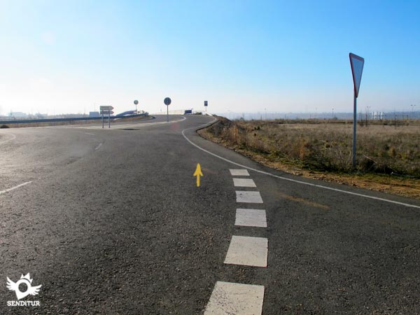
The Way of Saint James crosses the dual carriageway, ojo, over the bridge on our right, and begins a quick descent along the road that leads to Fresno del Camino (0h 15min), where as soon as we arrive we are joined by the other link.

If we choose the other options we must continue the route of the Way that leads to Valverde de la Virgen to first find the road that from the dual carriageway takes us to the path left behind and from there to Fresno del Camino, traveling a few more 200 m, but by road.

Or continue until you cross under the first underground pass that you pass, and then leave this Way of Saint James that continues on your right and turn left following the track that gently descends along the dual carriageway.

This track soon brings us closer to another underpass through which we pass to the heart of the junction of roads that we will soon have over our heads.

Following this dirt track that passes almost straight through the enormous pillars that support the roads above us, we will see the first buildings of Fresno del Camino.

We quickly went out to the road where we joined the rest of the pilgrims who chose any of the other possibilities and turning right, we continued together ascending the road that flanks the town.
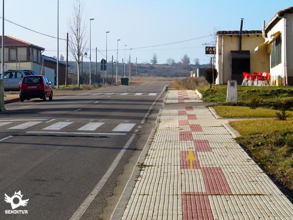
This option is approximately 800 m longer but has slightly less road travel.
Already together we have to face a cumbersome stretch of road that will take us to the next locality.

Leaving Fresno del Camino on the left hand side, we continue without detours this road that brought us here in some of the cases and that without further delay takes us out of the town, A local road line without hard shoulders that at best will leave us a narrow trail on its margin.
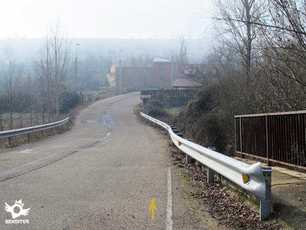
After a repeated ascent and descent we begin the descent that takes us, after passing over the train tracks to Oncina de la Valdoncina (0h 30min) and to its first street.

At this point we have to continue along the street on our right, leaving behind us two other streets in addition to the road we arrived on.

Soon we arrive at the first crossroads where we have to follow the street that we have on our left.

This street begins a maintained ascent that will take us quickly out of the town, becoming then a dirt road in quite good condition.

A few metres before reaching the top of the hill we are ascending we will leave on our right a track that continues flanked by a short row of trees. When we get to the top, the extensive landscape formed by the leones moor awaits us, which extends as far as the eye can see.

The track we are going along crosses this immense plain with a large number of roads to the left and right are further into the moor. With very good firm, that helps us to differentiate the main track that follows the Way, we will not have to deviate in any of the crossings by which we pass. After a while, the reddish earth that forms the surface of the track is replaced by the engraving and its grey, which breaks with the tonality of colours that these lands have.

After leaving to our right the track that would take us until Chozas de Arriba we undertake an almost imperceptible descent, the route is marked from time to time by the characteristic poyos with their pilgrim shells.

The track is cut by the road, although in front of us we will see the continuation of the road now asphalted by which we will cross the little distance that separates us from Chozas de Abajo (1h 45min), to which we enter following the street of the right in the first fork that we are.

Shortly after following this street we arrive at an elongated square where in front of us we will have another fork in the road.
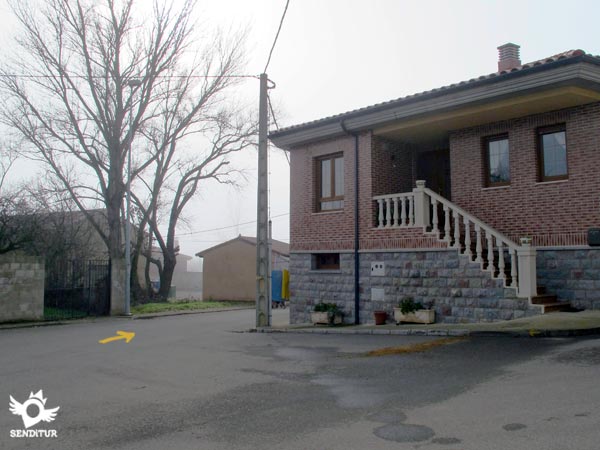
On this occasion, the French Way takes the street on the left, which takes us directly to the outskirts of the town.

Leaving behind a couple of streets that come out to meet us, we begin this section that today is paved and has become a local road.

The itinerary follows constantly by this road that only offers us a scarce trail, and not in its totality, that avoids us in part to walk by the asphalt.
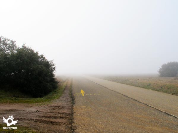
This part of the route, like the previous one, crosses a beautiful mixture of fields and holm oaks in addition to other species that give different panoramic views to previous stages.

With no possibility of loss, as we have to follow the road leaving aside all the paths we cross, we arrive at a curious corner formed by a dense raft of water, remaining a short distance until the next town.

Quickly and without deviating in any of the streets with which we find ourselves we enter Villar de Mazarife (2h 40min).
A good number of streets come out to receive us inviting us to enter the locality, we have to go straight ahead.

After a short descent we will find ourselves in a small square that we will cross from side to side to walk towards the outskirts of Villar de Mazarife.
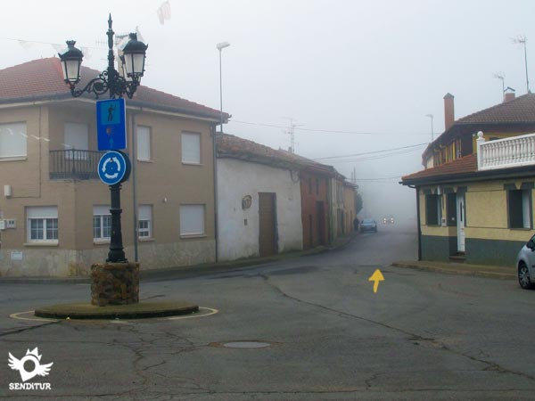
The street called Camino, which we will differentiate when we reach the square because it shows us all its extension without having to look at us again, accompanies us to the road that marks the limits of the population.

The Way of Saint James crosses this road to continue straight on, passing by the municipal sports centre. Again we face a long stretch of asphalt that runs through the fields that cover everything in our path. The ridiculous little trail that we have means that we can once again avoid walking on the heavy asphalt.

We leave behind us a large number of tracks and a few irrigation channels to reach the exploitation of Mantillas, an immense agricultural complex.

After a while our asphalted track meets the road that, passing by the nearby La Milla del Páramo, arrives from San Martín del Camino. It goes without saying that in each option we will see the possibility of returning to the official Way, which goes along the andadero next to the national road, there are many signs that invite us to join it. Our route continues straight across this road.
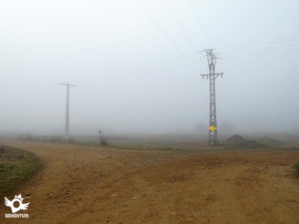
After a few metres we are forced to turn left, leaving behind the track that leads to La Milla del Páramo.

Quickly and after crossing an irrigation channel, the track we are going to turn again, this time to the right, to recover the orientation that we constantly carry.

A long stretch awaits us along a wide track, which we do not have to abandon on any of the countless paths that go into the fields on the left and right.

Just in the limits of the next locality of the day we find ourselves with a new dilemma, to pay attention to the signs that invite us to enter the locality or to follow the straight layout of the track by which we are going.

If you prefer to continue straight ahead, you will have no greater difficulty than passing the road that goes into the town and heading without detours towards a poplar grove that awaits you in front of you.

The only problem with this option, which is clearly shorter than the other, is that we will be forced to cross the railroad track that has cut the French Way without contemplation. This passage is dangerous because there are no barriers or signs, but it is necessary because it unites us with the pilgrims who chose the other possibility.

If we decide to enter the municipality we will have several accesses, the first will make us pass through a plot used by farmers. The second most direct will make us turn to the right to follow the line that marks a wall and leave to a wide square.

At this point several streets converge, in addition to the road, to our left we will see some arcades and followed by the street that we have to continue and that will take us to the interior of Villavante (4h 55min).

The church street we are going down will take us past the street that gives it its name, in front of us we can already see the dome of the water well.

Leaving the church behind us, the Way of Saint James continues, passing by the well, along the street on the left that will lead us to a park.

Now all we have to do is follow the asphalted track that leads to the bridge where we will cross the railway track.

As soon as you pass to the other side the itinerary turns to the left following the asphalted track by which we are going and leaving another one of earth that begins in that point. We say goodbye to the last buildings in the town to continue, now along a dirt track, towards the railway line, leaving behind some tracks in which we should not deviate.
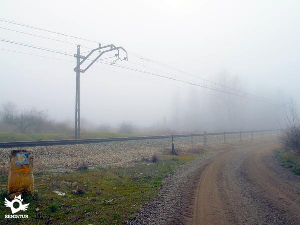
On reaching the height of the tracks, the route follows a section next to them in search of the straight track that leads to Villavante.

When we arrive there is nothing left but to turn right to take up again the lost course of the march and together with the pilgrims who chose not to enter the locality and who saved about 600 m of walk, to continue towards the end of the stage.

With no more detours for the moment we return to the monotonous and straight traced that leaves to right and left all the ways that communicate the fields that surround us.

Our track is with the motorway being forced to turn 90 º, at which time we say goodbye to it to continue by a kind of walkway that ascends parallel to the nearby motorway.

Once the earth slope has been overcome, the andadero ends and we come across the road that leads to Puente de Órbigo. Once past the bridge over the motorway there are two options, the first is to continue straight on the road to the meeting with the national. Cross it and go straight on along the road that will join us with the Way that reaches Puente de Órbigo from Villarangos del Páramo.

The second, approximately 500 m longer, forces us to cross the road to undertake the path by a dirt track that we have on our left.

This track at first returns to the motorway to quickly turn and continue parallel to it towards some industrial pavilions that we already see in front of us.

When you reach the limits of this industrial area, the track turns again, turning into an asphalted road that will take you to another road.

Already in it the route continues approaching towards the national bordering this industrial zone. When arriving at the national we will have to look for the best place to cross it, since the French Way continues straight going into the first streets of the locality.

Once saved the dangerous stumbling block that is the national and only remains to follow straight the street that leads us to the center of the population, until you reach a fork.

It is in this place where we must follow the street on the left that will take us to the medieval bridge and to the point of union with the other Way of Saint James in Puente de Órbigo (5h 55min), where this variant ends.

From here, crossing the bridge, we arrive at the Hospital de Órbigo.
To this figure we have to add the distance from our starting point to the starting point of the variant.
This time can vary in 10 or 15 min up or down depending on the variations its route undergoes, according to the choice of one or another of the options that will be presented to us, given that they do not have a great difference in distance between them.
Althoug:of course it is during the whole year when we can embark in this stage, by their special characteristics are the spring and the autumn the periods in whic:we will be able to enjoy the colorful landscape that surrounds us by these lands. The ochres and yellows of autumn dispute wit:the different tonalities of greens that intermingle wit:the typical colors of the moor in spring. It goes without saying that another attraction of this variant apart from the flora is the fauna that inhabits the different lagoons in the area and that together wit:the migratory birds that use these as a resting place, are an added value to our way.
Wit:the exception of rainy days when we can find some very muddy sections, the rest of the days allow us to carry out the stage wit:more comfortable footwear. We do not have to stop replenishing the canteen in eac:town and of course we can not miss the sunglasses, cap or hat and sunscreen. Adapting our clothes and footwear to the meteorological conditions and without forgetting that in most of the shelters of the Way it is obligatory the use of sleeping bag, that in summer we can substitute for the savanna:bag. Consult our list of material and equipment to make the Way. Read more
Physical
Practically flat wit:hardly any ramps to mention, the stage can be somewhat harder if we add the heat of summer, the lack of shade and the effect of asphalt that raises the temperature, otherwise unless we have to face the strong wind that sometimes blows in the moor should not have major problems.
Caution
Attentive in the asphalted sections or of highway, the apparent tranquillity should not make us lower the guard since they are habitually used to arrive from a locality to another one and we lack of verges that give us something of margin. Also in the crossroads of highways, especially the national one, it is essential to be attentive. The good state of the land is an ally that will facilitate the way to us and except some tramo something paved or wit:the drips undermined by the action of the water we will not find more complications, as long as it does not rain.
Orientation
Well signposted, it is in some cases the exaggerated signage that can cause more headaches. The straightness of the route and the marked better state of the tracks where we circulate also serves as a reference when it comes to doubts. It is important to be clear within the possible variations of the itinerary that we will be considering whic:one we are going to follow to avoid wasting time and unnecessary kilometres.
| 1-Variant start | 0:00h | 902m | 0Km | 30T 282934 4717320 |
| 2-Fresno del Camino | 0:15h | 878m | 1.6Km | 30T 282223 4716036 |
| 3-Oncina de la Valdoncina | 0:30h | 870m | 3.3Km | 30T 281529 4714532 |
| 4-Chozas de Abajo | 1:45h | 880m | 8.9Km | 30T 279114 4709727 |
| 5-Villar de Mazarife | 2:40h | 871m | 13.3Km | 30T 275756 4707018 |
| 6-Villavante | 4:55h | 840m | 23.2Km | 30T 266761 4705052 |
| 7-Puente de Órbigo | 5:55h | 832m | 27.8Km | 30T 263419 4705301 |
Coordinates UTM Datum WGS84

![]() Slope: 423m
Slope: 423m
![]() Slope +: 178m
Slope +: 178m
![]() Slope -: 245m
Slope -: 245m
![]() Maximum altitude: 925m
Maximum altitude: 925m
![]() Minimum altitude: 832m
Minimum altitude: 832m

This sketc:of the route is not made to scale nor does it contain all the information relating to the area, it is merely indicative.

This schematic wit:the pat:is approximate and has been created from the derived cartographic base © Instituto Geográfico Nacional "Cuadrantes 194, 193, 161 y 160 1:50.000".
Senditur has manipulated the tracks to correct the aberrant points that may exist, caused by problems wit:the reception of the GPS signal. In any case the tracks are always approximate. SENDITUR encourages you to use the new technologies within your reach, using them as support and consultation in your activity, not basing the realization and orientation of the same only and exclusively on them, since they may see their functioning altered by very diverse causes, not functioning correctly and their indications may not be precise.
Find out what to see in...
¿Did you know that...
As you pass through Chozas de Abajo you may have the opportunity to leave a Tree on the Way. The Association the Forest of Sury, offers you the opportunity to reforest a property next to the beautiful Laguna Fuentes Blancas to only 1,5 Km of the Way in the locality of Chozas de Arriba, being able to choose and to plant the tree with which more you feel identified.
Don't miss out...
The museums you will find in Villar de Mazarife, such as the museum of the painter and sculptor Monsignor, creator of the mural at the entrance to the Way in the town, which shows his works. You can also visit the museum dedicated to telegraph and telephone, which is in a beautiful old house called Casa Antolín.
From the commitment of SENDITUR with Nature and the respect to the balance of the environment, SENDITUR urges you to travel in a responsible way, with low environmental impact and respecting at all times the Natural, Cultural and Social environment wherever you go.
Besides sharing with all of us your experience on the route we would be grateful if you could write to us to inform us of any erroneous or outdated information you may have found, or simply to let us know what you think at Thank you.
This route has been carried out in the field by SENDITUR on 30-09-2018. The route may vary greatly depending on the time of year, weather conditions and terrain, as well as the actions of third parties and the evolution suffered in the natural environment where it is located. All opinions, advice and/or assessments made by SENDITUR in their descriptions are for guidance only and are subject to and/or refer to the specific conditions of the specific day of the route, referring to that specific day, taken from trained people, with the appropriate experience and with a high level of physical and technical preparation as a reference, as well as correctly equipped.
All the times are approximate and take an orientative character, the stops have not been taken into account, no matter how small they are. All the information related to the route, texts, images, videos, maps, diagrams, tracks, towns, and places of tourist interest are published as a guide, and may not coincide with the current state of each place. Before undertaking any activity, assess your technical knowledge, your physical condition, find out about the weather and the variations that the route may undergo, equip yourself correctly, be prudent and responsible at all times, and do not exceed your capabilities. SENDITUR is not responsible for any misuse or inappropriate use of the comprehensive guides of its routes and/or publications as well as its electronic guides, nor for any variations in their descriptions for the aforementioned reasons, and recommends that everyone be responsible and prudent in carrying out the activity. We also encourage you to read books and specialised guides to complement the information described above.
Continue watching …