Welcome to SENDITUR.COM · paths · routes · tourism


Stage 19 Hospital de Órbigo-Rabanal del Camino
The gentle transition from the plain to the mountain
![]() Difficulty-Remarkable
Difficulty-Remarkable
![]() 8:20 h.
8:20 h.
![]() 35.7 km.
35.7 km.
The gentle transition from the plain to the mountain
![]() Difficulty-Remarkable
Difficulty-Remarkable
![]() 8:20 h.
8:20 h.
![]() 35.7 km.
35.7 km.
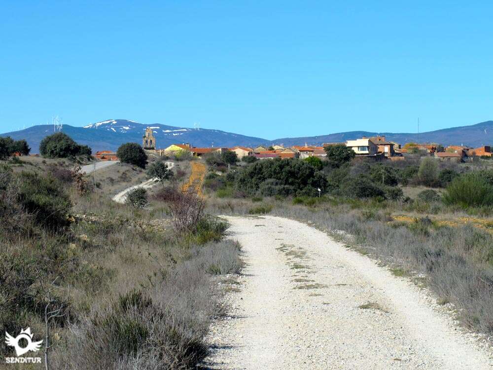
Hospital de Órbigo, in the fertile valley of the river Órbigo, is behind to transport us through the region of Maragatería to Rabanal del Camino, at the gates of the Montes de León, before passing through the historic and monumental Astorga. The route transforms from the plain of the leones moor to the rounded shapes of the profile of the first mountains to which we approach in many kilometres. The French Way route will take us through the history, traditions and gastronomy that have shaped these lands for thousands of years.

The church of San Juan, in Hospital de Órbigo, is the starting point of this stage 19 Hospital de Órbigo-Rabanal del Camino with 35.7 km. The different alternatives offered by the route continue to be the usual tone and come to our meeting as soon as we begin the day making us choose between the linear andadero next to the national or the hospitality of nearby towns such as Villares de Órbigo or Santibáñez de Valdeiglesias. The Cruise of Santo Toribio acts as a point of union between both options of the French Way and a privileged viewpoint where we lose ourselves in contemplating the unmistakable silhouette of Astorga and the Montes de León in our horizon. But before arriving to the city we must stop to know San Justo de la Vega, that anticipates our arrival to Astorga. Ancient city very united to the Way of Saint James, through which passed different villages that left their mark on it, such as the Walls originally built in Roman times around the third and fourth centuries.

The imposing towers of the Cathedral of Santa María, which attracted our attention before arriving in the city, form part of a complex that includes different architectural styles such as the Gothic or Plateresque on its western façade. Next to it the impressive Episcopal Palace, work of Gaudí, and that nowadays houses the Museum of the Roads, without forgetting us of its city council in whose beautiful facade we will be able to contemplate its traditional clock, they are some of the treasures that next to the cultural or the gastronomic ones Astorga hides. From here begins our journey by the populations that make up this region and that will bring us closer to the not-so-distant mountains. The eighteenth-century Ecce Homo hermitage, located near Valdeviejas, could well mark the beginning of our ascent of Monte Irago, which will last until the following day. Murias de Rechivaldo and the characteristic belfry of its church of San Esteban from the 18th century is a clear example of the typical Maragata population, whose maximum exponent can be found if from here we decide to follow the variant that will take us to Castrillo de los Polvazares.

This town of cobblestone streets and houses with coats of arms was declared a Historic-Artistic Site and its popular architecture has been preserved in its entirety. Regardless of the route chosen, Santa Catalina de Somoza is the next obligatory stop, given its well-known Jacobean hospitality. The church of Santa María can be seen from before arriving at this cosy town. The untiring ascent takes us to El Ganso, where there are still some teitadas houses with prehistoric covered with rye straw. The church of Santiago houses the chapel of the Pilgrims' Christ. After recovering strength we face the stretch with the greatest distance between towns to reach Rabanal del Camino, but before arriving is the hermitage of Vera Cruz, built in sillarejo and roofed by Arabic tile in the seventeenth or eighteenth century. It is worth mentioning the church of La Asunción, one of the few examples of Romanesque that we will see in this part of the French Way and shortly before reaching it, the hermitage of San José from the 18th century welcomes us to this locality where the route ends.
Legend has it that in the hermitage of Ecce Homo a pilgrim saw how her son fell into the well of the temple, this one, fearing the worst, asked for help to Santiago seeing his request for help fulfilled when the waters returned the little one safe and sound.
Hard day for the mileage, lack of shade and asphalt that represent a great effort for our friend, so we can not let him add more distance load than necessary. The land is the majority, alternating with the asphalt, so with the appropriate care should not give problems. A lot of attention in the crossroads with the national and in the sections of local road, with more traffic than desired.
The proximity between the towns is an ally that we must take advantage of to cool down and to replenish the water reserves that on the other hand cannot be missing since it is an open terrain and generally without intermediate water points.
To the habitual pets to our step by the different localities we have to add the cattle that if we go by the variant of Santibáñez we will find ourselves. For the rest we pass in great part by low mountain for what we can find with the fauna that inhabits it at any moment.
The cobbled Álvarez Vega street that brought us to Hospital de Órbigo (0h 00min) will serve as a guide through the town, the square next to the church being the starting point for this long stage.

Soon our straight street is cut by a road that crosses Hospital de Órbigo and that we will be forced to cross to continue straight now by the street Way of Saint James.

We continue advancing leaving to our right a street that deviates of the straight route that we took and that took us out of the locality. At the end of the street, just where the buildings end, we will find ourselves in another of the many places on the Way where we will have to decide which option to choose from those we are asked to choose.

Here we can go straight on in search of the inseparable travelling companions, andadero and la nacional, who have accompanied us from León. On the other hand, if we turn right we will take the variant of Santibáñez de Valdeiglesias something longer but that will take us between fields of cultivation and small hills. The parcelary track that continues the straight run of the street that took us out of the town is crossed with several ways that to left and right give access to the different parcels.

Without abandoning this track in any of these crossings we see how gradually it is getting closer to the national.

On reaching its height, the path runs parallel to it for a few metres until it is cut by another track, at which point we lose the comfort of the wide path to travel along a narrow trail next to the national one.

This section of the trail, with hardly any protection against the abundant traffic that supports the national, ends when it meets the road that leads to the nearby Villares de Órbigo.

In front of us we see a service road where, after crossing the one that leads to Villares, we must continue. This section of the old national road has remained as an access road to the farms and to the road that leads to Santibáñez de Valdeiglesias.

The national road is now over our heads and almost without realizing it we arrive at the junction with the access road to Santibáñez where we continue straight without deviating.

After a short ascent, we come across the national road again, and we are forced to walk a short stretch along its verge, next to some houses.

This section ends shortly after when the old disused section of the national route reappears, for which we continue.

After a while, this section is cut again by a track, at which point we go again along a narrow path that will take us quickly to the crossing of Estébanez de la Calzada.

It is in this place where we are forced to cross the dangerous national, as it is on the other side where the Way continues.

As soon as we cross, we leave in front of us the road that leads to this locality to continue our route that runs again along the old road that runs parallel to the national one.

This part of the route is a continuous and uncomfortable slide that reminds us of previous stages, always protected on one side by the national and on the other by the fields and the ordered trees that mark the route.

When you reach the top of one of these slides, the route turns gently to the right, leaving behind a dirt track that goes straight on and the bridge that crosses the nearby motorway. A few metres further on we are again forced to cross the cumbersome national road, this time through a much more dangerous place than the previous one.

The route continues along a road in very good condition, now with the national road on our left, until we come across another new road that stands in our way.

After crossing this road, the path we traveled seems to end, at which point it turns back into the old national road for a few metres.

The asphalt again gives way to a dirt track that begins to separate from the company of the national road.

Once again we are forced to cross another local road to follow the track that borders a tidy pine forest.

In the distance we can already contemplate the Santo Toribio cross, a point of union with the pilgrims who chose the Santibáñez de Valdeiglesias variant.

From here and after contemplating the panoramic view of Astorga offered by this privileged viewpoint, we begin a quick descent along a carefully chosen path that leads us to the gates of the next town.

The descent ends in a small park that gives way to the entrance road to the town. Following the straight sidewalk that borders the road and without deviating in any of the different options that we find we arrive until San Justo de la Vega (2h 40min).

If, on the other hand, we dare to cover the approximately 1 km more that the Santibáñez variant represents, instead of going straight on at the Hospital de Órbigo exit, we will have to take the track on our right.

This route takes us between fields of cultivation crossing a real tangle of ways that cross with ours.

The plain on which we walk allows us, on days of good visibility, to see in the distance a grove that can serve as a reference since it is to it that we are heading.

Without deviating from the main track on which we walked, we soon arrived at this poplar grove that precedes the first locality of the variant.

At the entrance to the village we continue to leave a few crosses on the left and right until we find ourselves forced by some houses to turn right.

Shortly after this small turn, the street that we are going down converges with a water channel and a wide street, the Way crosses both of them, leaving on the right the tree-lined street that goes into Villares de Órbigo (0h 25min) and on the left the water channel, to follow its course.

This new street on which we walk meanders between the houses until just before reaching a small square, the Way turns left to continue along the street that serves as the entrance road to the town.

The route always follows the asphalt road, leaving behind all the streets we find. We quickly reach the outskirts of the town, where we come across the road that leads from the national road to here.

In front of us, but something to our left begins the path where we have to continue after crossing this road.

This dirt track, which leaves a pavilion on the right, moves away from the road and then turns left and continues to a small rest area.

The route crosses this area, leaving on the left a path that comes from the nearby road, to continue with a gentle but continuous ascent.

The path, which is not in very good condition, advances halfway up the hill, leaving a path that deviates to the right. Following this track at all times we reach its end just when it meets a road that ascends from the one we left behind.

The route continues the ascent by going up again the little unevenness that we have left to overcome the hill that interposes in our way. This road will take us without loss to our next objective.

After a comfortable descent we reach the vicinity of the next town, which we enter following the course of the road that brought us here. We will go leaving behind us some street until we see ourselves in the necessity to decide since our guide splits in two.

Following the street on the right we arrive definitively at Santibáñez de Valdeiglesias (0h 50min). As soon as we take this street we find another one on our right, and a few metres further on, leaving behind us an underground fountain, with another street which is where the route continues.

This street, curiously enough, quickly joins the previous one to lead us to the outskirts of the town. Soon we will see ourselves walking again along a dusty dirt track that leaves pavilions and paths that lead to them.

The itinerary follows the course of this wide track through fields, ascending little by little and moving away from Santibáñez.

After a while and after crossing some solitary path that comes out to meet us, we arrive at a crossroads where we continue straight ahead, leaving a small and curious rest area on our right.

Shortly after this crossroads we leave the track on the right that ascends towards the hill to continue along the one on the left that leads us to a gentle descent.

The track extends into the distance letting us see its route and the new ascent area that awaits us. This part of the route meets again with other paths that we must ignore to continue along the main track well marked.

Shortly after starting the next ascent, still with almost no unevenness, the route leaves on its left a wide track to continue once again without leaving the path we are on.

The slope gains in inclination without demanding too much effort at the same time that the road increases its firm paving, not losing its well marked line that will serve as a reference in the crossings that we find.

The tireless pace of the pilgrims has created some bifurcation that comes together again soon after.

When we reach the top of the hill we will have to leave the tracks on the left and right that converge at this point to go straight on and start a new descent.

Once again there are several paths that come to greet us, and we will have to ignore them following our right course.

The gentle toboggans take us from the edges of the forest through fields of crops in a continuous up and down. A typical adobe building towards which our track goes serves as a reference when recovering part of the lost height.

Shortly after passing this building we find a road that we must cross to continue along the comfortable dirt track.

The route borders a forest of aligned pines until arriving at another crossroads of tracks, it is in this place where of the two tracks that we have to the left, the Way leaves the one of more to the left that continues bordering the forest, to continue by the other one that cuts diagonally the fields.

A few metres further on the Santo Toribio cruise awaits us, a place where both options are unified and arrive from Hospital de Órbigo.
Without deviating from the road we arrived on, which is a long avenue that runs through the town, we will leave behind a good number of streets.

Almost without realizing it, we already see ourselves outside San Justo walking towards the bridge that will serve us to cross the river Tuerto.

The road continues to mark the route, until shortly after crossing the second bridge we find a cement track on our right separates us from the road.

There are many pilgrims who prefer the company of the road, as as soon as you take the detour the track turns left again to continue parallel to the road.

The Way of Saint James follows the track, now a dirt track, far enough away from the bustling road, towards some pavilions. Astorga has been watching us for some time now and its closeness allows us to discover its charms little by little, while we advance leaving behind us the paths we come across.

The pavilions are definitely behind us, and the track we are walking on, because of the buildings we are passing, zigzags.

A small stone bridge allows us to cross a stream that cuts our way.

As soon as you cross the bridge, turn left and continue along the asphalted road. This asphalted road quickly takes us to the straight and old route of the road that we left before and which is cut off by the modern railway network that goes as far as Astorga.

A metal footbridge allows us to cross the railroads, thus overcoming this obstacle. On the other side, the old road once again marks the course of the Way.

Just a few metres before the road is cut by the train tracks, we have to turn left to follow the road that starts at that point.

Here there is the possibility of taking a trail that, bordering a wall and a house, shortens the turn that draws the road. The sidewalk that flanks the road serves as a guide to lead us to the old level crossing where the trail that shortens the obligatory drawing of the road leaves.

When you reach a roundabout, a pedestrian crossing allows us to cross to the left to follow the street that leads to the town.

Following this street we soon find the first houses. At the end of it, the route turns left again, softening for now the ascent we had started.

Soon we arrive at a large intersection of streets where we have to turn radically to resume the ascent by the street that to our right almost forces us to return on our steps.

At the end of this short but intense ramp, the Way turns right again, bordering the church of Nuestra Señora del Castro to continue entering the historic town.

When the cobblestone street turns right, the itinerary continues straight on passing through a narrow street that allows us to see the Astorga square (3h 25min).

At the opposite end of the elongated Spain Square, on its left side begins the street Pío Gullón where the Way continues.

This part of the route leaves on both sides the streets with which it crosses. The winding layout introduces us to the heart of the city.

After this route through the streets of Astorga, the itinerary turns to the right, partly forced by the buildings.

A few meters the street ends in a large square, where the cathedral and Gaudí's palace serve as a reference.

The French Way continues in search of the main façade of the cathedral, reaching its main front.

Just in front of it begins the street that we have to continue and that will take us, with the cathedral on our back, until a new crossing.

In it we have to turn right to continue a long and straight stretch.

The street on which we now walk leaves a small park on its left to offer us the chance to walk along narrow sidewalks towards the outskirts of the city.

This street, which we do not have to leave at any of the crossroads we encounter, ends at the old N-VI.

To our right we will see a pedestrian crossing that will serve us to cross the national one since the itinerary continues straight for the highway that in front of us leads to Santa Coloma de Somoza and Castrillo de los Polvazares among others.

A relatively long stretch of road awaits us, which fortunately has a sidewalk and a andadero almost the entire length of the route. We say goodbye to Astorga following the course marked by this busy road.

We soon reached the crossroads with Valdeviejas, a town close to the city that also offers its hospitality and services to pilgrims who need it.

Leaving behind the detour towards Valdeviejas, the next place to pass is the hermitage of Ecce Homo, when it is better to pass to the right side of the road if we had not already done so.

The road then crosses over the A-6, at which point the pavement ends. As soon as you cross the bridge, you will come to the start of the andadero, which will prevent you from walking along the sometimes very busy road.

This andadero runs between the road and a track that gives access to the different farms that border it.

This first part of the walk ends abruptly on an asphalt track, at which point, leaving the track that goes straight on, we will have to return to the nearby road.

On the left side of the road we find a metal bridge that allows us to cross a stream to follow the direction of the road.

This stretch without hard shoulder has some short escape and a narrow trail that runs to the edge of it. Luckily we soon arrive at the beginning of the road that will take us to the next town of the day, already nearby. Murias de Rechivaldo (4h 25min) welcomes us when we reach a small square next to a park.

Place where we will have to decide again if to continue straight following the original Course of the Way or against we turn to the right to go for the variant that will take us to know Castrillo de los Polvazares.

Without further complication than following the straight street that brought us here we quickly reached the boundaries of the locality.

Once again we find the andadero and next to it a dirt track that will accompany us at all times. The plain of the terrain where we are going partly hides the gentle but constant climb that is already beginning to be noticed.

Without abandoning the andadero at the crossroads that leave our path, we arrive at the encounter with the road that we left before. Once again we find ourselves obliged to cross it to continue the march along the andadero, which continues to the other side.

This part, with steeper ramps, runs between the inseparable dirt track and the road leading to the next town of the day.

When the slope softens again we find the crossroads where pilgrims who would have decided to visit Castrillo de los Polvazares will join us. The path will lead us without any possibility of error to the gates of the next town.

A path between the old stone walls that delimit the land of the municipality will guide us to the interior of Santa Catalina de Somoza (5h 25min).
Those who decide to cover the approximately 1.5 km that we do more if we do this variant, and visit the beautiful town of Castrillo de los Polvazares, will have to turn right and head towards the nearby road.

When we reach it, we have to turn left again and follow it, crossing Murias. Shortly after leaving the town on our right begins the andadero that will avoid us the road.

This andadero, or road, leads us straight without place to loss to the proximities of the population. It ends at the entrance road where we will continue.

The entrance to the locality already lets us intuit the careful aesthetics that so much fame has reported to him, the street perfectly paved will do us the times of guide by Castrillo de los Polvazares (4h50min).

The Royal Street, which is the one we must follow at all times, will take us all over the town.

A crossroads marks the end of Royal Street, at which point it forks, and you must continue along the street on the left that will take you out of the town.

On the outskirts of Castrillo de los Polvazares we find ourselves at a crossroads where we must turn left and continue along the road that leads us to a solitary football and basketball field.

This road we are going along borders a wall of stones turning to the left, while we have to continue on the right. The asphalt quickly gives way to the earth, where we find a fork, in which the Way of Saint James follows the track on the left.

This part of the route, badly signposted, obliges us to be attentive to avoid unnecessary detours. We begin to gain little by little height leaving to our back the population and the horizontal line that marks the forest. Soon we come across another crossroads where we have to go straight on to get directly to the andadero without loss.

It is here where we will join the usual route of the Way of Saint James that comes from Murias de Rechivaldo.

The Real street, where we enter Santa Catalina, will lead us in its rectum through the locality.

This street takes us back to the road where we have to continue for a few meters until we leave the town definitively.

A little further on we find ourselves on our right again with the beginning of the andadero, where we continue. The straight andadero extends until it gets lost far from our sight, showing us the unevenness we have to face. The route combines sections in which it takes more height evidently with smoother areas.

One or another solitary crossing breaks the monotony of the walkway that luckily allows us to enjoy the interesting landscape ahead. The following population of the day is shown in front of us allowing us to intuit at its back the final point of the stage and in the distance part of the next day with Foncebadón and Monte Irago where the Cruz de Ferro is located.

The andadero expels us back to the road to cover the short distance that separates us from the next objective.

Quickly we find the detour that forces us to separate from the road to which we will return a little later. This street on which we walk will definitely introduce us to El Ganso (6h 30min).

Once again the Real street will guide us through the locality without letting us get out of it.

Almost at the end, when the houses seem to give way to the fields, to our left we will see the street that leads us to the church where we will follow. This street takes us past the old building back to the road.

The Way of Saint James then resumes its lost course to continue advancing through the locality following the course marked by the road.

As if it were déjà vu, we will once again find ourselves at the beginning of the andadero shortly after saying goodbye to the town. The stretch that awaits us, one of the longest of the day between towns, is also the most entertaining and demanding, as far as the terrain we will cross is concerned.

The andadero loses its straight running to meander between the small hills it runs through. After passing a rest area, next to a crossroads, the slope begins to become more pronounced.

Soon we reached the end of our companion, being forced to return to the road. This section will take us to cross a demanding ramp, the passage of pilgrims has created an uncomfortable trail at the edge of the road that sometimes invites us more to get out of it than to follow it.

At the end of the straight ascent we find the beginning of a wide path that runs next to the road avoiding us to continue along it. Rabanal del Camino is already clearly visible, although we should not be confused by its false closeness, as we still have a long way to go.

This undulating path will accompany us for a long time until we reach the junction with the Rabanal Viejo road, at which point the track ends and our route returns to asphalt. In this place we should not be confused by the path that borders the road as it will take us to a meadow next to the stream of Reguerinas, the itinerary continues along the road.

As soon as we cross the bridge over the stream, we say goodbye again to the road to continue along the path that leads into the forest on the right. For cyclists it is better to follow the road as the state of part of the route and its unevenness can force us to set foot on the ground.

Shortly after starting the ascent, as if it were a new opportunity to change your mind, we left on the left a path that would take us to the road if we followed it. After a demanding ascent through a trail with a quite decomposed road surface, the route softens its unevenness, and it joins the road again, giving us more links with it.

The path, in quite poor condition, continues along the boundaries of the forest accompanied by the nearby asphalt, reaching its final point shortly after the end of the lush forest that surrounds it.

Now the road will lead us back to the end of the day. This part of the route does not lose its continuous ascent and once again offers us the possibility of following the h on the edge of the road formed by trail the tireless treading of the pilgrims.

As soon as you pass the Rabanal cemetery hermitage, you will come across a cement track on your right that will lead you directly to the town. There is a new ascent ramp which, added to the accumulated fatigue, becomes harder than it really is.

Without deviating at any time soon the buildings take over the environment indicating that we have reached Rabanal del Camino (8h 20min), where the stage ends.
 Distance. 35,7Km
Once again, the itinerary that we follow from the different possibilities that the stage has will mark the distance of the stage.
 Time. 8:20h
The different variants we can choose do not make a big difference in the total time we have to spend, as they do not involve a large increase in distance. Althoug:we must take it into account in case of incorporating bot:variants to our route, since in that case they suppose about 45 min more in total, approximately.
 Time of year
In winter the area usually has heavy snowfalls, so we can find the terrain completely snowed from below. This, added to the low temperatures, forces us to inform ourselves very well of the state of the route and of the places that we will find open. The road then becomes the inseparable travelling companion, since if there is snow it is the only one that tries to keep clean. The rest of the year the lack of shade is the biggest obstacle we will find. The landscape gives us all its spectacular all year round, thanks to its absence of obstacles and the proximity of the mountains, allows us to enjoy magnificent panoramic views.
 Required equipment
Comfortable clothes according to the time of the year and the meteorological conditions, besides clothes for rain even being summer. You can not miss the equipped backpack, canes, canteen and food. The camera, sunglasses and sunscreen are good allies. In winter we have to take into account the necessary material for snow or ice. Consult our list of material and equipment to make the Way. Read more
 Difficulty. Remarkable
Physical
Demanding stage in the physical thing not only by its long distance, we also have to add the continuous unevenness that practically from Astorga we will find, that althoug:it does not accumulate in great ramps if it accompanies us at all time. In addition, the first part of the stage is a continuous up and down that does not make the first kilometres comfortable. To all this we must add the absence of shady areas that makes the hot days harder. It is important not to be deceived by the apparent lack of unevenness and to dose the efforts well.
Caution
The national road crosses several times on the pat:of those who prefer to follow the pat:in the first part of the stage and unfortunately still endures a lot of traffic every day so we must exercise caution when crossing it because, althoug:the steps of pilgrims is signposted and its limited speed vehicles are thrown over faster than it seems. In the sections that we must share wit:the local road should not deceive us its apparent tranquility as it is a road quite traveled to communicate areas of great tourist value. The rest of the route does not involve major difficulties to run on tracks and walkways generally in good condition, except the last section somewhat decomposed. In case of rain, some parts of the stage may be quite muddy.
Orientation
Well signposted, it's the different possible routes that will create the most problems for us. The itinerary is followed without major complications by walking clearly marked and almost always under the protection of the nearby road. The variant of Santibáñez is signposted, althoug:it is the area where we will find more crossings and worse signposted throughout the stage, especially in the stretc:from Santibáñez to San Justo de la Vega, so we must be careful. The variant of Castrillo de los Polvazares deserves a special mention. Even thoug:there is no loss to this locality, it is from here until it connects again wit:the pat:where the signposting can play a trick on us.
 |
 |
 |
 |
 |
| 1-Hospital de Órbigo | 0:00h | 825m | 0Km | 30T 263028 4705272 |
| 2-San Justo de la Vega | 2:40h | 852m | 11.7Km | 29T 745475 4704531 |
| 3-Astorga | 3:25h | 872m | 15.4Km | 29T 742311 4704471 |
| 4-Murias de Rechivaldo | 4:25h | 885m | 20.1Km | 29T 738040 4704876 |
| 5-Santa Catalina de Somoza | 5:25h | 985m | 24.7Km | 29T 733589 4704243 |
| 6-El Ganso | 6:30h | 1020m | 28.7Km | 29T 729627 4704946 |
| 7-Rabanal del Camino | 8:20h | 1158m | 35.7Km | 29T 723165 4706908 |
| 1-V-Villares de Órbigo | 0:25h | 831m | 2.6Km | 30T 260735 4706016 |
| 2-V-Santibáñez de Valdeiglesias | 0:50h | 855m | 4.6Km | 30T 259056 4704840 |
| 2-San Justo de la Vega | 2:50h | 852m | 12.7Km | 29T 745475 4704531 |
| 3-V-Castrillo de los Polvazares | 4:50h | 910m | 22.3Km | 29T 736055 4705419 |
| 5-Santa Catalina de Somoza | 5:35h | 985m | 25.9Km | 29T 733589 4704243 |
Coordinates UTM Datum WGS84

 Slope: 617m
 Slope +: 472m
 Slope -: 145m
 Maximum altitude: 1158m
 Minimum altitude: 820m

This sketc:of the route is not made to scale nor does it contain all the information relating to the area, it is merely indicative.

![]()
This schematic wit:the pat:is approximate and has been created from the derived cartographic base © Instituto Geográfico Nacional "Cuadrantes 193 y 192 1:50.000".
Senditur has manipulated the tracks to correct the aberrant points that may exist, caused by problems wit:the reception of the GPS signal. In any case the tracks are always approximate. SENDITUR encourages you to use the new technologies within your reach, using them as support and consultation in your activity, not basing the realization and orientation of the same only and exclusively on them, since they may see their functioning altered by very diverse causes, not functioning correctly and their indications may not be precise.


El cocido Maragato... para no perdérselo!!!

Sistine Chapel of Romanesque Art, palatine temple of the kings Fernando I and doña Sancha


Castle of the Templars, the most representative construction of Ponferrada

Find out what to see in...
¿Did you know that...
Much of the stage passes through the region of Maragatería, inhabited since ancient times and loaded with traditions and history. Its real name is Maragatos Country and includes several sub-regions that share culture and similar characteristics, which make the localities of this land a pleasure for the visitor.
Don't miss out...
The Cocido Maragato, which is one of the most traditional of the region, whose most outstanding characteristics is that this stew is served upside down, ie first the meats of the stew, then the vegetables and to finish the soup. A consistent dish that served to feed in a single meal to the men of the field in their hard days and that feeds the pilgrim in his.


From the commitment of SENDITUR with Nature and the respect to the balance of the environment, SENDITUR urges you to travel in a responsible way, with low environmental impact and respecting at all times the Natural, Cultural and Social environment wherever you go.

Besides sharing with all of us your experience on the route we would be grateful if you could write to us to inform us of any erroneous or outdated information you may have found, or simply to let us know what you think at Thank you.
This route has been carried out in the field by SENDITUR on 01-10-2018. The route may vary greatly depending on the time of year, weather conditions and terrain, as well as the actions of third parties and the evolution suffered in the natural environment where it is located. All opinions, advice and/or assessments made by SENDITUR in their descriptions are for guidance only and are subject to and/or refer to the specific conditions of the specific day of the route, referring to that specific day, taken from trained people, with the appropriate experience and with a high level of physical and technical preparation as a reference, as well as correctly equipped.
All the times are approximate and take an orientative character, the stops have not been taken into account, no matter how small they are. All the information related to the route, texts, images, videos, maps, diagrams, tracks, towns, and places of tourist interest are published as a guide, and may not coincide with the current state of each place. Before undertaking any activity, assess your technical knowledge, your physical condition, find out about the weather and the variations that the route may undergo, equip yourself correctly, be prudent and responsible at all times, and do not exceed your capabilities. SENDITUR is not responsible for any misuse or inappropriate use of the comprehensive guides of its routes and/or publications as well as its electronic guides, nor for any variations in their descriptions for the aforementioned reasons, and recommends that everyone be responsible and prudent in carrying out the activity. We also encourage you to read books and specialised guides to complement the information described above.
Continue watching …


 Previous: Stage 18 León-Hospital de Órbigo
 Next: Stage 20 Rabanal del Camino-Ponferrada


