The Duero River, from its source in the abrupt Urbión mountain range to its mouth in the Atlantic Ocean, runs through a large part of the Iberian Peninsula, being a silent witness and a reference point for the history of the peoples and lands it bathes. After saying goodbye to the mountains that saw its birth, the Duero paints a landscape full of charming corners, through which the Trail of the Duero from Garray to Soria takes us.

The route in its 8.2 km allows us to discover natural places of great beauty and value as well as allows us to visit real jewels of history such as the Archaeological Site of Numancia in Garray, a town from which the tour starts. The Duero River is well known for its different hiking routes that follow its course, either in part or in full. Routes like the GR 14 or Path of the Duero with which we will coincide even if only for a moment. We leave behind the historic Numancia and after passing by the remains of one of the Roman fortifications that besieged it we enter the leafy riverbank.
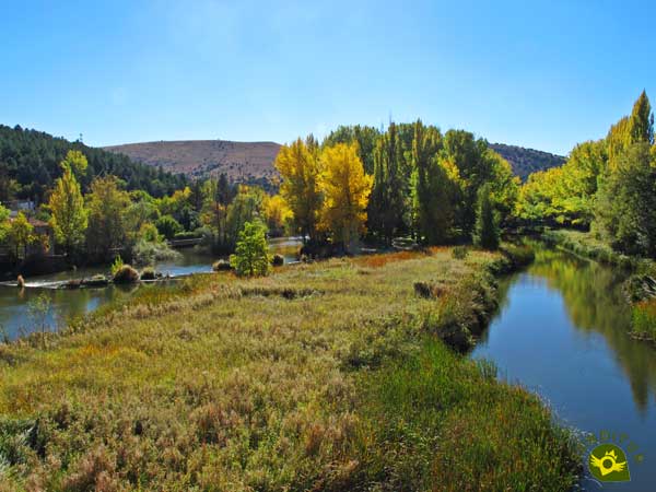
A surprising journey full of colorful landscapes awaits us, where the river is the protagonist. A protagonism in which the conditioned footbridges that allow us to follow its course without losing any of its corners make us participate. The Monastery of San Juan de Duero, the Monastery of San Polo or the Hermitage of San Saturio, provide an unbeatable cultural value to the already magnificent attraction that this Trail of the Duero has. This is a very popular route for the inhabitants of Soria given the proximity of the town to the route and the different routes we can take in the area.
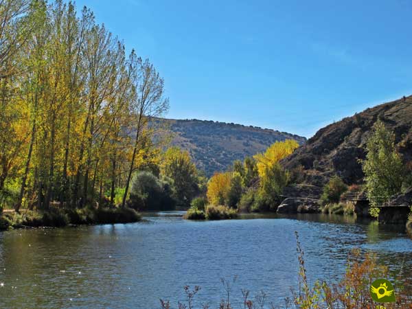
If we need to return to the starting point, whether it is Garray or Soria, we have a bus service with different timetables that connect both localities. We can also design a route to suit our needs and starting from Soria we can take advantage of the different bridges that cross the Duero River and make a circular route that will take us to see the most spectacular places that the path passes through.
There are different roads that connect Soria with Burgos, Valladolid, Zaragoza and Logroño, being the national road that communicates this last one with Soria where we will find the town of Garray. In both cases we have to go in search of the river bank, for this we will only have to follow the course of the old road that crossed both towns and that will take us to the proximities of the course of the river. Once there, both in Garray and in Soria, we will have enabled areas where we can park our vehicle.
Bear in mind that in many public transports the access to the dogs is not allowed so to the 8,2 km of the route we will have to add the corresponding ones of the return until the departure point reason why the physical exigency becomes remarkable for our friend.
The whole bank of the Duero River is catalogued as a LIC zone so it is not advisable to let our friend go into the water, both for his safety and to avoid further disturbance to the native fauna.
Surely there will be several pets that we will meet along the route. We must pay attention in the short stretches where we will coincide with the vehicles since there is more traffic than we can imagine.
The town of Garray (0h 00min) at the foot of the remains of ancient Numancia is the starting point for this tour of the Duero riverbank.

More specifically, the route begins next to the bridge over which we cross the river just where the Tera River flows into the illustrious Duero.

On the other side, just after crossing the bridge, the detour awaits us, which we must take next to the information signs of the GR 14 also known as the Path of the Duero and those belonging to the Antonine Way and the Natural Way of the Soriano Water.

These are routes that we will only coincide with at this point since we must turn off again to get as close as possible to the river bank, while these other routes continue their course close to the road that we have just abandoned.

The GR 14, known as the Path of the Duero, does not live up to its name in this part of its route and runs through the network of roads that surround the capital Soria.

Our path leads us to a flour factory, which we must cross following the course of the road that brought us there.
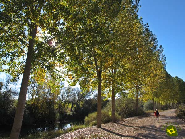
After doing so, a conditioned dirt road awaits us, which runs close to the river, from which the trees that line its banks separate us. This track already allows us to get an idea of the beautiful landscape that awaits us.

The conditioned track reaches its end leaving us at the foot of the Dehesilla hill which we skirt.

Shortly afterwards we arrive at the crossroads (0h 30min) where we again have the possibility of linking up with the route that we left behind before. In fact, for those who do the route the other way round, the directions send them through this little-travelled link.
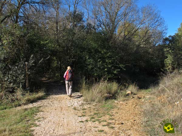
From here, our route takes us definitively to the Duero riverbank, taking us along a well-defined path.
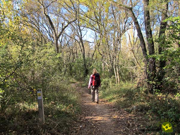
Also from now on we will have the information provided by the different signs that accompany our Trail of the Duero.

The river begins to gain much of the limelight as we continue to move along the conditioned path. A path that hardly makes us strive, as it maintains a more than pleasant profile.

After a while the noise of the traffic on the road in front of us takes us out of the relaxing walk we are taking.

As soon as we pass under the road we find ourselves in front of a new junction where we must do nothing more than follow the marked route of our path.

The first section of the footbridges begins immediately, allowing us to travel along this part of the river. From then on, the most beautiful area of the entire route awaits us, where the landscape around us shows all its splendor.

A route that if it were not for the footbridges with which it is equipped would be impossible to cross.

We continue to move forward, approaching the town of Soria with every step, as witnessed by the Hermitage of El Mirón.
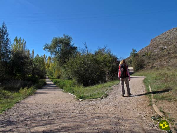
Suddenly we will have to choose the direction to follow, since in front of us is the detour that leads to the Monastery of San Juan de Duero (1h 15min).
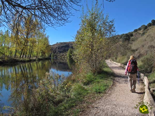
We follow the same slope by which we arrived here from where we can contemplate the route that follows the path on the other side of the river.

Once again, an entertaining stretch of footbridges awaits us, justifying the choice made at the previous junction.
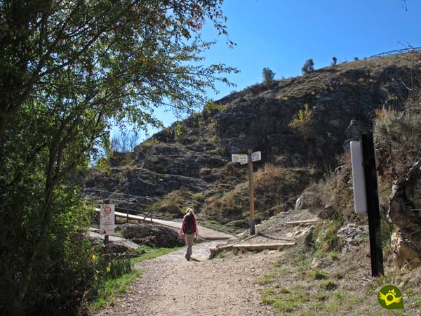
After this area of footbridges, we find ourselves before a new crossroads that enables us to approach the viewpoints located at the top of the hill we are crossing.

The ancient walls that protected the town of Soria warn us of our arrival in this city.

Once again we leave behind another crossroads of the different routes that visit the corners of this area of Soria.

In front of us we can already see the Stone Bridge, through which we will pass to the left bank of the Duero.

To do so, we will have to say goodbye to our trail, which follows its course by the river, to go up in search of the bridge.

Once up, we cross the Stone Bridge, and on the other side we find the link that comes from the nearby Monastery of San Juan de Duero (1h 40min).

Here we will be joined by those who decided to take the detour leading to the monastery. Already together, and after approaching to visit this architectural jewel, we will follow the course of the Duero River.

Once again, it is the footbridges that allow us to stay close to the course of the river.

These footbridges take us to a new bridge that allows us to pass to another of the groves that the Duero has formed as it passes through Soria, a bridge that we leave behind to continue our route.
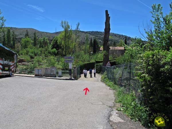
We quickly find ourselves in front of the road we had previously crossed, but fortunately our route turns right to continue along the track that leads to the Monastery of San Polo.

This asphalted track takes us through the monastery grounds, as it crosses them. After doing so, we will see ourselves going through a nice walk until we find the road that will take us to the end of the route.

A road that is rather a conditioned walk that without major problems allows us to enjoy the last part of the route.

Shortly before reaching the Hermitage of San Saturio (2h 10min) where the route ends, we find another of the accesses that allow us to cross the river, an access through which those who decided to continue along the right bank of the Douro River reach the hermitage.
Travelling along either side of the river does not alter the distance of the route.
This figure only refers to the outward journey, so if we return to the starting point we have to add up the time it takes. On the other hand we will not have a great difference in time to follow one or another variant.
There are many different attractions that this route offers throughout the year, to the virtues that nature offers us with the landscapes that it draws on our path are added the architectural and cultural jewels that leads us to know. As it runs so close to the riverbed, its flow conditions the accessibility of the route.
Initially the different characteristics of the route only ask us to wear comfortable shoes and clothing, but it is not too much to take some water and food, especially if it is summer or if we are going to walk back to the starting point. Don't leave your camera behind as some areas of the route are quite interesting. Consult our list of material and equipment for hiking. Read more.
Physical
Of course the final distance of the route, if we decide to walk back to Garray, makes the level of difficulty increase, fortunately we will not have to overcome a great slope.
Severity of the environment
The river's flooding may reach some sections of the route, so it is not advisable to venture into these conditions. Otherwise we should not have major problems as long as we do not abandon the proposed route.
Orientation
The different trails we will encounter and the different possibilities of varying the route is what will create the most complications for us. Besides, the initial part of the route, although it is the one that people usually follow the most, does not have a signposting that leads us to follow it. On the contrary, it encourages us to follow the GR 14 route.
| 1-Garray | 0:00h | 1010m | 0Km | 30T 545945 4629350 |
| 2-GR 14 detour | 0:30h | 1009m | 2.3Km | 30T 545266 4627398 |
| 3-Junction Monastery of San Juan de Duero | 1:15h | 1008m | 5Km | 30T 545537 4625283 |
| 4-Junction Monastery of San Juan de Duero | 1:40h | 1010m | 6.6Km | 30T 545357 4624053 |
| 5-Hermitage of San Saturio | 2:10h | 1038m | 8.2Km | 30T 545142 4622569 |
Coordinates UTM Datum WGS84
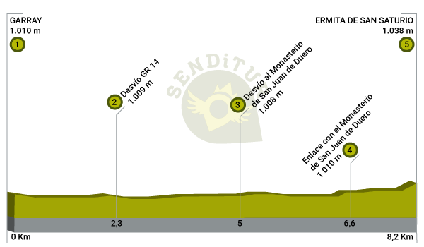
![]() Slope: 110m
Slope: 110m
![]() Slope +: 55m
Slope +: 55m
![]() Slope -: 55m
Slope -: 55m
![]() Maximum altitude: 1038m
Maximum altitude: 1038m
![]() Minimum altitude: 1005m
Minimum altitude: 1005m

This sketch of the route is not made to scale nor does it contain all the information relating to the area, it is merely indicative.
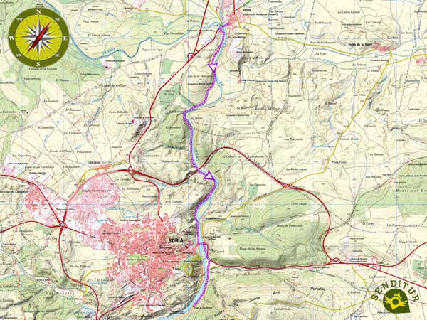
This schematic with the path is approximate and has been created from the derived cartographic base © Instituto Geográfico Nacional "Cuadrante 350-1, 25.000"
Senditur has manipulated the tracks to correct the aberrant points that may exist, caused by problems with the reception of the GPS signal. In any case the tracks are always approximate. SENDITUR encourages you to use the new technologies within your reach, using them as support and consultation in your activity, not basing the realization and orientation of the same only and exclusively on them, since they may see their functioning altered by very diverse causes, not functioning correctly and their indications may not be precise.
¿Did you know that...
The Douro River rises at an altitude of 2160 m and has a length of 897 km, 213 of which are navigable. It also has the particularity of having 112 km of its course with the qualification of international waters, being the border between Spain and Portugal.
Don't miss out...
The visit to the Monastery of San Juan de Duero also known as Arches of San Juan and the hermitage of San Saturio jewels, each in their respective architectural styles, and references for the city of Soria and its history.
From the commitment of SENDITUR with Nature and the respect to the balance of the environment, SENDITUR urges you to travel in a responsible way, with low environmental impact and respecting at all times the Natural, Cultural and Social environment wherever you go.
Besides sharing with all of us your experience on the route we would be grateful if you could write to us to inform us of any erroneous or outdated information you may have found, or simply to let us know what you think at Thank you.
This route has been carried out in the field by SENDITUR on 16-10-2018. The route may vary greatly depending on the time of year, weather conditions and terrain, as well as the actions of third parties and the evolution suffered in the natural environment where it is located. All opinions, advice and/or assessments made by SENDITUR in their descriptions are for guidance only and are subject to and/or refer to the specific conditions of the specific day of the route, referring to that specific day, taken from trained people, with the appropriate experience and with a high level of physical and technical preparation as a reference, as well as correctly equipped.
All the times are approximate and take an orientative character, the stops have not been taken into account, no matter how small they are. All the information related to the route, texts, images, videos, maps, diagrams, tracks, towns, and places of tourist interest are published as a guide, and may not coincide with the current state of each place. Before undertaking any activity, assess your technical knowledge, your physical condition, find out about the weather and the variations that the route may undergo, equip yourself correctly, be prudent and responsible at all times, and do not exceed your capabilities. SENDITUR is not responsible for any misuse or inappropriate use of the comprehensive guides of its routes and/or publications as well as its electronic guides, nor for any variations in their descriptions for the aforementioned reasons, and recommends that everyone be responsible and prudent in carrying out the activity. We also encourage you to read books and specialised guides to complement the information described above.
Continue watching …