Way of the Mâture
Etsaut, Pyrénées Atlantiques![]()
![]()
![]()
![]()
![]() (1)
(1)
A path carved into the vertical wall of the mountain
Etsaut, Pyrénées Atlantiques![]()
![]()
![]()
![]()
![]() (1)
(1)
A path carved into the vertical wall of the mountain
In the French Pyrenees, more specifically in the Aspe Valley, there under the protection of the great mountains that mark it out are the gorges d'Enfer. A spectacular ravine with vertical rocky walls through which the Way of the Mâture runs. A historical route of great beauty and spectacularity that allows us to travel this once impregnable ravine.

The route of just 8 km, counting from the parking lot where the trail begins, takes us through this ancient path carved into the rock by the hand of man. It was around 1660 when Louis XIV ordered the construction of this path in order to transport the trunks that would serve as masts for his future army. Today the Way of the Mâture, formerly travelled by oxen pulling the heavy trunks, has become an attractive hiking route. The path goes up the spectacular ravine, offering us a magnificent view of the Fort of Portalet. The cut made in the rock transports us little by little towards the interior of the ravine until arriving at the Perry Farm where two shepherds' huts serve as a refuge for mountaineers in winter.

From there we are surrounded by a leafy forest that accompanies us on this part of the route. After a small detour, which takes us to visit the battered Trungas bridge, we begin the return journey to our starting point, but not before saying goodbye to the GR 10, the Pyrenean trail on the French side, which had accompanied us until here. The return takes us to the top of the Col d'Arras, from where we can enjoy magnificent views of the surrounding mountains. After this more than deserved pause, we begin a dizzying descent that will lead us to the car park from where we started this trekking route through the Pyrenees.

The area is usually very crowded, so parking is often a complicated task. If we get up early we have a better chance of parking in the car park where the path begins, otherwise we will have to do it with luck in the one at the Bridge of Cebers. Also in Etsaut there is another car park and the route to the Way of the Mâture is well signposted. Another possibility is to continue going up the road that leads to the first car park as we will have some areas where we can park. If we follow this asphalted road we will arrive at the Bieus car park, another of the points from where we can begin this route.
To get there we must follow the road between Jaca and Oloron Sainte Mari, more specifically the access to the route is in the section between Urdos and Etsaut. We will have to cross the Bridge of Cebers and nothing more to do it we will find the parking of Cebers and the highway that ascends towards the nearer parking to the route.
A route where more than ever we should be aware of our partner. The most certain thing is that the curiosity can and comes closer than necessary to the precipice.
For the rest, we are facing a physically demanding route, in which it is important to bring him some water and food. We will have a couple of points where you can drink, in the cabins, as we approach the bridge and almost at the end of the route.
This is a livestock area where you should avoid disturbing the animals that graze there.
There are several parking areas from which we can leave. If we are lucky enough to be able to park our vehicle in the car park where the path starts, we will avoid a long and heavy road section.
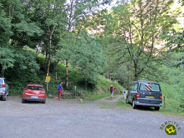
There are numerous routes with which we will initially coincide, among them the GR 10 the Pyrenean Path on the French side.
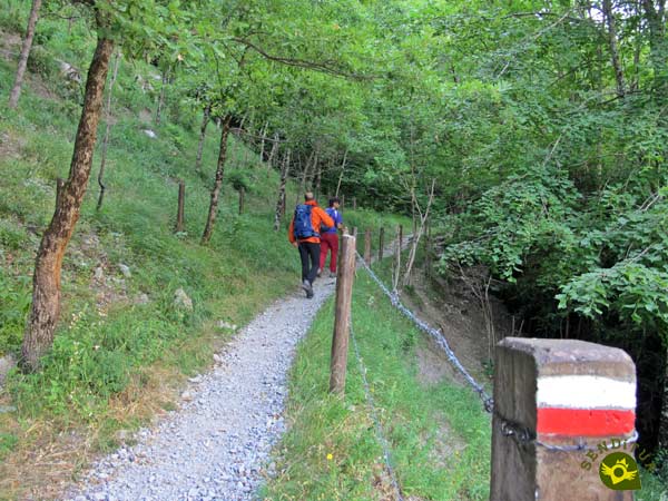
From the first moment we start to gain height with every step we take. The marks of the GR 10 will accompany us in a good part of the route.
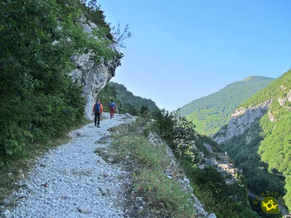
Soon the silhouette of the imposing Fort of Portalet comes into view, allowing us to contemplate it from our privileged location.
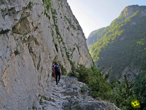
The itinerary quickly turns to enter the gorges d'Enfer, where the stream of the Secoue runs, and thus begins our passage through the Way of the Mâture.

This part of the route once on it, although it is the most known for its spectacularity, does not give the sensation of being as impressive as it really is. The route still demands a considerable effort to continue gaining height.

Once the most famous part of the route is over, we find ourselves in much more exposed areas than the previous one. The path continues up the gorges d'Enfer without hardly leaving us a moment's respite.

After a while the vegetation begins to take over the environment around us. A vegetation that in some cases hides the precipice that we still have at our side.

Finally, the slope becomes softer, warning us of the near end of our journey through this spectacular ravine.

The shepherds' huts, also a refuge for mountaineers in winter, mark the beginning of the final stretch of this part of the route.

Surrounded by a thick forest we advance in search of the crossroads where we will say goodbye to the GR 10. This area of the route at first sight does not seem to have the spectacularity of the previous sections.
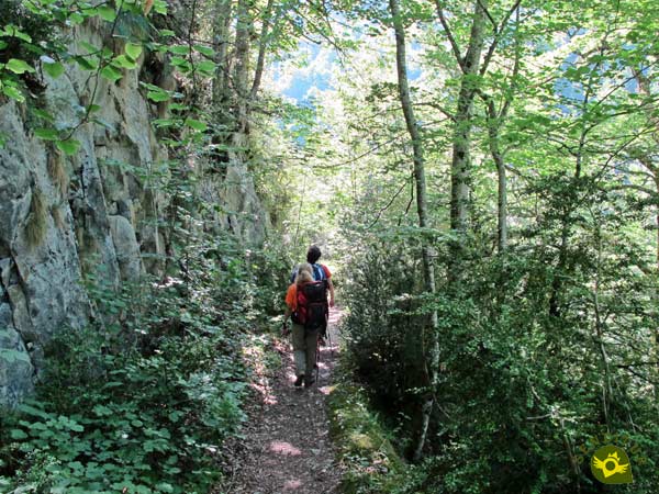
The vegetation hides the dizzying profile of the trail we are walking on.

After a while, we reached the detour that gives us the interesting possibility of approaching the battered bridge that crosses the river we have climbed.

Once there we will have to decide if we skip the recommendation of not crossing this bridge to visit the bridge and the nearby river waterfalls.
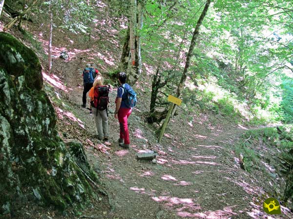
Back to the previous detour, we start a strong ascent, to head towards the Col d'Arras. This steep trail winds up the side of the mountain, softening some of the slope.

After a while we arrive at the crossroads where we say goodbye to the GR 10 which continues its course, while we head towards the starting point.

This part of the route continues to make us gain height, although not as much intensity as before, except for a few short ramps.

Now we can see ourselves crossing the same ravine that we went through before but also in the opposite direction, through the high part of the mountain that imprisons it.

After a while the vegetation gives way to the pastures that mark our arrival at Col d'Arras. From here the view of the Pyrenean mountains is magnificent, compensating for the effort made.

Almost immediately we start the long and intense descent ahead of us. A descent that could well be said to gain in intensity from crossing one of the fences that delimit the areas of pastures.

From now on, we will be walking along a typical mountain trail, whose condition does not allow us to get distracted.

Another crossroads comes into view, we continue to descend along the trail on the left, leaving behind the path that leads to the Bieus car park.

The remarkable unevenness we are facing makes us happy not to have to tackle it in the opposite direction. As it could not be otherwise, our trail does nothing but draw curves to mitigate the unevenness it has.

After a long time descending, we came across a creek that forced us to look for the best way to cross it. This creek marks the beginning of the final stretch of the trail we are following.

A trail that ends when it meets the path by which we must continue to descend.

This path quickly takes us to the meeting point of the road that leads to the parking lot from which we left.

A road that we must follow, leaving in this case on our right the path that leads to Etsaut.
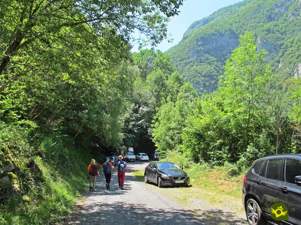
All that remains is to continue descending along the road to reach the car park from which we started at the beginning of the route.
The distance will vary depending on where we park our vehicle.
This figure can vary considerably depending on the car park from which you start your journey.
Autumn is a very good time to visit this area of the Pyrenees, given the colourful forests that the route crosses. If the weather conditions are not appropriate, it rains, there is snow or ice, certain areas of the route are not very advisable in these circumstances.
The type of terrain we will be walking on makes it essential to wear specific hiking or trekking shoes. We must also take some water with us, as we will not have drinking fountains along the way. Remember that you are in the middle of the Pyrenees and the climate can change abruptly, so it is essential to be properly equipped. Consult our list of material and equipment for hiking. Read more.
Physical
The slope to be overcome is remarkable, with some entity ramp. Fortunately, the distance allows us, provided we leave in time, to face it with the necessary calm so that it does not pose a problem, if we are well physically.
Severity of the environment
It is important not to lose respect for the route, given how exposed and vertical it is in some sections. The path is generally wide enough to allow us to get away from the abyss that opens up beside us. We are not exempt from falling stones either, the area is frequented by climbers so it is important to be attentive, and although it should not be remembered, neither should we throw stones down the cut. If the surface is humid it is not advisable to do the route. In addition even being in perfect conditions the stones are very polished being some of them extremely slippery.
Orientation
Well signposted throughout the route, we should have no problem following the route. It is certain that the great amount of signaled paths with which we will coincide can generate some doubt to us throughout the route.
| 1-Parking | 0:00h | 722m | 0Km | 30T 699087 4751775 |
| 2-Bridge Detour | 1:45h | 1162m | 3.1Km | 30T 701385 4751668 |
| 3-Col D'Arras | 2:35h | 1280m | 5Km | 30T 700082 4751659 |
| 4-Parking | 3:40h | 722m | 8Km | 30T 699087 4751775 |
Coordinates UTM Datum WGS84

![]() Slope: 1316m
Slope: 1316m
![]() Slope +: 658m
Slope +: 658m
![]() Slope -: 658m
Slope -: 658m
![]() Maximum altitude: 1305m
Maximum altitude: 1305m
![]() Minimum altitude: 722m
Minimum altitude: 722m
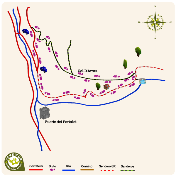
This sketch of the route is not made to scale nor does it contain all the information relating to the area, it is merely indicative.
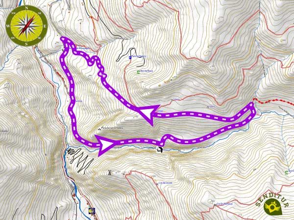
This scheme with the route is approximate and is merely orientative.
Senditur has manipulated the tracks to correct the aberrant points that may exist, caused by problems with the reception of the GPS signal. In any case the tracks are always approximate. SENDITUR encourages you to use the new technologies within your reach, using them as support and consultation in your activity, not basing the realization and orientation of the same only and exclusively on them, since they may see their functioning altered by very diverse causes, not functioning correctly and their indications may not be precise.
¿Did you know that...
The Way of the Mâture after its completion there around 1771 was in use for a little more than 6 years for the transfer of the logs and wood needed for the construction of the ships of the French navy.
Don't miss out...
The Fort of Portalet, built in 1842 to protect the passage of possible Spanish incursions, even though it was mainly used as a prison. Currently it can be visited several times a week, under reservation.
From the commitment of SENDITUR with Nature and the respect to the balance of the environment, SENDITUR urges you to travel in a responsible way, with low environmental impact and respecting at all times the Natural, Cultural and Social environment wherever you go.
Besides sharing with all of us your experience on the route we would be grateful if you could write to us to inform us of any erroneous or outdated information you may have found, or simply to let us know what you think at Thank you.
This route has been carried out in the field by SENDITUR on 06-07-2019. The route may vary greatly depending on the time of year, weather conditions and terrain, as well as the actions of third parties and the evolution suffered in the natural environment where it is located. All opinions, advice and/or assessments made by SENDITUR in their descriptions are for guidance only and are subject to and/or refer to the specific conditions of the specific day of the route, referring to that specific day, taken from trained people, with the appropriate experience and with a high level of physical and technical preparation as a reference, as well as correctly equipped.
All the times are approximate and take an orientative character, the stops have not been taken into account, no matter how small they are. All the information related to the route, texts, images, videos, maps, diagrams, tracks, towns, and places of tourist interest are published as a guide, and may not coincide with the current state of each place. Before undertaking any activity, assess your technical knowledge, your physical condition, find out about the weather and the variations that the route may undergo, equip yourself correctly, be prudent and responsible at all times, and do not exceed your capabilities. SENDITUR is not responsible for any misuse or inappropriate use of the comprehensive guides of its routes and/or publications as well as its electronic guides, nor for any variations in their descriptions for the aforementioned reasons, and recommends that everyone be responsible and prudent in carrying out the activity. We also encourage you to read books and specialised guides to complement the information described above.
Continue watching …