Welcome to SENDITUR.COM · paths · routes · tourism

It's a neighborhood of Burgos since 1969. It is located 7 km to the east of the centre of the municipality, on the plain formed by the river Vena and its tributary Pico, and is integrated into the urban fabric of Burgos, but separated by the Gamonal industrial estate. The first written reference to Villafría dates from the year 931, when it was mentioned as Villa Frida, Alfonso IV donated it to San Pedro de Cardeña.

It formed part of the Alfoz and Jurisdiction of Burgos, and was one of the fourteen places that formed its Intendancy during the period between 1785 and 1833, as stated in the Census of Floridablanca of 1787. As it depended on the Monastery of San Pedro de Cardeña it had the jurisdiction of an abbot and the abbot appointed the mayor.
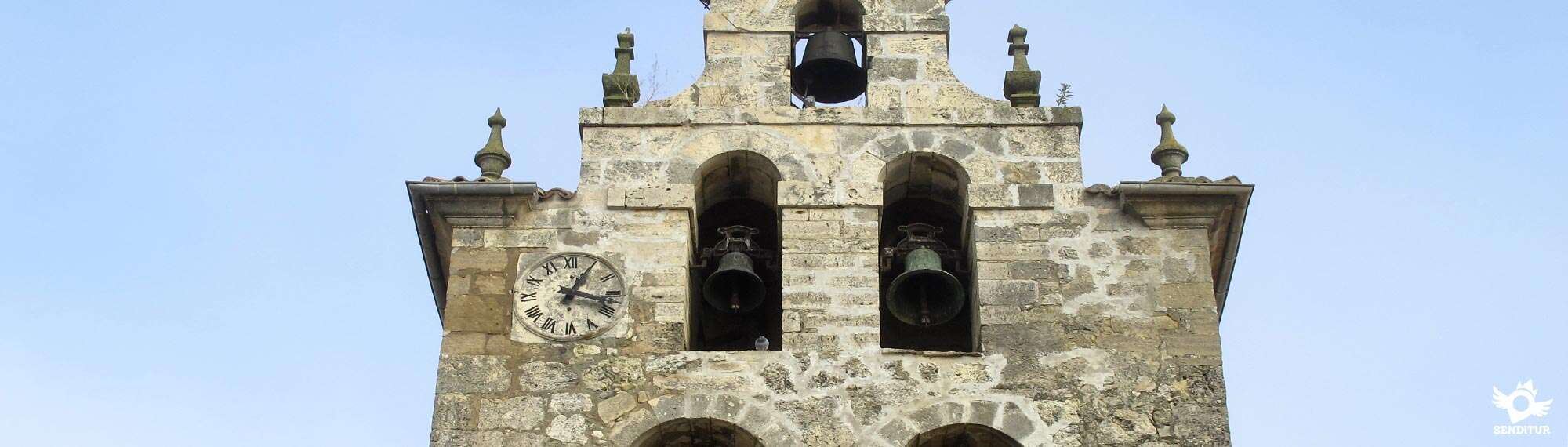
The parish church of San Esteban, which was rebuilt in the sixteenth century and has an interesting Baroque altarpiece inside. On the façade of the entrance door you can see the detail of a shell. Next to the church, a fountain with an original pyramidal body attracts attention. There is also an old pilgrims' hospital.

Villafría celebrates its festivities in mid-July in honour of San Esteban Protomártir.
In this old municipality, today a district of Burgos, come together the two most important pilgrimage routes that cross the province of Burgos: The French Way and the Route from Bayonne to Burgos.
Villafría is located on the N-I between Burgos and Vitoria, the town is located in the vicinity of Burgos capital.
The bus line 8 of Burgos brings us to Villafría.
SENDITUR is not responsible for any variation in the information described, as well as for the misuse of its guides and recommends that everyone be responsible and prudent in carrying out the activity. Likewise, we invite you to document yourself with books and specialized guides to complement the information described. From the commitment of SENDITUR with Nature and the respect to the balance of the environment, SENDITUR urges you to travel in a responsible way, with low environmental impact and respecting at all times the Natural, Cultural and Social environment wherever you go. For any suggestion, SENDITUR invites you to send an email to .
7:35 h.31.9 km.

4:45 h.20.2 km.

6:55 h.29.9 km.


Great encyclopedia of the evolution of man, natural treasure kept in time

Manganese mines whose exploitation is probably one of the oldest in Spain


Benedictine monastery where the monks raise their prayers through Gregorian chant
Continue watching …