Welcome to SENDITUR.COM · paths · routes · tourism


Climb to Cebollera from Lomos de Orio
Villoslada de Cameros, La Rioja![]()
![]()
![]()
![]()
![]() (1)
(1)
On horseback between two provinces
![]() Difficulty-Remarkable
Difficulty-Remarkable
![]() 5:50 h.
5:50 h.
![]() 19 km.
19 km.
Villoslada de Cameros, La Rioja![]()
![]()
![]()
![]()
![]() (1)
(1)
On horseback between two provinces
![]() Difficulty-Remarkable
Difficulty-Remarkable
![]() 5:50 h.
5:50 h.
![]() 19 km.
19 km.
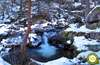
The Sierra Cebollera Natural Park, between Villoslada de Cameros and Lumbreras, is a protected area that marks the border between La Rioja and Soria, full of traditions and history that add to its special environmental importance. These lands, which for years were pastures for livestock, now house one of the lungs of La Rioja in which we find different species of plants that have grown looking for, according to their characteristics, the best places for them. Junipers, heathers and pines endure the rigours of the summits and high areas of the mountains that make up the park, while the beech and oak trees find the freshness and humidity they need proliferating close to the low courses of the streams. A natural environment that offers us a perfect mixture between culture, history and nature with which to enjoy every corner.

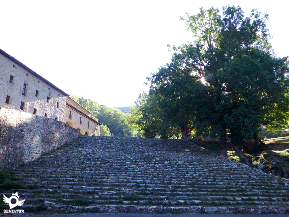
The climb to Cebollera from Lomos de Orio with 19 km takes us from the emblematic hermitage of Lomos de Orio, where every year hundreds of pilgrims come together to live the Charidad Chica and the Caridad Grande, shows the roots in the traditions that are preserved in these lands. From here, partly following one of the many paths that run through this natural park, we head towards a hard ascent that, through one of the firebreaks that protect this place, will take us to the high peaks that make up the park from where we can contemplate an impressive panoramic view of it. But before we will see ourselves recovering the breath lost in the effort of the ascent at the same time that we throw the sight to behind being surprised of the beautiful landscape that we are leaving to our feet. The first summit will resist to be conquered putting us a real chaos of blocks of stones for which we will have to advance looking for the best possible way to overcome the entertaining reefs that Cueva Grande puts us to our step. The reward that awaits us at its summit mitigates the effort necessary to reach it, allowing us to contemplate an extensive view of the park and the environment that surrounds it. Once we have overcome this hard ascent up to here, a more comfortable route awaits us through a false plateau that takes us to another summit of the park, the Alto de la Gamella, to go towards the highest summit of all those that we will tread on this route and that already extends in front of us.

Another stone wall stands in our way, separating us from La Mesa Cebollera, which, as its name suggests, resembles the shape of a table with a wide, almost flat summit that stretches out to end on the slopes that act as legs. This summit provides a different and extensive view that allows us, on clear days, perfectly observe other mythical peaks of the Iberian System such as Moncayo, Urbión or San Lorenzo. The route takes us from side to side through La Mesa, heading towards the next summit that we have set as an objective, already in the territory of Soria. But before that there are several summits that we will pass without realizing, La Mesa Sur or Alto de la Chopera go unnoticed between the silhouette towards which we go. The Cebollera peak gives us a panoramic view in which Soria and La Rioja are intermingled, adding the formations that ancient glaciers left on their skirts. Once enjoyed and recovered the effort that undoubtedly involves getting here, we head in search of the lower part of the circus of Cebollera where they form the lagoons that feed the stream Puente Ra. With luck, in wet periods, we will be able to see the lagoons full of water, next to the cliffs that surround them. Again in the main track of Lomos de Orio, we only have to travel the not little distance that separates us from the chapel. But before arriving, we will find the detour that leads to the Majada de las Desecadas and from there to the Puente Ra Waterfalls, another of the cultural and natural treasures that this park hides inside.
More information about the itinerary is available. DO NOT MISS IT...

From the nearby top of the Telegraph we can, following the shoulder of the mountain opposite to the one we arrived at, descend to the esplanade of the lagoons without having to return again to the Cebollera and take the path described at the end of the circus. The disadvantage of this descent lies in locating the path that descends to the valley, a route that until it is found will make us pass through very exposed areas whose difficulty and absence of marks requires experience in this type of terrain to avoid further problems.
The access to Villoslada de Cameros, 50 km from Logroño, is made following the LR-333 that joins it with the N-111, between Logroño and Soria, and with the neighbouring town of Montenegro de Cameros. Villoslada has a bus service that, from Monday to Saturday, connects it with Logroño and nearby towns. Following the N-111 road from Logroño to Soria, we will arrive after crossing Villanueva de Cameros, at the detour of the LR-333 that will lead us towards Villoslada de Cameros. When arriving at Villoslada we continue straight for the highway, to the height of the building that lodges the Center of Interpretation of the Park we found an asphalted track by where we must turn aside, leaving the highway LR-333 that joins Villoslada with Montenegro and the two Viniegras, to continue in direction to the Achichuelo and to the hermitage of Lomos de Orios. This track crosses the valley of the high Iregua to after passing next to the main recreational area of the Achichuelo, to arrive at the surroundings of the refuge of the Achichuelo where we will cross the river to begin the ascent that will take us until the surroundings of the hermitage of Lomos de Orio where we will find the parking lot to be able to leave our vehicle.
The great distance of the route added to the strong ramps that it will have to face make of this a demanding route in which in addition it will not have zones of shade that protect it of the sun, extending the hardness of the route the days of heat. Another factor to add in the physical thing is the passage by the zone of blocks that without a doubt will demand an extra effort to him, and where the safest thing we will have to give a hand to our companion to help him to save some of the steps, so much for his security as for that does not leave good part of his energies in it. Be very careful with the barbed wire fence in the environment of the Onion, the wire is pulled by the floors and it is easy to get hooked with it.
Without shadow in good part of the layout and without water except in the troughs that we will pass by the track of Lomos to our return, we are forced to calculate with looseness the water that we are going to take him, that next to the food that helps him to recover the spent energies they have to form part of the material that we carry.
We are in a Natural Park with its own rules so we must comply with the rules. The cattle is a habitual one of this zone reason why surely we will find with cows and some flock of goats with their pertinent shepherd dogs of a considerable size. Other animals to which we must be attentive are the bees and especially the wasps that abound in season in some sections of the route.
The car park of the hermitage of Lomos de Orio (0h 00min) is the point of departure, or of passage, of a good number of routes that cross the Natural Park of Sierra Cebollera and also in this case of ours.

We follow the dirt track that gives continuity to the road that brought us here. Little by little we leave the hermitage behind us, beginning a gentle ascent, for now, through a leafy pine forest, ignoring all the detours we find.

Soon, in front of us, in the middle of the curve of the track, a clearing opens up in the forest from where we will be able to contemplate part of this magnificent natural park.

It is at this same point where the beginning of the firebreak (0h 15min) is located, which takes us to climb the mountain following its course, which divides the forest in two.

Here we have the opportunity to decide whether to take this detour or to follow the track heading directly towards the Cebollera, depending on our experience and physical form.
The first steepness already exposes us clearly the strong slope that we are going to save by following the firebreak.

After this first ramp, in front of us is the route that awaits us in front, a staggered ascent that alternates zones of strong unevenness with other more benevolent ones.

There are few references of trails or paths that we can follow in search of the best way to gain height, the vegetation has been responsible for hiding almost any hint of path that indicates the path, so we will have to find for ourselves the most comfortable layout to progress uphill. The limits of the forest are the ones in charge of guiding us at all times, not having to leave us of the strip that they delimit.

Little by little we are rapidly gaining height, leaving behind a magnificent landscape to enjoy at each stop we make to catch our breath.

More or less half way up we will find a real wall, which will require a greater effort if possible to save it. Normally the route is something easier to follow on the right side of the firewall where we will find a better route.

The end of the firebreak, which does not of the ascent, is marked by the line of pines that unite both sides of the forest, being in her where towards its right part we will find the step that follows the route. This entry point is marked by stone milestones that indicate the exact point to enter the forest.

A path awaits us among the pines, sometimes following a diffuse trail that winds through the trees, continuing with the ascent. We must be attentive to the stone milestones that serve as guides leading us along the right path, making us leave behind a first stony field that stands in our way.

At each step the leafy forest gives way to more open areas, thanks in part to the fields that cover the terrain and force us to jump from stone to stone to follow the path that continues to the other side. We follow the itinerary of a marked path that tries to overcome the different obstacles that is in its way.

Again a small tongue of blocks makes us maintain the balance from stone to stone while we look for the continuation of the trail, marked by a small milestone on a huge rock. Our first summit is reluctant to let us reach it, putting all the pitfalls that can make it difficult for us to climb.

In front of us we can already see the cliff towards which we are heading and which, like a protective wall, separates us from the summit.

The route seeks to border on the left this wall of blocks, plunging us fully into the labyrinth of stones through which we will advance in this section of the climb.

Here the trail gives way to our intuition to find the ideal path between the blocks by following the milestones that mark the course to follow and the places we must pass.

This amusing stretch without great difficulties, does not exempt us from being attentive to avoid accidents that without a doubt could become of consideration, since we do not stop transiting by an abrupt terrain where stones can fall, or we can step where we should not and do much damage to ourselves.

The itinerary makes us border the cliff at the same time that we gain height surrounded by blocks and loose stones while we follow the milestones that take us towards our objective.

The presence over our heads of several pines indicate the proximity of the end of this wall that stands in our way.

Once up the battered trail makes again act of presence to guide us towards the true summit of which already little separates us.

But before we will have to jump again from stone to stone to save the short unevenness that separates us from the summit of the Alto de Cueva Grande (2h 00min).
Once this summit has been conquered, we have to sharpen our senses to find again the trail that will take us to the next summit of the day.

As a reference to follow, as long as we have good visibility, it is the very silhouette of La Mesa towards which we must direct our steps in search of the small milestones that point the trail.

Another option that we can use to find the path is to follow, not very close, the limits of the cliff, which following course SE extends towards La Mesa. The difficulty in finding the trail and even its absence in some sections makes it misleading, and even with fog or poor visibility we are relatively easy to get lost.

Once located, the path awaits us with a comfortable, almost flat stretch, in which we will advance relatively quickly, always with La Mesa in front of us.

To our left we can contemplate the silhouette of Pico Verde another mass of blocks to which, if we wish it, we can go from the environment of the top of the Alto de la Gamella (2h 15min) to which we arrive almost without realizing it after a new and short step between stones.

From here we take up again the false flatness that brings us closer to each step to the wall that we must climb to reach the next peak of the day. In the skirt of the mountain we can distinguish the route that follows the trail to save this apparent wall that is situated in front of us, leaving aside another chaos of stones that delimits one of its sides.

The more adventurous can head towards him to ascend between the blocks and then find again the right course. The rest of us follow the marked trail that undoubtedly leads us to the ascent section that awaits us a little further on.

What seemed like a hard ascent was not really as demanding as it seemed at first glance, allowing us to gain height with relative comfort.

At the end of the ascent, an immense plateau extends in front of us as far as we can see, here we have two options, the first is to follow the few milestones that take us almost in a straight line to the top of La Mesa, the second transports us to the left to follow the limits of the cliff and then guide us to the top, saved a short stretch of blocks.

Either option forces us to look for the best route to follow, as our trail returns to leave us to our fate, leaving us at the mercy of our ability to guide when it comes to following the right course. In any case, La Mesa Cebollera (2h 40min) offers spectacular views, allowing us to contemplate the environment that surrounds us.
From this peculiar summit we have to head towards the next objective, the Cebollera. To do this, we stand between the geodesic vertex that marks the summit and the table-shaped mailbox and, logically, leaving behind us the slope that falls towards the bottom of the valley, we walk almost in a straight line towards the SW.

We walk with almost no references to guide us, just some solitary milestone that in the distance makes us think we are going in the right direction. La Mesa, doing honor to its name offers us a wide practically flat land leaving to both sides and to enough distance the limits of the plain that we are crossing.

There are not many of them, nor are they as followed as we would be grateful for in case of fog, the milestones that trace the route, making us pass without noticing the southern summit of La Mesa, from where we will vary a little the orientation that we brought here, to continue through the middle of the wide cordal cimero by which we go.

The next summit we can climb is Alto de la Chopera. Although in this occasion they are the milestones and a punctual stretch of diffuse footpath those that avoid us, of not knowing it, to crown this summit.

We head towards the meeting with an elongated stone wall that delimits the border between La Rioja and Soria, with our mind and eyes set on our next summit of the day that is already clearly shown in front of us.

We are approaching the wall which, a little further ahead, gives way to a wire fence. When we reach its height, we will decide if we cross it or follow its limits that a little further on turn directly towards the Cebollera. The two options meet again quickly, having shortened some of the road those who chose to cross the battered fence, to avoid the curve it makes.

The fence marks the straight path to follow, using a battered road that runs parallel to it and seems to lengthen to the very summit.

Shortly before embarking on the final ascent of the mountain, some milestones mark the exact point where, on our right, the path arrives, by which we would come if, at the beginning of the firebreak, we decided to follow the track and not our route. Path that we will use to return to Lomos de Orio.

Together again, the two paths lead us to the summit, but not without first having to cross the railing, entering the province of Soria, the holder of this summit.

The final stretch of ascent does not require much effort to save it, allowing us to reach the top of the Cebollera peak (3h 40min) quite quickly.
Once we have enjoyed the privileged views that this mountain offers us, we are ready to start the way back, to do so we must partially retrace what we have walked following the trail that brought us here.

With the look we try to discover the route that we will follow to descend until the bottom of the valley that we have to our left.

When this part of the descent ends a little before reaching the milestones we left behind, a narrow trail avoids us a few metres of road, shortening the route diagonally.

In the beginning we will see each other again looking for the milestones that will assure us the direction to follow, since the trail is not so defined as to let us go less attentive. Little by little, as we descend the route is marked more and more as it gains in width.

A steep descent awaits us following an occasionally broken path that zigzags from side to side of the hillside seeking to cross the slope more easily.

The pines again make an act of presence, to the point of obstructing the road with their branches. The cobbled path quickly loses height reminding us of the unevenness overcome by following the firebreak.

In no case should we abandon the path on any of the trails we will cross. The plain of the lagoons extends to our left forming part of the glacial circus of the Cebollera, with its cliffs and its intermittent lagoons whose drains precipitate towards the bottom of the valley.

The marked way that we followed gives way to a green meadow in which once again we must be attentive to follow the correct course that takes us away from the Cebollera, between the milestones and the blurred layout.

We follow the meandering course of the route that alternates well-defined areas with others that are not so well-defined. Once again we have to cross a small ramp from where we can already see the still distant track that we will soon follow.

Once again another green meadow hides the route we must follow, making us doubt for an instant due to the absence of milestones that seem to have been replaced by ribbons hanging from the branches of the pines.

In any case, the tenuous path leads us in the right direction to recover its marked form among the pines and lead us in a steep descent to the track of Lomos de Orio.

Our way leads us directly to the junction with the track of Lomos de Orio (4h 20min), by which we will travel the kilometers that still separate us from the end of the route.

A long journey awaits us, following this track in perfect condition, which meanders across the hillside, saving the ravines and hills that descend towards the valley.

This section does not leave room for losses as it makes us constantly follow the course of the track that crosses the path that descends towards the Majada and Puente Ra.

The detour of the firebreak that we follow at the beginning of the route warns us of the proximity of the end of the route, from which we are little separated. Once again, we will retrace our steps at the beginning of the route, without turning off at the few crossroads we will find.

The car park of the hermitage of Lomos de Orio (5h 50min) awaits us to conclude this beautiful route.
 Distance. 19Km
Returning by the same route from the Cebollera hardly subtracts any distance from the route.
 Time. 5:50h
As we make the ascent to Cueva Grande will mark the time we need to make the journey, not by how fast we climb but by the energies we use in it, and that we may need the rest of the journey. If we encourage ourselves to visit the summit of Pico Verde we will have to add about 20min more and if we do it with the Telegraph will take us about 35min approximately.
 Time of year
In both periods the surroundings of the route will offer us a true spectacle of colors guaranteeing us more or less stable days and not very hot that allow us to enjoy to the maximum the perspective that has from the summits of the natural park of the Cebollera. Winter or periods with snow, require a different physical and technical condition added to the necessary material that allow us to face a journey that tends to accumulate a lot of snow and ice. In summer, heat and the absence of shade are the main enemies we will encounter.
 Required equipment
Due to the characteristics of the route, the map of the area and the compass, together with the GPS with the tracks, cannot be missing in the backpack, nor can we forget enough water to face such a long route as well as some food to replenish the spent energies. Some binoculars will allow us to contemplate with more detail the other mythical summits of the Iberian System that surround the route. Trekking boot or technical shoe will help us to progress safely through the blocks of stones, but without forgetting that there are 19 kilometers that we have to walk. Sun protection cream, sunglasses and a hat or cap cannot stay at home on a route without hardly any shade, to all this we have to add the usual backpack, clothing according to the time of year, without forgetting that this mountain range acts as a barrier between the plateau and the north of the peninsula so the weather can be something different on one side than the other, also the first-aid kit and the mobile with the battery at full capacity must be part of the group. Consult our list of material and equipment for hiking. Read more.
 Difficulty. Remarkable
Physical
The distance marks the demand and the physical difficulty of this route. It is true that the ascent through the firebreak will condition the rest of the itinerary due to the strong unevenness that we save in such a short distance. These hard ramps require a good physical preparation, although taken with the due calm they will make us dent, but it should not spend all the energies in the attempt. The distance and the heat that we can find at certain times can play a trick on us if we insist on climbing these sections with too much joy.
Severity of the environment
Virtually the entire route passes through places that should not cause us too many complications, beyond those of walking through scrubland. Now the route that follows the firebreak will require us, to reach the first summit of the day, to advance between blocks of stone helping us in few occasions of our hands to pass between them. Although this section of blocks does not represent a major difficulty for a person accustomed to mountain routes through somewhat abrupt terrain, being even a fun and entertaining part of the route, for someone who has not developed through this type of terrain can have a hard time, not only because of its difficulty but also because of the need to recognize the right path to follow so as not to get into greater complications. Here we must be attentive to avoid falls or to put the leg where we should not, in addition if someone advances in front of us it is possible that some stone is thrown to us. For the rest another factor to keep in mind are the holes that are hidden between the bushes that cover part of the route not to put the foot in them and to do us harm. The way of descent is, in zones, quite decomposed bothering us the advance.
Orientation
The whole route is signposted by stone milestones that are the only reference to follow in many sections of the road in which the path disappears completely leaving us without its appreciated reference. Therefore this is a route that with fog or poor visibility is not very advisable because in many cases we will not see the milestones that mark the path and we will have to pull map and compass to be able to move forward with guarantees. In any case and even with good weather, the GPS with the tracks is the least we should take to avoid problems, especially if we do not know the area. The easiest option to follow for those who do not have too much experience is the one that continues along the track until the detour towards the esplanade of the lagoons since except for short stretches it develops through well marked paths and paths that take us almost to the summit of the Cebollera.
 |
 |
 |
 |
 |
| 1-Hermitage of Lomos de Orio | 0:00h | 1420m | 0Km | 30T 526669 4655083 |
| 2-Firewall Startup | 0:15h | 1495m | 1Km | 30T 526450 4654459 |
| 3-Alto de Cueva Grande | 2:00h | 2081m | 3.8Km | 30T 528269 4653255 |
| 4-Alto de la Gamella | 2:15h | 2102m | 4.8Km | 30T 528840 4652492 |
| 5-La Mesa Cebollera | 2:40h | 2163m | 5.9Km | 30T 529327 4651627 |
| 6-Cebollera | 3:40h | 2141m | 9.1Km | 30T 527036 4649599 |
| 7-Link to the Lomos track | 4:20h | 1660m | 12.5Km | 30T 526177 4651685 |
| 8-Hermitage of Lomos de Orio | 5:50h | 1420m | 19Km | 30T 526669 4655083 |
Coordinates UTM Datum WGS84

 Slope: 1762m
 Slope +: 881m
 Slope -: 881m
 Maximum altitude: 2163m
 Minimum altitude: 1420m

This sketch of the route is not made to scale nor does it contain all the information relating to the area, it is merely indicative.

![]()
This schematic with the path is approximate and has been created from the derived cartographic base © Instituto Geográfico Nacional "Cuadrante 279-4, 279-3, 317-2 y 317-1 1:25.000"
Senditur has manipulated the tracks to correct the aberrant points that may exist, caused by problems with the reception of the GPS signal. In any case the tracks are always approximate. SENDITUR encourages you to use the new technologies within your reach, using them as support and consultation in your activity, not basing the realization and orientation of the same only and exclusively on them, since they may see their functioning altered by very diverse causes, not functioning correctly and their indications may not be precise.


Una zona de La Rioja muy bonita, con muchos recorridos de diferentes tipos, me encanta.


Location of the Virgin of Valvanera, Patron Saint of La Rioja


Place of burial of a holy body, Saint of the River, Saint of the Duero

Rocks polished by natural elements that hold the memory of millions of years

Find out what to see in...
¿Did you know that...
Not so long ago what is now populated by dense forests was actually a vast field of pastures where thousands of cattle from the south of the peninsula spent the summer in search of a more benevolent climate than the summer Manchego and Extremadura.
Don't miss out...
El centro de interpretación de la Trashumancia que podrás encontrar en la Venta Piqueras, junto a la otra ermita significativa del parque, la de la Virgen de La Luz. En el centro de interpretación podemos sumergirnos en la vida e historia que ha marcado estas tierras durante años.


From the commitment of SENDITUR with Nature and the respect to the balance of the environment, SENDITUR urges you to travel in a responsible way, with low environmental impact and respecting at all times the Natural, Cultural and Social environment wherever you go.

Besides sharing with all of us your experience on the route we would be grateful if you could write to us to inform us of any erroneous or outdated information you may have found, or simply to let us know what you think at Thank you.
This route has been carried out in the field by SENDITUR on 30-08-2018. The route may vary greatly depending on the time of year, weather conditions and terrain, as well as the actions of third parties and the evolution suffered in the natural environment where it is located. All opinions, advice and/or assessments made by SENDITUR in their descriptions are for guidance only and are subject to and/or refer to the specific conditions of the specific day of the route, referring to that specific day, taken from trained people, with the appropriate experience and with a high level of physical and technical preparation as a reference, as well as correctly equipped.
All the times are approximate and take an orientative character, the stops have not been taken into account, no matter how small they are. All the information related to the route, texts, images, videos, maps, diagrams, tracks, towns, and places of tourist interest are published as a guide, and may not coincide with the current state of each place. Before undertaking any activity, assess your technical knowledge, your physical condition, find out about the weather and the variations that the route may undergo, equip yourself correctly, be prudent and responsible at all times, and do not exceed your capabilities. SENDITUR is not responsible for any misuse or inappropriate use of the comprehensive guides of its routes and/or publications as well as its electronic guides, nor for any variations in their descriptions for the aforementioned reasons, and recommends that everyone be responsible and prudent in carrying out the activity. We also encourage you to read books and specialised guides to complement the information described above.
Continue watching …


.jpg "Go to Caves of Ortigosa")
.jpg "Go to Estate of Ribavellosa")