Enchanted forest of Urbasa
Olazti/Olazagutía, Navarra![]()
![]()
![]()
![]()
![]() (2)
(2)
One of the jewels that treasure the mountain ranges of Urbasa and Andía
Olazti/Olazagutía, Navarra![]()
![]()
![]()
![]()
![]() (2)
(2)
One of the jewels that treasure the mountain ranges of Urbasa and Andía
The Natural Park of Urbasa and Andía, in Navarre, treasures countless hiking trails that lead us to discover great natural landscapes of incalculable value and not only landscape, but also ecological. One of these routes crosses the interior of the well-known enchanted Forest of Urbasa, a chaotic one, to the pair of beautiful corner, of this privileged land.

The route along its 7 km takes us, from the information center of the park, to this majestic place that makes just reference to its adjective of enchanted. As it could not be otherwise, on our way we will meet some of the paths that cross the Natural Park of Urbasa and Andía, itineraries such as that of the Mountaineers that ascends to the mythical peaks that mark the forest we are going to travel. In our way we will be able to know part of the old activities that were given here, charcoal burners and shepherds, among other characters, left their mark in these places. After saying goodbye to the Montañeros path, we will enter a world of fantasy where countless shapes and figures capriciously carved by nature await us. An enormous txapela, a simply spectacular boletus or a natural arch that reminds us of those built by the Romans, are just some of the surprises that await us. We walk through this labyrinth of rocks seeking to make our way while different shapes and figures assault us.
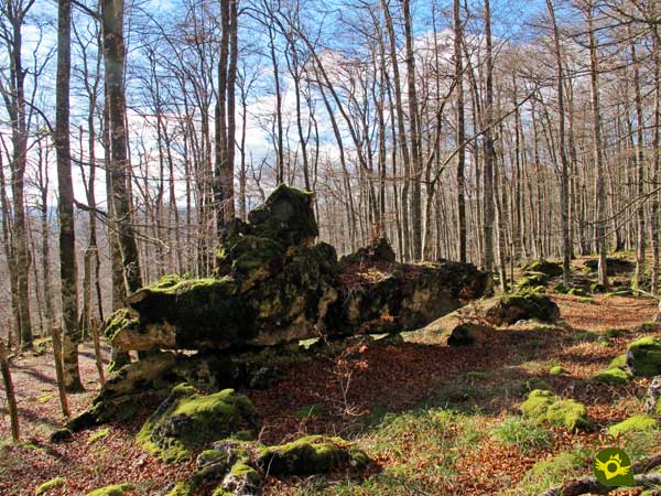
We ascend leaving behind us the remains of an old sailboat, careful not to fall into the chasms that characterize these karstic terrains. As we ascend we discover the silhouettes that hide the stones that surround us, a submarine in the middle of a forest, the head of a big bear, a solitary duck several meters high or the elongated neck of a diplodocus are just some of the treasures that this enchanted forest has in store for us. Without a doubt, letting our imagination fly will make us discover many more forms. But for those who want to take advantage of the day we can still continue climbing up to the abrupt crest by which we will go to crown the summit of Bargagain, from where we can enjoy the magnificent panoramic views that this mountain Navarre offers before returning to the car park that was our starting point.
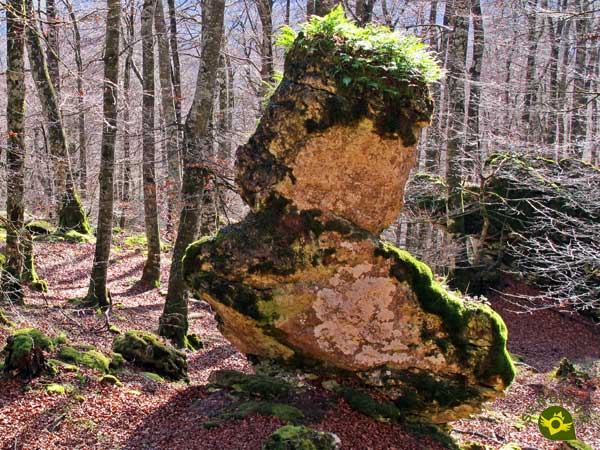
Legend has it that many years ago in the area lived some giants who had terrorized the inhabitants of neighboring villages. Although this family of giants did not do any evil and were dedicated to live in harmony with nature, the locals attributed to them everything bad that happened there. Until one day a furious mob was made to the mountain to try to finish off those giant monsters. The father trying to save his little son from the enraged pack that was thrown on them took him deep into the forest to hide it, asking him not to move from his hiding place. When everything happened and the father returned to his little one's hiding place, he had disappeared and it was never known again. Since then his father, hoping to find him, or at least not alone, takes him each year a toy to the forest where his little one is still lost today, being the first thing he left his txapela because the little giant used to put it on as soon as his father got lost.
To get to the Urbasa and Andía Natural Park information booth, from where this route starts, follow the road that links the towns of Estella, in the middle of the Camino dual carriageway between Logroño and Pamplona, and Olazagutía on the A-1. Once there we will have several areas fitted out for parking vehicles from which we can access the enchanted forest.
Nice route for our friend who should not require great efforts to make it. We must take into account the regulations of the park that, in addition to asking us to take it under control at all times, asks us to have the necessary documentation regarding health issues.
We will not have points where our partner can drink, so it is essential to bring some water.
Cattle usually graze in the area, usually not in the forest, so taking our friend controlled if we also add how easy it is to get lost in the labyrinth we are going to be in is a very good idea.
We begin the tour next to the house that houses the information point (0h 00min) of the Natural Park of Urbasa and Andía.

Luckily we can avoid walking along the road thanks to the trail that runs parallel to it.

We left behind another of the parking areas we have available in this area of the park. The marks of the Path of the Mountaineers, with which we will coincide in part of our route, serve us as reference to follow.

The trail takes us without loss to the meeting of the adapted itinerary that begins in the nearby car park next to which we are passing.

This circular route serves as a guide in this part of our route. The posts of the route of the Mountaineers continue marking us the way to follow in the different crosses that we are finding.

We soon reached the moment of abandoning the adapted path and entering the leafy forest. Almost at the moment we will see ourselves crossing a wide clearing of the forest.
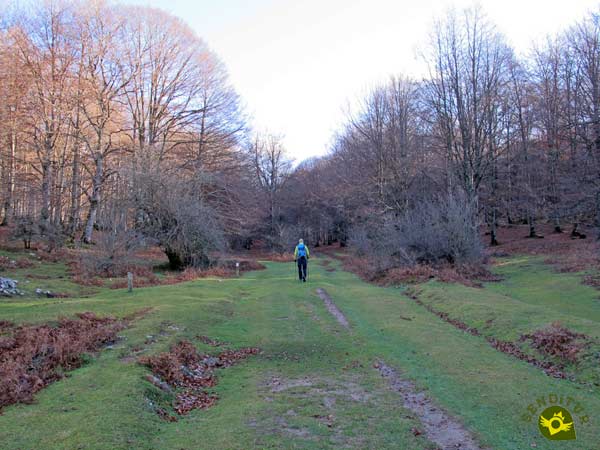
On the other side, a kind of track covered by grass brings us back into the forest. This track, together with the marks we are following, leads us to our destination without major complications.

Soon we'll see ourselves passing by an old coalman's txabola, almost at the same time that we left to our right the GR that was accompanying us until the moment.

From now on, and not for long, it will be the green marks of the Path of the Mountaineers that will continue to guide us.

Once again the track is diluted again under the green tapestry that covers it, forcing us to be attentive to the posts that indicate the direction to follow.
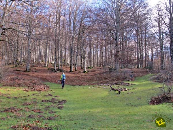
Almost without realizing it, we arrive at the point where we must say goodbye to the track we had been following in order to begin to gain height along the trail that begins here.

A trail that immediately disappears under the leaf litter that covers it. Without time to get used to this new environment that surrounds us the Path of the Mountaineers that we were following turns to the left while we continue straight into the enchanted Forest of Urbasa.

From now on we will not enjoy any sign or a footpath that serves as a reference and we will have to guide us by other means to find the different sculptures that await us, such as the Txapela that welcomes us to this spectacular labyrinth.

After visiting the Txapela a couple of stones like colossal columns will call our attention inviting us to look for the way to cross them.

On the other side we head towards the apparent exit of the rocky cliffs that surround us, where another of the monuments of the Enchanted Forest of Urbasa, the Great Arch, awaits us.

A low arch that we will cross for nothing more than to make it turn to the right and to continue in search of the following surprise that keeps us this forest.

Without a defined layout we will have to look for the best way to advance through this labyrinth of stones, roots and trees. Luckily we have the GPS that helps us to find the Gran Boletus, which hides in this forest.

Getting from one point to the other is a fun task through this spectacular spot. Each stone that we leave behind evokes us different silhouettes according to the perspective that we adopt, even we arrive to find us with a slender Sailboat.
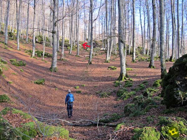
We came out of this wonderful chaos to begin to gain altitude, as could not be otherwise without anything to guide us, except the GPS.

After passing by another pile of stones we face the slope of the mountain looking for the best way to save the slope more comfortably.

It is a cross-country ascent in which we sometimes come across a tree marked by signs that do not belong to our route.
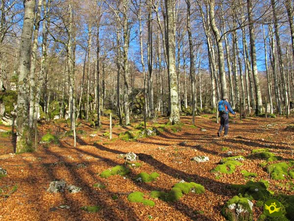
After a while, in front of us emerges a fence and the path that ascends the itinerary of the Mountaineers with which we reconcile.

We continue along this path, gaining height without much effort and with the invaluable help of the brands that guide us again.
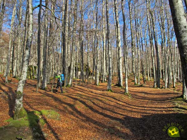
But much faster than we would have liked we must say goodbye to the path and its signs to cross the fence thanks to a step it has.

Here we have the possibility of ascending straight, leaving the fence behind us, to approach a small cave located not far away.

After visiting it, we must return to the enclosure to take up our route, which seems to make us return down the road, a path that led us to pass, surely without realizing it, next to an old submarine stranded in this charming forest of Urbasa.

After approaching to visit it we take up again our route that makes us separate little by little from the fence.

Once again we are immersed in the chaos of enormous stones and deceptive chasms that characterize this forest looking for the best way to continue.

If we look closely, to the left of this labyrinth runs a kind of path that borders it facing the new ascent ahead. Already in it it becomes much easier to continue with our route.

A route that takes us past the enormous Head of a Bear. And shortly after, next to a solitary Duck of surprising dimensions.

The route begins to meander and in order to make our work easier, the typical stone milestones that mark it begin to appear.

The slope is evident and the route to follow although more obvious than in previous sections is still difficult to find.

We remain obliged to guide ourselves by our own means in order to find the right path. A big ball and what looks like the head and part of the neck of a diplodocus are the following characters of the forest that greet us at our pace.

At this point those who consider it so can return on their steps and thus avoid the final ascent and the crest to the top of the Bargagain.
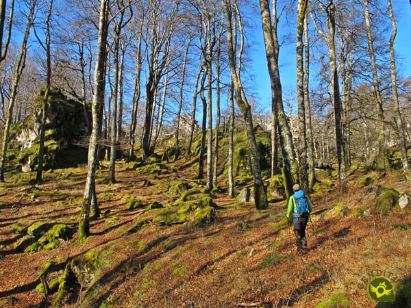
The rest of us will continue immersed in full ascent through the labyrinthine forest that we are crossing.

We still have nothing marked the itinerary to follow but between the GPS and the trail that seems to be intuitive we advance without too many complications.

The proximity of the crest towards which we are heading is noticeable on the ramps we have to face.

Once again we see ourselves crossing a battered fence that warns us of the near end of this stretch of ascent.
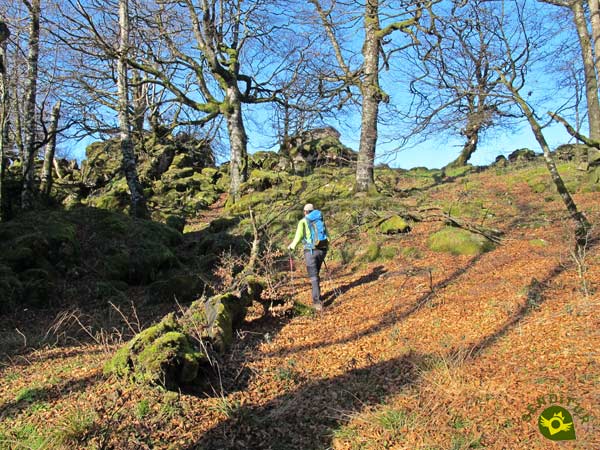
We approach the crestero, which we must follow, although another chaotic stretch is still waiting for us to do so.
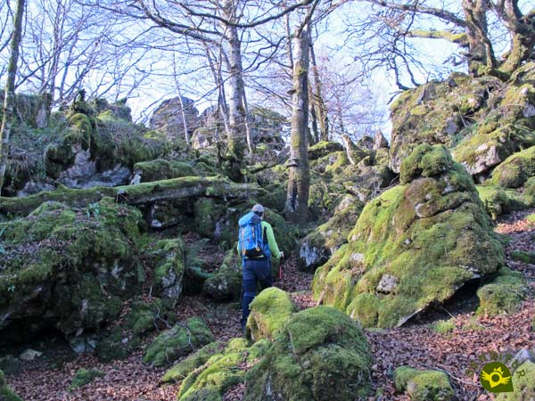
An area in which once again we must be attentive to cross it as best as possible.

Once up we will find the marks of the path that runs along the cresterío, in truth we will have the possibility of doing it either by the south slope, or by the north.

We decided to follow the path of the northern slope although it is not easy to find the passage that allows us to access it safely. Already on the other side the trail is clear and without major complications.

After a small serpentine that allows us to lose some height, we definitively join the path that runs under the ridge that we have crossed.

A trail that except for the usual mud that characterizes it does not present many more difficulties. Soon we reach the point where we will walk again to the top of the ridge.
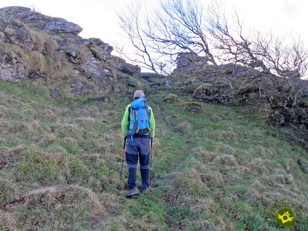
After doing so, a much more amiable terrain opens up before us from which we can already sense the nearby summit towards which we are heading.

But to crown the Bargagain (2h 05min) we still have some slippery step or another in which we will have to take extreme precautions.

After enjoying the marvellous views offered by this Navarrese mountain, we continue our route dabbling in a simple rocky stretch. Those who are not seen with the security or agility necessary to do so can follow the path that borders the southern slope of the same.

We continue crossing this beautiful and already simple crest in search of the path that will return us to our starting point.

This trail is marked by a battered landmark that indicates the beginning of the descent.

On this occasion the leaves do not completely hide the wide and steep path we are following. We lose height quickly and advance cautiously to avoid slips.

After a while we'll be forced to cross another fence again, this time thanks to a wooden bridge.

The descent practically reaches its end when we come across one of the singular trees of this forest, delimited by its corresponding wall.

A couple of stones seem to serve as a gateway or exit to the forest we have traveled.

After crossing them, to our left we will see the ramp that will return us to civilization. The adapted itinerary that we follow at the beginning of the route awaits us there.
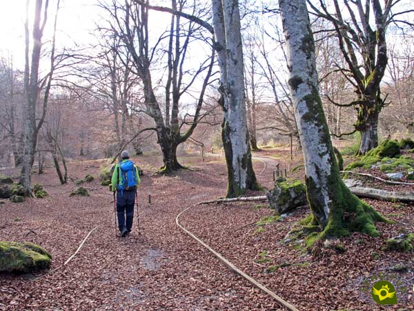
All that remains is for us to return on our steps to the car park (2h 45min) from where we leave at the beginning of this route through the enchanted forest of Urbasa.
On this route, more than ever, this figure is a guideline, as we will undoubtedly increase the final distance in the forest.
This figure in this occasion is practically symbolic since it will be very affected by the itinerary that each one follows and by the time that must be used to find the route to follow, without counting on the multiple stops that without a doubt will make.
The terrain on which we move is extremely slippery so if we increase the humidity that already has the result can get to complicate the route quite a bit. The landscape is undoubtedly spectacular all year round, but like any forest that prides itself is in spring and especially in autumn when it gives us all its splendor.
Not only because of the mud we can find, but also because of the hidden traps we will go through, like stones and holes, make it more than advisable to wear good hiking shoes that protect us and give us a better grip. Indispensable the GPS with the tracks of the loaded route, the canes also can serve us of aid and neither can lack us some water and food. Consult our list of material and equipment for hiking. Read more.
Physical
Neither the distance nor the unevenness should be a great complication for someone accustomed to hiking and the mountains, although it is true that the type of terrain through which it runs and the lack of references to follow in the route, can and in fact increase the physical demand that this route would normally have.
Severity of the environment
This section, together with the orientation section, are the ones that bring practically all the difficulty to this route. Chasms and dolinas, stones and very slippery trails and a section of crest that, depending on where we face it, leaves us more exposed, make it advisable to take extreme precautions and not take the itinerary lightly.
Orientation
As it is not an official route in much of its layout, and run at will through the interior of the forest, we are faced with a route that requires some experience, in addition to taking with us the necessary means for navigation through the labyrinth that is the Enchanted Forest of Urbasa. In addition the different paths that we will find do not make it easy either, even more in the area of the crest, where the different trails are added to the convoluted terrain.
| 1-Parking | 0:00h | 886m | 0Km | 30T 567098 4745636 |
| 2-Txapela | 0:30h | 927m | 2.2Km | 30T 569057 4746142 |
| 3-Big Arch | 0:40h | 922m | 2.3Km | 30T 569147 4746125 |
| 4-Boletus | 0:45h | 933m | 2.35Km | 30T 569165 4746146 |
| 5-Sailboat | 0:50h | 935m | 2.4Km | 30T 569193 4746173 |
| 6-Cave | 1:00h | 1012m | 2.9Km | 30T 569374 4746505 |
| 7-Submarine | 1:05h | 995m | 3Km | 30T 569347 4746415 |
| 8-Bear head | 1:20h | 1046m | 3.5Km | 30T 569155 4746606 |
| 9-Duck | 1:25h | 1052m | 3.55Km | 30T 569161 4746634 |
| 10-Big Ball | 1:35h | 1078m | 3.7Km | 30T 569087 4746722 |
| 11-Neck of Diplodocus | 1:40h | 1086m | 3.75Km | 30T 569028 4746747 |
| 12-Bargagain | 2:05h | 1153m | 4.6Km | 30T 568418 4746795 |
| 13-Parking | 2:45h | 886m | 7Km | 30T 567098 4745636 |
Coordinates UTM Datum WGS84

![]() Slope: 660m
Slope: 660m
![]() Slope +: 330m
Slope +: 330m
![]() Slope -: 330m
Slope -: 330m
![]() Maximum altitude: 1153m
Maximum altitude: 1153m
![]() Minimum altitude: 886m
Minimum altitude: 886m

This sketch of the route is not made to scale nor does it contain all the information relating to the area, it is merely indicative.

This schematic with the path is approximate and has been created from the derived cartographic base © Instituto Geográfico Nacional "Cuadrante 114-3, 25.000"
Senditur has manipulated the tracks to correct the aberrant points that may exist, caused by problems with the reception of the GPS signal. In any case the tracks are always approximate. SENDITUR encourages you to use the new technologies within your reach, using them as support and consultation in your activity, not basing the realization and orientation of the same only and exclusively on them, since they may see their functioning altered by very diverse causes, not functioning correctly and their indications may not be precise.
¿Did you know that...
Thanks to dolmens, tumuli, menhirs and other remains it is known that there were human settlements in the area since prehistoric, Palaeolithic lower and middle. Its inhabitants, initially hunters, learned to domesticate animals becoming shepherds, an activity that still occurs today in the area.
Don't miss out...
The different corners of the enchanted forest of Urbasa, it is worth wasting some time in going deeper into it because there are many secrets that it hides, but with care not to get lost and of course attentive to the dangerous chasms and dolines that populate the area.
From the commitment of SENDITUR with Nature and the respect to the balance of the environment, SENDITUR urges you to travel in a responsible way, with low environmental impact and respecting at all times the Natural, Cultural and Social environment wherever you go.
Besides sharing with all of us your experience on the route we would be grateful if you could write to us to inform us of any erroneous or outdated information you may have found, or simply to let us know what you think at Thank you.
This route has been carried out in the field by SENDITUR on 09-02-2019. The route may vary greatly depending on the time of year, weather conditions and terrain, as well as the actions of third parties and the evolution suffered in the natural environment where it is located. All opinions, advice and/or assessments made by SENDITUR in their descriptions are for guidance only and are subject to and/or refer to the specific conditions of the specific day of the route, referring to that specific day, taken from trained people, with the appropriate experience and with a high level of physical and technical preparation as a reference, as well as correctly equipped.
All the times are approximate and take an orientative character, the stops have not been taken into account, no matter how small they are. All the information related to the route, texts, images, videos, maps, diagrams, tracks, towns, and places of tourist interest are published as a guide, and may not coincide with the current state of each place. Before undertaking any activity, assess your technical knowledge, your physical condition, find out about the weather and the variations that the route may undergo, equip yourself correctly, be prudent and responsible at all times, and do not exceed your capabilities. SENDITUR is not responsible for any misuse or inappropriate use of the comprehensive guides of its routes and/or publications as well as its electronic guides, nor for any variations in their descriptions for the aforementioned reasons, and recommends that everyone be responsible and prudent in carrying out the activity. We also encourage you to read books and specialised guides to complement the information described above.
Continue watching …