Path of the Source of the River Zirauntza
A natural space recovered to the industry
A natural space recovered to the industry
The Alava side of the Aizkorri-Aratz Natural Park rises above charming villages such as Araia. At the foot of such rugged peaks as the Aratz, we find natural areas of incalculable ecological value and great beauty that have survived the industrial boom. An industry whose footprint today has been annexed by nature forming an unparalleled natural environment.

The Path of the Source of the Zirauntza River, which is 4 km long, brings us closer to one of these corners where nature and the hand of man have come together to give us a surprising place. This trekking route starts from the house in the Aizkorri-Aratz natural park, in the town of Araia, and is ideal for doing it with the children as a family. After visiting the Mitxarro museum, the path takes us to the limits of the old metallurgical factory whose activity conditioned this region. The river gives us capricious waterfalls as we move towards its source. Nooks that next to the spectacular forest that surrounds us invite us to walk calmly, enjoying every step we take. Almost at our destination we have two ways to reach it, one follows the quiet course of the water channel that flows down the valley.

The other takes us to the riverbank in search of the spectacular Zirauntza waterfall. The two paths join again to cross the wooden bridge that gives access to the source of the Zirauntza, and the dam that holds back its waters. From this spot we can either retrace our steps or follow the course of the old water channel that feeds the factory we passed through at the beginning. This option follows in the footsteps of one of the GRs that cross these Basque Mountains. The old channel ends in a small water pond, and after leaving it behind we will join the route that goes up to the nearby Aratz. In our case and resisting the temptation to conquer its summit, we will begin the dizzying descent that will take us to Araia or rather to the house in the park from where we set off.

The local people tell us that many years ago, when the charcoal burners travelled through these forests, two rival gangs joined together, one from Alava and the other from Bizkaia. Both of them boasted of their abilities and mastery to the point of challenging each other in a singular duel. On Sunday morning, very early in the morning and in their best clothes, the two teams faced each other to decide which of the two was the best charcoal maker. Such was their skill that to date no winner is known, but it is known that after the contest there was a lively celebration that lasted well into the night.
To get to Araia, follow the A-1 between the towns of Salvatierra and Alsasua, where you will find a well-marked turnoff that will take you to the town of Araia. Once there, all you have to do is follow the road into Araia, which will take you to the entrance to the park where there is a parking area.
Nice and simple tour for our friend in which, however unaccustomed he may be, he should have no problem. Pay attention to the rules of the natural park and the short urban section we will cover.
Water is not a problem on this route but it is not out of the question that we bring him something just in case.
In addition to the fauna of the place we have to add the pets that in the urban zone we surely have to find.
The house of the Aizkorri-Aratz natural park (0h 00min) in the town of Araia in Alava, as well as housing the Mitxarro museum, is the starting point for this trekking route.

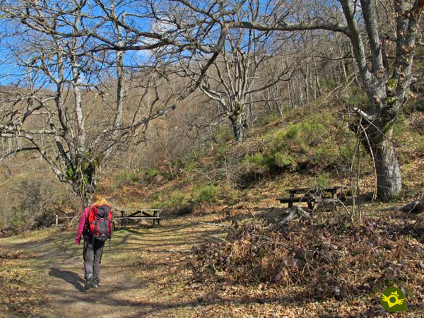
The route borders the building on its left to go in search of the beginning of the path. Just behind the park house we will find the real starting point of this route.

At the moment we started to gain height as if we wanted to prepare for what is to come. We will have our itinerary, in this part of the route, marked by green and white marks.

We quickly come across a crossroads, the one on our left being the one we must continue along.

The remains of the old Ajuria-Urigoitia factory can already be seen as we go along, with our eyes set on the steep Aratz.

We leave this old factory on our left to continue our journey. After passing through a wooden gate we will definitely enter the leafy riverbed whose course we are going to climb.

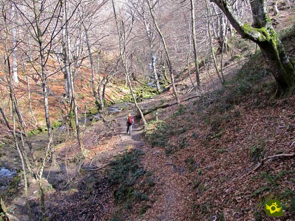
A river that will accompany us and will make the effort we must face more enjoyable. Although we are not facing a great slope, it does test our physical form.

Luckily the most demanding ramps are not long enough to get us into trouble.

In addition, these areas of ascent alternate with other much kinder areas that allow us to recover.

We continued advancing while we came across some paths that would go unnoticed if it were not for the signs that mark the route.

The river alternates its protagonism with the majestic forest we are crossing. A forest that gives us cozy corners where we can take a break and enjoy the beauty that surrounds us.

After a stretch of calm, the trail changes course abruptly to take another steep slope. Here we can approach the river for a moment to contemplate the waterfalls in front of us.

We return to our trail and the ascent takes us to a fork (0h 35min) where we must make a decision as there are two possible itineraries that will take us to the source of the Zirauntza.

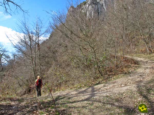
The most comfortable one, although it seems to be a lie, is the path that continues to ascend since almost at the moment we will reach the end of the ascent.

There we will come across a new crossroads and the water channel that we must follow, leaving behind these dirt tracks.

A water channel that, without any further complications, will bring us closer to the dam that precedes the source.

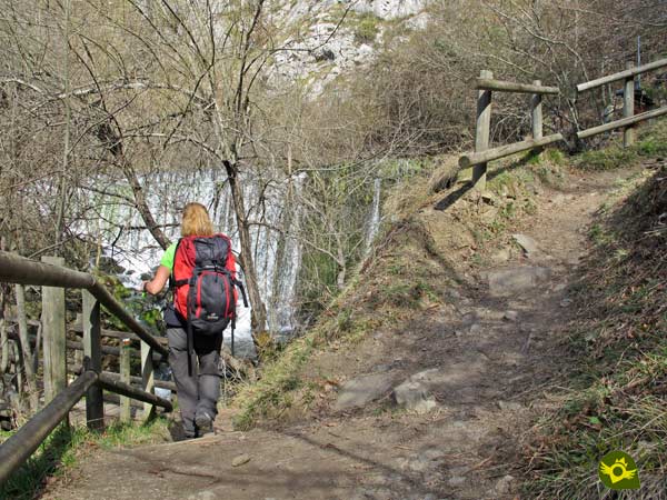
If, on the contrary, we dare to follow the option that borders the course of the river, we will have to face a trail that, although it does not have great complications, does force us to progress with more prudence.

The river has left some section of the path somewhat decomposed by wearing it out in one of its floods.

But in return he rewards us with unbeatable views of the Zirauntza River waterfall.

After enjoying it, all that remains is to follow the course of the trail that quickly leads to the meeting of the other path that runs alongside the canal to cross together the wooden bridge that precedes the dam and the source of the river Zirauntza (0h 50min).

On the other side, and after enjoying this natural spot, the GR-25 awaits us, through which we will return. This part of the route follows the course of another of the channels that were fed by the dam we have just visited.

We will have to face some short narrow and somewhat exposed stretch, this channel today apparently in disuse supplied water to the old factory through which we passed.

But otherwise the tour allows us to enjoy the landscape around us.

After a while, we arrive at a small water pond that we will save thanks to the trellis that allows us to follow the itinerary.

It is at this point that the channel reaches its end while we begin to gain height leaving a narrow path to our left.

This ramp reaches its end when it meets the road that ascends from Araia to the Aratz and by which we will begin to descend.

A battered path whose slope reaffirms the correctness of the direction chosen for the route.

As normally happens on these mountain paths we will find shortcuts that cut the curves they draw and which have become the main routes followed by the hikers who pass through here.

So in exchange for covering less distance we will face a steep trail which fortunately we will have to descend.

As you would expect, we will alternate this trail with a few stretches of path.

Although we'll quickly leave it again to get back on the trail.

Almost without realizing it, this tangled area brings us closer to Araia.

Here, a paved track will be in charge of guiding us in the final stretch of our route.

We continue descending, leaving on our left the old factory we passed at the beginning of the route.

Little by little we are getting into the first buildings of the town.

We walked down the streets of Araia in search of the park house from which we departed. A route that quickly brings us to the detour that leads to the parketxea (1h 35min).

Once again the river rises before us to accompany us on the last steps of this path of the source of the Zirauntza River.
The different layouts we can make should not cause this figure to change significantly.
Following the fork in the path by the river or the route by the water channel has or should have little impact on the total time of the route since there is almost no difference in distance.
Autumn and spring give an added value to this type of itinerary. Of course, the flow of the river has a great influence on the attractiveness of the route. But periods such as summer are also a good option since we can enjoy all the freshness and luxuriance of the forest we are walking through. In winter, the snow can paint a radically different landscape, although it also requires a certain amount of experience.
This is an apparently simple route but it requires us to wear suitable footwear, carry some food and water, put warm clothes in our backpacks in case it is necessary and have our walking sticks with us, which will undoubtedly help us on the ramps we will be passing. Consult our list of material and equipment for hiking. Read more.
Physical
Although we will have to overcome ramps with a certain unevenness, the distance or duration of these added to the numerous rests that we will find allow us to take them with the necessary calm so that they do not put us in trouble, as long as our physical level is reasonable.
Severity of the environment
By following the marked path at all times and maintaining the necessary common sense and caution in the most exposed areas we should not have any complications, always of course keeping in mind that we are in a changing natural environment where, as the fallen trees testify, not everything is controlled. Pay attention also to the flow of the river, especially if we go through the area of the waterfall.
Orientation
Marked by the marks of the SL-A14 in the first half of the route and by those of the GR-25 in the second half, the route does not leave many moments of doubt and these gather practically all in the final part of the itinerary where the paths and trails are more numerous. The route through the streets of Araia can also generate some doubts as it is not so well signposted.
| 1-Mitxarro Museum | 0:00h | 615m | 0Km | 30T 556219 4749407 |
| 2-Bifurcation | 0:35h | 734m | 1.4Km | 30T 556296 4750576 |
| 3-Source of the Zirauntza | 0:50h | 775m | 1.8Km | 30T 556499 4750816 |
| 4-Mitxarro Museum | 1:35h | 615m | 4Km | 30T 556219 4749407 |
Coordinates UTM Datum WGS84

![]() Slope: 362m
Slope: 362m
![]() Slope +: 181m
Slope +: 181m
![]() Slope -: 181m
Slope -: 181m
![]() Maximum altitude: 775m
Maximum altitude: 775m
![]() Minimum altitude: 615m
Minimum altitude: 615m

This sketch of the route is not made to scale nor does it contain all the information relating to the area, it is merely indicative.

This schematic with the path is approximate and has been created from the derived cartographic base © Instituto Geográfico Nacional "Cuadrante 113-4, 25.000"
Senditur has manipulated the tracks to correct the aberrant points that may exist, caused by problems with the reception of the GPS signal. In any case the tracks are always approximate. SENDITUR encourages you to use the new technologies within your reach, using them as support and consultation in your activity, not basing the realization and orientation of the same only and exclusively on them, since they may see their functioning altered by very diverse causes, not functioning correctly and their indications may not be precise.
¿Did you know that...
Mitxarro is the name given to the grey dormouse in this area, an animal that is very much appreciated in the area and which inhabits the forests of this part of Alava and Navarre. In the past its meat was highly appreciated and even medicinal oils were made.
Don't miss out...
The San Pedro hydroelectric power station in Araia, which houses the Aizkorri-Aratz natural park interpretation centre and the Mitxarro museum. We will be able to see the history and customs of this land through ecology and energy.
From the commitment of SENDITUR with Nature and the respect to the balance of the environment, SENDITUR urges you to travel in a responsible way, with low environmental impact and respecting at all times the Natural, Cultural and Social environment wherever you go.
Besides sharing with all of us your experience on the route we would be grateful if you could write to us to inform us of any erroneous or outdated information you may have found, or simply to let us know what you think at Thank you.
This route has been carried out in the field by SENDITUR on 02-03-2019. The route may vary greatly depending on the time of year, weather conditions and terrain, as well as the actions of third parties and the evolution suffered in the natural environment where it is located. All opinions, advice and/or assessments made by SENDITUR in their descriptions are for guidance only and are subject to and/or refer to the specific conditions of the specific day of the route, referring to that specific day, taken from trained people, with the appropriate experience and with a high level of physical and technical preparation as a reference, as well as correctly equipped.
All the times are approximate and take an orientative character, the stops have not been taken into account, no matter how small they are. All the information related to the route, texts, images, videos, maps, diagrams, tracks, towns, and places of tourist interest are published as a guide, and may not coincide with the current state of each place. Before undertaking any activity, assess your technical knowledge, your physical condition, find out about the weather and the variations that the route may undergo, equip yourself correctly, be prudent and responsible at all times, and do not exceed your capabilities. SENDITUR is not responsible for any misuse or inappropriate use of the comprehensive guides of its routes and/or publications as well as its electronic guides, nor for any variations in their descriptions for the aforementioned reasons, and recommends that everyone be responsible and prudent in carrying out the activity. We also encourage you to read books and specialised guides to complement the information described above.
Continue watching …