Welcome to SENDITUR.COM · paths · routes · tourism


GR 38 Route of the wine and of the fish Section 2 Laguardia-Albaina
Accompanied by the GR 1 and the Path of the Charcoal Burners
![]() Difficulty-Moderate
Difficulty-Moderate
![]() 7:25 h.
7:25 h.
![]() 22.6 km.
22.6 km.
Accompanied by the GR 1 and the Path of the Charcoal Burners
![]() Difficulty-Moderate
Difficulty-Moderate
![]() 7:25 h.
7:25 h.
![]() 22.6 km.
22.6 km.
The natural border represented by the Toloño and Cantabrian mountain ranges has not only separated the wide valley of the Ebro, where the Rioja Alavesa is located, from the villages and people who live on the northern side of these mountains, it is also the border that separates two very different landscapes and climates. An orographical barrier that has not been an obstacle over the years for the hard-working muleteers and the intrepid charcoal workers who used to cross the paths carrying their goods.

At 22.6 km, the GR 38 Route of the Wine and of the Fish, section 2 Laguardia-Albaina, starts from this medieval town settled among vineyards to set a course among them towards the steep mountains that stand in its way. A route that we initially shared with the GR 120 or Ignatian Way to say goodbye to it shortly before visiting one of the archaeological jewels that we will pass through along this route, the Village of La Hoya. A long ascent awaits us, which little by little leaves behind the landscape of the vineyards, which is replaced by holm oaks. The Toro Pass has been and still is the natural pass that connects both sides of the mountain. We left the top of the Cross of the Castle to undertake a dizzying descent through a leafy beech forest, a sign of the enormous change given by the landscape.

The GR 1 and the Path of the Charcoal Burners will accompany us in part of the descent to Lagran, allowing us to discover the history of the charcoal burners here. The interpretation centre of the GR 38 Route of the Wine and of the Fish awaits us in Lagran before setting off in search of the next town we will visit. Once again, we will see ourselves walking through a thick beech forest ascending to the muga that marks the Milestone of the Hazelnut tree, at which point we say goodbye to Álava to enter the County of Treviño and begin the descent to Laño. This well-kept town precedes our arrival at another archaeological treasure, the Las Gobas hermitage site. From here we only have to walk the short stretch that separates us from the town of Albaina, in whose church we will end this stage of the GR 38.

The strategic location of the town of Lagran, 11.6 km from Laguardia and 11 km from Albaina, allows us to consider dividing this stage 2 of the GR 38 into two halves, stage 2a Laguardia - Lagran and stage 2b Lagran - Albaina. This reduces considerably the level of demand of the route and will allow us to take it easy and enjoy the different places we will pass through.
Laguardia can be found in the middle of the N-232a road that comes from Logroño on one side or from Briñas, on the N-124 road between Haro and Vitoria, on the other side passing before Labastida, Ábalos and Samaniego. You can also get there from Cenicero on the A-3210 road that links both towns, passing through Elciego. The A-3228 also reaches Laguardia and connects it with the nearby towns of Elvillar and Cripán, among others. From Vitoria, another option is the A-2124 road that joins the N-232a after passing through the Herrera pass. Laguardia has bus services that cover different routes and communicate it with Logroño, Vitoria and Bilbao as well as with the neighbouring towns and villages that are on these routes. Travellers who use any of these routes are also offered a transport service on demand, in which a taxi will take them to the nearest bus station. You also have a regional transport service that connects you with the villages in the region. Once there, you only have to go to the municipal sports centre from where this stage of the GR 38 begins.
The physical preparation of our friend has to be optimal so that he can face this stage. It is important that we keep an eye on him to avoid unnecessary races or journeys by following some trail that crosses his path.
We can't stop bringing him food and water, even if we pass through villages. Also pay attention to the road section.
It is not strange to meet the native fauna and we must also take into account the hunting periods.
The same street of Laguardia (0h 00min) where we finished the first stage is the starting point for this day.

We start the tour following this street that makes us pass by the back of the Civil Guard barracks. Our street quickly turns into a paved track that runs almost parallel to the national road that crosses Laguardia.

We follow their route without deviating on any of the few occasions that they present themselves to us. Almost without noticing it, our track ends when it meets the road that leads to Elvillar.

We cross this road to enter an area of wineries with a view on the mountains that await us. We say goodbye to the town of Laguardia as we leave behind us the different pavilions that stand in this part of the route.

We follow the paved track that runs through this area, leaving behind a few crossroads until we reach a fork where we say goodbye to the GR 120 or Ignatian Way that accompanied us until here.

At the moment, the Village of La Hoya invites us to visit it while we cross its limits towards our first objective of the day. Our track and the GR 38 signs will leave no room for doubt at the different crossroads we will encounter.

For the moment the slope does not have the prominence that awaits it later. There will be many crossroads that we will find, all of them well signposted and without great difficulties.

The first ramps begin to make an appearance, warning us of the hard stretch ahead.

Already in full swing, we reach the point and end of our paved track, where the path we must follow begins.

This path will be in charge of guiding us in a good part of our ascension to Pass of the Bull. The unevenness practically does not give us any respite in this part of the route.

As usual, we will find some paths that we will leave behind to continue our ascent.

After a short rest and just after a new junction, the slope becomes demanding again. We continue to gain height without ever leaving our wide path.

Sometimes we stop to catch our breath, with the excuse of contemplating the spectacular landscape around us. Our path draws a long curve, seeking to soften part of the notable unevenness we are facing.

Luckily some short stretches provide us with refreshing shade, much appreciated if the heat is tight.

After a while, the path becomes a footpath that goes into the thick vegetation. This trail, as it could not be otherwise, gives us stretches of a demanding slope as we get closer to our goal step by step.

Shortly before reaching the Bull's Pass, the trail winds along the side of the mountain at the foot of the cliffs that crown it.

In front of us awaits the final stretch of the ascent that will allow us to change sides.

Shortly before reaching this change of slope, our path forces us to enter again a thick stretch surrounded by vegetation.

After this section we find a crossroads where we will continue to the right leaving aside the final part of the ascent to the Cross of the Castle.

Already on the northern slope of the mountain we start the descent towards Lagran, looking for a wide trail that starts a little further down.

The trail begins to lose height quickly, moving away from the Pass of the Bull with every step we take. Like most of the mountain routes, our path draws some zigzags to make our work easier.

After a while and after gaining width, our trail, now converted into a wide path, begins to meet more junctions, well signposted. For the time being, we must not abandon the wide track we are following.

Later on, we came to the moment when we said goodbye to the track we were on, which continues its course towards Bernedo following the GR 1 route, while we turned left to continue descending towards Lagran.

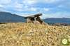
Shortly afterwards, we reached the detour that, if we followed it, would take us to one of the charcoal burners located on this part of the route. After this short detour we continue the descent that leads us to pass by another of these charcoal burners.

A long downhill section awaits us, following this old path. A path that in some areas forces us, given its condition and the humidity it accumulates, to take it easy to avoid frights.

After a while a new charcoal burner comes out to meet us, taking us another stop to visit it. Again the GR 1 route joins ours as we meet the path that leads to Pipaon.

We continue to descend in search of the now closer Lagran. For the time being, the leafy forest continues to provide us with all its freshness, very pleasant if the heat is too much.

The slope gradually loses its intensity almost at the same time as clearings begin to open up in the forest.

After a while our path turns into a paved track, which will be in charge of guiding us in this part of the itinerary.

With our eyes already set on the nearby Lagran, we continue to advance without deviating in any way from the track we are following.

The first buildings of the town come out in our path, welcoming us, to this town of Alava.

Lagran (4h 10min) invites us to make a stop along the way to get to know it and recover the strength we will need for the next part of this Route of the Wine and of the Fish.
We cross the road that crosses Lagran to continue our route through the village.

The GR 38 interpretation centre allows us to get to know this ancient route a little better.

We continue the tour leaving behind us this interpretation centre to say goodbye to Lagran.

The old washhouse of the town marks the end of the tour of the village. We will quickly find ourselves following a perfect dirt track that takes us away from Lagran with every step.

A path that will be in charge of guiding us in this part of the route. A stretch that will allow us to walk calmly through the leafy forest through which it runs.

There are several, as usual, the junctions that we will find all of them quite well marked. The area is covered by a good number of official trails whose signs are added to those of our GR 38.

Ahead of us lies a beautiful route under the protection of the vegetation that populates this area. For the moment, the unevenness we have to face is almost effortless.

The path we are following usually leaves no room for doubt at the various crossroads we will encounter.

The darkness of the area makes our path accumulate quite a lot of mud, in some areas, even more if it has rained recently. There will be many junctions and bifurcation that we will find in this area.

All of them with their pertinent signs that we will have to be aware of.

In many cases, this signage coincides with that of other routes in the area. Almost without realizing it, we will gain height little by little, although we will have to face some ramp of certain entity.

After a good while of our departure from Lagran we approach the end of this ascending part of the itinerary.

The Milestone of the Hazelnut tree marks the end of the ascent and of this part of the forest.

The route takes us out of the forest, to border it following its limits, in search of the place that will allow us to enter it again.

A few meters below, following the diffuse path that borders the limits of the farm and the forest, the beautiful entrance door to the forest awaits us.

A forest through which we will begin a gentle descent surrounded by imposing trees. A forest and a descent that is interrupted for a moment.

Once again we will see ourselves walking the line that separates the forest from one of the estates here.

Luckily this section reaches its end quickly, introducing us again into the forest to continue losing height. A long and steep descent awaits us before we can reach Laño.

The path gives us practically no breathing space, making us happy that we have not chosen to do the route the other way around.

The forest has gradually ceased to be so lush, leaving us at the mercy of the relentless sun. After a while, we must say goodbye to the path we were following to start a short and intense stretch of trail.

A trail that leads to the encounter with a new path. A path along which we will continue to lose height but now more gently.

Our route changes abruptly to set a course for Laño. The first houses of the town can already be seen among the trees.

There is not much left to do to get to our nearby destination and enjoy its warm welcome. Laño (6h 50min) welcomes us with the calm that the entrance in this beautiful town transmits.
As soon as you arrive at Laño square, the route turns sharply again to continue along the road that leads to this town.

A good journey awaits us, following the route of the road at all times. Once again we will have to leave aside the detours that we find.

When we reach a curve we will find the path that we must follow to say goodbye to the tiresome asphalt. This path, besides being the GR 38, leads to the rupestrian site of Las Gobas.

Following its route at all times we will reach its point and end, as the path becomes a dense trail that we will follow.

This trail, surrounded by the vegetation of the place, brings us closer to the archaeological site with every step.

Without realizing it, we arrived at the detour, which if we followed it would take us to Las Gobas. After visiting this curious place, we resumed the course of the wine and fish route.

The trail continues between the site's cliffs and the stream that runs to our right. This part of the route is not very complicated, but it will force us to be attentive given the lack of footprints in some areas.

The trail comes to an end when it meets a dirt track, which comes from the nearby road, a track that we will cross to continue our course.

Later on, at another intersection, we will turn to our right, to set a course for Albaina, which is getting closer and closer.

Without realizing it, the track we were on becomes one of the streets of the town that we will enter.

This street leads us to the heart of Albaina (7h 25min) where we will be able to finish this stage 2 of the GR 38 Route of the Wine and of the Fish.
 Distance. 22.6Km
The distance can be considerably increased considering the difficulty of finding places to sleep at this stage.
 Time. 7:25h
The slope to overcome conditions the total time it will take us to complete the route.
 Time of year
Except for the occasional day, the route and its landscapes have great appeal throughout the year, although the colours with which autumn dresses both sides of the route provide added value at this time of year. Spring is another interesting period to do the route.
 Required equipment
The distances that we have to assume between town and town are considerable, in almost all the journey we will be alone and without fast escapes. Neither will we have water, except in the villages. It is also important to bear in mind that, even though we are almost entirely on paths and trails in relatively good condition, we may come across some fairly muddy areas, so we should wear boot type footwear. Likewise, there are usually notable differences in climate from one side to the other. Consult our list of material and equipment for hiking. Read more.
 Difficulty. Moderate
Physical
The slope and the distance contribute almost 100% of the difficulty of this stage of the GR 38, forcing us to have a good physical preparation in order not to suffer too much. Pay attention to the hot days that can make the route more demanding.
Severity of the environment
The biggest problems we should encounter are the mud and the slipperiness of some areas of the descent if we find them wet. As for the rest, as we mainly travel along well-defined paths and tracks, as long as we do not leave them, we should not have any problems. Pay attention to the road section, it does not have too much traffic but you should not be too confident.
Orientation
Well signposted at all times, with a layout that is generally clearly defined, it is the great accumulation of signs belonging to other routes and paths that can generate the most doubts. Doubts that should dissipate quickly if we have prepared the route properly.
 |
 |
 |
 |
 |
| 1-Laguardia | 0:00h | 597m | 0Km | 30T 534249 4711381 |
| 2-Lagran | 4:10h | 747m | 11.6Km | 30T 534085 4719330 |
| 3-Laño | 6:50h | 685m | 19.1Km | 30T 531089 4723573 |
| 4-Albaina | 7:25h | 603m | 22.6Km | 30T 529918 4726439 |
Coordinates UTM Datum WGS84

 Slope: 1822m
 Slope +: 919m
 Slope -: 903m
 Maximum altitude: 1207m
 Minimum altitude: 597m

This sketch of the route is not made to scale nor does it contain all the information relating to the area, it is merely indicative.

![]()
This schematic with the path is approximate and has been created from the derived cartographic base © Instituto Geográfico Nacional "Cuadrante 170-2, 170-4 y 138-4, 25.000"
Senditur has manipulated the tracks to correct the aberrant points that may exist, caused by problems with the reception of the GPS signal. In any case the tracks are always approximate. SENDITUR encourages you to use the new technologies within your reach, using them as support and consultation in your activity, not basing the realization and orientation of the same only and exclusively on them, since they may see their functioning altered by very diverse causes, not functioning correctly and their indications may not be precise.


Romanesque jewel from La Rioja


Home of the Patron Saint of Alava, a jewel of Alava's Romanesque style.

¿Did you know that...
Women were usually responsible for transporting the coal produced in the Charcoal Burners pits on the northern hillside of the Sierra del Toloño and of Cantabria. By means of mules and following old roads such as the wine and fish route, they took the coal to towns such as Laguardia where they exchanged it for oil, wine and other products.
Don't miss out...
The archaeological sites of Village of the Hoya and Las Gobas. The first one dates back to the Bronze Age and was discovered by chance by a neighbour from Laguardia. Here we can visit the remains of the ancient settlement. On the contrary, Las Gobas is an old hermitage carved in the cliffs that separate Laño from Albaina, which was initially used as a dwelling and later became a religious centre.


From the commitment of SENDITUR with Nature and the respect to the balance of the environment, SENDITUR urges you to travel in a responsible way, with low environmental impact and respecting at all times the Natural, Cultural and Social environment wherever you go.

Besides sharing with all of us your experience on the route we would be grateful if you could write to us to inform us of any erroneous or outdated information you may have found, or simply to let us know what you think at Thank you.
This route has been carried out in the field by SENDITUR on 16-08-2018. The route may vary greatly depending on the time of year, weather conditions and terrain, as well as the actions of third parties and the evolution suffered in the natural environment where it is located. All opinions, advice and/or assessments made by SENDITUR in their descriptions are for guidance only and are subject to and/or refer to the specific conditions of the specific day of the route, referring to that specific day, taken from trained people, with the appropriate experience and with a high level of physical and technical preparation as a reference, as well as correctly equipped.
All the times are approximate and take an orientative character, the stops have not been taken into account, no matter how small they are. All the information related to the route, texts, images, videos, maps, diagrams, tracks, towns, and places of tourist interest are published as a guide, and may not coincide with the current state of each place. Before undertaking any activity, assess your technical knowledge, your physical condition, find out about the weather and the variations that the route may undergo, equip yourself correctly, be prudent and responsible at all times, and do not exceed your capabilities. SENDITUR is not responsible for any misuse or inappropriate use of the comprehensive guides of its routes and/or publications as well as its electronic guides, nor for any variations in their descriptions for the aforementioned reasons, and recommends that everyone be responsible and prudent in carrying out the activity. We also encourage you to read books and specialised guides to complement the information described above.
Continue watching …
 Previous: Section 1 Oyón-Laguardia
 Next: Section 3 Albaina-Estíbaliz