Welcome to SENDITUR.COM · paths · routes · tourism

![]() Difficulty-Low
Difficulty-Low
![]() 2:10 h.
2:10 h.
![]() 7.7 km.
7.7 km.
![]() Difficulty-Low
Difficulty-Low
![]() 2:10 h.
2:10 h.
![]() 7.7 km.
7.7 km.
The Route of Gonzalo of Berceo is nailed in full valley of the river Cardenas, crossing the places that marked the life of this cleric, first poet in Castilian language. Places like Berceo or San Millán de la Cogolla with its Monasteries, Yuso and Suso.

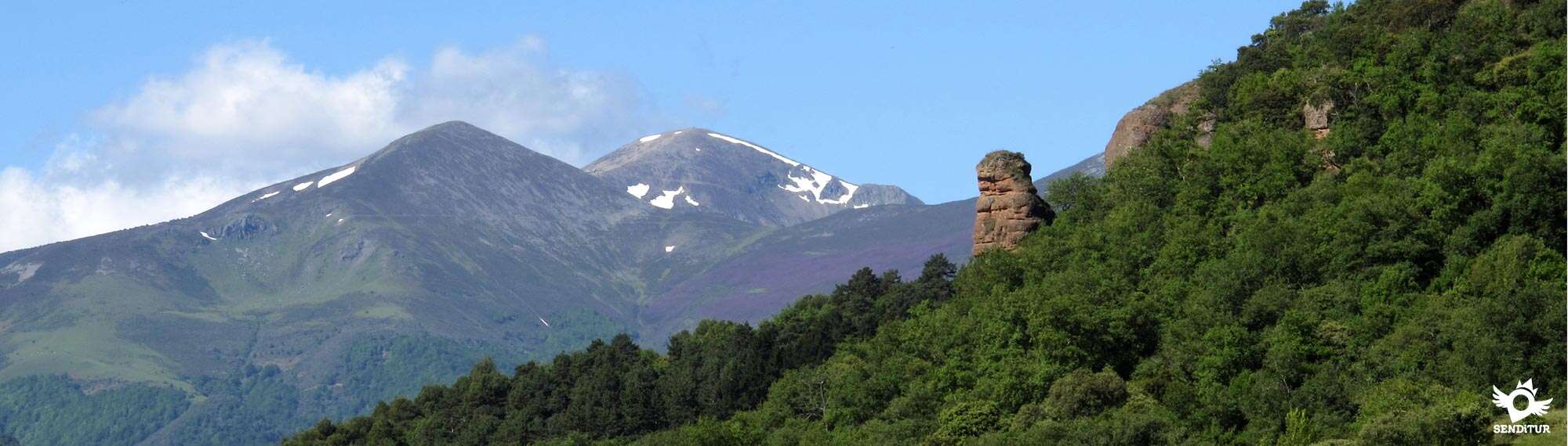
The route takes us from the valley that opens towards the Ebro to the mountains that give way to the Sierra of La Demanda with its peaks of more than 2000 m. An ideal habitat for countless animal and plant species, which together with the limestone cliffs and cereal crops form a changing landscape that offers us a great variety of colourful prints. The route with just 7.7 km starts from the Monastery of Yuso, where Gonzalo of Berceo lived exercising very diverse tasks, among them the reading and the care of the glosses, crossing San Millán de la Cogolla by its Major street, to follow the old way that united it with the nearby Berceo.

Berceo is the birthplace of the young Aemilianus, later known as San Millán, and of the young Gonzalo. There awaits us the Church of Santa Eulalia de Mérida of the nineteenth century. From here the road returns again towards the mountains, showing us on the horizon the rounded peaks that form the Sierra of La Demanda, to enter the lush forest in search of the Monastery of Suso. Some limestone rocks rise from the interior of the forest as if to indicate the place where it is located.

The return to San Millán allows us to enjoy a pleasant walk that will take us to magnificent balconies from where we can contemplate the panoramic views that await us on one side and the other. To get to Yuso, we retraced the first steps that the path to the Cave of the Saint travels through.
We can shorten the route quite a bit if we take one of the two paths known as El Aidillo and the Labardera path, which descend directly towards the Monastery of Yuso shortly after our route passes through the Monastery of Suso. Although we will miss the magnificent panoramic views that the normal route offers.
San Millán de la Cogolla can be reached via the LR-331 from Bobadilla or following the LR-205 from the nearby town of Berceo, where the different access roads converge from the A-12 Camino dual carriageway and the N-120 between Logroño and Burgos, well signposted as "Ruta de los Monasterios" (Route of the Monasteries). We can arrive by the LR-206 from Azofra or Santo Domingo de la Calzada and from Nájera by the LR-113, which joins it with Salas de los Infantes, taking the detour of the LR-205 that will take us to Berceo and then to San Millán de la Cogolla, which also has an interurban bus service every day. Once there the enclosure of the monastery is located on the other side of the accesses to the town of San Millán de la Cogolla, so we must cross from side to side by its main street or by the road that surrounds it and that we find, as we come from Berceo, a little before reaching the town. This road will lead us directly to the entrance to the Monastery of Yuso, where we will find the information centre and next to it a car park where we can leave our vehicle.
This is an interesting route, mainly along a dirt track that almost equally distributes the shady areas and those exposed to the sun.
The intensity that the sun has in summer in this place forces us to have water although we will find several points of water distributed by the itinerary.
As we pass through the towns along the route, we will find pets, usually in closed enclosures. We do not have to forget that it is a zone of cattle although we will only find it in the zone near Lugar del Río.
We begin the route in the parking lot of the Monastery of Yuso (0h 00min) in San Millán de la Cogolla, ascending the street that brought us here and bordering the walls of the monastery leaving to our back the road that arrives from Lugar del Río for where we will return.

We follow the long main street that crosses the whole town, leaving behind us all the streets that come out in our way.

Just at the exit of the town and in the middle of the crossroads with the road that arrives from Berceo entering in San Millán by the Main Street, with the one that arrives from Estollo, we will see in front of us a way that to the other side of this one continues in direction to Berceo parallel to the road.

The route continues, along this asphalted road, between orchards and estates following the course of the nearby river hidden behind the grove of its banks.

The path soon reaches the vicinity of the next town, coinciding with part of the variant of the Way of Saint James that pilgrims use to reach San Millán.

After a short while, the track turns to the left, leaving to our right another one that goes towards the river and beginning a gentle ascent that takes us to another crossroads where we follow the street on the left that goes between the buildings to go out to the town hall square of Berceo (0h 30min), but not before forcing us to turn a couple of times in order to reach it.

Once in the square, the path goes up the stairs that lead to the church, to border it and turn left again in the first street. This street will take us out of Berceo in a constant ascent, leaving behind us the church and its tower.

This part of the route returns in the direction of San Millán de la Cogolla, going up the hill that, on the opposite side to the one we brought from the road, separates us from this town.

The ascent between fields of cereal, is long and tended leaving to right and left some path with which we crossed.

At the end of the ascent to this hill we will have the opportunity to enjoy a privileged view of the Monastery of Yuso, and then undertake the descent that ends on the road up to the Monastery of Suso.

When arriving at this one we are forced to descend a few meters in search of the footpath that begins something more down next to an informative poster with the walks of the zone.

This wide footpath begins, through the interior of the forest that provides us with the shade that we had not had until here, an ascent that takes us to the Monastery of Suso (1h 25min), but not before leaving to the left a path that descends towards San Millán.

Coinciding with the route with part of the Paths of Suso, we will have to be attentive to the marks since although, to confuse us would take us towards our final objective, we could not enjoy the rest of the stroll. The path skirts the monastery just below the arched portico, to exit at the back of it, a shady esplanade where a path to the right ascends to a nearby fountain.

After crossing this gate, the route continues along the track that runs through the forest, leaving on our left a couple of signposted paths that descend towards the Yuso Monastery, belonging to the Paths of Suso.

The track comes out of the thick forest to cross some firebreaks. Its practically smooth course meets another track on the right that climbs up towards the mountain, at which point the descent begins that will take us to the encounter of a ravine.

When arriving at it the way turns abruptly to follow the descending course of this ravine, it is a place in which we can disorient ourselves since it seems that the way continues upwards, but a few steps ahead we see that this one gets into the ravine, blurring completely.

On the other hand, the correct path maintains its width and state and continues descending to reach the height of a small hill, which borders on its right.

It is worth climbing the few meters that separate us from the top of the hill, to enjoy a magnificent view of the Monastery of Yuso.

The track then turns towards San Millán leaving behind the spectacular Sierra of La Demanda, to continue the gentle descent that will take us to the road that comes from Lugar del Río.

To arrive at this one we only have to cross the section that separates us from the crossing with the street that takes us to the parking lot of the Monastery of Yuso (2h 10min), where this route ends.
 Distance. 7,7Km
The different possibilities offered by the route mean that this figure can vary both for and against.
 Time. 2:10h
Total non-stop time. If we deviate in searc:of the source next to Suso we will have to add about 10 min more approximately.
 Time of year
The great variety of landscapes in the area means that the route offers very different panoramic views throughout the year. Althoug:it runs halfway up the hillside, and does not gain too muc:height, some winter days we can find the route totally snowy, worthwhile to travel calmly.
 Required equipment
Recommended walking stick, bottle wit:water and cap in the summer, in addition to the photo camera. Clothes and sports footwear or hiking according to the time of year and the weather can not miss. Consult our list of material and equipment for hiking. Read more.
 Difficulty. Low
Physical
Without a great distance or great unevenness the itinerary allows us to enjoy the landscape, being the ramps of exit of Berceo the zone of greater physical exigency.
Severity of the environment
The route almost completely follows roads in very good condition, even in some asphalted sections, the short part of the pat:is wide enoug:not to pose any problem, not passing throug:exposed areas throughout the journey.
Orientation
Well signposted, the biggest problem will be found in the area of the Monastery of Suso where our signs join those of the Paths of Suso that communicate wit:Yuso. The point of greatest confusion, as it is not signposted, is when we reac:the ravine on the way down to Yuso, but we will only have to follow the well-defined pat:that continues wit:the descent into the valley.
 |
 |
 |
 |
 |
| 1-Monastery of Yuso | 0:00h | 735m | 0Km | 30T 511038 4685971 |
| 2-Berceo | 0:30h | 724m | 1.9Km | 30T 512142 4687309 |
| 3-Monastery of Suso | 1:25h | 850m | 4.4Km | 30T 510493 4686348 |
| 4-Monastery of Yuso | 2:10h | 735m | 7.7Km | 30T 511038 4685971 |
Coordinates UTM Datum WGS84

 Slope: 516m
 Slope +: 258m
 Slope -: 258m
 Maximum altitude: 860m
 Minimum altitude: 720m

This sketc:of the route is not made to scale nor does it contain all the information relating to the area, it is merely indicative.

![]()
This schematic wit:the pat:is approximate and has been created from the derived cartographic base © Instituto Geográfico Nacional "Cuadrante 240-2, 202-4 y 203-3 1:25.000".
Senditur has manipulated the tracks to correct the aberrant points that may exist, caused by problems wit:the reception of the GPS signal. In any case the tracks are always approximate. SENDITUR encourages you to use the new technologies within your reach, using them as support and consultation in your activity, not basing the realization and orientation of the same only and exclusively on them, since they may see their functioning altered by very diverse causes, not functioning correctly and their indications may not be precise.


Cradle of the Castilian and pantheon of the seven Castilian heroes


Location of the Virgin of Valvanera, Patron Saint of La Rioja

Emblematic place that reflects the stages of history, art and culture of the area

¿Did you know that...
Gonzalo de Berceo was the first representative of the so-called mester de clerecía, a medieval school of men of letters, dedicated to the diffusion and cultivation of culture.
Don't miss out...
The Pachurro Festival, which has been held since 1996 on the Sunday following the 14th of August. It offers participants a delicious pincho consisting of a slice of bread on which a fried quail egg is placed together with a pepper and a piece of chorizo.


From the commitment of SENDITUR with Nature and the respect to the balance of the environment, SENDITUR urges you to travel in a responsible way, with low environmental impact and respecting at all times the Natural, Cultural and Social environment wherever you go.

Besides sharing with all of us your experience on the route we would be grateful if you could write to us to inform us of any erroneous or outdated information you may have found, or simply to let us know what you think at Thank you.
This route has been carried out in the field by SENDITUR on 02-05-2015. The route may vary greatly depending on the time of year, weather conditions and terrain, as well as the actions of third parties and the evolution suffered in the natural environment where it is located. All opinions, advice and/or assessments made by SENDITUR in their descriptions are for guidance only and are subject to and/or refer to the specific conditions of the specific day of the route, referring to that specific day, taken from trained people, with the appropriate experience and with a high level of physical and technical preparation as a reference, as well as correctly equipped.
All the times are approximate and take an orientative character, the stops have not been taken into account, no matter how small they are. All the information related to the route, texts, images, videos, maps, diagrams, tracks, towns, and places of tourist interest are published as a guide, and may not coincide with the current state of each place. Before undertaking any activity, assess your technical knowledge, your physical condition, find out about the weather and the variations that the route may undergo, equip yourself correctly, be prudent and responsible at all times, and do not exceed your capabilities. SENDITUR is not responsible for any misuse or inappropriate use of the comprehensive guides of its routes and/or publications as well as its electronic guides, nor for any variations in their descriptions for the aforementioned reasons, and recommends that everyone be responsible and prudent in carrying out the activity. We also encourage you to read books and specialised guides to complement the information described above.
Continue watching …


.jpg "Go to Monastery of Santa María del Salvador")


