Welcome to SENDITUR.COM · paths · routes · tourism


Stage 03 Zubiri-Pamplona/Iruña
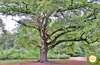
Zubiri, Navarra![]()
![]()
![]()
![]()
![]() (1)
(1)
Following the course of the Arga through the Esteribar valley
![]() Difficulty-Medium
Difficulty-Medium
![]() 5:00 h.
5:00 h.
![]() 20.8 km.
20.8 km.
Zubiri, Navarra![]()
![]()
![]()
![]()
![]() (1)
(1)
Following the course of the Arga through the Esteribar valley
![]() Difficulty-Medium
Difficulty-Medium
![]() 5:00 h.
5:00 h.
![]() 20.8 km.
20.8 km.
From Zubiri, at the head of the Esteríbar valley, leaving behind us the mountains through which we travelled in the previous stages, following the banks of the Arga, the French Way enters the city of Pamplona-Iruña. The itinerary takes us in transition from the beautiful mountain villages to the modern urbanism that, without completely losing the Jacobean essence, will accompany us to Pamplona-Iruña from Trinidad de Arre, allowing us to know and enjoy places full of history and tradition.

In the bridge of La Rabia de Zubiri begins this stage 3 Zubiri-Pamplona-Iruña of the French Way of 20.8 km, which traveling along the paths and roads leads us through the geological deposit of magnesite to pass through Ilarratz and shortly after Ezkirotz before arriving to Larrasoaña-Larrasoaína and its bridge of "Los Bandidos", town founded to the edge of a monastery and of notable tradition jacobea, in which they emphasize its careful houses emblazoned besides the parochial church dedicated to San Nicolás de Bari and the hermitages of San Blas and Santiago. From here the Way of St. James ascends to Akerreta where we have, next to the church of the Transfiguration, a privileged balcony from which to enjoy the journey so far to begin a quick and beautiful descent that will take us back to the banks of the Arga and Zuriain and its neighborhoods, such as Alto where is the parish church of San Millán of the sixteenth and seventeenth centuries.

A short but unavoidable stretch next to the national one will lead us, before passing through an old quarry, to the locality of Irotz to immediately descend in search of the river and cross it by the bridge of Iturgaiz, of Romanesque origin and rehabilitated last century. To Zabaldika and its district of San Esteban we arrived crossing the footpath that walks between a fluvial stroll that arrives at Huarte and the national one, to decide if we continue by the footpath that next to it takes us to a small recreational area or we cross it ascending up to the church of San Esteban, Romanesque-Gothic temple of the XVI century and from this one we meet again with the footpath that goes up from the recreational area, to continue to the encounter of the old lordship of Arleta and shortly after we say goodbye to the valley of Esteribar.

The way approaches step by step to the proximities of the great city, to which we arrive crossing the medieval bridge of the river Ultzama that gives way to the hermitage of Trinidad de Arre, old hospital of pilgrims of the XI century that still conserves its Romanesque apse, to walk along the main street of Villava-Atarrabia that gives way to the straight avenue that connects with Burlada-Burlata, leading us again to the meeting of the river Arga and its bridge of the Magdalena of the thirteenth century, which saves it. From here the Way goes through the moat of the walls, next to the Bastion of Our Lady of Guadalupe, to pass a drawbridge and then the portal of France or Zumalacárregui, in the year 1553, which gives access to the historic center and the Navarrería. Walking through the bustling streets of the old town, scene of the world-famous Sanfermines running of the bulls, we arrive at the Pamplona-Iruña town hall square where this stage ends.
The proximity of Cizur Menor-Zizur Txiquia gives us the opportunity to extend the route easily, if what we are looking for is to escape the hustle and bustle of the big city.
A simple stage, although the final part is through the streets of the towns near Pamplona/Iruña. Mixed terrain of tracks and dirt tracks that give way to the asphalt of the city.
Without great distances between the towns of the route, where we will find water points, to which we must add the proximity of the river and its easy access in certain points of the route, even so we should not trust ourselves, especially in the stretch from Zabaldika to Trinidad de Arre, the longest and where we will have neither shade nor water points.
A farm with its corresponding animals and local pets is all we will find at this stage.
 |
 |
 |
 |
 |
 |
 |
 |
 |
 |
 |
| Zubiri |  |
|
|
|
|
|
|
|
||
| Ilarratz | |
|
||||||||
| Ezkirotz | |
|
||||||||
| Larrasoaña | |
|
|
|
||||||
| Akerreta | |
|||||||||
| Zuriain | |
|
|
|||||||
| Irotz | | |
||||||||
| Zabaldika | |
|||||||||
| Trinidad de Arre | |
|||||||||
| Villava | |
|
|
|
|
|
|
|
|
|
| Burlada | |
|
|
|
|
|
|
|
|
|
| Pamplona | |
|
|
|
|
|
|
|
|
|
We begin the itinerary from Zubiri (0h 00min) crossing the medieval bridge that in the previous stage brought us to this locality, for nothing else to cross it to take again to our right the Way that takes us definitively out of Zubiri.

The route in a gentle up and down, marked by bushes, trees and a wire fence, goes through a stream or two, towards the imposing factory that dominates this first part of the journey.

Our path meets a track that climbs up the mountain from the factory. Turning to the right and descending through it, after passing a power station, we reach the vicinity of the factory where we find a road that comes from the nearby national.

The path continues along this road that goes up along the edge of the factory so that, shortly after a curve and after practically leaving behind the main buildings, we find ourselves on our right with a path that goes into its enclosure and where we must continue.

A few metres after following this track, a fence prevents us from accessing the factory and a narrow path begins, which continues between the road, where we used to go before, and the factory enclosure.

This path continues ascending next to the road until arriving at a small esplanade where it says goodbye definitively to it to continue, now with greater width, bordering the factory.

The route begins a gentle descent until it meets a crossroads of tracks, where drawing a kind of that, turning first to the right, we find some stairs that will take us back our course and descend quickly, crossing the last meters of the enclosure of the factory to say goodbye, finally, after crossing a small bridge that allows us to enjoy a nice waterfall.

The way is introduced again between trees, to ascend with enough loose stone, leaving to right and left how many detours we are until arriving at Ilarratz (0h 50min), where turning to the left immediately after entering the locality we see a road to our right where we must continue.

The way continues along this road that descends a good stretch towards the valley for shortly after passing a hermitage and in full curve to arrive at a crossroads where we have to turn left and leave the road that descends towards the nearby river, to continue for the one that ascends towards our next objective, to which we arrive following straight leaving to our left the entrance to Ezkirotz (1h 05min).

The cement track through which we cross the town, turns to the left to become a dirt road that descends protected by trees, which provide a pleasant shade, until shortly after crossing a stream leaves its protection.

Shortly after passing a farm we are forced to cross a road to continue to the other side of it, now on a slightly narrower road.

The route goes through again surrounded by the trees that flank it, heading towards the next town on the Larrasoaña-Larrasoaína day (1h 30min), which we will reach if we cross its medieval bridge, as in Zubiri, the path continues along the bank opposite to the one where the village is located.

Leaving behind us the road that leads to Larrasoaña-Larrasoaína our route returns to gain height between meadows of grass showing us in front of us the next town where we will pass. The Way enters in Akerreta (1h 40min) until the center of the small town where it turns to the right to leave it and to begin the descent of the hill where the locality is settled.

The somewhat narrow road descends quickly, crossing a couple of portholes that prevent the passage of livestock, to reach the height of the road that connects Akerreta with the national.

At this point we have to ascend a few meters along this road, as the path continues to the other side but forcing us to deviate somewhat to our left to find it.

This part of the itinerary crosses a leafy pine forest, alternating areas of good firm with loose stone and conditioned sections. The path descends in search of the river, and upon reaching it continues along its course, leaving on our right a good number of steps that cross it.

After leaving the protection of the forest we reach the height of a bridge on our right where, after crossing it, the road enters Zuriain (2h 20min).

As soon as you enter the locality, you will come across the national road that crosses it. The road then turns to the left and continues a good distance along the road until it reaches a crossroads where, for now, it bids farewell to the national road to continue along the road that gives access to the different localities in the area.

In this section of national we have the advisable possibility of realizing it by the path formed by the passage of the pilgrims, that runs between the border of the same one and the fields that flank it.

Shortly after deviating and just crossing the river again we say goodbye to the road that continues to our left to continue straight on an asphalted road that starts right in the middle of a curve.

This path quickly becomes a dirt track with good firm that passes next to an old abandoned quarry, ascending smoothly and contemplating to our right the river and the national we arrive until Irotz (2h 50min).

The way passes by the church of Irotz and continues along the cement track that passes by it.

Without leaving this track at any time, which is bordered by a wooden railing, we arrive again to the river Arga.

As soon as we cross it, we find the entrance to the River Walk of the Arga that goes as far as Huarte and Pamplona, a walk that is best continued by cyclists. Shortly after its entrance, the path that leads between the Arga and the national road begins and leads us to Zabaldika.

On reaching Zabaldika (3h 05min) there are a number of recognised variants, such as continuing to the left taking up the route of the fluvial park.

Or continue on the right to visit the church of San Esteban and ring its symbolic bells.

If we continue along the fluvial promenade we will arrive, after passing under the road, until the recreational area of Zabaldika.

Once there, we will again have to choose between continuing along the fluvial promenade or ascending the path that goes from this recreational area in search of the other road that comes from the church of Zabaldika.

This ascent, of notable unevenness, is equipped with a small stretch of steps that help us in the task of gaining altitude with each step, before joining the path by which the pilgrims who chose the other option arrive.

If, on the other hand, in Zabaldika we decide to head towards its church, after crossing the national road we climb up a path to reach the other part of the town centre and from there we descend along the cement track that goes up from the national road itself, in the middle of a curve we come across the beginning of a path that, on our right, leads across the countryside.

From this trail we can contemplate the national and the other option that reaches the recreational area. The way continues to half slope to turn radically and to descend leaving to our right a pair of ways that begin right in the border of the forest.

The way joins with the track that comes from the recreational area which we leave to our left to continue towards Arleta and the depopulated one of Burrín by a way with some railing of wood.

The slightly wider, half-slope way passes through small areas of shade, gradually descending until it is found after turning left with a road that we cross through a tunnel and as soon as we leave it, we turn right again and take a ramp up the wide path that runs parallel to the road we have just crossed.

Without deviating from this pathway at any time, we are gradually separating from the road until we reach, now in descent, up to the height of the medieval bridge that on our right takes us across the Ulzama River to Trinidad de Arre (4h 00min).

The way continues along the pedestrian street that leaves behind us the old convent-hospital of Trinidad de Arre, entering Villava-Atarrabia (4h 05min).

This pedestrian street accompanies us on our journey through Villava-Atarrabia until at the end of the pedestrian zone we are forced to cross a street.

We continue straight on by the wide avenue that leaving to left and right all the streets we find and crossing a good quantity of roundabouts that leave to our step takes us, almost without realizing it, until the entrance to the following population Burlada-Burlata (4h 20min) where the way follows the straight run of this avenue that joins the two populations.

Shortly before reaching the end of the avenue, we will have to turn a little to the right to continue along Larraínzar street, which goes diagonally away from the main avenue, through the walls of a school, to reach the Burlada-Burlata ring road.

After crossing it, we continue along the road that borders a gardening company, leaving the ring road behind us.

This road has a sidewalk with trees in its first part and leads us without deviating from it to the banks of the river Arga, where the medieval bridge of La Magdalena that appears on our right will serve us to cross it.

This bridge takes us to a wooded area and right in front of us we can see the perfectly preserved walls of the city.

Crossing a couple of heavily trafficked streets, the way continues along the landscaped inner moat formed by the two walls, to the gates that give access to the old fortification and to the old part of the town, which we reach after crossing them.

As soon as you cross the second door, the road continues straight on along Carmen Street, definitively entering the city. At the end of this street, the route turns right and continues along Mercaderes Street until the Pamplona-Iruña Town Hall square (5h 00min), where this stage ends.

 Distance. 20,8Km
The different itinerary options, together with the route we take through Pmaplona, will determine the distance we have to cover.
 Time. 5:00h
Total time without stops, making the usual route, if we make the variant that without ascending to Zabaldika goes directly to the recreational area and then link wit:the route that comes from this town we will save a few minutes and the time spent by the other route in visiting the churc:of San Esteban. If on the contrary we choose the variant that takes us towards Huarte, something longer we will have to add of 30 to 45 min approximately.
 Time of year
The route by the valley allows us to enjoy the different and colorful landscapes that in eac:period of the year compose the mixture between the forests and the fields of cultivation. In San Fermín some hostels in Pamplona-Iruña close.
 Required equipment
We recommend sunglasses and sunscreen, as well as an equipped backpack, canes, water bottle and food, footwear and sportswear according to the time of year and weather conditions. The last part of the route allows us to do it wit:lighter footwear. Consult our list of material and equipment to make the Way. Read more
 Difficulty. Medium
Physical
Relatively short and comfortable stage that in its first half forces us to a soft and low continuous, protected by the shade provided by the woods where we pass, to make way for the final part wit:hardly any shade but smoother, as we pass throug:the city.
Caution
We must pay special attention to the short but inevitable section along the national road, whic:althoug:it gives us the chance to travel along the roads that pilgrims have drawn on the farms that border it, they do not stop going next to this road and its dense traffic. We must also pay special attention to the many street crossings that we will find from Trinidad de Arre to Pamplona/Iruña. The route does not entail any major difficulties when running along a track and paths that are generally in good condition, except if it rains, in whic:case they are muddy and althoug:some sections of the descent are equipped wit:stairs, they are still quite slippery.
Orientation
Well signposted at all times, apart from the complication that is usually follow the marks inside cities given the hustle and bustle and the large number of crossings we pass, the biggest problem we find after crossing the bridge of Iturgaiz, at the exit of Irotz, where we should not confuse the first wide pat:that we find and that would take us directly by the fluvial walk towards Huarte and the pat:that shortly after we found and where the Way runs to Zabaldika, moment in whic:again we will find ourselves wit:the doubt to continue straight towards the recreational area or to turn to the right to join later wit:the first option.
 |
 |
 |
 |
 |
| 1-Zubiri | 0:00h | 535m | 0Km | 30T 622021 4754165 |
| 2-Ilarratz | 0:50h | 551m | 2.9Km | 30T 621038 4751997 |
| 3-Eskirotz | 1:05h | 533m | 3.7Km | 30T 620412 4751638 |
| 4-Larrasoaína-Larrasoaña | 1:30h | 499m | 5.5Km | 30T 619150 4750819 |
| 5-Akerreta | 1:40h | 537m | 6.2Km | 30T 618903 4750347 |
| 6-Zuriain | 2:20h | 477m | 9.3Km | 30T 617106 4748327 |
| 7-Irotz | 2:50h | 478m | 11.4Km | 30T 616712 4746414 |
| 8-Zabaldika | 3:05h | 508m | 12.7Km | 30T 615852 4745789 |
| 9-Trinidad de Arre | 4:00h | 434m | 16.2Km | 30T 614061 4743546 |
| 10-Villava-Atarrabia | 4:05h | 430m | 16.9Km | 30T 613714 4742970 |
| 11-Burlada-Burlata | 4:20h | 426m | 17.9Km | 30T 613053 4742322 |
| 12-Pamplona-Iruña | 5:00h | 445m | 20.8Km | 30T 610848 4741520 |
Coordinates UTM Datum WGS84

 Slope: 754m
 Slope +: 275m
 Slope -: 479m
 Maximum altitude: 555m
 Minimum altitude: 420m

This sketc:of the route is not made to scale nor does it contain all the information relating to the area, it is merely indicative.

![]()
This schematic wit:the pat:is approximate and has been created from the derived cartographic base. © Instituto Geográfico Nacional "Cuadrantes 116,115 y 141 1:50.000".
Senditur has manipulated the tracks to correct the aberrant points that may exist, caused by problems wit:the reception of the GPS signal. In any case the tracks are always approximate. SENDITUR encourages you to use the new technologies within your reach, using them as support and consultation in your activity, not basing the realization and orientation of the same only and exclusively on them, since they may see their functioning altered by very diverse causes, not functioning correctly and their indications may not be precise.


Preciosa y entretenida etapa!!!


Find out what to see in...
¿Did you know that...
The third Sunday in June is Esteribar Valley Day. It is a festival of the whole valley that is held annually and alternatively in the villages of Zubiri, Larrasoaña and Eugui.
Don't miss out...
In the church of San Esteban in Zabaldika is the oldest bell in Navarre, allowing us to access the bell tower to see for ourselves its characteristic replication.


From the commitment of SENDITUR with Nature and the respect to the balance of the environment, SENDITUR urges you to travel in a responsible way, with low environmental impact and respecting at all times the Natural, Cultural and Social environment wherever you go.

Besides sharing with all of us your experience on the route we would be grateful if you could write to us to inform us of any erroneous or outdated information you may have found, or simply to let us know what you think at Thank you.
This route has been carried out in the field by SENDITUR on 13-09-2018. The route may vary greatly depending on the time of year, weather conditions and terrain, as well as the actions of third parties and the evolution suffered in the natural environment where it is located. All opinions, advice and/or assessments made by SENDITUR in their descriptions are for guidance only and are subject to and/or refer to the specific conditions of the specific day of the route, referring to that specific day, taken from trained people, with the appropriate experience and with a high level of physical and technical preparation as a reference, as well as correctly equipped.
All the times are approximate and take an orientative character, the stops have not been taken into account, no matter how small they are. All the information related to the route, texts, images, videos, maps, diagrams, tracks, towns, and places of tourist interest are published as a guide, and may not coincide with the current state of each place. Before undertaking any activity, assess your technical knowledge, your physical condition, find out about the weather and the variations that the route may undergo, equip yourself correctly, be prudent and responsible at all times, and do not exceed your capabilities. SENDITUR is not responsible for any misuse or inappropriate use of the comprehensive guides of its routes and/or publications as well as its electronic guides, nor for any variations in their descriptions for the aforementioned reasons, and recommends that everyone be responsible and prudent in carrying out the activity. We also encourage you to read books and specialised guides to complement the information described above.
Continue watching …
 Previous: Stage 2 Roncesvalles-Zubiri
 Next: Stage 4 Pamplona-Cirauqui