Stage 09 O Cádavo-Lugo
On the way to the thousand-year-old city
On the way to the thousand-year-old city
The moments of seeing ourselves surrounded by mountains, furrowing their rounded peaks and hills are already history in this stage of the Primitive Way that takes us to bridge the distance that separates O Cádavo from Lugo, crossing the false plain that serves as an unequalled stage in our journey. A journey that will be almost like travelling back in time through villages that still keep the unmistakable Galician essence and visiting historical and magical places that tell us about what happened in these lands in the past, while we enjoy the spectacular landscape of fields and forests that precede the big city and that surround this part of the Way of Saint James.

The stage 9 O Cádavo-Lugo with 30,8 Km, one of the longest of the Primitive Way, leaves from the very heart of O Cádavo, to undertake almost at the moment the ascent to which we could call the last high or mountain pass that we will have to ascend, not before knowing the first small village of which we have to visit in this stage, Pradeda, that marks the beginning of the ascent. We are crossing the same limits that separate the mountain from the plain of Lugo, feeling with each step the transition between both. The descent leads us to the beautiful spot that houses the 15th century Sanctuary of Nuestra Señora del Carmen, which precedes the imposing church of Santa María de Vilabade, known as the Cathedral of Castroverde for its elegant appearance and meticulous architecture. The Way of St. James quickly takes us to Castroverde, where we are surprised by the singular Fonte Dos Nenos next to the church of Santiago and the homage tower, the last vestige of the old feudal castle that existed here in the 14th century. A succession of villages, green fields and lush native forests await us from now on, which will make the distance we still have ahead much more pleasant. Proof of this is the small village of San Miguel, which we passed almost without noticing, if not for the distant presence of its church. The Primitive Way passes quietly through the fields, embedded by the walls and slopes that separate it from them, protecting us for now from the hustle and bustle that awaits us later.

Brooks, forests and fields that give way to the church of Santo Tomé, which together with the careful cross that is next to it, mark our arrival at Souto de Torres. The tangled paths and the steep mountain trails that in previous stages have accompanied us in each of them have given way to wide tracks and local roads that are now in charge of guiding us from village to village. Our way is surprised by small urban nuclei that are confused with the landscape that surrounds us, as the one of Nadela, which we crossed quickly without hardly realizing its presence. From the next town we visit, Vilar de Cas, we are struck by its meticulous architecture, which, as if it didn't want to let us go, extends around the Primitive Way, accompanying us for a long distance. With almost no time to say goodbye, we reach Soutomerille, where the Way puts us back in the position to follow its straight course or take the detour that will lead us through beautiful landscapes to the old pre-Romanesque church and the remains of the House tower of Montofortino, vestiges of another era, and from there return to the current itinerary later. Irrespective of the route chosen, the two come together again shortly afterwards to set course together for Gondar, the first of the towns that already belong to the council of Lugo. The eighteenth-century church of Santa María watches us from its watchtower as we go through the town step by step to face an undulating stretch between hundred-year-old chestnut trees and the hustle and bustle of the quarry through which we are forced to pass in order to enter a little later on a beautiful route that will take us to Bascuas and shortly afterwards to Daquelcabo.
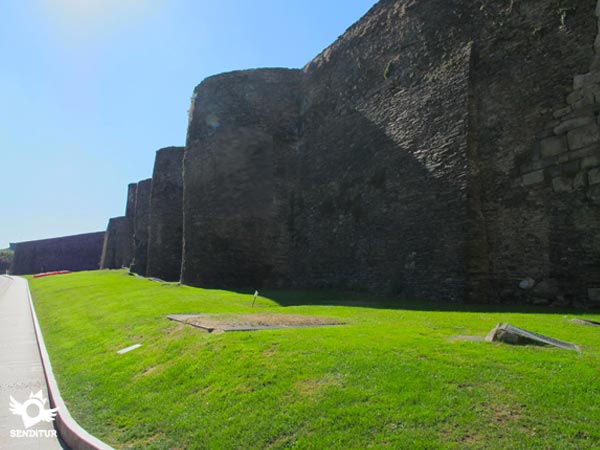
Prelude both localities of the forced detour that years ago was given as provisional and today continues to take that unjustified name. After an uncomfortable and dangerous stretch by road, the Primitive Way returns to its natural surroundings, returning us to the tranquillity and beauty that characterizes it, which we can continue enjoying until As Casas da Viña, from where we will go to submerge in the entrance of the Primitive Way in Lugo. A process in which after saving several knots of communication, we will see ourselves crossing the different villages that nowadays almost have been engulfed by the expansion of the great city. Villages such as Castelo, whose church of Santiago warns us of our passage through this village, or A Chanca where, in addition to crossing the river from which it receives its name, we will surely be struck by the imposing figure of the railway viaduct that rises above it. The entrance to the big city will require a new effort to climb the height that separates us from the castro where this old Roman villa used to settle and which we are about to enter by crossing its historic walls through the Puerta de San Pedro. From here, all that remains for us to do is immerse ourselves in the day-to-day life of its streets, travelling the short distance that separates us from the Main Square of Lugo, where in addition to its baroque town hall, there is also the end of this stage of the Primitive Way.
Getting up early may be a good option at this stage. The differences that we will find in comparison with other stages, tracks in relatively good condition, well prepared local roads and a less abrupt terrain, leave a little more margin to the pilgrim to get up early in order to take advantage of arriving early enough in Lugo. And so we can use those additional hours of stay in the city, to learn about the treasures it offers us.
Possibly one of the hardest stages of the Way for our friend, not only because of the kilometres to cover that are a good challenge in themselves, but even more because of the long entrance to the city and the return of the hustle and bustle, the dense traffic and the long stretches of asphalt that accompany it. Special attention must be paid to the obligatory detour following the shoulder of the road, a road that bears a lot of traffic.
The water given the many villages that we will visit should not be inconvenient, but the heat will undoubtedly make even more important the need to bring sufficient supplies, in stages so long and with so much asphalt, hydrate it and feed it adequately makes the difference.
The cattle is still a habitual of the Way, the dogs in the villages and farms can give us some fright although normally the less friendly are tied up or in closed enclosures. Our arrival in Lugo is also marked by the largest influx of pets as is normal in any big city.
| O Cádavo | ||||||||||
| Pradeda | ||||||||||
| Vilabade | ||||||||||
| Castroverde | ||||||||||
| San Miguel | ||||||||||
| Souto de Torres | | |||||||||
| Nadela | | | | |||||||
| Vilar de Cas | ||||||||||
| Soutomerille | ||||||||||
| Gondar | ||||||||||
| Bascuas | ||||||||||
| Daquelcabo | ||||||||||
| As Casas da Viña | ||||||||||
| Lugo |
The road, converted into the Avenue of Doctor Escobar next to the park of Rosalía de Castro in O Cádavo (0h 00min), where we finished the route yesterday, are the starting point of this stage 9 O Cádavo-Lugo.

We descend the stairs that we find just beginning, to go in search of the outskirts of the town.

At the moment we leave the park behind us to continue descending and leave O Cádavo.

Just when the last houses in the town say goodbye to us, we will have to turn left to continue along the road that will take us away from the town once and for all.

This narrow road will be in charge of leading us to the first village through which we will pass in this stage of the Primitive Way. We advance comfortably without leaving the road at any time.

We quickly travel the distance that separates us from Pradeda (0h 15min), at the same time that we undertake the first ascent to the Vacariza pass. We cross the small village of Pradeda following the perfect course marked by the road.

Always in continuous ascent and already to the outskirts of the locality, the asphalt finishes leaving step to a way by which we will leave behind Pradeda. A long uphill stretch awaits us, which will not give us a moment's respite.

The trees provide us with their appreciable shade, which we look for in its entirety when we deviate leaving our track to follow a path that enters the forest that we are bordering.

The cobblestone path continues to ascend without any consideration for us. The road towards which we seem to be heading reminds us of its closeness, with the noise of the vehicles that circulate on it.

Luckily when arriving next to her our journey barely touches her and she continues her course by taking us away from her company again.

We follow this wide dirt track while the road, step by step, moves away from us, a road that will not have as much protagonism as in previous stages, although it does have some surprises in store for us.

Our track, perfectly defined, runs through an area of timber exploitation where the trees are repopulated from time to time. This means that there will be several paths that we will meet, but in no case these will create any doubt about the right course to follow.

The slope has given us a break for some time now, allowing us to progress more quickly and comfortably.

After a while we come to a bifurcation where we leave the wide track to follow the somewhat narrower left path that seems to start a long descent.

We continue to find ourselves with more paths which we are leaving behind as we descend. The trees have been gaining presence as we advance, seeing us already crossing a leafy forest of pines.

The route takes us across the hillside of the mountain, saving a small stream, while we enjoy this part of the stage.

Our path comes to an end when we come across an asphalt track which we must continue to radically change direction. We set our course in search of the next town that this stage makes us visit, but not before passing by the Sanctuary of Carmen.

This asphalt track makes us leave behind us this beautiful spot of the Primitive Way, while we continue its run.

There are several paths we cross while we can already see the silhouette of the town we are about to reach.

The first houses of Vilabade (1h 35min) receive us in the town, at the same time that we enter it.

When you reach the height of the church, known as the cathedral of Castroverde, the Way continues on the left undertaking the descent that will take us out of Vilabade.

We then begin a long stretch following the road that joins Vilabade with Castroverde, leaving the town little by little.

Accompanied by the houses that are located around the road which must not be abandoned at any time, we leave Vilabade behind.

The itinerary in clear descent makes us advance leaving to left and right how many junctions we are going to be finding.

As on previous occasions we see ourselves irremediably directed towards the road that we have followed so many times. When we reach its height, we will follow its course that seems to take us to the interior of Castroverde.

But nothing further from reality, since not much further on, on the left sidewalk as we go towards the locality we will find the detour that we must continue to leave thus the company of the road that continues into Castroverde.

Rather, it seems that we are going to border it by crossing the boundary that separates the buildings and the meadows. This green road comes to an end shortly after crossing an industrial zone.

Here we have to detour a few meters to our left to find the path we will follow.

For now it continues to give us the impression that this will be another of the localities that the Primitive Way barely allows us to visit.
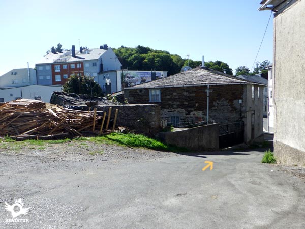
But nothing further from reality, the dirt road gives way to a street, between the buildings, which leads us directly to the very center of Castroverde (2h 10min).

Go straight on passing the church and the town hall, which are on your right, to go without delay to the outskirts of Castroverde.

We quickly find ourselves out of the village walking along a dirt track, surrounded by tall, leafy trees that hardly let us contemplate what surrounds us.

Shortly after leaving the village we have just crossed behind us, we come across a fork in the path where the itinerary to follow is on the right, a wide path that begins to descend through the forest.

With almost no time for more, the path ends abruptly when it is cut off by the road that we must cross.

On the other side begin a couple of roads, the itinerary then turns sharply to follow the road that descends, passing through a tunnel.

For now, we must follow this road without turning off at the few junctions we are going to encounter, as we advance surrounded by chestnut trees that protect us from the sun.

The pleasant route transports us between green meadows, cultivated fields and the few houses that are located there.

Shortly after, at the same time that the road is divided into three, we realize that we are passing through the small village of San Miguel (2h 25min). We of the three options that are proposed to us in this crossing must continue by the middle one leaving to our right the church of San Miguel do Camiño.

We advance flanked by a careful stone wall and a high slope of earth that delimit the road, at the same time that they do it with the lands that we are furrowing.

We quickly find ourselves again at a new junction where the correct path is the one that descends between high earth slopes.

This part of the route is well delimited by the walls and slopes that border it, at the same time as we walk along pastures that alternate with wooded areas.

But once again the dense grove recovers the terrain, seeing us surrounded by the thick vegetation that covers the path almost preventing the passage of daylight.

There are not many roads that go out to our step and in any case the clear better state of ours, together with the walls of stones that mark it, they are in charge of not leaving any doubt of which is the correct course to follow.

The idyllic walk among chestnut trees ends suddenly when we find a building that forces us to go towards the nearby road.

As soon as we reach it, we begin to ascend following the course marked by the asphalt.
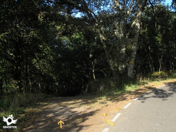
After a short and intense ascent we leave the road to descend again following a nice path that is introduced between the holm oaks. The well-defined path leaves no room for doubt in the few junctions we find.

There are several streams that cross our path, which we save thanks to stone footbridges. The itinerary takes us directly to the church of the next locality through which the Primitive Way passes.

As soon as we pass it, we reach the road that will lead us to the nearby town, which we can already see in front of us.

This new road introduces us step by step in Souto de Torres (3h 05min).
We advance following the road that crosses all the locality leaving to both sides the streets that are introduced between the houses.

After a short while we come face to face with a house, that's the moment to turn right and leave Souto de Torres definitively.

Once again we see ourselves following a dirt path that reintroduces us fully into the pastures and forests that will accompany us from now on. The ups and downs continue to be the usual tonic in the Primitive Way although no longer with the intensity of previous days, which is to be thanked.

Our path suddenly meets another asphalted track that we have to continue ascending, marked by stone walls that delimit the fields that we have on both sides.

Once again, the path we are following, which we do not have to abandon, is nestled between large earthen slopes in the style of the typical corredoiras.
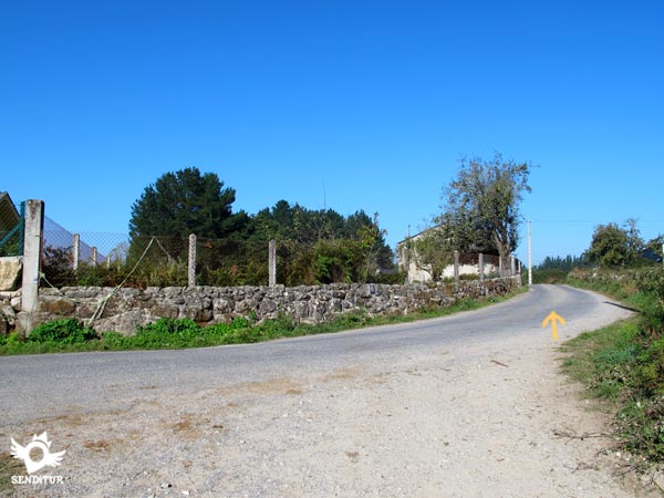
A new intersection takes us to a narrow road that will be in charge of guiding us for a while.

We set course for the next village we will visit at this stage, leaving the Moreira access road behind us.

Almost without realizing it we will see ourselves crossing Nadela (3h 30min) following the impassive course of the road by which we arrived up to this village.
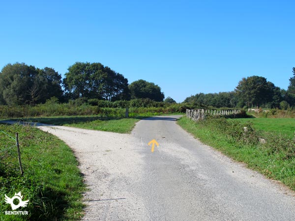
After leaving Nadela, the road is again in charge of guiding us correctly in the different crossroads that we are finding. In front of us we can already see the next objective of the day, to which we will arrive without more delay.

Our narrow road is again in charge of leading us through the locality. Vilar de Cas (3h 40min) extends around the road that makes us leave behind the streets of this town.

Almost without realizing it we see ourselves arriving at the limits of Vilar de Cas, while we follow the course that marks us the highway.

As soon as we leave the town we can see the next town we have to visit.

Quickly we arrive until Soutomerille (3h 45min), where now we will leave the company of the road to continue our straight run.

This small village gives us the opportunity to take a small detour and approach the old church of Soutomerille.

This route, approximately 900 m longer than the normal route, continues on our right into a shady wooded area.

Well signposted as to the few junctions that are found, this route makes us descend in search of the location of these ruins.
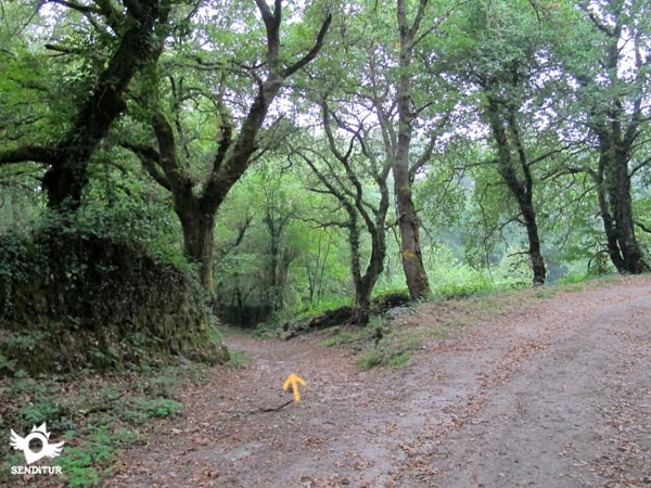
First we have to find the ruins of the House Tower of Monfortino, which resist being engulfed by vegetation.

Later, after passing through a colossal chestnut tree, the ones from the pre-Romanesque church will arrive.

From here it is possible to return on our steps or to continue the path that will return to ascend and to introduce us in the forest.

This option reaches an old quarry and without further detours takes us back to the Primitive Way to follow the road together.

Those who, on the other hand, prefer to follow the normal course of the Way will have no choice but to continue from Soutomerille straight ahead without leaving the wide dirt track that the itinerary now passes through.

This section does not run into too many junctions, where as on previous occasions the best state of our way will be useful in case of doubt to decide the option to follow.

Our track makes us descend to reach the road we will follow, just next to the old quarry in disuse where we will join the pilgrims who came to visit the old church.
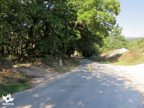
A long stretch of road awaits us in front, which will allow us to advance with a certain speed, thanks to its comfortable profile.

A crossroads takes us out of the lethargy in which the asphalt had plunged us, to fall back into it. We begin to gain height with smoothness following this new road just as narrow as the previous one and also without hard shoulder that separates us from the traffic that circulates through it.

The ascent seems to be coming to an end at the same time as the first houses of the new locality to which the Primitive Way has brought us appear before us. The road leads us through Gondar (4h 20min), without allowing us to doubt the direction to follow.

The asphalt continues being our inseparable companion making us cross Gondar, whose main nucleus is to our right.
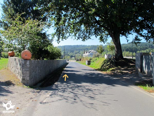
After saying goodbye to the town, the road leads us to a long and hard climb in which we must irremediably follow the course that this one marks us.

The ascent is made at these heights of the Way something harder than it might seem at first glance.

There are several roads that invite us to leave the road, but for now in none of them should we deviate.

At the top of this mini mountain pass, we find a crossroads that lead to the quarry right next to us. As it could not be otherwise, we must follow the road, even if this is for a short time.

Shortly after leaving the quarry behind, next to an old light post begins the path that allows us to leave the road and continue down a dirt track that introduces us directly into the forest.
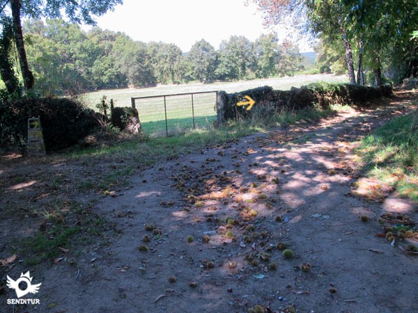
The track descends quickly until it comes up against a fence, at which point we must follow the path on the right.

With almost no time to enjoy the path we are at the gates of the next village we will visit today.

The itinerary introduces us to Bascuas (5h 00mni), making us pass by its church to look for the outskirts of the town.

Again we see ourselves walking on an asphalt track that takes us out of Bascuas without further delay. The asphalt returns to be our particular driver that we must follow without more doubt.

We are travelling the short distance that separates us from the next village that awaits us a little further on.

The asphalt track, most of its route, finally brings us to Daquelcabo (5h 10min).
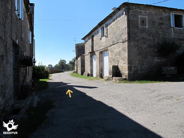
The route takes us quickly through this small village. After passing by its chapel we say goodbye to it, to continue along the asphalt in the long approach to Lugo.

This area dotted with houses and their corresponding paths serves to bring us closer to the dreaded reencounter with the road, which has been with us for several stages and seems to resist letting us go.

When we reach your height we will dodge your company for now, following a path that starts on our right and runs parallel to it.

This short section leads to the old route of the road, now in disuse. In front of us we have a wide track that is introduced between the pines.

At the moment we leave behind another path that arises in this same place and that we should not follow.

The dirt track, almost without time to enjoy it, takes us to a road that we have to follow and that takes us back to the inseparable road.

In front of us, a dangerous section along the shoulder of the road, an obligatory provisional detour from the Primitive Way that has been going on for too many years to continue to hold that title.

The road is in charge of leading us along this stretch in which we will have no more protection against traffic than the shoulder we walk on.

After a little more than a kilometre we come to the crossroads where we must turn off and finally leave the martyrdom of the road.

Not far from this crossroads, we leave the asphalt definitively and return to the original route of the path. Back to tranquillity, the itinerary takes us back through pastures that alternate with the different trees that populate this part of the route, which is appreciated after the stressful stretch of road.

The way now makes us advance without a doubt leaving to both sides the different junctions with which we are meeting without any doubt in any of them.

This area does not allow us to intuit the relative proximity of the bustling capital, towards which we are heading.

The route leads us to the last village that this stage will allow us to enjoy.

As soon as you get there, you will come across a crossroads, where the route continues into As Casas Da Viña (6h 15min).
We quickly crossed the small village to see ourselves again surrounded by holm oaks and fields of pastures.

Just when we reach the last house in the town, on our left, begins a wide dirt track to which we must go, bordering the enclosure of the last building of As Casas da Viña.

This wide track in perfect condition makes us advance with enough speed and without leaving us doubts, in the different crosses that we are finding.

There are quite a few road junctions that we are going to come across in this part of the stage as we approach its end. The trees are gradually giving way, although we can still enjoy the shade they offer.

We leave to our left the asphalted track that communicates the village that we have just passed with the road, while we continue straight between the pines. The noise of the vehicles reminds us of the proximity of the road and prepares us for the entrance into the big city.

Our track after a while takes us past what looks like a driving school complex.

We cross the limits of this complex embedded between the pines until arriving at its other end where we will turn to the right leaving it to our left along with the road.

The white dirt track, forced by the junction of roads we have to cross, leads us to make a detour to save it.

The itinerary leads us to cross the A-6 dual carriageway, leaving on both sides of the bridge the paths that run parallel to this road. In any case, we continue without detouring, leaving this motorway behind.

The whitish track is in charge of guiding us, without allowing us to deviate from it at any time, by a route full of junctions with other roads much less marked than ours. We are about to cross another junction of roads, this time around Lugo.

Although some pilgrims insist on trying to cut a few meters the trails will not make the route easier.

The dirt track continues to lead us without delay towards our final destination.

Once we have crossed this motorway, we are ready to get fully into a complicated stretch as far as the junctions are concerned.

The proximity of the big city means that roads, crossroads and houses are becoming more and more evident, replacing the green meadows and rounded mountains.

We alternate sections of local roads with occasional paths that still remind us of past moments. The urbanized areas force us to snake between them as we go through them.

The labyrinth of paths that lead to the different houses in the area forces us to be attentive at each junction, in case we change direction.

There are several narrow roads that reach us from our old friend, the road, who refuses to say goodbye to us. In addition, we are not rid of the continuous variations in the slope that continues to leave its undulating profile to this stage.

Lugo already shows itself before us at the same time that we undertake a remarkable descent that will take us to save the river da Chanca.

This part of the stage is still perfectly delimited by the walls that limit the land of the houses that precede the city. We continue the rapid descent, leaving behind as many junctions as possible.

The imposing bridge over which the train arrives in Lugo serves as a reference point for us to realise the slope we have to bridge.

We set course in search of the bridge that will serve us to cross the river that separates us from the end of the stage.

From this point begins a demanding ascent increased by the fatigue accumulated throughout the day.

The street on which we go leads us to the meeting of the train tracks that we once observed from afar and that we now cross under them.

As soon as we cross an old friend of ours, the road, comes to say goodbye to us for good.
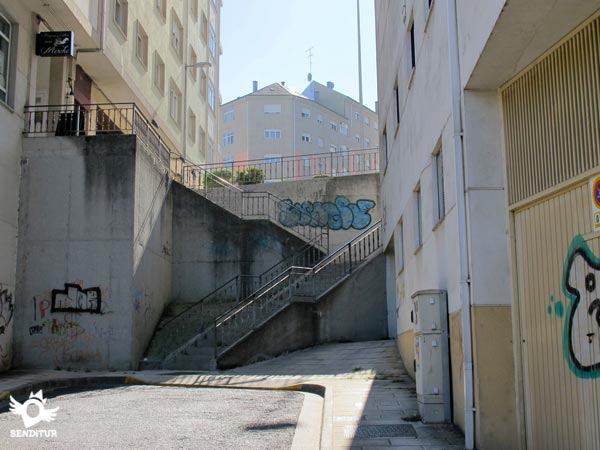
After crossing it we will have to face some uncomfortable stairs that will take us to a wide avenue.

Once there, in front of us we can see the street along which the Primitive Way continues at its entrance in Lugo, towards which we will go following a few meters to the left in search of the pedestrian crossing by which we will cross.

Once again we are hit by a steep street that will not have the slightest consideration for us and that will ask us for a new effort.

This street leads us to pass under another before taking us right in front of the very walls of Lugo.

Here we will advance a few meters to locate the pedestrian crossing that takes us directly to the door that gives access to the walled enclosure.

As soon as we cross it, we will be enveloped by the historic centre of the city, as we enter it. There will be many marks and signs that, as in any city, will indicate us to one side or the other wanting to take us to the different hostels. The Way of Saint James continues along the straight street that we find as soon as we cross the gate of the walls.

This street leads us without detours, except that we need it when we go to our accommodation. The Main Square of Lugo (7h 55min) next to the city council welcomes us with the picture of the towers of the cathedral protruding above the roofs.

This symbolic square is the point and followed by the Primitive Way as it passes through Lugo, and the end of this stage 9 O Cádavo-Lugo.
The itinerary through the city of Lugo will have the greatest influence on this figure.
Long stage, which will seem even more so because of the eternal entrance in Lugo. In case of taking the detour to visit the pre-Romanesque church of Soutomerille we will have to add to the time that we dedicate to it an additional 20 min, which is what will take us to cross the extra distance that we add to the total distance.
Autumn in this stage, or rather the famous magic chestnut trees and their spectacular colours, bring to this stage an added value that will surely surprise us. For the rest the fields and mountains that we cross will give us beautiful stamps during the whole year. The summer gives us a greater number of hours of light that we will be able to take advantage of in our obligatory visit to Lugo, against the winter it can offer us with a beautiful postcard of the snowy walls, reserved to a few pilgrims who share those days the city with their habitual inhabitants.
The mountain trails have given way in this stage to paths and tracks in quite good condition which, together with the many kilometres on asphalt that we will cover, allow us to wear something less tough than the typical boot which we will reserve for better occasions. This is clear, as long as it has not rained or it is raining, in which case the roads are quite muddy and even flooded. A vest or reflective objects will allow us to be seen with greater facility by the drivers that we will find in the dangerous sections by road, in addition if the fog does act of presence the headland can be a good ally in the difficult mission to warn of our presence to the drivers. The walk sticks will allow us to lower the demand to which we will submit to the legs, we can not trust that the large number of villages through which we will pass ensure we have services where to replace forces, since most are small towns without services or at most some vending machine, that yes very well equipped. The heat and the sun advise us not to leave the cap, sunglasses and protective cream that even in winter should always accompany us. Time of the year and the weather, as always, will mark our equipment and the clothes we wear. Consult our list of material and equipment to make the Way. Read more
Physical
The kilometres, plus those that we have already accumulated in our legs, are the biggest obstacle in this stage of the Primitive Way. It is true that the continuous ups and downs, less demanding than those left behind, will follow, to which is added a long approach to Lugo, which will make more psychological wear on our forces. But these will be, together with some lonely hard ramp, all the difficulties that we will find in this section.
Caution
With no great unevenness or steep descents, the itinerary runs along wide tracks and narrow local roads on which, especially the latter, we should not lower our guard because although it does not seem there is enough traffic. Where we have to take extreme precautions is in the long and forced detour that forces us to travel along the shoulder of the road, at the mercy of the fast and dense traffic that runs through it. It goes without saying that we will have to be attentive on the two occasions on which we will have to cross it, and that we must not forget that we enter a large city, loaded with traffic and full of junctions and detours to follow.
Orientation
Both the stage and the detour to the church of Soutomerille are well signposted, only the vegetation can put us in trouble by covering some of these marks. In this section it is necessary to emphasize, as in all transit by a city of the Way, the difficulties that we can get to have to locate the marks or the correct street to follow, although in this occasion they are quite visible, at least until the interior of the walls. It is from this point where the different signs that want to take pilgrims to one place or another can bring some doubt to those who do not want to go to these places or want to continue the Way through Lugo without more.
| 1-O Cádavo | 0:00h | 721m | 0Km | 29T 642887 4764148 |
| 2-Pradeda | 0:15h | 733m | 0.9Km | 29T 642196 4763670 |
| 3-Vilabade | 1:35h | 669m | 6.1Km | 29T 638417 4766162 |
| 4-Castroverde | 2:10h | 592m | 8.5Km | 29T 636315 4765415 |
| 5-San Miguel | 2:25h | 537m | 9.5Km | 29T 635388 4765163 |
| 6-Souto de Torres | 3:05h | 512m | 12.2Km | 29T 633192 4764217 |
| 7-Nadela | 3:30h | 504m | 13.8Km | 29T 631756 4764033 |
| 8-Vilar de Cas | 3:40h | 520m | 14.6Km | 29T 631020 4764010 |
| 9-Soutomerille | 3:45h | 512m | 15Km | 29T 630610 4764015 |
| 10-Gondar | 4:20h | 483m | 17.3Km | 29T 628609 4764476 |
| 11-Bascuas | 5:00h | 510m | 19.6Km | 29T 626723 4764099 |
| 12-Daquelcabo | 5:10h | 509m | 20.3Km | 29T 626195 4764231 |
| 13-As Casas Da Viña | 6:15h | 501m | 24.5Km | 29T 622427 4764040 |
| 14-Lugo | 7:55h | 460m | 30.8Km | 29T 617622 4762925 |
Coordinates UTM DAtum WGS84

![]() Slope: 1493m
Slope: 1493m
![]() Slope +: 615m
Slope +: 615m
![]() Slope -: 878m
Slope -: 878m
![]() Maximum altitude: 875m
Maximum altitude: 875m
![]() Minimum altitude: 447m
Minimum altitude: 447m

This sketch of the route is not made to scale nor does it contain all the information relating to the area, it is merely indicative.

This schematic with the path is approximate and has been created from the derived cartographic base © Instituto Geográfico Nacional "Cuadrante 072, 073, 097 y 098 1:50.000"
Senditur has manipulated the tracks to correct the aberrant points that may exist, caused by problems with the reception of the GPS signal. In any case they are always approximate. SENDITUR encourages you to use the new technologies within your reach, using them as support and consultation in your activity, not basing the realization and orientation of the same only and exclusively on them, since they may see their functioning altered by very diverse causes, not functioning correctly and their indications may not be precise.
Find out what to see in...
¿Did you know that...
The stone slabs nailed to the ground delimit many of the paths that we have been following along the Primitive Way, they are called or known in these lands by the name of chantas. Their mission is none other than to separate the path from the forest or the fields it crosses and also to avoid the free passage of animals from one side to the other. These stones are the only thing preserved from the firm paving that once covered the Primitive Way in certain areas.
Don't miss out...
The walk along the adarve of the wall of Lugo, an architectural work carried out in Roman times, World Heritage Site, which surprises by its good condition and its dimensions, just over two kilometers long and walls between four and seven meters thick. This walk will take us to discover, among other peculiarities, its ten gates: the New, the Santiago, the Miñá, the San Pedro or the False gates.
From the commitment of SENDITUR with Nature and the respect to the balance of the environment, SENDITUR urges you to travel in a responsible way, with low environmental impact and respecting at all times the Natural, Cultural and Social environment wherever you go.
Besides sharing with all of us your experience on the route we would be grateful if you could write to us to inform us of any erroneous or outdated information you may have found, or simply to let us know what you think at Thank you.
This route has been carried out in the field by SENDITUR on 20-11-2018. The route may vary greatly depending on the time of year, weather conditions and terrain, as well as the actions of third parties and the evolution suffered in the natural environment where it is located. All opinions, advice and/or assessments made by SENDITUR in their descriptions are for guidance only and are subject to and/or refer to the specific conditions of the specific day of the route, referring to that specific day, taken from trained people, with the appropriate experience and with a high level of physical and technical preparation as a reference, as well as correctly equipped.
All the times are approximate and take an orientative character, the stops have not been taken into account, no matter how small they are. All the information related to the route, texts, images, videos, maps, diagrams, tracks, towns, and places of tourist interest are published as a guide, and may not coincide with the current state of each place. Before undertaking any activity, assess your technical knowledge, your physical condition, find out about the weather and the variations that the route may undergo, equip yourself correctly, be prudent and responsible at all times, and do not exceed your capabilities. SENDITUR is not responsible for any misuse or inappropriate use of the comprehensive guides of its routes and/or publications as well as its electronic guides, nor for any variations in their descriptions for the aforementioned reasons, and recommends that everyone be responsible and prudent in carrying out the activity. We also encourage you to read books and specialised guides to complement the information described above.
Continue watching …