Welcome to SENDITUR.COM · paths · routes · tourism


Stage 10 Lugo-San Romao da Retorta
Lugo, Lugo![]()
![]()
![]()
![]()
![]() (1)
(1)
A transition stage with more history and tradition than it seems
![]() Difficulty-Medium
Difficulty-Medium
![]() 4:35 h.
4:35 h.
![]() 18.4 km.
18.4 km.
Lugo, Lugo![]()
![]()
![]()
![]()
![]() (1)
(1)
A transition stage with more history and tradition than it seems
![]() Difficulty-Medium
Difficulty-Medium
![]() 4:35 h.
4:35 h.
![]() 18.4 km.
18.4 km.
The river Miño next to the eternal city of Lugo and its imposing walls are the exceptional witnesses of the pilgrim's march that will take him to leave behind the valley to furrow the soft fields of green pastures and the leafy groves of chestnut and eucalyptus trees, among others, that separate Lugo from San Romao da Retorta. An east route of the Way of Saint James that goes through the traditional Galician villages and places while giving us pleasant corners brimming with history, culture or nature.

The stage 10 Lugo-San Romao da Retorta of the Way of St. James with 18.4 km is a quiet walk that starts from the very heart of the city. The Plaza Mayor and the town hall of Lugo, are the point of origin chosen by the Primitive Way to begin to say goodbye to the city and its people. A city that offers to the pilgrim several possibilities to leave it after having enjoyed everything that it offers, its provincial museum, the house two Batitales Mosaics or the thermal baths, are only some of the many places that Lugo and its history offer to the visitor. Two routes that will be joined shortly before leaving the city definitively and that will give the possibility to the pilgrim to enjoy the slender cathedral of Santa María de Lugo just before crossing the protective walls through the Puerta de Santiago and undertake the descent that will take him to the meeting of the river Miño. Or take a longer walk through the historic centre of Lugo in search of the Puerta del Carmen or Miñá and, after passing by the church of Carmen, today an exhibition hall, visit the orchards that populate this district of Lugo to find the other way, and together reach the banks of the river Miño. The old and well-kept stone bridge that joins both banks of the river has been for years the place chosen by many pilgrims to look back and say goodbye to what for a few hours was their city. We go up the waters of the Miño following its bank that brings us closer to San Lázaro and its well-kept church, from where the Primitive Way bids farewell to the valley of the Miño forcing us to gain height quickly as if we wanted to avoid resisting leaving it behind. For now, the close presence of the big city continues to condition a landscape marked by urbanizations and roads that in one way or another communicate with it.

Step by step the asphalt is making us move away from the city at the same time that the green meadows next to the Galician villages are gaining ground. The stage reminds us of other typical pictures of other roads, taking us along a andadero at the edge of the road, which if it were not for the green of the fields and the leafy groves that we furrow would lead us to think that we are in other lands. But villages like Seoane are in charge of dispelling any doubt, villages that in many cases we barely touch, carried away by the impassive course that the road follows. Carrigueiros and its small chapel of San Bartolomé do Burgo, not far from the village, are the next stop on the Primitive Way towards Santiago. The Ribicás fountain marks our entrance to O Burgo, where its Baroque church stands out, somewhat separated from the route of the Primitive Way. The road is our irremediable travel companion that guides us at all times, but as any good companion knows how important it is to give us a break allowing us to separate from it to visit Bacurín and its important church of San Miguel de Bacurín which seems to date back to the thirteenth century. Back on the road we will see again following the comfortable flow that this marks us.

A journey that takes us to O Hospital and shortly after to San Pedro de Abaixo, two small villages that take us for a short period of time from the stupor in which the road has plunged us. The cemetery next to the church of San Romao da Retorta marks the end of this stage of the Primitive Way, although for years the absence of nearby accommodation forced pilgrims to continue their journey for a few more kilometres. Another peculiarity is that two sections of the Primitive Way depart from here, one known as the Roman Way or Calzada Romana, a little shorter, which crosses San Romao da Retorta and reaches Castrelo, where the pilgrims really end this stage, to join again with the official way in Mosteiro. Another one, the official one, follows the course of the road towards Xanaz, to continue from there passing by the chapel of Santa Cruz da Retorta and to follow the whimsical course of the Primitive Way that takes it to cross the villages and places of this part of Galicia. Villages such as Sestelo, Seixalbos, Xende, O Paraño and Senande before reaching Ponte Ferreira and the places of Mosteiro and Ferreira, where it joins the Calzada Romana or Via Romana and together march to Melide.
Not a few pilgrims, moved by the apparent simplicity of the stage, embark on the journey, extending the route well to the places that make up Ponte Ferreira, or even the bravest reach As Seixas. It measures well your forces and the time that it will take you this extension, from time to time does not come badly a less demanding stage that helps us to recover part of the lost forces, bear in mind that there are still many kilometers and several days and efforts that remain until arriving at Santiago de Compostela.
Quiet route as far as the physical one refers for our friend, always clear it is in comparison with the previous stages and unless we decide to add the prolongation up to Mosteiro. The city and the road with its traffic and its crossroads will force us to take extreme precautions to avoid scares. Many kilometres of asphalt that can take their toll on their pads after so much time on roads and stones.
The water, with the quantity of villages that we will be finding, would not have to be a problem, but we cannot trust ourselves since they are not many the points where we will find water, nor are of easy access the streams that we will cross. In summer the combination of asphalt and heat can be a problem if we do not hydrate it properly.
There are several farms next to which we will pass, the cattle is one of the kings of these lands, so we will probably run into the dogs that protect and live in them. The thick vegetation of some areas forces us to take a closer look at the end of the day, to prevent possible parasites typical of livestock.
 |
 |
 |
 |
 |
 |
 |
 |
 |
 |
 |
| Lugo |  |
|
|
|
|
|
|
|
|
|
| San Lázaro | |
|
||||||||
| Seoane | ||||||||||
| Carrigueiros | | |||||||||
| O Burgo | |
|||||||||
| Bacurín | | |||||||||
| O Hospital | | | | |||||||
| San Pedro de Abaixo | ||||||||||
| San Romao da Retorta | ||||||||||
| Castrelo | |
|
||||||||
| Xanaz | |
|||||||||
| Sestelo | ||||||||||
| Seixalbos | ||||||||||
| Xende | ||||||||||
| O Paraño | ||||||||||
| Senande | ||||||||||
| Mosteiro | |
|
The Plaza Mayor of Lugo (0h 00min), where we ended the previous day, is today the starting point of this stage 10 Lugo-San Romao da Retorta.

Leaving the Lugo Town Hall building behind us, we head towards the cathedral's needles.

We descend the stairs following the street that takes us out of the Plaza Mayor, a street that takes us instantly to the square of Santa Maria. In this square we find the first dilemma of this stage, to choose which of the two possible routes of which we are presented before us decided to continue to leave Lugo.

The marks suggest us again with greater emphasis one of the two options, the one that follows the street of our right without letting us visit the cathedral.

This route, somewhat longer than the other possibility, will take us to places whose first impression does not advise to be traveled at certain times of day, even so those who choose this itinerary will quickly find themselves in another small square. Once there, the arcades will guide us to the next detour, which we will soon arrive at.

All the streets we are crossing remind us of the proximity of the Miño river that awaits our arrival.

Rúa do Miño leads us in search of the wall that surrounds the old part of Lugo.

As could not be otherwise is the street Travesía de Miño the street that will take us to Puerta Miñá where this route leaves the walled enclosure.

As soon as we cross the wall, in front of us we will have the Rúa do Carme, street that we will follow after crossing the Ronda de la Muralla, avenue that borders this historic construction.

We descend following this new street that seems to take us quickly to the very limits of the city.

We will see ourselves following an old path embedded between the walls that delimit the orchards that are located in this area. The route takes us through this desangelada zone of Lugo, full of vegetation and making us think that we have already left behind the great city.

Nothing could be further from the truth, since our path soon comes to an end, leaving us before the great avenue that forces it to end.

Suddenly we meet again walking through the city, climbing a few meters up this avenue as if we wanted to return again to the center of Lugo.

Quickly a solitary mark of the Primitive Way warns us that we must descend by some stairs that take us to the street on which we have just passed almost without realizing it.

Here we will unite again with the pilgrims who decided to follow the other option at the beginning of the stage. These pilgrims, in the square of Santa Maria where the route is divided, followed the wall of the cathedral.

The square Pio XII, keeps jealous the beautiful cover of the cathedral of Lugo, as well as the Door of Santiago. This gate of the wall will serve us to cross its limits and begin the route that will take us out of the city.

As soon as we cross, there will be several streets that we will find. After looking for the pedestrian crossing to cross the Ronda de la Muralla, we will begin the descent towards the river following the Rúa Santiago.

This street forces us to lose height leaving to both sides the streets with which we are meeting. Not much lower our street seems to divide in two, moment in which we will say goodbye to it to take the Rúa Calzada da Ponte, which, as its name indicates, will bring us closer to the bridge where we will cross the Miño river.

But before that there is still a long way to go in which we will join the pilgrims who followed the other route. Our street crosses under the avenue through which these pilgrims arrived and continues without pause with the descent.

The cobblestone street is leading us towards the very limits of the city, sharing space with the vehicles that cross it.

A new tunnel appears before us allowing us to pass under the old national VI. Once again we are surrounded by buildings that hide the landscape we had already begun to contemplate.

Rúa Santiago comes back to visit us at the same time as we arrive at the old bridge where we will cross the Miño River leaving Lugo almost definitively.

As soon as you cross the other bank of the river, the itinerary turns sharply to go up its course.

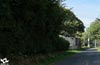
From the first moment the stage makes its intentions very clear to us, being none other than to make us follow the impassive course of the road, allowing us to leave its company in few occasions. The itinerary takes us past a very busy sports complex.

This complex precedes our arrival at San Lázaro (0h 25min) which extends along the road.

Shortly after passing by the church of San Lázaro we arrive at the crossroads where we will leave the nearby company of the river Miño to begin the ascent that separates us from its bed.

For now we are still walking through an urbanized area, the last vestiges of the great city that we left behind us. Soon the grove replaces the buildings wrapping us with its protective mantle while we continue the ascent.

A new junction makes us change course to follow the road that leads to the irremediable encounter with the N-640.

When reaching its height we are pleased to see that the Primitive Way has a small detour.

A detour that leads us to the tunnel where we will cross this busy road safe from dangerous traffic.

Already on the other side, of the two roads with which we find ourselves we will follow the one of our left that makes us take up again the ascent. Once again we advance between the houses of an urbanization, ignoring how many paths we find.

After a while a new crossroads alters our relative tranquility, forcing us to take extreme precautions to cross it, as our route continues its unalterable march.

Once this obstacle has been overcome, the Primitive Way gives us a small footpath next to the road that reminds us of the long Castilian stages of the French Way. From now on, this footpath will alternate with the asphalt in its mission to guide us in this stage, without letting us doubt in the different junctions through which we will pass.

We pass by the small villages and places that populate these lands without the itinerary allowing us to know them. We find several junctions that we are leaving behind, and in all of them the path serves as a clear reference.

The road, inseparable companion, sees how we try to flee from his company to quickly return to it without having hardly separated us.

Our path sometimes uses the old sections of the old road to lead us to our next goal.

Seoane (1h 50min) would go practically unnoticed before our eyes if it weren't for the old sign indicating its access road. Road that of course we left behind to continue with the now incombustible andadero.

For some time now, the unmistakable Galician landscape has surrounded us with its greenery, to which are added the imposing chestnut trees that mark part of the route. Soon we arrived at the moment of saying goodbye to our friend the andadero seeing us doomed to follow the cold asphalt.

There are still several paths that, to the left and right, the road makes us leave behind.

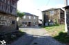
Without realizing it, Carrigueiros (2h 10min) passes before our eyes as we cross the four houses that compose it.

Almost at the same time, as if the same place were hardly separated by the green pastures, we can already contemplate the next locality of this stage towards which the road leads us.

We enter O Burgo (2h 20min) without letting ourselves be guided by the options that invite us to leave the road we arrived on.

This locality, as in previous occasions, extends following the course of the road, which we must not abandon.
Accustomed to small villages of just a couple of houses O Burgo, one of the largest localities that we will visit at this stage, it takes a long time to cross.

The road continues being our inescapable guide, leading us by the locality without margin for doubt.

Once again the green fields recover their dominion over the landscape, partly compensating for the long stretch of road that awaits us. Section in which we will continue leaving of side the crosses that continue going out to our meeting.

The smoothness of the profile, in comparison with that of previous stages, together with the perfect firm that in exchange for its uncomfortable company gives us the road, allows us to advance relatively quickly.

We walk with the solitary company of the trees that alternate their presence with the pastures, where with some luck we will see some animal grazing.

The slope without almost realizing it has hardened its demand, without reaching that of other occasions, but yes as not to leave us as much comfort as before. Some lonely house takes us out of the lethargy in which the journey had plunged us.

It is shortly after one of these houses when we will arrive at the detour that will separate us for a time of road. This detour, almost hidden by the vegetation of the shady area where it is located, will take us to make a small detour and then return to the road.

We crossed a wooded area, of the typical ones that we have crossed so many times, but that still seems to us more beautiful when liberating us of the gray panoramic one that we took up to the moment. A stretch that runs along the borders of the pasture fields, leaving behind the trails and paths that lead to them.

The embedded silhouette of our path serves as a clear reference to follow in the event of doubting the correct itinerary.

Our idyllic walk ends suddenly when we run into a new road. At this same point, in front of us, begins the road that gives access to the next town through which passes the Primitive Way.

We quickly see ourselves walking through the streets of Bacurín (3h 20min), arriving at the moment up to its very heart.

Here the tour turns suddenly making us continue with the pleasant walk through the village. An old hórreo marks the moment to say goodbye to Bacurín.

Fitted between the walls that separate the last houses of the village, we follow the cobbled road that will finally take us out of it.

Once again we are surrounded by nature, leaving Bacurín behind us as we cross the fields.

The path we are following takes us straight to the encounter with an asphalt track that will replace it in the task of taking us to our destination.

At the moment we arrive at a wide esplanade where the track turns to go to the nearby church of San Miguel, saying goodbye to the Primitive Way that continues straight.

After the advisable visit to the church we return to the path to resume its course that will return us to the road. The route runs again surrounded by vegetation, the narrow path is equipped, in some sections, with some stone tiles that free us from the mud.

We gain height with each step as we cross this forested area and its unique trees. There are not many paths that we will find and in any case the well-delimited route to follow makes its course clear.

We continue ascending embedded between the tiles and slopes that mark our path. The road is nearby but still hidden from us by the vegetation that surrounds us.

When we reach your height we will take your course again which we will not abandon, except a short detour, until we reach the end of this stage. The asphalt is now the one in charge of leading us correctly towards the next locality through which we will have to pass.

The soft undulations of the terrain continue to make us spend forces to go up the ramps that we are finding. Once again we see ourselves crossing a landscape that alternates the green meadows, the solitary houses or places, with the chestnut trees and other wooded zones.

O Hospital (3h 55min) welcomes us, taking us out of the monotony to which the road had induced us. We quickly crossed the village, following without detours the course of our inseparable companion. Without hardly realizing it, we left behind O Hospital on our way to a new detour.

In the middle of the bend, on our right, begins a new path that will lead us to take a curious detour, taking us off the asphalt.

This path describes a kind of parable, lengthening the route by a few metres compared to the itinerary followed by the road. Even so, the change of terrain is appreciated, as well as the carefree nature of not encountering the dangerous traffic that crosses the road.

This section in continuous ascent takes us embedded by the earth slopes that delimit it, that in few occasions leave a small step to accede to the fields that surround us.

The vegetation struggles to take over the path at the same time that it leads us to the reencounter with the road.

Once again when we reach its height, we will resume its course that without further detours, will take us to the very gates of San Romao da Retorta.

Practically at the moment of stepping on the asphalt again we will see ourselves crossing the four houses that form San Pedro de Abaixo (4h 10min). This small village sees how the pilgrims pass quickly through it, to say goodbye to it quickly.

Once again another stretch of asphalt awaits us where it will guide us without complications, not allowing us to leave its course.

There are not many junctions that we will meet as we travel the relatively short distance that separates us from the end of this stage of the Primitive Way.

In all of them, the marks of the Way of St. James and the road take care of perfectly marking the route to follow.

The church of San Romao not only indicates the proximity of the village, but also the place where the Primitive Way divides again giving us two options to follow. Both those who decide to extend the stage, and those who have this village as a starting point for the next.

While the Primitive Way, known as the official Way, continues straight ahead, the other option known as the Roman Way leaves the asphalt to enter the village together with the pilgrims who finish the day here.

This dirt road takes us, after passing by the church, to the asphalted track by which we will reach San Romao da Retorta (4h 35min), where this stage ends. Although really the pilgrims that give for finished here the stage will have to advance a little more in any of the two cases, since the shelters are not in the same village but in the following one.
Those who decide to prolong the stage or those who prefer to follow the so-called official Way the next day, should take as their starting point the entrance to San Romao da Retorta on the road next to the cemetery and church of the town. Others, from their place of departure, connect again with the Camino oficia,l by some of the paths that join these two routes. Like the one that connects Castrelo with Santa Cruz da Retorta. The official Way of Saint James, somewhat longer and more convoluted in its final part, is falling into disuse on the part of pilgrims, who to these disadvantages in comparison with the Roman Way, add the subjective fame of greater beauty that has been created around the latter. Both routes are unified in Ponte Ferreira, in the region of Ulloa, or more specifically in the place of Mosteiro, to march together to Melide.

We face the asphalt that leads us, as soon as we start, to the crossroads between Friol and Gutín. The itinerary crosses it giving us the first warning of the proximity of the French Way, in the form of a sign that indicates the coincidence of our march with the one that leads towards Palas de Rei.

Once again the road takes us directly to pass through the places of Xanaz (4h 40min) and later Santa Cruz da Retorta.

We will leave behind these villages and their small chapels to continue facing the long stretch of road without hard shoulders, to which we are already accustomed.

Follow the undulating route leaving to the left and right how many paths we find.

The whimsical flow of the road gives way to a long straight that extends beyond what we can see.

Before reaching the end of this endless straight, we will come across the path we should take.

From here we will be moving away from the road through a dirt road that struggles not to succumb covered by vegetation. We descend gently, moving further and further away from the road.

A solitary track that also seems to come from the road cuts us off the pass forcing us to cross it to continue with our course.

We continue descending at the same time as our way, almost dissolved by the vegetation in some sections, modifies its orientation as if it wanted to return us already to the road.

In this part of the itinerary we do not come across too many crosses that can complicate our progress and in any case, the marks and the cobbled of our way serve as a reference in case of doubt.

The stream do Burgo allows us to contemplate the old and battered bridge that once crossed this river.

Behind him we can already contemplate among the trees the nearby village towards which we are heading. Sestelo (5h 35min) takes us for a moment out of the fields and forests that we cross.

In reality, we hardly touch this village, leaving on our left the track that would take us into it, while we pass a few houses that warn us of the existence of this place.

We ascend again surrounded by vegetation, leaving Sestelo behind with a certain speed. We continue with the ascent with our eyes set on a solitary house towards which we are heading.

After passing by this house, the path that brought us to the house comes to an end, leaving us on an asphalt track along which we continue bordering the stone wall that delimits the house.

At the same time this track takes us almost instantly to the junction with another track by which we have to continue with the ascent.

This new track takes us directly to the center of Seixalbos (5h 50min).

In the very heart of the village we find a new crossroads, this time it is the one on the left that we will use to leave Seixalbos.

We advance along an old and battered asphalted track that connects the village, from which we will still pass a couple of lonely houses, with the road we left to continue this entertaining journey.

When we reach her height we will follow the course that this one marks us in search of the moment in which we will say goodbye definitively of her.

As in previous occasions, we progress leaving behind the crossroads and paths we find.

At the end of a great downhill straight we arrive at the beginning of the path by which we have to continue, leaving already the company of the road, which will still approach us a little later.
.jpg "We follow the descent")
We continue the descent, now crossing the wide dirt road that leads us to pass by a quarry.

The path seems to end up going into a farm, but if we look well at that moment, almost covered by vegetation, we see the continuation of the route that enters the thick forest.

Shortly after walking surrounded by the trees that rise around us, we will see ourselves crossing another stream, thanks to the enormous stones that make up the footbridge over the stream. From here a strong ramp awaits us that will make us recover the lost altitude.

The ramp loses part of its steep slope as it is forced by the wall of some fields to change its course. We follow the hard ascent that loosens its demand until almost arriving at the next village through which this stage will take us to pass.

Another road cuts us off forcing us to cross it to continue with the straight trajectory that will take us into Xende (6 30min).

The perfect track through which we enter the village leads us through Xende making us cross it from side to side.

Already on the outskirts of the village our track forks, at which point we will leave it to say goodbye to Xende for good.

This part of the route takes us, after passing some agricultural pavilions, to cross the limits of a green meadow from which only the fence that delimits it separates us.

The itinerary crosses these lands describing an elongated curve that will bring us closer to the next village we will visit.

The fences are in charge of leading to the path between the fields and the tree areas that populate this part of the route.

We continue to gain height, now much smoother, approaching a new crossroads.

Just before reaching it, our path is divided into two parts, one that goes straight on until it reaches the nearby asphalt track and the other that we will follow if possible, which deviates to the left cutting the farm to quickly go out to meet the same asphalt track as the other.

This slightly deteriorated asphalt track is now in charge of taking us towards our next objective. Without further detours we can already sense the first houses of the village in front of us.

A few pavilions are the first to receive us on our arrival to O Paraño (6h 45min), in this place we will have to be attentive because once again the road passes through the village, without hardly entering it. The track continues to the right entering O Paraño, while we just past the first pavilion we detour to pass between two large trees.

The somewhat contradictory marks lead us to border the wall of the second pavilion that receives us when we arrive. The itinerary runs along the wall that delimits it, following a battered path that will take us directly to the outskirts of the village.

The path is cut by another track, in front of us but a few meters to the left, hidden by vegetation, we will see the continuation of the path that we continue. Cyclists who prefer to do so can follow the track and after passing the nearby A Valiña arrive at a new crossroads where they will continue on the right, ascending the track that will take them to Senande where they will return to the official route.
.jpg "We're moving through this jungle zone.")
The vegetation on this section of the route reminds us of the less and less affluence of pilgrims on this route. The narrow path struggles with the herbs not to disappear, but nothing can be done before the hand of man, who makes it disappear swallowed by a farm.

The route is forced to cross this estate almost in a straight line, leaving aside the buildings of the village towards which we will go after crossing the estate.

After crossing to the other side, the terrain is divided in two with a section of ascent and another one in descent, we will continue by the zone in descent setting course towards an old chestnut tree.

At this point we must not get confused and go up the slope of the earth, as the route continues bordering the estate and leads us towards the village.

We advance bordering the property in search of the nearby tree that indicates us the place where the hidden stone footbridge is located for the one that we will be able to cross the stream that we have to our right.

This narrow trail takes us directly to the village, leaving us on the track that will take us into it.

Senande (6h 50min) comes to free us from this tangled stretch, one of the reasons for the fall in disgrace of this track. We cross the village ascending the asphalted track that takes us quickly out of Senande.

The road that accompanied us from Lugo approaches us as if it wanted to greet us again, but before reaching it we will come across the cobbled path that the itinerary continues without letting us meet our old companion.

Quickly this new road forks, having to follow the path to the right of the two that arise at this point. The vegetation that grows on the walls that mark out the path almost hides the landscape that surrounds us.

The path, with no more detours to surprise us, continues in a gentle ascent towards our next objective.

As could not be otherwise, a new road cuts half our path. The route crosses it heading towards an imposing chestnut tree, making us border the walls of a house.

We see ourselves again walking on a good dirt track passing by an old hórreo and leaving behind us this pleasant area of the journey.

The itinerary leaving this area abandons the path and goes straight on converted into a tangled path surrounded by trees. The route gains and loses width at the same time as the vegetation gains or loses ground.

The path leads us to the encounter of a new path that already allows us to sense the place towards which we are heading.

The place of Mosteiro (7h 10min) is the point of union of the two routes that depart from San Romao da Retorta.

 Distance. 18.4Km
Our final destination will mark the distance to be covered.
 Time. 4:35h
Fast stage due to its relatively short distance and relatively good layout that will allow us to advance at a faster pace than in previous days. Those who decide to extend the stage to Mosteiro, depending on the chosen route, will have to have a total of 7h 10min if they choose the official Way or 6h 30min if they choose the Roman Way, as this is approximately 2 km shorter.
 Time of year
Except for very adverse conditions, both the layout and its characteristics make this stage of the Primitive Way an affordable route throughout the year, in which you can enjoy the fields and villages of Galicia with the calm that brings us its relative short distance.
 Material required
We are in front of a pleasant walk along the paths and road that, except for the short detours that we must take, do not require heavy footwear that we can reserve for better occasions. If the rain makes presence the roads that follow the detours will surely be very muddy, recommended the use of boot and even gaiters. This fact is repeated even more if it fits in the extensions up to Mosteiro. We pass through many localities but we will not have many possibilities to replenish supplies so it is advisable to bring sufficient supplies. An object or reflective clothes will help us to be seen by the drivers in the long stretches of road. The dense fogs continue being more habitual of what to this heights we could expect therefore to our clothes and equipment in agreement, with the time of the year, it is not too much that we add some windproof or insulating garment. Consult our list of material and equipment to make the Way. Read more
 Difficulty. Medium
Physical
As long as we assume the stage as it is planned, that is, starting from Lugo and finishing it in San Romao da Retorta, we are faced with a route that will allow us to replenish part of the lost forces. In comparison with previous stages, its benevolent profile and the good road surface of most of the kilometres will facilitate the effort, allowing us to have extra time for ourselves, so appreciated at this point of the Primitive Way. Watch out if we decide to incorporate to this stage the prolongation until the places of Mosteiro or Ferreira, the degree of difficulty climbs a step, becoming moderate.
Caution
The march of Lugo, depending on which route is chosen, does not seem to be too advisable to make it at certain times, much less alone. This fact together with the dangers that every stage has, with stretches of road without hard shoulder and junctions with other roads are the most remarkable of the entire route. If it rains or has done so with intensity we will have many possibilities of encountering stretches of roads muddy or even flooded by water, which will hinder our progression. The most important thing is not to trust the apparent scarce traffic of the road we are going to travel, because otherwise we will probably get at least a good scare.
Orientation
Every march of the Way of a big city is usually a headache for many pilgrims and this was not going to be an exception, even more so when we have several options and brands sometimes leave us somewhat confused. For the rest one of the few advantages of following the asphalt is that the road is in charge of freeing us of the doubts that could arise to us. Another factor to take into account in this stage of the Primitive Way is its new division just at the end of this route, where we are given the option of following the official route or the Roman Way, today a little more followed than the other option. If we follow the original route we must know that in the section that goes from Xende to Senande we will find a route entangled by vegetation in certain areas, even cut by farms that we must cross.
 |
 |
 |
 |
 |
| 1-Lugo | 0:00h | 460m | 0Km | 29T 617655 4762942 |
| 2-San Lázaro | 0:25h | 375m | 2,1Km | 29T 616325 4761812 |
| 3-Seoane | 1:50h | 539m | 7,2Km | 29T 612405 4759434 |
| 4-Carrigueiros | 2:10h | 532m | 8,8Km | 29T 611225 4758419 |
| 5-O Burgo | 2:20h | 534m | 9,6Km | 29T 610450 4758242 |
| 6-Bacurín | 3:20h | 561m | 13,2Km | 29T 607157 4757705 |
| 7-O Hospital | 3:55h | 569m | 15,6Km | 29T 605357 4757370 |
| 8-San Pedro de Abaixo | 4:10h | 584m | 16,6Km | 29T 604487 4757368 |
| 9-San Romao da Retorta | 4:35h | 580m | 18,4Km | 29T 602898 4756624 |
| 10-Xanaz | 4:40h | 572m | 18,9Km | 29T 602912 4756340 |
| 11-Sestelo | 5:35h | 478m | 22,6Km | 29T 600419 4754627 |
| 12-Seixalbos | 5:50h | 510m | 23,2Km | 29T 600226 4755066 |
| 13-Xende | 6:30h | 532m | 25,6Km | 29T 598557 4754469 |
| 14-O Paraño | 6:45h | 542m | 26,6Km | 29T 597841 4754546 |
| 15-Senande | 6:50h | 532m | 27,1Km | 29T 597536 4754772 |
| 16-Mosteiro | 7:10h | 527m | 28,6Km | 29T 596556 4755592 |
Coordinates UTM Datum WGS84

 Slope: 707m
 Slope +: 414m
 Slope -: 293m
 Maximum altitude: 605m
 Minimum altitude: 370m

This sketch of the route is not made to scale nor does it contain all the information relating to the area, it is merely indicative.

![]()
This schematic with the path is approximate and has been created from the derived cartographic base © Instituto Geográfico Nacional "Cuadrante 072 y 097, 1:50.000"
Senditur has manipulated the tracks to correct the aberrant points that may exist, caused by problems with the reception of the GPS signal. In any case they are always approximate. SENDITUR encourages you to use the new technologies within your reach, using them as support and consultation in your activity, not basing the realization and orientation of the same only and exclusively on them, since they may see their functioning altered by very diverse causes, not functioning correctly and their indications may not be precise.


Mucha carretera en esta etapa de Camino Primitivo. Después de las montañas y paisajes por los que pasas este tramo al principio se hace un poco pesado, pero también tiene sus rincones con encanto.

One of the oldest castles in the province of Lugo

Find out what to see in...
¿Did you know that...
The administrative division of Galicia groups the localities in concellos and these in turn are composed by parishes which are formed by villages or places. This singularity is due to the demographic dispersion that characterizes Galicia, making that together with the Principality of Asturias they have an administrative structure different from the rest of the territory of Spain.
Don't miss out...
Santa Eulalia de Bóveda, a spectacular sanctuary from the 3rd century, from the late Roman period dedicated to the goddess Cibeles, in which a magnificent set of murals, sculptures from the Visigothic period and whose architecture still conserves true treasures from other eras are conserved. The detour of the access road you will find a while after passing through O Burgo, the approximately 5 km that means to visit this place and later recover the route of the Way, are unbeatably rewarded with the beauty and importance of the place that we will know.


From the commitment of SENDITUR with Nature and the respect to the balance of the environment, SENDITUR urges you to travel in a responsible way, with low environmental impact and respecting at all times the Natural, Cultural and Social environment wherever you go.

Besides sharing with all of us your experience on the route we would be grateful if you could write to us to inform us of any erroneous or outdated information you may have found, or simply to let us know what you think at Thank you.
This route has been carried out in the field by SENDITUR on 21-11-2018. The route may vary greatly depending on the time of year, weather conditions and terrain, as well as the actions of third parties and the evolution suffered in the natural environment where it is located. All opinions, advice and/or assessments made by SENDITUR in their descriptions are for guidance only and are subject to and/or refer to the specific conditions of the specific day of the route, referring to that specific day, taken from trained people, with the appropriate experience and with a high level of physical and technical preparation as a reference, as well as correctly equipped.
All the times are approximate and take an orientative character, the stops have not been taken into account, no matter how small they are. All the information related to the route, texts, images, videos, maps, diagrams, tracks, towns, and places of tourist interest are published as a guide, and may not coincide with the current state of each place. Before undertaking any activity, assess your technical knowledge, your physical condition, find out about the weather and the variations that the route may undergo, equip yourself correctly, be prudent and responsible at all times, and do not exceed your capabilities. SENDITUR is not responsible for any misuse or inappropriate use of the comprehensive guides of its routes and/or publications as well as its electronic guides, nor for any variations in their descriptions for the aforementioned reasons, and recommends that everyone be responsible and prudent in carrying out the activity. We also encourage you to read books and specialised guides to complement the information described above.
Continue watching …
 Previous: Stage 9 O Cádavo-Lugo
 Next: Stage 11 San Romao da Retorta-Melide