Welcome to SENDITUR.COM · paths · routes · tourism


Greenway of the Cidacos. Section 1 Calahorra-Autol
A landscape of olive trees, almond trees and vineyards
![]() Difficulty-Low
Difficulty-Low
![]() 3:00 h.
3:00 h.
![]() 11.9 km.
11.9 km.
A landscape of olive trees, almond trees and vineyards
![]() Difficulty-Low
Difficulty-Low
![]() 3:00 h.
3:00 h.
![]() 11.9 km.
11.9 km.
At the end of the river Cidacos shortly before its mouth, between the towns of Calahorra and Autol in La Rioja, we find this section of the old railway that linked Calahorra with Arnedillo, today known as the Greenway of the Cidacos.

The valley of the river Cidacos is a landscape in which there are dry crops of Mediterranean character with olive trees, almond trees and vineyards, along with shrubs adapted to arid soils with gypsum and salts, species such as the albardín (Lygeum spartium) is an example of this. This route of the Greenway of the Cidacos, section 1 Calahorra-Autol with 11,9 km begins in the beautiful park of the Cidacos of Calahorra, city with a great and ancient history very tied to the Roman epoch in which Calagurris Iulia Nassica enjoyed great splendor.

After enjoying the magnificent park we will be able to contemplate the vestiges of the old Roman aqueduct that supplied water to the locality from the Sierra of La Hez, to continue the route of transition between the valley and the Sierra between olive trees, almond trees and arid soils. We will pass by the old halt of the river Livillos from where we will be able to admire in the horizon the mountain range of Yerga and Autol where the Picuezo and the Picueza are waiting for us. A very old military settlement that watched over the narrow gorge, through which the river Cidacos and the Roman road ran, under whose protection this town was formed.

The route continues until it reaches the recreational area of Autol station, where this section of the Greenway of the Cidacos ends.
There is the alternative of crossing a variant that starts from the underpass that crosses the motorway in Calahorra and goes straight on along a dirt track that leads to the El Perdiguero reservoir, a wetland of certain ecological value. The track continues at the foot of the clay crests of Cerro Agudo, joining the original layout shortly before its arrival in Autol.
To get to Calahorra, the main access roads are the AP-68, the N-232 that connects Calahorra with Logroño and Zaragoza, next to the LR-134 that connects it with nearby towns such as Arnedo or San Adrián. It also has an intercity bus service, with a daily service from Monday to Friday, and a regular bus service from Logroño to Zaragoza and from Calahorra to Soria, as well as a train station with a stop on the line between Logroño and Zaragoza. Once there we will go to the cathedral of Santa Maria located east of the city, at the first entrance coming from Zaragoza. Here we will find a large car park on the right bank of the river, in addition to those available next to the park of Cidacos on its left bank, where we can leave our vehicle and start the itinerary.
Good walk, almost entirely on asphalted terrain, with a first part of the route that runs first through the park and then by dirt road to the first recreational area, the rest between orchards and industrial buildings, also with the obligation to cross the road near Autol.
We will only find water points at the beginning and end of the route, as well as in the recreational area of the old Livillos River stop, approximately halfway along the route. Without shady areas the heat can be high.
We will pass through industrial zones, as well as meeting the pets of the orchards next to which the route passes.
The path begins in the Park of the Cidacos of Calahorra (0h 00min), in front of the cathedral, following the compacted way that parallel to the river ascends the course of this one and crossing all the park, at the end of the same one we will find a narrow way that continues next to the Cidacos leaving behind the park and leaving to a deforested bank.

Leaving on our left a modern footbridge that joins the two banks of the river, we arrive at the motorway bridge and after crossing it underneath, turn right and continue along the dirt road that runs next to the AP-68.

This path has some section of a small asphalted andadero that separates us from the traffic that we can find by this access track to the different orchards in the area.

Continuing next to the motorway, leaving behind us all the detours that leave our path, the path is forced by the LR-134 to turn to the left, a road that will accompany us a few km, to gain height step by step to reach a recreational area.

The railway route continues on a slope, escorted on one side by a dirt track that leads to the recreational estates that mark this part of the route and on the other by the LR-134 road.

Going away little by little from Calahorra it continues next to the LR-134 saving the crossroads of the ways that enter from this one towards the orchards, happening next to the fire station of the locality, for little later to go away from the near road drawing a long curve that took us until our next companion, the LR-282 that did not abandon us until the end.

Shortly after this junction we arrive at the old stop, and now Recreational Area of the river Livillos (1h 40min).
The path goes along the long straight that separates us from our destination, passing by the surroundings of several industrial pavilions, as well as leaving behind any paths that cross with us, until we are forced to cross the road, as the road cuts through the route, which continues on the other side.

From here until the end of the route, the path is shared with vehicles, and continues into the interior of the Autol industrial estate.

We cross this industrial zone going straight and passing next to several pavilions until arriving at a ravine where these constructions finish, the layout recovers its form and describes a sinuous curve that crosses this ravine and arrives until the Station of Autol (3h 00min) and to the recreational area next to it, final point of this route.
 Distance. 11,9Km
The route that we are forced to take through Calahorra to reach the starting point of the greenway will mark the distance of this stage.
 Time. 3:00h
Total non-stop time. Starting the tour in the park of Cidacos next to the Cathedral of Calahorra. The variant for the reservoir of the Perdiguero can save us approximately 30 min, as long as we do not miss the way.
 Time of year
Althoug:the tour can be done at any time, it is in spring and autumn when the walk offers a spectacular and colorful landscape.
 Required equipment
Clothes and sports footwear, according to the time of the year and the meteorological conditions, canteen wit:water, sun protection cream, walking sticks and cap as there are no shaded areas practically all the way. Consult our list of material and equipment for hiking. Read more.
 Difficulty. Medium
Physical
Without great physical demands, the largest steepness of the entire route is on the dirt track next to the motorway. The rest of the route runs practically flat, overcoming the unevenness that the access roads to the different farms near Calahorra cause when cutting the slope that serves as the base of the railway line.
Accessibility
The route is fully conditioned, wit:a firm in good condition and practically asphalted in its entirety, except in its initial stretc:that runs combining dirt road wit:conditioned area, has about 1.5 m wide in its narrowest area. We will be forced to cross the road near Autol and the final section from whic:we cross to the recreation area of the Autol station is shared wit:vehicles, as well as the part that runs next to the motorway that is also of mixed use.
Orientation
Well signposted, only at the beginning of its passage under the highway can we miss the route. A good part of the itinerary is bounded by a wooden railing, also has signs indicating the distance to the next important area of passage.
 |
 |
 |
 |
 |
| 1-Park of the Cidacos | 0:00h | 321m | 0Km | 30T 585403 4683546 |
| 2-Livillos river stop | 1:40h | 393m | 6.7Km | 30T 581495 4680145 |
| 3-Autol Train Station | 3:00h | 439m | 11.9Km | 30T 581719 4675114 |
Coordinates UTM Datum WGS84

 Slope: 149m
 Slope +: 134m
 Slope -: 15m
 Maximum altitude: 439m
 Minimum altitude: 321m

This sketc:of the route is not made to scale nor does it contain all the information relating to the area, it is merely indicative.

![]()
This schematic wit:the pat:is approximate and has been created from the derived cartographic base © Instituto Geográfico Nacional "Cuadrante 243 1:50.000".
Senditur has manipulated the tracks to correct the aberrant points that may exist, caused by problems wit:the reception of the GPS signal. In any case the tracks are always approximate. SENDITUR encourages you to use the new technologies within your reach, using them as support and consultation in your activity, not basing the realization and orientation of the same only and exclusively on them, since they may see their functioning altered by very diverse causes, not functioning correctly and their indications may not be precise.


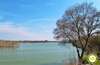
Bonito paseo.

First Museum in La Rioja de Pasos de Semana Santa


Jewel of Ujué, ordered to be constructed by kings

¿Did you know that...
In the 1920, construction began on a narrow-gauge railway to transport mining, industrial and agricultural products from the Cidacos valley. In 1947 the construction of the railway was completed, but its operation dragged great crisis until it was finally closed in 1966.
Don't miss out...
The Sierra de Yerga is a typical example of a Mediterranean mountain, consisting of a large wooded area, surrounded by farmland and deforested areas, between the rivers: Cidacos and Linares. It is a living set, which has arrived to our days in a good state of conservation of great scenic and natural value.


From the commitment of SENDITUR with Nature and the respect to the balance of the environment, SENDITUR urges you to travel in a responsible way, with low environmental impact and respecting at all times the Natural, Cultural and Social environment wherever you go.

Besides sharing with all of us your experience on the route we would be grateful if you could write to us to inform us of any erroneous or outdated information you may have found, or simply to let us know what you think at Thank you.
This route has been carried out in the field by SENDITUR on 20-10-2015. The route may vary greatly depending on the time of year, weather conditions and terrain, as well as the actions of third parties and the evolution suffered in the natural environment where it is located. All opinions, advice and/or assessments made by SENDITUR in their descriptions are for guidance only and are subject to and/or refer to the specific conditions of the specific day of the route, referring to that specific day, taken from trained people, with the appropriate experience and with a high level of physical and technical preparation as a reference, as well as correctly equipped.
All the times are approximate and take an orientative character, the stops have not been taken into account, no matter how small they are. All the information related to the route, texts, images, videos, maps, diagrams, tracks, towns, and places of tourist interest are published as a guide, and may not coincide with the current state of each place. Before undertaking any activity, assess your technical knowledge, your physical condition, find out about the weather and the variations that the route may undergo, equip yourself correctly, be prudent and responsible at all times, and do not exceed your capabilities. SENDITUR is not responsible for any misuse or inappropriate use of the comprehensive guides of its routes and/or publications as well as its electronic guides, nor for any variations in their descriptions for the aforementioned reasons, and recommends that everyone be responsible and prudent in carrying out the activity. We also encourage you to read books and specialised guides to complement the information described above.
Continue watching …
 Next: Section 2 Autol-Arnedo