Welcome to SENDITUR.COM · paths · routes · tourism

![]() Difficulty-Low
Difficulty-Low
![]() 0:45 h.
0:45 h.
![]() 1.6 km.
1.6 km.
![]() Difficulty-Low
Difficulty-Low
![]() 0:45 h.
0:45 h.
![]() 1.6 km.
1.6 km.
The Monastery of Valvanera, surrounded by the mountains of the Mountain Range of La Demanda, has been visited by numerous pilgrims and pilgrims since time immemorial along the traditional paths that connected this temple with the nearby villages. Today these paths have been converted into beautiful hiking routes, which allow us to discover and enjoy not only the monastery, but also its surroundings. These routes can be combined with each other, for example, thanks to the link between the GR 93 and the Valvanera Route. Paths that reach the Monastery of Valvanera, one coming from Anguiano and the other from the villages of Matute and Tobía.
In the middle of the GR 93, just before it starts the final descent towards the Monastery of Valvanera, in a clearing in the forest that it runs through, where it is situated on the Cándalo hill (0h 00min), begins this link with the Route of Valvanera. The signpost with the corresponding indications leads us to our objective. We start to climb up the shoulder of the mountain, surrounded by vegetation as we follow the signs that allow us to avoid the chaos of stones and vegetation that we are crossing. This entertaining section of the route quickly gives way to a much more open area. In front of us we can already see the hill we have to climb.

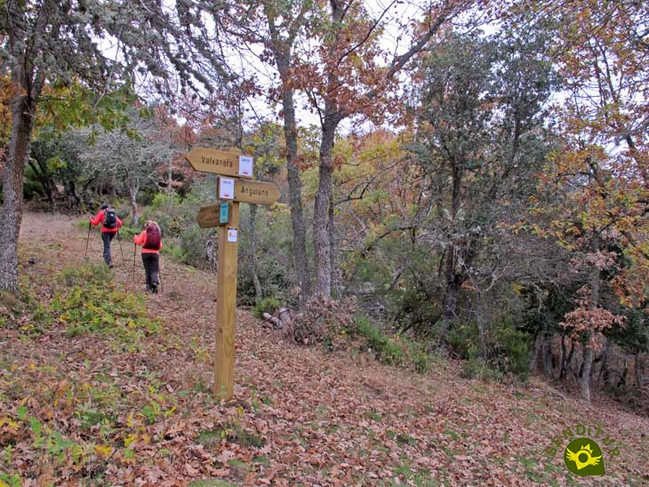
Start of the route in Cándalo Hill

Ascending through the trees
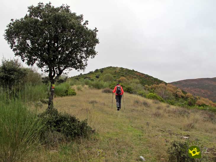
We can already see the summit of La Mesa

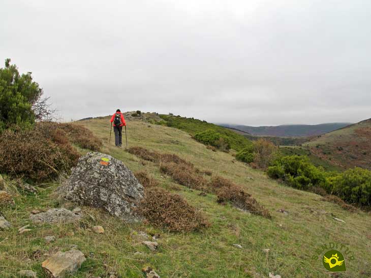
We follow the route markers
We walk the last few metres before reaching La Mesa.

We descend towards the pass of La Mesa
After a short while the thick vegetation again forces us to look for the best path to follow through it, to continue ascending almost in a straight line.
Once we have passed this stretch, both the vegetation and the slope give us a break. We continue without changing course towards the rocks that mark the summit of La Mesa. We pass the rocks and the summit and head towards the next section of our route. After a short walk along this wide peak with beautiful views, we begin the final descent that will take us to our objective. The route markers lead us along the shoulder of the mountain to the La Mesa pass (0h 45min) where the signpost awaits us to warn us that we have reached the route that follows the Route of Valvanera, along which we will continue either towards Valvanera or towards the Cervanco pass.
1-This link allows us to follow a circular route from Valvanera of just under 7 km or even a circular route of just over 12 km, depending on our tastes.
2-Bear in mind that in any case, in addition to the distance and the slope of this route, you have to add both the distance to reach it and the continuation that you develop.
3-The panoramic views from the top of La Mesa are spectacular, so take some time to enjoy them.
4-If you do the small circular route don't forget that you are in the middle of the mountains, so equip yourself correctly.
 |
 |
 |
 |
 |
| 1-Cándalo Hill | 0:00h | 1216m | 0km | 30T 512232 4676154 |
| 2-Pass of La Mesa | 0:45h | 1362m | 1.6Km | 30T 510992 4676853 |
Coordinates UTM Datúm WGS84

.png) Distance: 1.6Km
Distance: 1.6Km
.png) Time: 0:45h
Time: 0:45h
.png) Difficulty: Low
Difficulty: Low
 Slope: 217m
 Slope +: 180m
 Slope -: 37m
 Maximum altitude: 1382m
 Minimum altitude: 1216m

This sketch of the route is not made to scale nor does it contain all the information relating to the area, it is merely indicative.

![]()
This schematic with the path is approximate and has been created from the derived cartographic base © Instituto Geográfico Nacional "Cuadrante 240-4 y 241-3 1:25.000".

Location of the Virgin of Valvanera, Patron Saint of La Rioja

¿Did you know that...
The section of the GR 93 that links Anguiano with the Monastery of Valvanera is a branch of the GR 93 itself that was created relatively recently to recover and conserve this traditional route that was used in ancient times to reach Valvanera.
Don't miss out...
The area with tables and benches next to the river Valvanera. It is a pleasant natural spot that you will find not far from the monastery, going down the path that continues after crossing the monastery complex.


.jpg)

From the commitment of SENDITUR with Nature and the respect to the balance of the environment, SENDITUR urges you to travel in a responsible way, with low environmental impact and respecting at all times the Natural, Cultural and Social environment wherever you go.

Besides sharing with all of us your experience on the route we would be grateful if you could write to us to inform us of any erroneous or outdated information you may have found, or simply to let us know what you think at Thank you.
This route has been carried out in the field by SENDITUR on 24-11-2021. The route may vary greatly depending on the time of year, weather conditions and terrain, as well as the actions of third parties and the evolution suffered in the natural environment where it is located. All opinions, advice and/or assessments made by SENDITUR in their descriptions are for guidance only and are subject to and/or refer to the specific conditions of the specific day of the route, referring to that specific day, taken from trained people, with the appropriate experience and with a high level of physical and technical preparation as a reference, as well as correctly equipped.
All the times are approximate and take an orientative character, the stops have not been taken into account, no matter how small they are. All the information related to the route, texts, images, videos, maps, diagrams, tracks, towns, and places of tourist interest are published as a guide, and may not coincide with the current state of each place. Before undertaking any activity, assess your technical knowledge, your physical condition, find out about the weather and the variations that the route may undergo, equip yourself correctly, be prudent and responsible at all times, and do not exceed your capabilities. SENDITUR is not responsible for any misuse or inappropriate use of the comprehensive guides of its routes and/or publications as well as its electronic guides, nor for any variations in their descriptions for the aforementioned reasons, and recommends that everyone be responsible and prudent in carrying out the activity. We also encourage you to read books and specialised guides to complement the information described above.
Continue watching …


