The Path of Valvanera is located in a place of spectacular beauty, in the middle of the mountain, in the Sierra of La Demanda at the feet of the Pancrudos, in the foothills of the Monastery of Valvanera, patron saint of La Rioja, in the municipality of Anguiano.

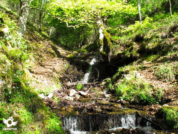
Beeches, holm oaks, oaks and ashes are part of the varied and lush vegetation of the forests through which this path runs, all escorted by the large and rounded mountains of the Sierra. The 4.5 km route takes us from Valvanera to the path followed by the waters that supply the monastery, passing through different ravines where the streams fall from the snow-covered mountains, contributing their waters to the river Valvanera.

Ravines such as the Moro or Tobía ravines that offer us the chance to enjoy some magnificent corners as we pass through them. The path leads to the dam built in the middle of the last century and whose waterfall is used to generate the electricity consumed in the monastery. The return trail will lead us through the interior of a leafy and pleasant beech forest, to reconnect with the river Valvanera and return to the monastery.

It is advisable to make the route in the proposed direction, as this will save us from having to face the ascent of the hardest ramps of the itinerary.
To get to the municipality of Anguiano, follow the LR-113 that joins Nájera with the town of Salas de los Infantes in Burgos. This same road in Nájera communicates with the A-12, Autovía del Camino and with the N-120 between Burgos and Logroño. There is a wide schedule of intercity buses that connect Anguiano with both Nájera and Logroño. We arrive at the monastery following the LR-113 from Anguiano in the direction of Mansilla, it is in this section and after approximately 9 km from Anguiano and 20 km from Mansilla de la Sierra, where we will find the junction with the road that ascends to the Monastery of Valvanera. Going up this road we arrive at the monastery, both at the entrance and crossing the arcade to the inn are the parking areas enabled.
Spectacular and comfortable route largely by paths in good condition, although the first part the bushes do not leave too much space.
Although the water is a constant in this route, is not easily accessible except at very specific points, but the short distance of the route do not have a problem.
Although it is not usual to find cattle on the route, we will pass through the trails used by the animals that live there to go down to the river, so we can cross some of them.
The route starts from the parking lot of the Monastery of Valvanera (0h 00min) that is passing the arcade, just at the end of the buildings start a staircase that ascends, leaving the path where we will return, to the meeting of the footpath where an informative sign marks the beginning of the route.

This trail begins a short but demanding ascent, until we reach the beginning of other stairs that will take us, after crossing a metal door, to some buildings that serve as storage.

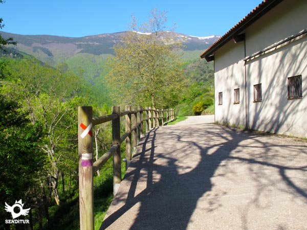
Here we say goodbye to the GR 190 that accompanied us in the first steps, to continue straight ahead next to these buildings, following the white and purple markings on the path, heading towards the dirt track that comes from the valley.

We continue ascending along this track until we reach the point where we will abandon it to descend along a path that leaves to the left of our track.

This grass-covered path reaches the height of a kind of fenced pond, to border it and become a trail and head towards the interior of the valley.

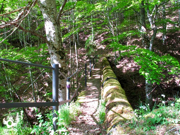
The trail draws a winding route to save the streams that fall from the mountain towards the bottom of the valley. Little by little we are crossing a spectacular forest saving the ravines that we are finding thanks to narrow bridges built to support the water channels that cross the area.

The trail, which cuts the hillside of the mountain, passes, protected by a wooden handrail, through a somewhat steep stretch to get closer and closer to the river that flows through the bottom of the valley.

Almost without realizing it, the important slope that separated us from the river disappears, leaving us the thick vegetation to intuit the small dam that forms the Reservoir (0h 45min).
We pass over this artificial waterfall, thanks to the metal structure that crosses it, to turn to the left, start the journey along the trail on the other side of the river to Valvanera.

This trail runs through a leafy forest, but curiously with different types of vegetation. Soon we must wade a stream that feeds the river Valvanera, this time without bridges to help us, also being a darker area we can find the terrain somewhat muddy and moss.

As we walk along this wide path the river stays lower and lower until we hear only its murmur, moment in which our path begins a quick descent to meet it again.

Upon reaching its height a wooden bridge allows us to cross it to go out to a dirt road and follow its downward course by it, leaving the river now to our right.

We will pass through a small recreation area and shortly after we will reach the crossroads with a path, which without the protection of the forest, descends from the monastery and which is the one we have to follow.

We will then take the ascent ramp along this track which, shortly after and in the middle of a curve, meets the path on our right that will take us to the last few metres of ascent to the Monastery of Valvanera (1h 20min), which we will reach by passing next to the stairs where our adventure began.
Our route along the river area will mark the final distance of the route.
Total non-stop time. If we make the route in opposite direction we will have to add the time about 10 min more approximately.
Preferably in not very dry season, to be able to enjoy the streams with sufficient flow. Pay attention during the rainy season and thaw, as on the return path we do not have bridges to help us cross streams.
Clothing and footwear for sports or hiking according to the time of year and the weather. Recommended photo camera and walking stick. Consult our list of material and equipment for hiking. Read more.
Physical
The ramps we must climb do not have a great length or unevenness, except if we do the itinerary passing by the recreational area before, even so the distance of the route allows us to take it calmly.
Severity of the environment
The path is protected by the bushes and the forest, which hide the considerable slope where we pass, not having any problem as long as we do not leave the marked route. The bridges that cross the ravines are in good condition, but they force us to be attentive if we go with children because they are somewhat narrow, the one with the highest height is equipped with a metal railing. The metallic footbridge of dam in the lagoon finishes in the structure of the same dam having to walk on her a few meters, with the sufficient width but something exposed. The path that runs through the interior of the forest does it through a very shady area and slope so it is very conducive to slips.
Orientation
The route is perfectly signposted by white and purple marks, when we are in the interior of the valley the distance between these marks can lead us to think that we have skipped some sign, but the path is very well defined and we do not have to abandon it at any time.
| |
||||
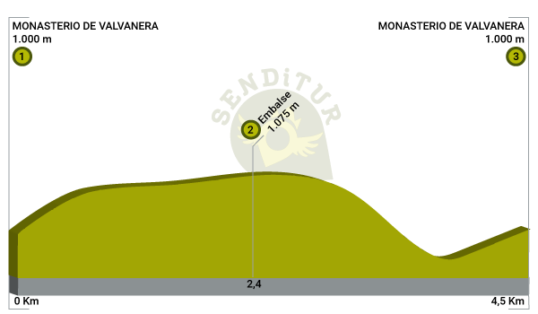
| 1-Monastery of Valvanera | 0:00h | 1000m | 0Km | 30T 510583 4675363 |
| 2-Reservoir | 0:45h | 1075m | 2.4Km | 30T 508805 4674704 |
| 3-Monastery of Valvanera | 1:20h | 1000m | 4.5Km | 30T 510583 4675363 |
Coordinates UTM Datum WGS84

![]() Slope: 604m
Slope: 604m
![]() Slope +: 302m
Slope +: 302m
![]() Slope -: 302m
Slope -: 302m
![]() Maximum altitude: 1080m
Maximum altitude: 1080m
![]() Minimum altitude: 925m
Minimum altitude: 925m

This sketch of the route is not made to scale nor does it contain all the information relating to the area, it is merely indicative.

This schematic with the path is approximate and has been created from the derived cartographic base © Instituto Geográfico Nacional "Cuadrante 240-4 1:25.000".
Senditur has manipulated the tracks to correct the aberrant points that may exist, caused by problems with the reception of the GPS signal. In any case the tracks are always approximate. SENDITUR encourages you to use the new technologies within your reach, using them as support and consultation in your activity, not basing the realization and orientation of the same only and exclusively on them, since they may see their functioning altered by very diverse causes, not functioning correctly and their indications may not be precise.
¿Did you know that...
The monastery has suffered serious fires, one of them in 1809 by Napoleon's troops during the War of Independence. Shortly afterwards, with the disentailment of Mendizábal, the monastery was left in a state of total abandonment.
Don't miss out...
The magnificent panoramic view of the monastery and its surroundings from the transept that you will find on the way up to the monastery by the access road.
From the commitment of SENDITUR with Nature and the respect to the balance of the environment, SENDITUR urges you to travel in a responsible way, with low environmental impact and respecting at all times the Natural, Cultural and Social environment wherever you go.
Besides sharing with all of us your experience on the route we would be grateful if you could write to us to inform us of any erroneous or outdated information you may have found, or simply to let us know what you think at info@senditur.com Thank you.
This route has been carried out in the field by SENDITUR on 24-06-2021. The route may vary greatly depending on the time of year, weather conditions and terrain, as well as the actions of third parties and the evolution suffered in the natural environment where it is located. All opinions, advice and/or assessments made by SENDITUR in their descriptions are for guidance only and are subject to and/or refer to the specific conditions of the specific day of the route, referring to that specific day, taken from trained people, with the appropriate experience and with a high level of physical and technical preparation as a reference, as well as correctly equipped.
All the times are approximate and take an orientative character, the stops have not been taken into account, no matter how small they are. All the information related to the route, texts, images, videos, maps, diagrams, tracks, towns, and places of tourist interest are published as a guide, and may not coincide with the current state of each place. Before undertaking any activity, assess your technical knowledge, your physical condition, find out about the weather and the variations that the route may undergo, equip yourself correctly, be prudent and responsible at all times, and do not exceed your capabilities. SENDITUR is not responsible for any misuse or inappropriate use of the comprehensive guides of its routes and/or publications as well as its electronic guides, nor for any variations in their descriptions for the aforementioned reasons, and recommends that everyone be responsible and prudent in carrying out the activity. We also encourage you to read books and specialised guides to complement the information described above.
Continue watching …