
The Monastery of Valvanera, located in the Alto Najerilla region of La Rioja, has been a place of pilgrimage for years for the people of the villages of La Rioja, as well as for pilgrims from various geographical areas. There are several routes and paths that have as their destination or starting point this temple that houses the patron saint of La Rioja, being the Route of Valvanera one of them. Routes that cross the forests and mountains that make up the landscapes that surround this cultural property and that are a natural heritage of incalculable value.

The route along its 9.6 km runs through hills, passes and mountains, crosses thick forests of beech and holm oak and fords small streams that flow into the basin of the Najerilla River. The route starts at the Monastery of Valvanera, without doubt a place that is full of tranquillity and symbolism, without forgetting the importance and historical and cultural value that it treasures. From here we go up the course of the Christ's stream following the course of the ravine that has formed over the years, but not before saying goodbye to another of the paths par excellence of La Rioja, the GR 190, also known as the Highs Valleys Iberian. The Herradero pass and Campastros pass, at the foot of Bañadero Peak, will mark our ascent of the mountain range through which much of the route runs. From the heights we will be able to enjoy in all its splendour the valley that houses the famous The Rajao beech forest or the imposing peaks that mark the roof of La Rioja, San Lorenzo Peak. Without the extra effort of going up the slope that separates Valvanera from the highest area of this trekking route, we will go through green folds where cattle graze while we cut through the rounded mountains that characterize this land.

Mountains such as Peña Tomé or Valdeloshaces, from which countless streams flow on either side of their slopes. Mountains that serve as natural borders between municipalities such as Tobía, Matute or Anguiano. At our feet run the wide valleys of this region, valleys like the Najerilla that run quietly in search of the Ebro Valley. In short, a route whose layout will allow us to contemplate a varied panoramic view full of contrasts and a sign of the identity of La Rioja. The Hill of Las Frádigas marks the moment to say goodbye to the peaks, hills and folds to begin the rapid descent that through a leafy beech forest will lead us to the Cervanco Pass, point and followed by this route that is in charge of joining the monastery with the diverse routes that arrive from the nearby villages and that form part, together with it, of the conglomerate of routes known as Routes among Beech Forests. From here we can go to Tobía or Anguiano following the Route of Three Villas, or if we prefer we can climb to the mythical peak of Saint Quiles or go to the town of Matute, besides of course we can return on our steps again to the Monastery of Valvanera.

This route links up with different routes in the area such as the Route of Saint Quiles or the Route of Three Villas. Through the latter you have the possibility of returning to Valvanera without doing so by the same route. To do so, you have to go down to Anguiano and, at the end of the descent, you will find the route that joins the GR 93 as it passes through Anguiano with the GR 190 at the Monastery of Valvanera, which returns just below the route by which we reached Cervanco. Going up the Najerilla valley to the monastery, closing the circle and becoming a demanding and beautiful route almost equally.
The municipality of Anguiano is reached by following the LR-113 that links Nájera with the Burgos town of Salas de los Infantes. This same road in Nájera connects with the A-12, Autovía del Camino and the N-120 between Burgos and Logroño. There is an extensive schedule of intercity buses that connect Anguiano with both Nájera and Logroño. We arrive at the monastery following the LR-113 from Anguiano in the direction of Mansilla, it is in this section and after approximately 9 Km from Anguiano and 20 from Mansilla de la Sierra, where we will find the crossroads with the road that goes up to the Monastery of Valvanera. Going up this road we will arrive at the monastery, both at the entrance and crossing the arcade to the inn are the parking areas enabled.
Without a doubt, it is a pretty hard hiking route for our dog, as we will have to add to the slope the final distance he has to overcome, so it is important that he is used to this kind of outdoor activities.
It is very important, given the demands of the route, that our companion is hydrated and fed correctly throughout the route. We will find water points but concentrated at the beginning of the route, we will also have to have the characteristics of the return route that we choose.
The cattle is one of the lords of the great majority of the places through which we will pass, cows, horses and sheep graze peacefully together with the local fauna. We may also come across a few shepherd dogs as well as areas of beehives.
The Monastery of Valvanera (0h 00min) is the starting point of this path in La Rioja, more specifically we start at the end of the parking area that is after crossing the arcade of the monastery.

Right there and hand in hand with the GR 190 we began without further delay to climb the slope ahead of us. A short but demanding ramp that makes us warm up quickly.

At the moment we are forced to cross a gate to change course sharply and continue the ascent after crossing another of the gates that delimit this area.

We follow the marked trail which, although not as demanding as the first one, continues to make us gain height with every step.

After a few metres we will reach the crossroads where we will have to say goodbye to the GR 190 company that turns left while we continue on our way.

Little by little we are gaining height as we enjoy the panoramic views that the surrounding vegetation allows us to contemplate.

We must not find other trails that invite us to follow them, and both the marks of the route we are following and the steps of our path will guide us without hardly giving any option to doubt.

The path continues up the ravine of the Christ, crossing the hillside of the mountain without putting us in too many complications.

We will only have to face a short step that only if it is wet should be something more committed.

After a while, the footpath begins to lose its inclination, indicating our proximity to the first of the streams we will have to wade through. After doing so, we will resume the ascent in search of a nearby sheepfold that awaits us a few meters ahead.

This totally clear area invites us to take a break while we contemplate the landscape around us. The silhouette of the trail, hidden under the green grass of the meadow, serves as a guide to lead us to the wooded area where the route continues.

We go back into the vegetation, which is less thick than in previous sections, to continue climbing up the course of the stream of Christ. We alternate almost flat sections with others of greater slope as we approach the head of the ravine.

Once again, we will have to cross the course of the stream just to start a new ramp that will make us overcome practically all the slope that lies ahead.

Further up, we'll come to a bifurcation in our trail. Although both options lead to the next sheepfold we will visit, it is more advisable to follow the footpath on our left.

The other option, although it has a solitary mark painted on a tree, ends up coming out from under the place where the following marks of the route are located and in addition the footprint that follows is blurred until it disappears leaving us at the mercy of the visibility that we have so that we can see the posts that mark the route.

Once at the top, the route turns to the left to continue climbing up the slope of the mountain, already devoid of the thick vegetation that accompanied us. In this spot, the col of La Mesa, we also find the signs that warn us that we have the possibility of turning off to head towards the GR 93, thanks to the link that starts from here.

We continue on our path which continues to make us gain altitude although without the demands of the previous ramps. Almost on reaching the next pass that we have to visit, we will once again come to a fork in the path.

On this occasion it is better to follow the option on the right, since it will take us directly to the next post that marks the itinerary of this trekking route.

Once up on our right, if the fog allows it, we will see a central path and several footpaths parallel to it. At the Cruz de Campastro, as this pass we have just reached is known, we will also have another possible detour. This time it is the link between the Valvanera route and the GR 190, which leaves our itinerary to return to the monastery but via the peaks of the mountains we have just crossed. These variants allow us to follow different itineraries or circular routes around the monastery.

We continue on our route to reach another point where we will again have several possibilities, the direct one being the path that goes up the small hill in front of us, while the path on the right cuts through the hillside to join the path on the other side.

After overcoming this obstacle we will again come across another hill that we will have to climb. Fortunately, shortly before the top of the hill, we will be able to leave the path and follow a symbolic trail that runs along the side of the hill without climbing up to the top.
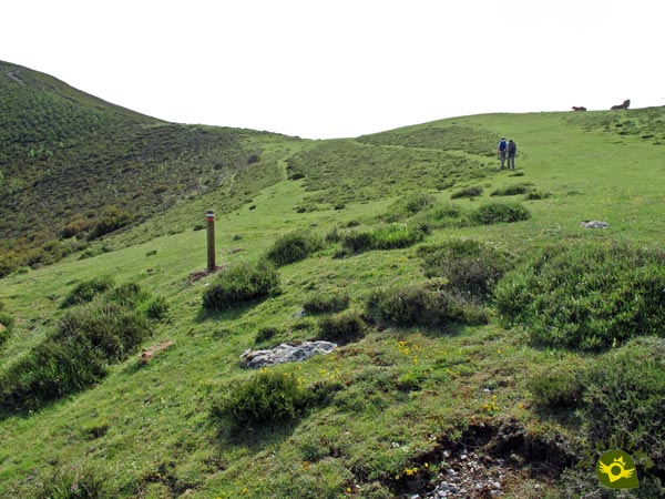
In any case, the fence on our right that marks the separation between municipal areas can serve as a reference in case of doubt, although we will gradually move away from it as we gain height.

Once up and tempted by the possibility of crowning La Rioja Peak, our route leads us up its hillside, now through a marked roadway.

We can say that from this point and except for some small slope we have already overcome the positive slope that marks this route.

Our journey seems to come to an end when we come across a new meadow, on the opposite shoulder of the mountain we are crossing.

But nothing could be further from the truth, as the route continues to skirt the mountain, leading us quickly to the continuation of our journey. A path that runs along the side of the mountain taking us from pass to pass from meadow to meadow.

A path that is later blurred under the green mantle that covers these meadows.
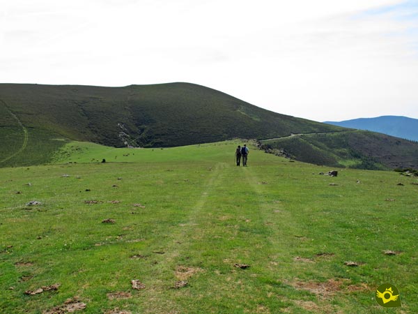
In this area, especially if the visibility is reduced, we should pay attention to the marks and signs of the route, since the path practically disappears under the grass.
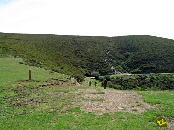
Another peak, the Valdeloshaces or Peña Tomé, invites us to crown its summit, but our route and we, ignore it as before to cut its hillside following the stony path that crosses it.
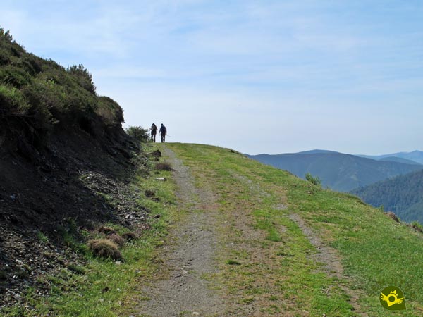
The gentle undulations of the terrain continue to make us face short upward stretches, although without the demands of past experience.

A clear and pleasant stretch awaits us without major complications and whose route is well defined by the path that guides us.

A path that once again disappears before our eyes when we reach a rocky area. Here we will change course, to go to the top of the hill on our right, a hill where you can sense another of the posts of the route.

Above, a group of rocks serve as a reference to follow.

In them we will find more marks and with good visibility we will also see the summit of Cabeza de las Frádigas, towards which we seem to be heading.
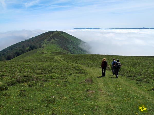
We then begin a rapid descent guided by the diluted path that comes back to us. Soon we will arrive at the pass that separates both mountains, and that puts the long teeth again with the possibility of treading on the nearby summit.

But our route again leaves us with honey on our lips as we decide to border it on its northern slope.

For the time being, we are moving forward following the limits of the forest we are about to enter.

Soon the trees will envelop us completely as we continue the descent we began long ago.

We will have to pay attention to the marks of the trees as the path is hidden under the thick layer of leaf litter.

The slope for the moment is not as noticeable as expected, although the mud can put us in some difficulty if it makes an act of presence. The forest gives us a little respite but soon the surrounding landscape hides from us again.

Shortly before we reach the edge of the forest we will pass an area somewhat entangled by vegetation.

But at the moment our trail comes to the rescue to lead us on the final stretch of this route.

Once out of the forest and with our sights set on the peak and pass of the same name we will begin the final dizzying descent.

Almost without realizing it, and after leaving behind a stony trail, we will reach the Cervanco Pass (3h 30min), the end point of this trekking route in La Rioja.
To this figure we must add the distance to our final destination.
Of course, to this time we will have to add the time corresponding to the route we are following in order to really finish this route.
The autumn and the spring, or what is the same thing the reddish and ocher tones or the great variety of green that characterize each one of these periods of the year, contribute to this route a great added value when allowing us to contemplate from a privileged perspective the different valleys and mountains that will surround us throughout the route.
We should not only count on the official route, but also on the section that has to be added to finish it, this is important so that we do not get our fingers caught like for example the water and the food that we have to carry. We must not forget either that a large part of the route runs at altitude, at the mercy of the elements, something that in summer as well as in the rest of the year must be valued, because of the heat, the cold or the wind that we can find. Of course the photo camera, some walking sticks and sun protection, along with the usual, we can not miss. Consult our list of material and equipment for hiking. Read more.
Physical
In principle, we are facing a not very demanding route, in which its slope is faced in a more or less comfortable way. But as it is a route that joins the monastery with other routes in the area, yet is far from any point where you can put an end to the route. Therefore we will have to take into account the characteristics of the additional route we follow to reach our final destination, a fact that will undoubtedly condition the total difficulty. The heat is another factor that will undoubtedly add points to the physical demands we must face.
Severity of the environment
As with other occasions, the route itself has no exposed areas or areas that should put us in difficulty, always under normal conditions of course. Except for a couple of streams, a short stretch somewhat abrupt and the muddy terrain, especially in the beech forest, we should not encounter more complications.
Orientation
Without a doubt, fog or poor visibility are the factors to take into account before embarking on this route. Although it is signposted at all times, when crossing wide meadows where the footpath or the road disappears under the grass we are at the mercy of the marks we find and these may not be as available or visible as they are necessary these days. Otherwise only in two or three points we may have doubts when we find several paths that seem to lead to the same place but only one makes it more concise.
| 1-Monastery of Valvanera | 0:00h | 1000m | 0Km | 30T 510589 4675369 |
| 2-Cervanco Pass | 3:30h | 1225m | 9.6Km | 30T 515697 4679432 |
Coordenadas UTM Datum WGS84

![]() Slope: 862m
Slope: 862m
![]() Slope +: 535m
Slope +: 535m
![]() Slope -: 327m
Slope -: 327m
![]() Maximum altitude: 1478m
Maximum altitude: 1478m
![]() Minimum altitude: 1000m
Minimum altitude: 1000m

This sketch of the route is not made to scale nor does it contain all the information relating to the area, it is merely indicative.

This schematic with the path is approximate and has been created from the derived cartographic base © Instituto Geográfico Nacional "Cuadrante 240-2, 240-4, 241-1 y 241-3, 1:25.000"
Senditur has manipulated the tracks to correct the aberrant points that may exist, caused by problems with the reception of the GPS signal. In any case the tracks are always approximate. SENDITUR encourages you to use the new technologies within your reach, using them as support and consultation in your activity, not basing the realization and orientation of the same only and exclusively on them, since they may see their functioning altered by very diverse causes, not functioning correctly and their indications may not be precise.
¿Did you know that...
A few years ago, several mining excavations took place in the mountains that this route crosses. In fact, the route does not pass too far from the remains of one of them. These excavations were abandoned due to the harsh conditions of the area and the low profitability that was achieved with them.
Don't miss out...
The landscape that surrounds the whole route is one of the strong points of the tour and will allow you to contemplate from the great peaks of the Sierra of La Demanda to other more distant ones such as those of the Sierra of Urbión or Cebollera. Without forgetting of course the beech forests like The Rajao which we will contemplate embedded in the valley of the Tobía River.
.jpg)
From the commitment of SENDITUR with Nature and the respect to the balance of the environment, SENDITUR urges you to travel in a responsible way, with low environmental impact and respecting at all times the Natural, Cultural and Social environment wherever you go.
Besides sharing with all of us your experience on the route we would be grateful if you could write to us to inform us of any erroneous or outdated information you may have found, or simply to let us know what you think at Thank you.
This route has been carried out in the field by SENDITUR on 16-06-2017. The route may vary greatly depending on the time of year, weather conditions and terrain, as well as the actions of third parties and the evolution suffered in the natural environment where it is located. All opinions, advice and/or assessments made by SENDITUR in their descriptions are for guidance only and are subject to and/or refer to the specific conditions of the specific day of the route, referring to that specific day, taken from trained people, with the appropriate experience and with a high level of physical and technical preparation as a reference, as well as correctly equipped.
All the times are approximate and take an orientative character, the stops have not been taken into account, no matter how small they are. All the information related to the route, texts, images, videos, maps, diagrams, tracks, towns, and places of tourist interest are published as a guide, and may not coincide with the current state of each place. Before undertaking any activity, assess your technical knowledge, your physical condition, find out about the weather and the variations that the route may undergo, equip yourself correctly, be prudent and responsible at all times, and do not exceed your capabilities. SENDITUR is not responsible for any misuse or inappropriate use of the comprehensive guides of its routes and/or publications as well as its electronic guides, nor for any variations in their descriptions for the aforementioned reasons, and recommends that everyone be responsible and prudent in carrying out the activity. We also encourage you to read books and specialised guides to complement the information described above.
Continue watching …