Snowshoe Circuit The Ferial
A postcard landscape in the Navarrese Pyrenees
A postcard landscape in the Navarrese Pyrenees
As the natural border between France, Navarre and Huesca, the imposing Pyrenean ecosystem of the Belagua Valley, located to the north of the famous Roncal Valley, counts among its natural treasures the Larra Natural Reserve, a singular karstic spot that turns white every year. The Ferial Snowshoe Circuit, traced at the foot of this spectacular natural reserve, allows us to enter hidden corners of this area of the Navarrese Pyrenees and enjoy the magnificent landscape that surrounds it.

The 5.5 kilometre route starts from the car park at the Larra-Belagua cross-country ski centre to follow a signposted route specially designed for this type of winter activity. The itinerary transports us through the whitish landscape, ceded at this time of year for our enjoyment by their usual tenants, the cattle, whose presence thus testify the cabins and enclosures through which we will pass. In the beginning, we will descend to a wide plain surrounded by imposing mountains, such as Lakora, whose summit rises to 1877 metres. There are many paths that cross these lands in summer and that wait hidden under the blanket of snow. Trails like the one that without realizing it will accompany us from the plateau to which we descended to the proximities of the cabins of Ligoléte.

A stretch in which, in addition to recovering part of the lost height, we will enter the forest, thus changing the landscape that accompanies us. Next to these cabins a short and demanding detour awaits us that will take us to the top of the Utzigagna, from where we can enjoy the best panoramic views of the entire route, from the sharp peaks of the Anie and the Arlas to the no less imposing silhouette of Mount Ori. On our way back to Ligoléte, we will return to the circuit to enter the final stretch of the journey that will take us through the forest, saving hidden chasms, to the meeting with the road that leads to the famous Piedra de San Martín. We only have to save the short distance that separates us from the car park, where we begin this entertaining adventure and where we will put an end to it.

Legend has it that a few years ago in Isaba lived a witch who had everyone terrified by her spells and covens but that no one had ever seen in her human form. One summer night a group of young people strolled around the locality enjoying the last moments of the day when suddenly a thick fog enveloped them and a sinister goat with big horns and twisted shapes jumped out of the bushes. One of the young men in fear grabbed a stone from the road and threw it at the goat with such aim that he hit it on one of its legs, leaving it badly wounded. The goat jumped and disappeared along with the fog that enveloped them while the bellows of pain could still be heard. The next morning one of the women of the village could be seen with her leg very battered by, according to her, a fall down the stairs of her house.
To get to the Roncalia Mountain Activity Centre we have to go towards Isaba, either from Ezcároz and Ochagavía via the NA-140 road that goes to Isaba from the N-135 shortly before reaching Roncesvalles, or from Sigües on the A-21 between Pamplona and Jaca going up the Roncal Valley via the NA-137 via Burgui, Roncal and Urzainqui. Once in Isaba, continue up the river following the NA-137 in the direction of France. Without leaving this road at any time we will go up the cliff that fits the valley of Belagua, for shortly after passing through the abandoned military barracks and leave behind the track that descends to the nearby shelter of Belagua, reach the Nordic ski center where we have a large area where to park our vehicle.
Snow, in general, is a great incentive for our dog with which you will undoubtedly have fun. We are not facing a demanding route but he also costs a greater effort to move through the snow, especially if it sinks too deep and this must be taken into account. To be stepping on snow or ice for a long time, together with the cold, can make you have a hard time, especially for unusual dogs, there are garments and boots that isolate and protect you.
Although water in these conditions does not seem to be a problem, it is advisable to bring his ration. So little we can forget to bring him some food, the cold and the greater effort to move forward will wear much more than it seems.
In general it is not very common to find the fauna that usually inhabits this area and that in summer is much more visible.
Next to the car park (0h 00min) of the Roncalia mountain activity centre, this winter itinerary for snowshoes starts.

We will head towards the esplanade just before passing under the footbridge that crosses the road, where informative signs serve as a reference to find the beginning of the route, provided that the snow does not cover them.

We leave the footbridge behind us to walk towards the valley where we will descend.

The amount of snow, and its state, condition the route to follow that in any case looks for the slope of the rocks to our right leaving to our left the road that ascends from Isaba.

We bordered this area as we began to lose altitude in search of the plain towards which we were heading. The road is already much higher than our itinerary, which rushes towards the bottom of the valley we are crossing.

To the typical posts that signpost the routes are joined the plastic rods with which the signposting of the route is reinforced.

We continue with the descent while we clearly observe the plain and the summits that surround it.

Already in the plateau a solitary post indicates us the direction to follow, which continues bordering the slope of the mountain although a little further away from it.

We leave to our right a solitary cabin to continue crossing the plain at the same time that we enjoy the landscape.

After a short while, a new group of cabins come out to meet us, and a little further ahead of them, as long as the snow does not cover it, a fence for the cattle.

We must walk towards the fence, since in its vertex more distant to us is another of the posts indicators of the itinerary.
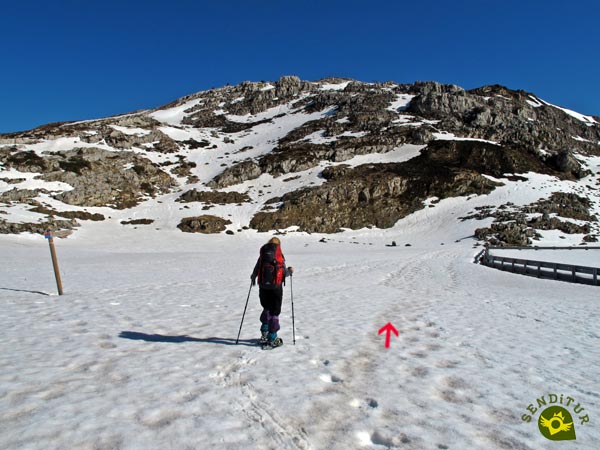
When we arrive next to him, we will radically change the course so that, skirting the fence, we can begin to ascend the opposite hillside to the one we were going down.

This stretch will make us quickly recover part of the lost height. As in all the route the snow will mark the best route to follow.

The open footprint can be of great help, facilitating the task of following the route, but given the special conditions of the environment in which we are developing our activity does not always have to be the best option to follow to save a particular area.

Already with the plain where we once walked on our backs, we embark on the hard ascent.

In summer a path marks the final point of this ramp, but the normal thing is that the snow does not give us this small advantage, reason why we will have to be attentive and not to ascend in vain the last meters of hillside.
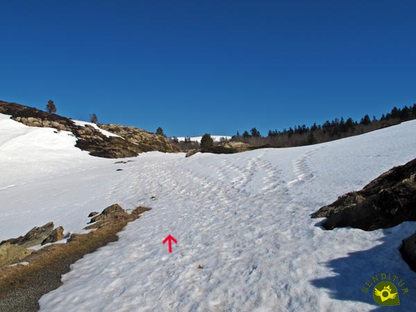
Once on top the stones on both sides of the way can serve as a reference in case of doubt. We continue to gain height, but without the requirement of the previous section.

We head towards the nearby forest that awaits us a little further on. This area, if the track is not visible, can put us in trouble since the signage can easily be covered with snow.

Do not forget that we are in a karstic territory, with large chasms, so it is not advisable to go out of way.

The forest brings a special landscape to the route, as we get closer to our next goal.
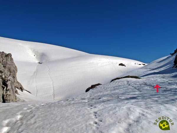
At the end of this stretch of woodland we will reach a small valley where we will say goodbye to the PR trail that accompanied us here, which turns round to undertake the descent while we continue ascending little by little.

To our left we contemplate in all its amplitude the skirt of the Utzigagna inviting us to ascend it.

For the moment we will leave this ascent to go up to the nearby hill of Ligoléte from where we will face this mountain without such a steep slope.

The cabins of Ligoléte mark our arrival to the detour towards Utzigagna (1h 10min) or to follow straight the continuation of our crossing.
Those who dare to crown this modest summit will be able to enjoy the magnificent views that it offers as a reward.

The itinerary of the ascent follows a rectilinear course until the summit, more demanding in its slope the more to our left we go.

Once at the top of the Utzigagna (1h 25min) and after the deserved rest, we will start the descent where we climb, to reach the cabins of Ligoléte.
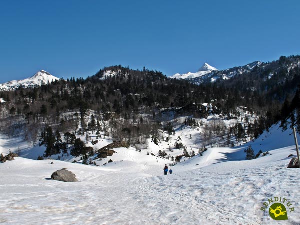
Next to them we will take again the route, that we left parked, with the sight put in the sharp peaks of the Arlas and the Anie.

Once again we will lose some height, unknowingly approaching the wildest stretch of this snowshoeing circuit.

Once again, the vegetation gains prominence as we enter the final part of the route.

This part that remains passes through the vegetation through narrower areas than those we have passed until now and faces short ramps bringing a more adventurous touch to the tour.
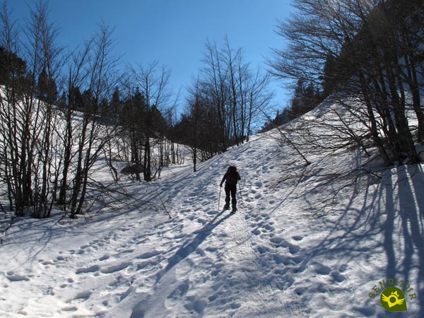
The short ramps force us to gain height with calm, luckily the ascent gives us small breaths where to recover the breath.

This area tends to accumulate a lot of snow which, together with the vegetation, hinders our progress, vegetation which usually serves as a support for the marks on the route.

As in other occasions the quantity and the state of the snow influence without a doubt in the route to follow.

Soon we will arrive at the final stretch of the ascent that will leave us close to the end of the route.

A stone mass covered with snow invites us to go around it on the side we want.

The route meanders through this area full of treacherous holes following the solitary markings that signal it.

Without realizing it, we are surprised by the layout of the road that we left behind at the beginning of the route. Now we will only have to follow its course in search of the Nordic ski centre.

Halfway up the mountain, we have the opportunity to separate a little from it and go up the mountain for a few meters without losing the direction we were taking.

This option, although it makes us gain height, is something more comfortable and interesting than advancing next to the road.

Once up we must turn radically to our left to go towards the footbridge that crosses the road, otherwise we would descend again by the valley of the beginning of the route.

All that remains for us to do is to carefully save the difference in level that separates us from the car park (2h 00min) in Roncalia, where this snowshoeing circuit ends.
This figure, more than ever, is indicative as this is a route where snow is the protagonist.
The state of the snow is undoubtedly one of the main factors that must mark the time we use to make the itinerary. In addition it is necessary to consider that with the rackets it is not possible to progress as fast.
Although of course we can cover the area throughout the year, it is in winter when it usually receives more visits since the route is prepared as a specific circuit for snowshoes, allowing us to look at this area of the Navarrese Pyrenees when its peaks are dyed white.
If we do not have the specific equipment in the ski centre, we can rent snowshoes and poles. Warm and waterproof clothing, sunglasses and sun cream, gloves and hat, some food and water, the camera and the necessary to follow the route in case of doubt, is the minimum we should carry in our backpack.
Physical
The extra weight we have to face, or what we get to sink in the snow, are conditioning factors that come to add to the usual of any route and we must take into consideration. For distance and slope we are before an affordable route and that faced with the time and the necessary patience should not suppose us great problems but to which it is not necessary to underestimate if we face it in winter situation.
Severity of the environment
In general, the route goes through places initially not very exposed, where the state of the snow and its quantity are what should cause us greater worries. We must bear in mind that we are in a karstic area and that it is not advisable to leave the marked circuit as we may find hidden chasms under the snow.
Orientation
Although the route has fixed signs all year round, winter beacons, and is usually quite stepped on, we can not be confident because the weather conditions can change much the state of the route from one day to another and even cover the marks completely. In addition the tracks if there is blizzard disappear very quickly so it is not too much to take a GPS with the track if we could need it.
| 1-Parking | 0:00h | 1590m | 0Km | 30T 679261 4758425 |
| 2-Detour towards Utzigagna | 1:10h | 1560m | 3.4Km | 30T 679254 4759293 |
| 3-Utzigagna | 1:25h | 1623m | 3.7Km | 30T 679100 4759555 |
| 4-Detour towards Utzigagna | 1:30h | 1560m | 4Km | 30T 679254 4759293 |
| 5-Parking | 2:00h | 1590m | 5.5Km | 30T 679261 4758425 |
Coordinates UTM Datum WGS84

![]() Slope: 578m
Slope: 578m
![]() Slope +: 289m
Slope +: 289m
![]() Slope -: 289m
Slope -: 289m
![]() Maximum altitude: 1623m
Maximum altitude: 1623m
![]() Minimum altitude: 1436m
Minimum altitude: 1436m

This sketch of the route is not made to scale nor does it contain all the information relating to the area, it is merely indicative.
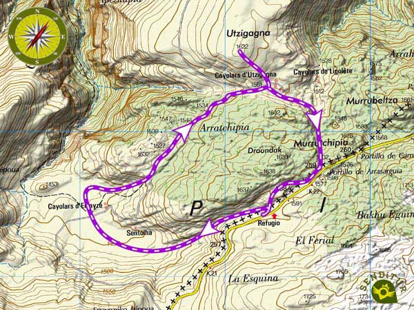
This schematic with the path is approximate and has been created from the derived cartographic base © Instituto Geográfico Nacional "Cuadrante 118-1, 1:25.000"
Senditur has manipulated the tracks to correct the aberrant points that may exist, caused by problems with the reception of the GPS signal. In any case the tracks are always approximate. SENDITUR encourages you to use the new technologies within your reach, using them as support and consultation in your activity, not basing the realization and orientation of the same only and exclusively on them, since they may see their functioning altered by very diverse causes, not functioning correctly and their indications may not be precise.
¿Did you know that...
Since the appearance, back in the 16th century, of the relics of Santa Engracia on the French side of the muga of San Martín, many pilgrims have varied their Jacobean route and have come to venerate them, thus creating a new route of the Pilgrim's Way to Santiago that crossed the Pyrenees and crossed the Roncal Valley, today this Roncalesa of the Way to Santiago that linked up with the Aragonesa has almost fallen into the oblivion of the current pilgrims.
No te pierdas…
The Belabarce Waterfall is a colorful and beautiful waterfall that surprises with its beauty. We can get there following the path that starts next to the Romanesque bridge over the Belagua River shortly after passing Isaba towards France or from Isaba itself following a pleasant walk through the lush forest.
From the commitment of SENDITUR with Nature and the respect to the balance of the environment, SENDITUR urges you to travel in a responsible way, with low environmental impact and respecting at all times the Natural, Cultural and Social environment wherever you go.
Besides sharing with all of us your experience on the route we would be grateful if you could write to us to inform us of any erroneous or outdated information you may have found, or simply to let us know what you think at Thank you.
This route has been carried out in the field by SENDITUR on 02-02-2017. The route may vary greatly depending on the time of year, weather conditions and terrain, as well as the actions of third parties and the evolution suffered in the natural environment where it is located. All opinions, advice and/or assessments made by SENDITUR in their descriptions are for guidance only and are subject to and/or refer to the specific conditions of the specific day of the route, referring to that specific day, taken from trained people, with the appropriate experience and with a high level of physical and technical preparation as a reference, as well as correctly equipped.
All the times are approximate and take an orientative character, the stops have not been taken into account, no matter how small they are. All the information related to the route, texts, images, videos, maps, diagrams, tracks, towns, and places of tourist interest are published as a guide, and may not coincide with the current state of each place. Before undertaking any activity, assess your technical knowledge, your physical condition, find out about the weather and the variations that the route may undergo, equip yourself correctly, be prudent and responsible at all times, and do not exceed your capabilities. SENDITUR is not responsible for any misuse or inappropriate use of the comprehensive guides of its routes and/or publications as well as its electronic guides, nor for any variations in their descriptions for the aforementioned reasons, and recommends that everyone be responsible and prudent in carrying out the activity. We also encourage you to read books and specialised guides to complement the information described above.
Continue watching …