In the Aralar Natural Park, more specifically on the Gipuzkoan side of the park, one of the most emblematic Basque mountains awaits us, the Larrunarri, better known as the Txindoki. This steep mountain is also known as the Basque Cervino, due to its characteristic silhouette, similar, saving the differences of course to that of the Alpine colossus. The climb to Txindoki from Larraitz is one of the most used routes to crown this beautiful summit.
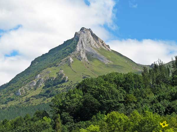
The usual route of 9.6 km takes us from the recreational area of the Larraitz chapel to the summit of Txindoki through a steep path that goes up to the Egurral pass. From there, the route begins the final steep ascent to the Larrunarri summit, from where one of the best panoramic views we can imagine can be contemplated. The return, as a general rule, is done by the same route that took us to the top of the mountain.

In our case, we decided to return, once we had descended to the Egurral pass, along the Muitze trail to visit the waterfall that gives it its name. This route, somewhat shorter than the normal one and more abrupt if possible, takes us through vertical cuts, almost hidden by the vegetation that grows on its slopes. The solitary Muitze waterfall, which usually dries up almost all year round, is the perfect excuse to escape from the busy traditional route and discover the spectacular landscapes that surround the Basque Matterhorn. A route that takes us to the doors of the Larraitz parking lot from where we start and where we finish this beautiful mountain route.

Legend has it that the goddess Mari has one of her favorite dwellings at the top of the Txindoki. From its summit, a good part of the Basque historical territory can be seen, and from there, Mari can also see her other dwellings, the Amboto, the Oiz, the Aketegi or the Murumendi, among others. Thus favoring to its election the weather changes in Euskadi, according to where it is inhabiting at that moment the Mari.
The main accesses to the Larraitz chapel are on the A-1 as it passes through the towns of Villafranca de Ordicia and Larraitz Auzoa. From there, the road starts, passing by Zaldivia or Abalcisqueta respectively, depending on our starting point, to reach the detour that leads to the Larraitz recreational area. Once there we will have the option of a parking area, from where the route leaves, and another one on the road, very useful on days of maximum affluence.
Look at the picture of 360º
Physically demanding route, with areas where we may have to help him overcome them. Watch out for the barbed wires that line part of the trail. It is not very advisable to let him go from one place to another, besides having to take it tied up by park regulations, we will avoid him spending energy that may be necessary.
Although we will find several water points where you can drink, it is advisable to bring some water, since the final climb to the top is hard and there is no water there. Of course we must also bring food that allows him to replace the energy spent.
Cattle raising area par excellence, cows and goats will not be missing along the route. It is interesting to take a look at the end of the route to discard ticks and other parasites.
Our tour begins in the parking lot of the recreational area of the Larraitz Hermitage (0h 00min).

We go through the metal door there is at the end of this parking lot to, at the moment, begin the ascent that will take us to this mythical Basque mountain.

For now, a wide path serves as a guide, while we begin to notice the unevenness in front of us.

Shortly after passing through another metal door we find the beginning of the path we must follow.

In reality this trail is a shortcut that avoids us turning around that draws the path we were following. We continue to shorten, thanks to the trail, the curves that the path describes in its ascent.

For the last time we cross the path that follows to some antennas on the side of the mountain, while we follow the steep path that serves as a guide.
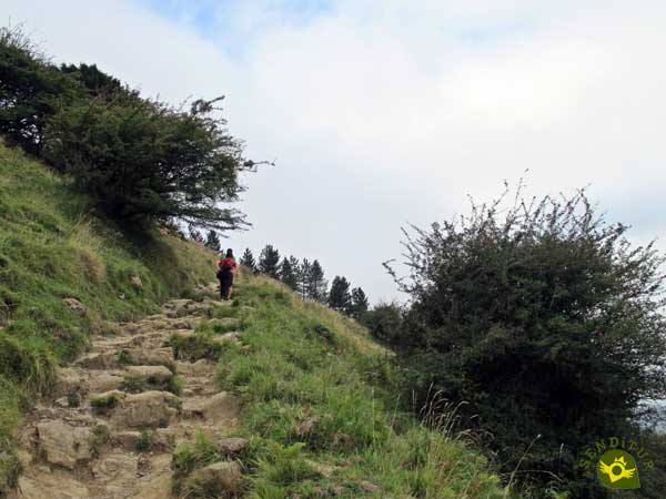
The unevenness is quite evident and given the distance that still separates us from our goal it is advisable to take it easy.
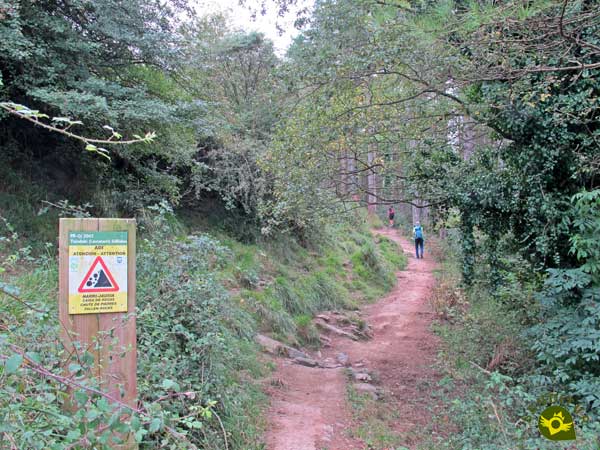
There won't be many moments of respite from the unevenness as we gain height. Little by little the forest that surrounded us disappears leaving us to contemplate the magnificent landscape that surrounds us.

After a while, in front of us, we can already contemplate the layout that follows our route and the steep path that offers us to shorten the itinerary. And the fact is that before us we have the tempting option of undertaking a radical ascent reserved for the brave.

We leave this detour, not advisable with the wet terrain and without a good physical condition, and follow the normal course of the route.

This layout, not exempt of unevenness, separates us from the mountain that we want to crown, looking for to smooth something the slope.

Again we will find more trails that in exchange for an extra effort shorten in part the curves that our path makes.

A few zigzags that make us gain height quickly as we go up the hillside of the mountain.

After a while, in one of these changes of direction, we left behind a new junction to face the final ascent to the col of Egurral.

A col that will still force us to make an effort to reach it while enjoying, if the fog allows it, the landscape at our feet.

This part of the route, although less demanding than the previous sections, also has some unevenness.

The white and yellow marks continue guiding us until they take us to the col where the hard final ascent to the Larrunarri begins.

From the col of Egurral, where we will say goodbye for now to the white and yellow marks, we will see ourselves following a steep path that without further ado climbs to the top.

A path with quite bare sections, whose inclination is remarkable. There are many trails that have been formed to overcome the slope and obstacles in the best possible way.
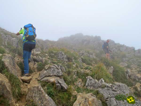
So many possibilities force us to be attentive, since getting confused can lead us to steps of greater complexity and exposure, without it really being necessary.

After the effort the summit of the Txindoki (2h 55min) welcomes us with all its splendor.
After enjoying the well-deserved rest and the views that this colossal mountain offers, we start the descent to the Egurral col.
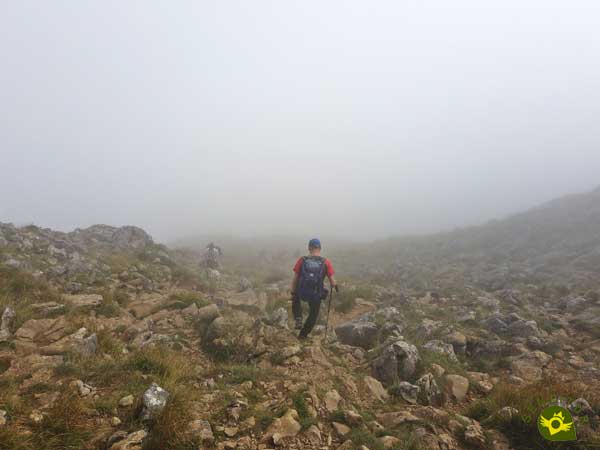
As in the ascent, one must be careful not to follow the wrong path. Once on the col, the great majority returns along the same route to Larraitz.

We left it to our right since we decided to do it by the Muitze path, less traveled given its greater exposure.
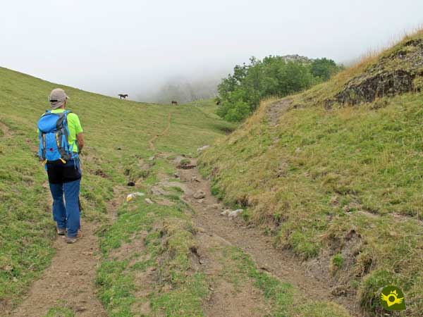
We took up again the white and yellow marks that accompanied us in the ascent and started a pleasant path.

We quickly start to lose altitude by going into a ravine that drops down the hillside. As always, we must be careful because there several paths are presented to us.

The ideal is to stick to the bed of the ravine and follow the path that runs next to it, this will avoid us having to descend field through.

We continue to keep the generally dry riverbed of the ravine as a reference to follow at all times.

Soon we will meet the stream that feeds the waterfall we are going to visit. A stream that we will have to cross on several occasions following the marks of the path.
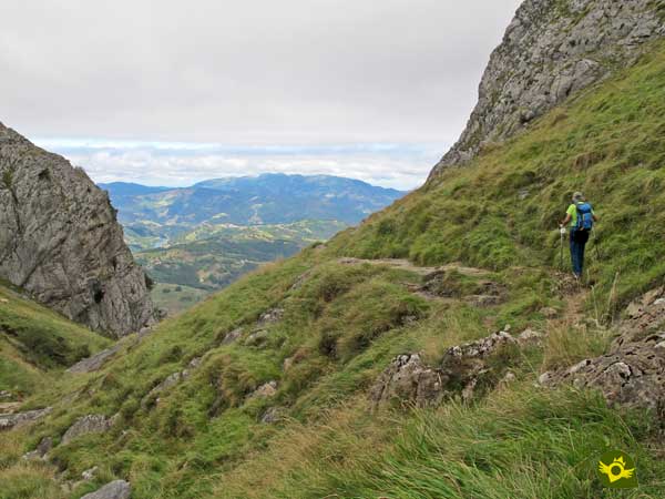
A path that takes us through a metal gate for the cattle, leaving us closer and closer to the exit of the ravine. This zone, although without major complications, does begin to have certain exposure.

We began to descend the jump that forms the waterfall towards which we are heading, at which point we radically changed course, saying goodbye to the white and yellow marks that accompanied us until here.

The descent takes us without further ado to the base of the Muitze waterfall (3h 10min), where we will cross it.

All this zone of the route transits with a quite remarkable cut to our right, that the vegetation that populates the hillside is in charge to dissimulate.

We continue to descend, crossing stretches of the path that are somewhat decomposed and zones that are in better condition. The forest wraps us up again, while our path continues to draw some zigzags, to continue descending.

After a while the path reaches its end when it hits the path that leads to the antennas' hut that, without realizing it, we have left behind. We continue to descend comfortably along the path, until we pass through a new metal gate.

Here the unofficial route of this Muitze route continues along the path until it meets the traditional climb to Txindoki and returns through it to Larraitz. But given the considerable turn that this option requires, the immense majority of people who follow it as soon as they cross the gate leave the path and begin a rapid descent along an almost hidden path that goes into the pastures.

This path makes us lose altitude quickly. We must be careful because we must leave it as soon as we reach the height of the Larraitz parking that we will see on our right. This zone is already a real cross country that descends in search of the passage that will allow us to save the fence of the fields that we are crossing.

If we get confused and follow the path, we will soon be forced to descend in search of the path and the place where we can cross the wire that separates us from it. Once we have crossed the fence, we only have to cover the distance that separates us from the Larraitz parking lot (4h 10min) from where we started.
If we return by the same route we used to ascend, we will cover a little more distance.
The unevenness to overcome conditions the time needed to make the journey. Returning along one side of the mountain or the other should not make a big difference.
The fogs are almost inseparable companions of this Basque mountain, providing a special atmosphere to the ascent. The summit on clear days offers one of the best panoramic views in the whole of the Euskadi, which is worth enjoying in calmly
The relative simplicity of the ascent to its summit and its fame among mountain lovers and hikers, make it one of the most visited mountains in the area. It is common to see people without the minimum essential equipment whenever you undertake an activity of this type, and more so when talking about a mountain like Txindoki. The difference in altitude between the parking lot and the summit, added to the sudden changes in weather that usually occur, can put us in more difficulties than expected if we are not properly equipped. Consult our list of material and equipment for hiking. Read more.
Physical
The slope to overcome is considerable and more in the distance in which it is done, so it is necessary to have a good physical condition. It is also not advisable to face the climb with too much impetus from the beginning, as it can take its toll later on. Be careful with the path that goes up directly to the final part of the ascent, it is quite demanding and increases the difficulty of this section.
Severity of the environment
Except for the somewhat decomposed sections of the path, it may seem to be a route without major risks, nothing further from reality. There are signs that warn us of the risk of landslides and if we get confused on some of the different trails that climb to the top we can get into serious trouble. Be careful also if the terrain is wet, in that case the direct detour to the summit is totally inadvisable. It is worth mentioning the return trip if we do it by the Muitze waterfall trail, a route only recommended for people with enough mountain experience. Not because of the route itself, but because of its exposed layout, with vertical cuts, and the greater risk of landslides in the area where it runs.
Orientation
The usual route is clearly defined, it is the multiple paths and shortcuts that we will find along the route that will create difficulties. The return through Muitze, except for the final stretch without a clear route to guide us, leaving us at the mercy of our ability to orient ourselves, and a short area at the beginning where the different paths that there are can make us lose track, does not have much complication by not encountering junctions almost at any time.
| 1-Larraitz | 0:00h | 411m | 0km | 30T 573599 4765115 |
| 2-Txindoki | 2:55h | 1346m | 4.8Km | 30T 574277 4763743 |
| 3-Waterfall of Muitze | 3:10h | 910m | 6.5Km | 30T 574944 4763878 |
| 4-Larraitz | 4:10h | 411m | 8.9km | 30T 573599 4765115 |
Coordinates UTM Datúm WGS84

![]() Slope: 1896m
Slope: 1896m
![]() Slope +: 948m
Slope +: 948m
![]() Slope -: 948m
Slope -: 948m
![]() Maximum altitude: 1346m
Maximum altitude: 1346m
![]() Minimum altitude: 410m
Minimum altitude: 410m

This sketch of the route is not made to scale nor does it contain all the information relating to the area, it is merely indicative.

This schematic with the path is approximate and has been created from the derived cartographic base © Instituto Geográfico Nacional "Cuadrante 89-3 1:25.000".
Senditur has manipulated the tracks to correct the aberrant points that may exist, caused by problems with the reception of the GPS signal. In any case the tracks are always approximate. SENDITUR encourages you to use the new technologies within your reach, using them as support and consultation in your activity, not basing the realization and orientation of the same only and exclusively on them, since they may see their functioning altered by very diverse causes, not functioning correctly and their indications may not be precise.
¿Did you know that...
Every year at the end of June, specifically on the 24th, a pilgrimage is held to the Larraitz hermitage. On that day the Larraitz fields are full of people, lunches, music and good atmosphere, as well as other activities.
Don't miss out...
A visit to the popular hermitage of Our Lady of the Remedies of Larraitz, located on the very laps of the Txindoki, a short distance from the start of the ascent of this great Basque mountain.
From the commitment of SENDITUR with Nature and the respect to the balance of the environment, SENDITUR urges you to travel in a responsible way, with low environmental impact and respecting at all times the Natural, Cultural and Social environment wherever you go.
Besides sharing with all of us your experience on the route we would be grateful if you could write to us to inform us of any erroneous or outdated information you may have found, or simply to let us know what you think at Thank you.
This route has been carried out in the field by SENDITUR on 26-08-2020. The route may vary greatly depending on the time of year, weather conditions and terrain, as well as the actions of third parties and the evolution suffered in the natural environment where it is located. All opinions, advice and/or assessments made by SENDITUR in their descriptions are for guidance only and are subject to and/or refer to the specific conditions of the specific day of the route, referring to that specific day, taken from trained people, with the appropriate experience and with a high level of physical and technical preparation as a reference, as well as correctly equipped.
All the times are approximate and take an orientative character, the stops have not been taken into account, no matter how small they are. All the information related to the route, texts, images, videos, maps, diagrams, tracks, towns, and places of tourist interest are published as a guide, and may not coincide with the current state of each place. Before undertaking any activity, assess your technical knowledge, your physical condition, find out about the weather and the variations that the route may undergo, equip yourself correctly, be prudent and responsible at all times, and do not exceed your capabilities. SENDITUR is not responsible for any misuse or inappropriate use of the comprehensive guides of its routes and/or publications as well as its electronic guides, nor for any variations in their descriptions for the aforementioned reasons, and recommends that everyone be responsible and prudent in carrying out the activity. We also encourage you to read books and specialised guides to complement the information described above.
Continue watching …